Author: Anthony R. Wood

  • Storms set off tornado and flood watches and warnings in the Philly region. Expect more rain this weekend

    Storms set off tornado and flood watches and warnings in the Philly region. Expect more rain this weekend

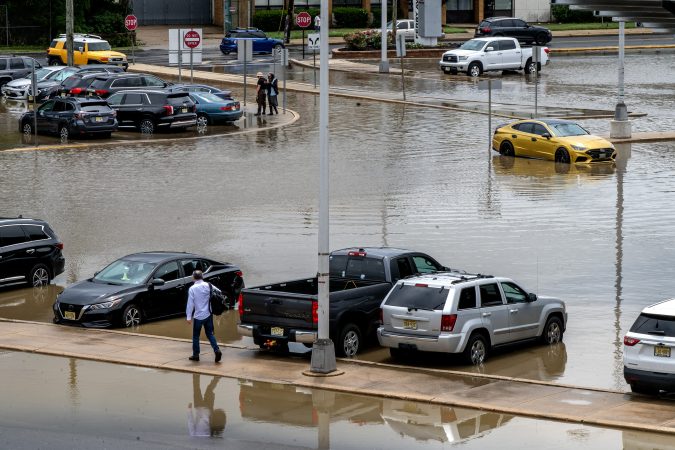
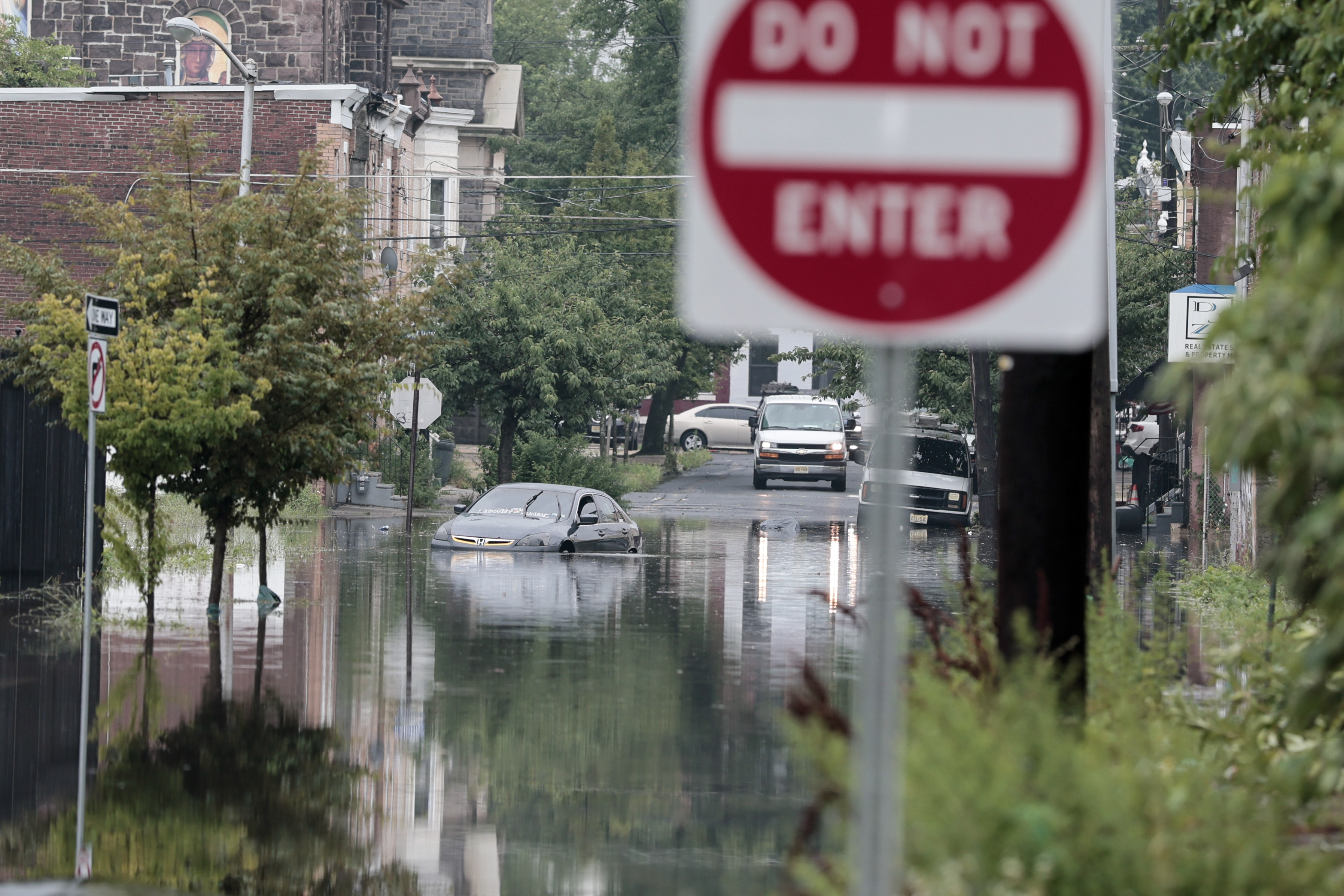
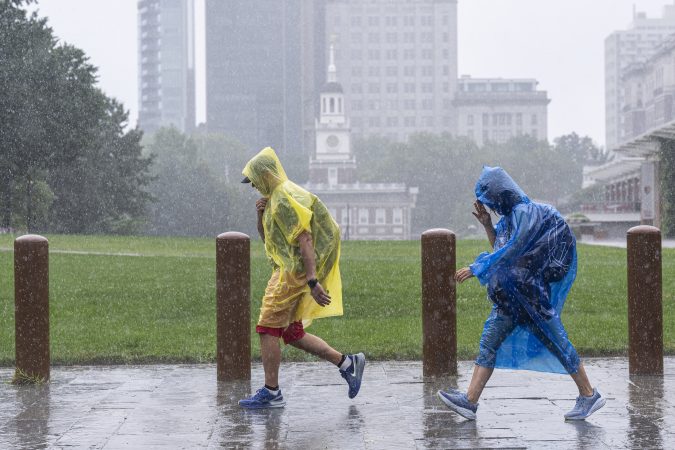
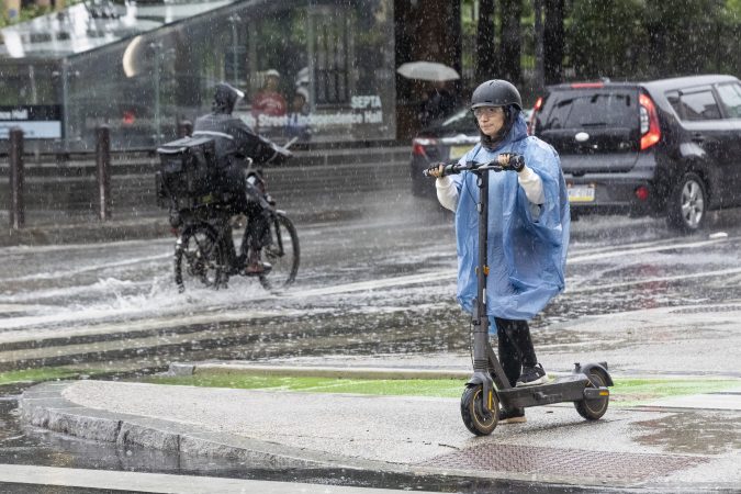
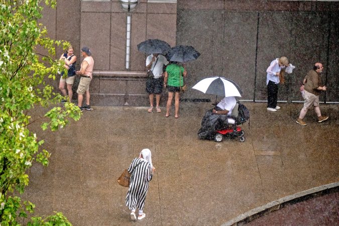
    Severe storms set off tornado and flood warnings on Thursday in the Philly region, and in some places turned the phrase “rush hour” into an oxymoron.

    Intense thunderstorms took down trees and wires in parts of Chester County, and fallen trees blocked portions of heavily traveled Route 322 in Honey Brook, the weather service reported.

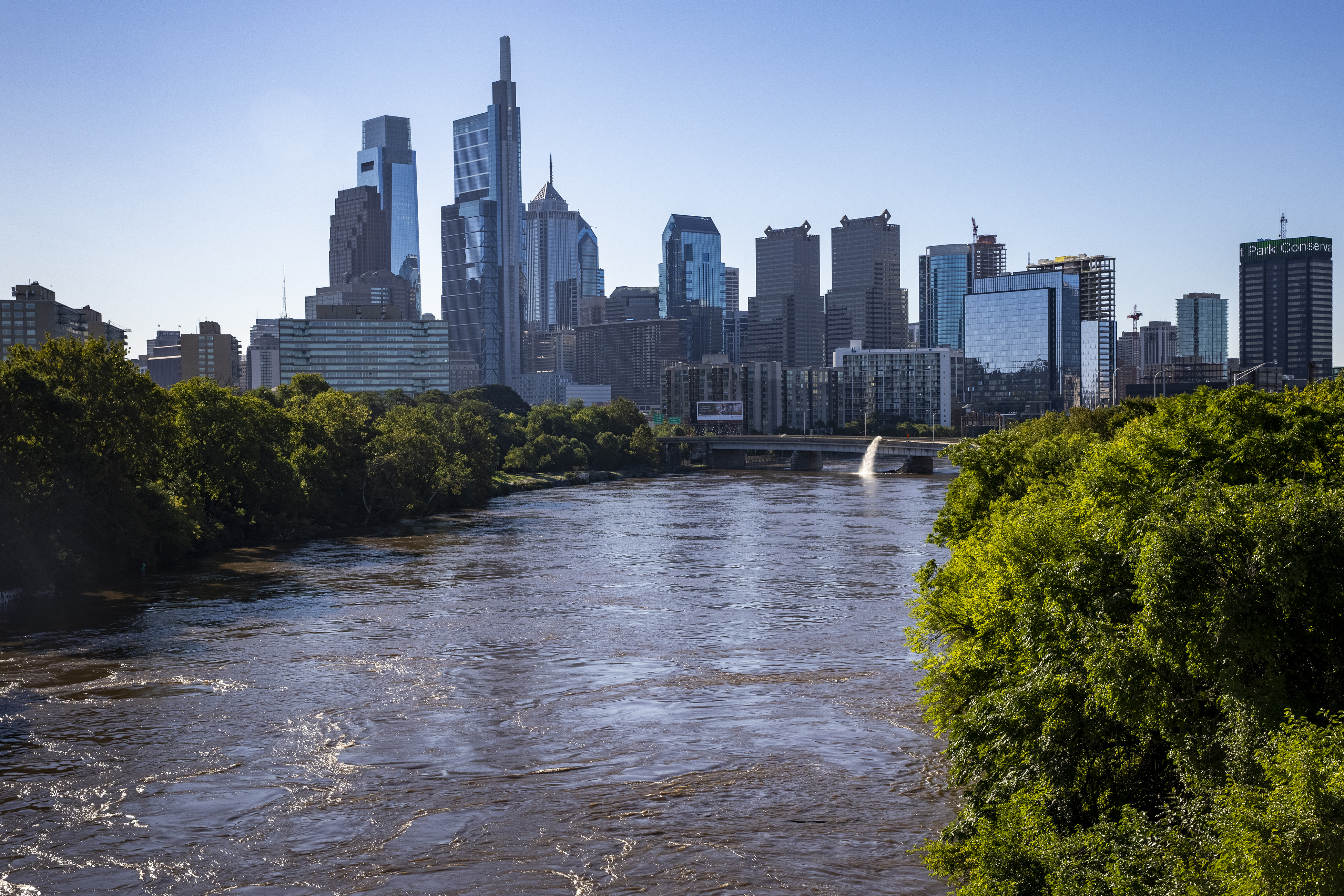
    Streams came out of their banks, and flash flooded occurred in West Norriton and Lower Providence Townships, in Montgomery County, making “many streets” impassable.

    A tornado warning had been issued for portions of Chester and Delaware Counties, but it was not known if a twister was sighted.

    About 21,000 Peco customers were without power as of 8 p.m.

    All of Philadelphia; areas to the west of the city, including the Main Line; northern Delaware; and in New Jersey along the Delaware River were under a flash-flood warning until 8:45 p.m.

    Lines of storms gathered to the west and south of the region during the day with the approach of an eastward-moving front interacting with a volatile, energized atmosphere.

    “It’s a pretty juicy air mass,” said Matt Benz, senior meteorologist for AccuWeather Inc. And more juice might be squeezed out of it over the next few days, especially Saturday.

    It turns out that the front that set off the storms may return in a repurposed form during the weekend.

    Disruptive storms came at a bad time

    The storms arrived between 5 and 5:30 p.m. in the immediate Philly area, right when a lot of people likely would have been heading home.

    The storms moved quickly, but the downpours were strong enough to set off flash-flood warnings.

    The fact that the sun interrupted the afternoon gloom on Thursday didn’t help matters, meteorologists said. On a day when the air was so full of moisture and energy, that was about the last thing they wanted to see.

    “It’s ironic, isn’t it,” said Joe Wegman meteorologist with the government’s Weather Prediction Center, in College Park, Md.

    The solar heating likely provided a power jolt to an already charged atmosphere.

    The outlook for the weekend

    If you have outdoor plans Saturday, this is probably something you don’t want to read.

    After the front clears the region, Friday should be a decent day, Wegman said.

    But it’s likely to migrate back, this time as a warm front, said Wegman. Showers are possible Friday night, and might be tapping into a generous moisture supply on Saturday.

    Said Benz, “I wouldn’t throw out the word washout, but it could be pretty wet on Saturday.” Steady rain is possible, as are more downpours Saturday afternoon into the night.

    As for Sunday, you guessed it — another chance of showers.

  • Philly is under flood, storm, and tornado watches Thursday, and more rain is likely this weekend

    Philly is under flood, storm, and tornado watches Thursday, and more rain is likely this weekend

    Both astronomy and meteorology suggest that it won’t be long before these things decline in frequency, but in the meantime another flash-flood watch is in effect for the Philly region.

    A tornado watch also was posted for Philadelphia and the neighboring Pennsylvania counties.

    The National Weather Service watch spans from noon Thursday until 2 a.m. Friday, for the potential for rain rates of 2-to-4 inches an hour in areas along I-95 and South Jersey.

    And the federal Storm Prediction Center has posted a severe-thunderstorm watch, in effect until 10 p.m., for storms that could kick up gusts approaching 60 mph.

    “There could be multiple rounds of heavy rain over urbanized areas,” said Joe Wegman, a meteorologist with the government’s Weather Prediction Center. In advance of the anticipated main events, a blob of light rain moved through the region late Thursday morning.

    Also, the federal Storm Prediction Center sees an outside chance of severe-level storms, those with gusts near 60 mph, and a 5% chance of tornadoes in and around Philly.

    And those who have not had the good fortune of spending the last two months in heat-free and smokeless environments probably can skip the next paragraph.

    The timing, ferocity, rain totals, and targets all remain uncertain.

    What is the best estimate on the storm timing in Philly?

    The higher-resolution models were suggesting that the likeliest time for storms to arrive in the Philly region would be between 2 and 3 p.m. Thursday, Wegman said.

    The worst of it may hold off until 4 or 5 p.m., said Matt Benz, senior meteorologist with AccuWeather Inc.

    The storms likely would back off between 6 and 7 p.m., but that timing could disrupt a peak commuting period.

    “Why would we conveniently time these things?” Wegman quipped.

    “There’s plenty of moisture coming up, and a front approaching from the west,” he said. “If the front stalls, the storms might linger longer than people want them to.”

    Plus, renegade storms could race out ahead of the front, setting off precipitation earlier, he added, and that appeared to be case Thursday.

    The weather service in Mount Holly said the “greatest risk” for severe storms would be between noon and 10 p.m.

    But timing remains one of the most vexing challenges for severe-weather forecasting, says Bill Bunting, deputy director of the storm center, in Norman, Okla.

    “I have seen remarkable progress,” said Bunting, who has been at it for 40 years, “but we’re nowhere near perfection. In the end, the science has its limitations.”

    The forecast for the weekend and the rest of August

    The storm experts have had plenty of practice around here this summer. So far, Philadelphia officially has recorded 21 thunderstorms since June 1, several more than normal.

    It has also been a banner summer for smartphone alerts and assorted scare grams.

    About 11 inches of rain has been measured at Philadelphia International Airport, roughly four inches above normal, since July 1.

    That said, yes, both Chester County and the entire state of New Jersey remain under state-declared drought warnings, with residents asked to conserve water.

    And drier times may be coming, or at least a reduced incidence of those late-day thunderstorms, said Brian Hurley, senior branch forecaster with the Weather Prediction Center.

    The days are getting shorter, and the sun is losing some of the gas it uses to fuel convective storms, he said.

    But all pumpkin spice aside, summer is not quite over, and shower chances are in the forecast into Sunday night.

  • Rains have returned to the Philly region, and they may come in handy later

    Rains have returned to the Philly region, and they may come in handy later

    Just as the soils were beginning to take on that cracked and dried look and the vegetation was working up a thirst, the rains have returned to the Philly region, and showers and possible thunderstorms may bookend the week.

    Rains Sunday ended the first seven-day period without measurable rain in Philly in two months. More showers were possible Monday and later in the week, forecasters said.

    In all likelihood they won’t remotely approach the destructive deluges in the Midwest, said Brian Hurley, senior branch forecaster with the federal Weather Prediction Center, in College Park, Md.

    And around here, despite the generous rains that have fallen upon the region since mid-June, additional rain wouldn’t be altogether unwelcome, said Hurley.

    Precipitation in the last 60 days has been well above normal everywhere in the region save for Montgomery County, where they were just about normal, according to the weather service’s Middle Atlantic River Forecast Center, which uses a network of stations in the counties.

    However, not so long ago, as we headed into June, Philadelphia had experienced 16 consecutive months of below-average precipitation totals.

    And drier times may be coming, Hurley warned.

    Drought conditions have eased, but not disappeared

    New Jersey and Chester County remain under state-imposed drought warnings, with residents asked to go lighter on the water usage.

    “We’ve been putting a dent in that drought,” said Hurley, but in the latest interagency U.S. Drought Monitor update, most of the region remains “abnormally dry,” with parts of Burlington, Bucks, and Montgomery Counties in “moderate drought.”

    Thunderstorm activity has been well above normal this summer, with the weather service reporting 19 days officially with thunder detected at Philadelphia International Airport. The average for the entire June 1 to Aug. 31 period is about 15 days.

    It’s also been quite warm. In 12 of the first 15 days of August, the temperature reached at least 90 at the airport, and this almost certainly is going to end up being one of the warmer summers on record.

    The warmth and the rains are related.

    Philadelphia has spent a whole lot of time on the western edge of the so-called Bermuda high, centered over the North Atlantic. Winds circulate clockwise around the center of high pressure, and areas to the west of the center (where we are) experience winds from the south and southwest.

    Being on the edge also places the region in spraying distance of shower activity as fronts and minor disturbances approach along the western flank of the ridge, with daytime heating adding a kick to the storms.

    Thunderstorms may become scarcer come September

    Those convective thunderstorms, which can wring out rain in waterfall-like downpours, in all likelihood will become less numerous as September approaches and the days shorten, Hurley said.

    “It does get a little harder to pop convection when the sun doesn’t do its thing as much,” said Hurley.

    “In September we tend to dry out until we get tropical connections,” he said.

    This year, however, those tropical connections may be scarce, according to the National Oceanic and Atmospheric Administration and other forecast services.

    What could become the most intense El Niño — the anomalous warming of vast expanses of the tropical Pacific Ocean — in records dating to 1950 is rapidly gaining steam.

    During El Niño, the interaction of the ocean and the overlying air generates powerful upper-level winds from the west that can shear apart tropical storms in the Atlantic Basin before they mature.

    No Atlantic hurricanes have developed yet this season. Meanwhile, Hurricane Lala in the Pacific has caused extensive damage in Hawaii. Typically, when the Pacific is quiet, the Atlantic is active, and vice versa.

    Lala is the 12th named tropical storm — those with winds of at least 39 mph — of the season to form in the Pacific. The average for the date is seven.

    In the Philly region, historically tropical-storm remnants have been generous sources of rainfall.

    Sometimes, however, they have been overly generous. (See Ida, 2021.)

  • A potentially ‘historic’ El Niño may become the biggest on record, NOAA says

    A potentially ‘historic’ El Niño may become the biggest on record, NOAA says

    The rapidly developing El Niño is likely to become a “historic event” that could become the most-intense in the period of record, the government’s Climate Prediction Center said Thursday.

    The El Niño warming in the tropical Pacific, coupled with how it is affecting the atmosphere, is all but certain to have dampening effects on the Atlantic hurricane season, researchers said.

    While it is likely to be disruptive and destructive during the next several months, during the tropical storm season it may mean fewer scares for East and Gulf Coast and Caribbean residents, and perhaps fewer flooding threats in the Philly region.

    El Niño already is making its presence evident thousands of miles away in the Atlantic Basin, said Philip Klotzbach, tropical storm specialist at Colorado State University. Colorado State’s forecast methodology has been the prototype for the outlooks issued by the National Oceanic and Atmospheric Administration and commercial companies.

    In his update last week, Klotzbach predicted the season would produce nine named storms, those with winds of at least 39 mph — down from 13 in the April outlook. NOAA also subtly trimmed its numbers. The long-term average is 14.

    Even with above-normal temperatures that usually would be favorable for storms in the hurricane-development regions of the Atlantic, what’s going on in the Pacific is going to dominate, he said.

    “El Niño is definitely the story of this season,” he said, and NOAA says the Pacific warming is likely to persist through April.

    (Even The Farmers’ Almanac has noticed. The winter outlook it has cooked up appears to be right out of the El Niño recipe book, calling for wetness and storminess in the South, typical of El Nino. Helpfully, it said the forecast up our way is “tricky.”)

    How does warmth in the Pacific affect Atlantic hurricanes?

    El Niños, which occur every two to seven years as part of a natural process, agitate the overlying air and disrupt atmospheric circulation worldwide. It is part of the so-called El Niño Southern Oscillation, or ENSO, and since oscillations do oscillate, El Niño periodically shares the stage with La Niña, during which the waters are cooler than normal.

    The climate center reported Monday that in the key El Niño region of the east-central Pacific, sea-surface temperatures over a 2.4 million-square-mile area were more than 3 degrees Fahrenheit above normal.

    That air-ocean interaction generates strong west-to-east upper-level “shearing” winds that can keep tropical storms from maturing into hurricanes.

    Klotzbach said that last week, the 30-day average of wind shear in the western Atlantic was higher than in any other 30-day period dating to 1979.

    Other players in the atmosphere affect tropical storm activity, but El Niño “usually becomes the dominant factor,” said Matt Rosencrans, the weather service’s lead hurricane forecaster.

    During the top six most-intense El Niños in records dating to 1950, tropical-storm numbers were significantly below normal.

    Is this El Niño yet another symptom of a warming planet?

    “There is still considerable debate in the scientific community on how warming may affect ENSO behavior,” said Michelle L’Heureux, physical scientist with NOAA’s Climate Prediction Center and the head of the ENSO team.

    El Niños likely have been occurring for eons, but the period of record dates only to 1950 because “much fewer observations” are available before then, she said.

    “It would take much more research to compare El Niño events in the older records,” she added.

    El Niños in which the temperatures reached 3.6 degree Fahrenheit — averaged over three-month periods — occurred in 1965-66; 1972-73; 1982-83; 1991-92; 1997-98, and in 2015-16.

    The warmest three-month average, 4.3 degrees Fahrenheit, was recorded in the 1982-83 event, and the climate center sees a 69% likelihood that this will exceed that level.

    But L’Heureux cautioned that “intense El Niño events are not totally unexpected.” The top six list shows that they have reappeared every 10 to 15 years.

    Thus, she said, “There’s a reasonable argument we were due.”

    What might all this mean for the Philly region’s weather?

    Tropical storms or their remnants “are especially notorious for flash-flooding impacts” in the region, said Sarah Johnson, warning coordination meteorologist in the weather service’s Mount Holly office.

    In 2020 and 2021, the region was affected by six such storms or remnants, including the devastating Ida, in September 2021.

    The 2020 season was quite active, and 2021’s hyperactive. Logically, fewer Atlantic storms would reduce the odds of remnants heading this way.

    With the exception of 2012, the year of Sandy, Johnson said that all the years with below-average flash-flood warnings issued by the Mount Holly office coincided with seasons in which no tropical storms or remnants have affected the region.

    We wouldn’t mind an encore.

  • Rains threaten the Phillies ‘Field of Dreams’ game Thursday night

    Rains threaten the Phillies ‘Field of Dreams’ game Thursday night

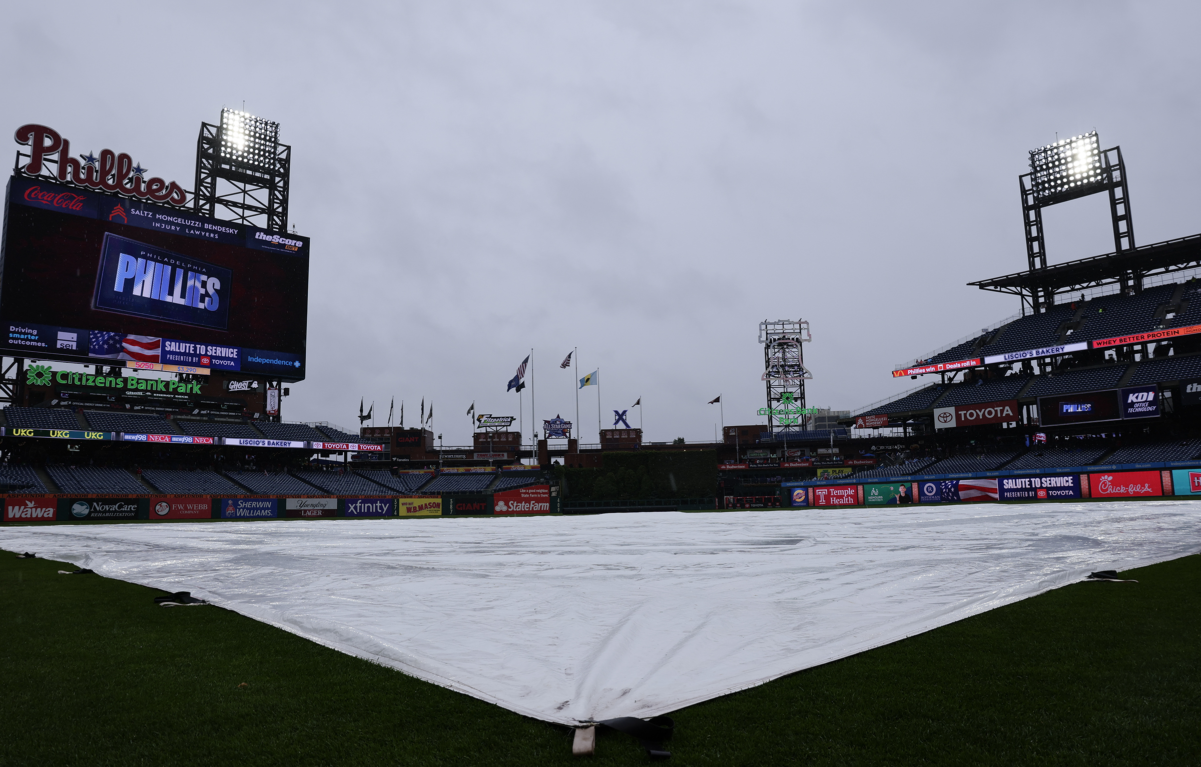
    The Phillies might feel right at home Thursday when they are scheduled to play the Minnesota Twins in the “Field of Dreams” game in Dyersville, Iowa.

    The weather out there is expected to have more than a dash of Philadelphia-style August flavor, with mugginess and rains during the day that could linger into game time, with the first pitch scheduled for 7:30 p.m. Philly time.

    “We’re tracing a potential band of storms that will set up near the ‘Field of Dreams’ Thursday evening,” said Connor DeLaune, meteorologist with the National Weather Service office in Davenport, Iowa.

    “There probably will be a few isolated lightning strikes,” he added.

    But this caveat might sound familiar: The timing and location of any storms remain uncertain, a forecast problem as challenging in northeastern Iowa as it is in Southeastern Pennsylvania.

    John Feerick, senior meteorologist with AccuWeather Inc. and a die-hard Phillies fan, said it is possible the rains will back off during the evening.

    “There may be enough of a break where they could get the game in,” he said.

    That said, the teams may be better off waiting until Friday, which “looks a lot better.”

    While no steady rain is expected Friday, Feerick added that he could not rule out that Philly special — a pop-up thunderstorm.

  • An eclipse and planet show are due Wednesday, but meteors may be the stars in Philly’s skies

    An eclipse and planet show are due Wednesday, but meteors may be the stars in Philly’s skies

    A partial eclipse will occur Wednesday, along with a planetary alignment that doesn’t happen all that often.

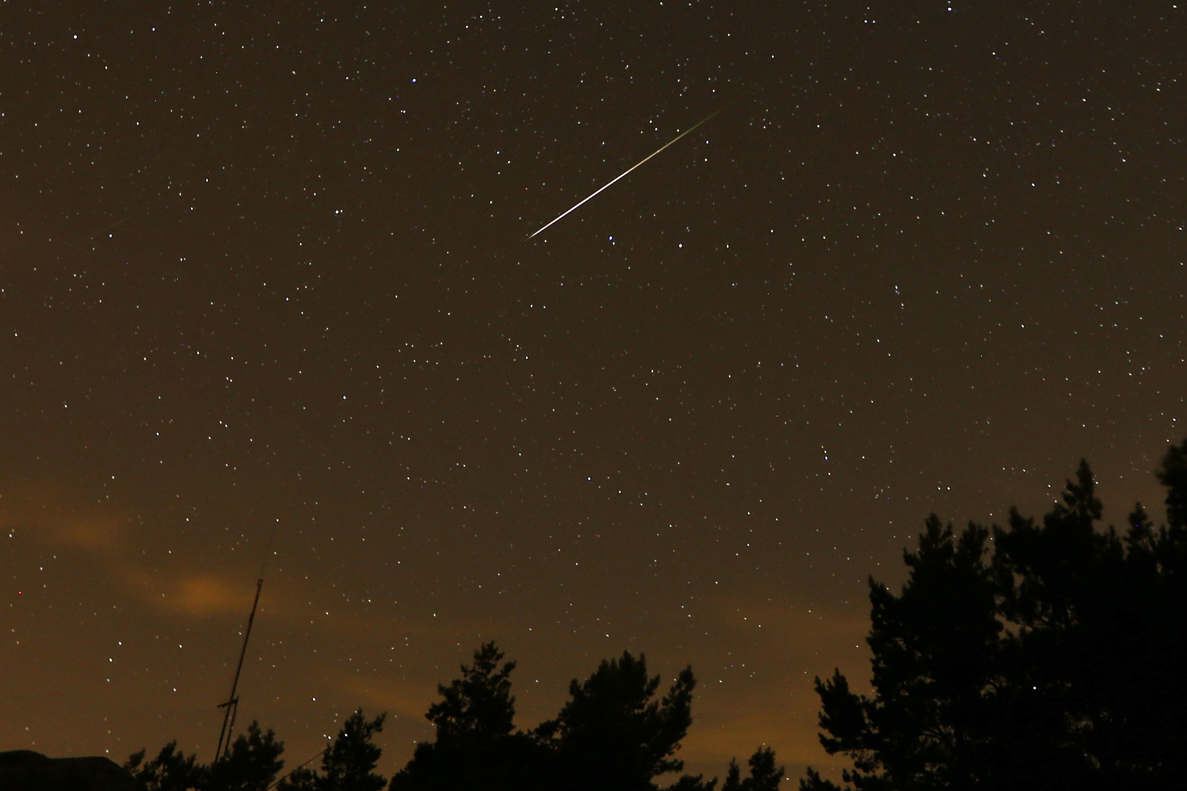
    For star power, however, the annual Perseids meteor shower, which will be peaking late Wednesday night and early Thursday, may outshine them both as the moon gets out of the way to prepare for its big night at the end of the month.

    The Perseids should put on quite a decent show this year for those who have access to reasonably dark skies and do not mind staying up a little late.

    These things can produce 50 to 100 meteors an hour under ultra-dark sky conditions, but you won’t see that many above light-polluted Philly.

    Above the darkness-challenged Philadelphia Museum of Art, you might be able to catch 10 an hour, said Bill Cook, NASA’s meteoroid guru at the Marshall Space Flight Center in Huntsville, Ala.

    The potential spoiler in all this would be the state of the skies, which are expected to be sunny Wednesday. But just how cloud-free they will be at night is not clear just yet, said Patrick O’Hara, meteorologist with the National Weather Service in Mount Holly.

    The weather service is calling for mostly clear skies late Wednesday night, but some clouds may roll in after midnight, and it says the forecast contains “a frustrating level of uncertainty.”

    About the eclipse

    The eclipse has been generating media attention, and it is going to be a spectacular show — if you happen to be in Greenland or Iceland or northern Spain, places that will experience the haunting magic of totality, which will occur around 1:45 p.m. Philly time.

    Locally?

    “Philly just isn’t in the right place for any good eclipse viewing this time around,” said Teddy Kareta, assistant professor of astrophysics and planetary science at Villanova University.

    Only about 8% of the sun will be blocked out at Philly’s latitude, said Dwight Dulsky, with the Bucks-Mont Astronomical Association.

    Said Kareta, “That’s a small enough change that … I don’t think I’d even notice.”

    Dulsky said the Bucks-Mont group “will be doing some safe solar viewing” of the eclipse in the marina parking lot of Nockamixon State Park, in Upper Bucks County.

    If you’re jonesing for a totality experience, NASA will be showing the whole thing live on YouTube.

    The parade of planets

    Early risers (or late stay-uppers) on Wednesday can admire a planet parade in the western sky, or at least some of its participants.

    Four planets — Jupiter, Mercury, Mars, and Saturn — will be lined up and visible to the unaided eye, said Kareta, though Jupiter and Mercury may be elusive, since they will be close to the horizon.

    The line may be slightly less orderly on the 13th, but may not look much different from the perspective of the average earthling, Kareta added.

    If you miss the planet show, Kareta advises that these things may be special but are not exactly rare. A similar alignment occurred “about a year ago,” he said.

    “As an astronomer,” he said, “I find these planetary alignments more fun and beautiful than I find them super interesting.”

    The Perseids are about to peak

    Several hours after the moon gets in the sun’s way Wednesday, it will be fortuitously out of the way for the annual Perseid meteor showers.

    As many as 50 to 100 meteors per hour may appear at their absolute peak, which this year would be in the early morning hours of Thursday.

    You would not find that absolutely dark sky anywhere around the city, but NASA’s Cook estimates that about 20 an hour might be visible over, say, Malvern. Similar numbers may appear in the open spaces of Valley Forge National Historical Park.

    Elsewhere in the great Philadelphia city-state, French Creek State Park, bordering Chester and Berks Counties, is a favorite among local sky watchers, and the prime viewing area is open all night.

    At least a few watch parties are planned, including one by the Bucks-Mont group from 8 to 11 p.m. at the Nockamixon park, Dulsky said.

    Also, the McKaig Nature Center in Upper Merion Township, Montgomery County, will be taking a busload of meteor-gazers to a clearing overlooking the McKaig Woods.

    The Perseids are so named because they appear to radiate from the constellation Perseus, but they show up all over the sky. They are the most popular among the 30 or so showers visible in the night sky annually.

    The Geminids, in December, outnumber the Perseids, but people prefer warmth with their meteor-watching. Plus, NASA reports that the Perseids are by far number one for those spectacular fireballs.

    The meteors are the result of debris from the comet Swift-Tuttle, one of the larger meteor-producing comets, having a diameter of about 15 miles.

    The earth encounters Swift-Tuttle detritus every year around this time, and those cosmic pebbles become bright streaks as they enter Earth’s atmosphere at 130,000 mph. If they’re big enough, they explode into fireballs.

    Cook says that while the moonless skies offer the ideal background, this will not be an especially prolific year for the Perseids. He said the 2028 harvest will be more abundant, when the earth passes through “a denser stream” of the comet’s sheddings.

    That once-in-a-blue-moon event

    The moon will be returning later in the month, on Aug. 31, as the second full moon of August, thus a “blue moon.” Like those planetary alignments, it is something to expect once in a blue moon.
  • Pumpkin spice and Halloween candy are arriving earlier, as seasonal creep is ‘accelerating’

    Pumpkin spice and Halloween candy are arriving earlier, as seasonal creep is ‘accelerating’

    A certain seasonal disorientation is understandable these days, and we’re not talking about whatever is going on with the planet’s climate.

    The Philly-born La Colombe coffee chain began offering its pumpkin spice drinks this week, and while that may seem early for evoking the spirit of Halloween, even among its rivals — Starbucks doesn’t turn to pumpkin until Aug. 25 — La Colombe is miles behind the candy industry, which has been at it for months.

    In early May, as part of its “Halfway to Halloween” promotion, Mars Inc. was offering a “Creepy Crunch” variant of Skittles, Twix “skulls,” and pumpkin-shaped Snickers.

    Over the weekend, as many as 3,000 people showed up for the seasonal grand opening of the Spirit Halloween store in Egg Harbor Township — 37 days before Labor Day, and in an era when summery weather appears to be lingering longer. (Philly’s average temperatures were above normal the last five Septembers.)

    Complaints about the so-called seasonal creep phenomenon are decades old, but what was once a creeping tide has mutated into a tsunami “in the last several years,” in the view of Mark Lang, associate professor of marketing at the University of Tampa and a longtime supermarket executive.

    “It snuck up on us,“ said Lang, an alumnus of both Temple and St. Joseph’s Universities.

    “The guardrails are gone,” he added, saying the creep movement was “racing forward.”

    “I see the movement as accelerating,” agreed Richard George, a St. Joe’s food-marketing emeritus professor.

    However, it is not as though consumers are resisting, he said. For example, Christmas shopping in October is becoming ever more popular. “Consumers want to capture these deals, take advantage of greater product choices, spread out their spending, and avoid some of the stress related to holiday shopping,“ he said.

    But one premature season at a time.

    What is driving seasonal creep?

    Money, for one, Lang said. And competition.

    Sales in the confectionary industry reached a record $55 billion last year, according to Carly Schildhaus, spokesperson for the National Confectioners Association, with Halloween an important bite of that.

    Businesses have to mine everything they can from the peak seasons — which very much include the sales of candy and assorted spooky paraphernalia for Halloween and holiday gifts for Christmas — said Lang, who for 11 years was the No. 2 marketing person at the Publix supermarket chain. And it doesn’t hurt to make those seasons longer.

    “If they don’t beat last year’s seasonal sales, their whole year is off,” he said

    Halloween is becoming the “longest retail season,” according to Mars executive Tim LeBel, who is quoted on the company website as saying, “Culture, not the calendar, is defining the seasons and our strategy.” According to Mars, it would begin in the spring.

    By Mars’ count, 30% of all 20-somethings have participated in “Summerween” events, which have been gaining media attention in recent years. As the word suggests, those are Halloween-themed parties during the sweaty season. (The phrase comes from an animated TV series episode that aired over a decade ago.)

    “Summerween has gained momentum,” said Schildhaus, who also invoked the cultural factor mentioned by LeBel.

    For the retailers, the seasonal creep momentum is more about the economic connection, Lang said.

    Stores are not only competing against one another but also battling “category killers,” like those temporary Halloween stores that put pressure on other shops to offer similar merchandise, he said.

    “Everybody is grabbing at the bag at the same time,” Lang said. “Retailers have to get their piece or the other guy is going to get it. It’s a lack of imagination. I think retailers and vendors are just out of ideas.”

    People gathering for the new Spirit Halloween flagship store in Egg Harbor Township, N.J., on Saturday, Aug. 1, 2026.Tyger Williams / Staff Photographer

    Will the seasons continue to creep?

    The consumer response argues that it will, and George believes the seasons will continue to stretch, and not just Halloween.

    He notes that the big drivers of the movement are the giant retailers, such as Amazon and Walmart, and that Black Friday is no longer merely a Thanksgiving weekend event.

    Online shopping has further blurred seasonal lines, George said, since it “combines technology with information and convenience, making shopping occur whenever consumers are in the mood.”

    But Lang said he was not so sure the elongations would continue to stretch into perpetuity.

    “I hear people saying, ‘Give me a break,’” he said. “When you see Halloween candy in July, it’s like, enough of it.”

    Jumping the seasons induces a certain “holiday fatigue,” he added.

    He said he fears that what was once an occasion “feels like it’s a selling event.”

    For the record, only 139 shopping days until Christmas.

    Staff writer Sarah Nicell contributed to this article.

  • More flooding downpours are possible in the Philly region. A heat advisory is in effect through Saturday.

    More flooding downpours are possible in the Philly region. A heat advisory is in effect through Saturday.

    Skin-clinging humidity, random downpours, heat indexes in triple figures, steamy nights. Welcome to Miami North.

    The heat advisory for the entire region has been extended to 8 p.m. Saturday, with more random showers likely. As to when something resembling comfort returns to Philly? “That’s the million-dollar question,” said Matt Benz, senior meteorologist with AccuWeather Inc.

    Similar conditions could persist into late next week, he added.

    Highs might not get much past 90, but with the atmosphere this steamy, the heat index in Philly had reached 102 at 2 p.m. (In Miami, it was down to 82, thanks to a cooling thunderstorm.)

    Both Camden and Delaware Counties have posted “code red” heat advisories, even though conditions are not expected to approach the official criteria of two consecutive days of highs of at least 95 degrees.

    Waves of air from the Gulf Stream and the gulf itself continue to wash over the Mid-Atlantic region, said Brian Hurley, senior branch forecaster at the federal Weather Prediction Center in College Park, Md., adding that the situation is going to persist.

    (function(){function e(){window.addEventListener(`message`,function(e){if(e.data[`datawrapper-height`]!==void 0){var t=document.querySelectorAll(`iframe`);for(var n in e.data[`datawrapper-height`])for(var r=0,i;i=t[r];r++)if(i.contentWindow===e.source){var a=e.data[`datawrapper-height`][n]+`px`;i.style.height=a}}})}e()})();

    On the plus side, drought conditions continue to ease, and officially in Philadelphia, rainfall since Jan. 1 is now about normal, recent rains having wiped out a significant deficit.

    Officially, both the entire state of New Jersey and Chester County are under state-imposed “drought warnings,” but changes may be in the wind and the clouds.

    Three months ago, all of New Jersey was in at least “moderate drought,” according to the interagency U.S. Drought Monitor, but with Thursday’s update, less than half the state was so designated. As for Chester County, the percentage of the county in “severe drought” has dropped from 90% to 37% in the same period.

    However, the recent rains have come in fits and starts and have been less generous in some areas and overly generous elsewhere, and have had a knack for outwitting science.

    Those random downpours are going to continue

    “Multiple rounds of showers and thunderstorms each afternoon and evening may become strong to severe,” the National Weather Service in Mount Holly warned Thursday.

    Don’t expect much notice.

    Case in point: Around 7:30 p.m. Wednesday, the weather service posted a missive: “The threat for flooding has diminished tonight.”

    Shortly thereafter, flood warnings went up for portions of all four of Philly’s neighboring Pennsylvania counties.

    That followed afternoon downpours that caused extensive road flooding in Philly and neighboring areas as a corridor of heavy rain cut through the city.

    Michael Silva, a meteorologist in the Mount Holly office, was among those who had not seen it coming.

    “Before work, I was about to go out twice for walks,” Silva said. “Then I looked at the radar.”

    Despite all the rain, and probably as result of the antecedent dryness — heading into July, Philadelphia had experienced 16 consecutive months of below-normal rainfall — stream and river levels remain well below the danger zones.

    And so far, the trees appear to be holding their ground, said Shane Farrell, arborist with the Davey Tree Expert Co., and to date he has not seen the type of “mud slurry” that might coax them out of their roots, barring severe-storm gusts.

    Showers are likely to be numerous and widespread on Friday, said AccuWeather’s Benz.

    The outlook for the weekend for Philly and the Shore

    Saturday is expected to be a clone of Thursday, as a so-called Bermuda high-pressure system over the North Atlantic continues to lure steamy air northward. Winds circulate clockwise around centers of high pressure; thus, areas to the west of the center, where Philly happens to be, experience winds from the south and southwest.

    Benz sees an outside chance that an approaching front will provide a very temporary and modest measure of relief on Sunday. Don’t bet on it, however. He said it is going to encounter a whole lot of resistance along the way.

    The outlooks are similar for the Jersey Shore, which is likely to be quite a popular destination this weekend.

  • After another round of flooding, a heat advisory is in effect Thursday

    After another round of flooding, a heat advisory is in effect Thursday

    Yet more rinse-and-repeat flood warnings were posted for Philadelphia and portions of adjacent counties Wednesday as more downpours oozed through the region.

    And don’t be surprised if more pop up later in the week, as the atmosphere will remain thickened with so much skin-clinging water vapor that “it’s not going to take much” to turn on the faucets, said Michael Silva, a meteorologist at the National Weather Service in Mount Holly.

    One indicator of the atmospheric saturation: The weather service has posted a heat advisory for Thursday as heat indexes could rise to 100 or better — even though temperatures won’t get much past 90. That is all about the humidity in what could be the start of a more muggy wave, as opposed to a traditional heat wave.

    The moisture in the air on Wednesday was such that the rain, which began around lunchtime, ended up being more ferocious than expected.

    “Before work, I was about to go out twice for walks,” Silva said. “Then I looked at the radar.”

    The heavy rains were wrung out along a narrow corridor cutting through the city, and they generated widespread traffic disruptions during the afternoon.

    The weather service said that 1.23 inches of rain had been measured at Philadelphia International Airport, just between noon and 1 p.m. More than 2 inches fell upon parts of Bucks County.

    Road flooding was widespread in Philly, Bucks County, and South Jersey.

    Among the highways affected were the Schuylkill Expressway in the Point Breeze area; I-95 in Eastwick, at the Platt Bridge, and in the Croydon, Bucks County, area, where the warning was extended until 6:15 p.m.; and Route 130 in Burlington County.

    (function(){function e(){window.addEventListener(`message`,function(e){if(e.data[`datawrapper-height`]!==void 0){var t=document.querySelectorAll(`iframe`);for(var n in e.data[`datawrapper-height`])for(var r=0,i;i=t[r];r++)if(i.contentWindow===e.source){var a=e.data[`datawrapper-height`][n]+`px`;i.style.height=a}}})}e()})();

    The rains were getting juice from a rich pulse of moisture from the South, said Mike Gorse, a meteorologist at the weather service’s Mount Holly office.

    What’s more, these types of threats may be a “repeated thing” later in the week, he added, echoing Silva’s comment, with showers in the forecast again for Thursday night and Friday as the region is stuck in another sultry air mass.

    The recent rains represent quite a reversal of fortune for the region and the entire state of New Jersey.

    After 16 consecutive months of below-normal precipitation in Philly, officially close to 10 inches of rain has been measured since July 1, and recent rains have set off rashes of flood warnings, including on Sunday.

    July’s total, 7.03 inches, was 2.65 inches above normal.

    Still, water levels along the Schuylkill in Norristown and the Delaware River at Trenton have remained relatively low, the result of all that antecedent dryness.

    However, flashier creeks, such as the Neshaminy, in Bucks County, are prone to slosh over in downpours, said Sarah Johnson, the weather service’s warning coordination meteorologist in Mount Holly.

    While Chester County and all of New Jersey remain under drought warnings, the recent turn to wetness may have some staying power, she said.

    According to the weather service’s Middle Atlantic River Forecast Center, which relies on networks of observations in each county, rainfall in all 21 counties in New Jersey has been well above normal in the 60-day period that ended on Tuesday.

    On the Pennsylvania side, rainfall was at or above normal in Philly and its neighboring counties — including Chester County, where the 9.17-inch total was 113% of normal.

    The federal Climate Prediction Center’s longer-term outlooks see chances favoring above-normal precipitation from next Tuesday through Aug. 19.

    Just hold the downpours.

  • Flood warnings are up for parts of the Philly area, with the potential for 5 inches of rain

    Flood warnings are up for parts of the Philly area, with the potential for 5 inches of rain

    For the first time since, well, Tuesday, flood warnings have been posted in the Philly region and a flash flood watch remains until 11 p.m. Monday, with a potential for up to 5 inches of rain in and around the city.

    The National Weather Service flood warnings were in effect until midafternoon for a broad area along the I-95 corridor where “slow-moving thunderstorms” had generated up to 4 inches of rain

    The Pennypack Creek in Northeast Philly jumped 1.5 feet in just 15 minutes to go above flood stage, the weather service said. At least one water rescue occurred in Montgomery County, and flooding resulted in lane closures along Route 130 in Gloucester County, the weather service reported.

    Strong storms remain possible during the day Monday, but Sarah Johnson, warning coordination meteorologist for the National Weather Service office in Mount Holly, said “the bigger threat we are concerned about is heavy rain and flash flooding.“

    While the weather service’s flood watch was in effect from 8 p.m. Sunday until 11 p.m. Monday, she cautioned that with computer models having their differences, the forecast had elements of “uncertainty.” (And when was the last time that happened?)

    Once again the atmosphere likely will be playing a version of rain roulette across the region, as it did on Tuesday, said Marc Chenard, senior branch forecaster at the federal Weather Prediction Center, in College Park, Md. Waterfall-like downpours turned the Delaware River into a shade of flowing mocha north of Philadelphia, while less than an inch fell upon the city.

    Areas of heavy rain moved through the region Sunday nigh an Monday morning. And regardless of how it all plays out this time around, “it’s definitely going to affect the morning commute” said Bill Deger, senior meteorologist with AccuWeather Inc., with rainfall rates of 1 to 2 inches an hour possible. Even if it’s not raining, he said, significant road flooding is possible.

    He said it’s likely that Philly and the surrounding area might be in the 2-to-4-inch bull’s-eye zone.

    When is likely timing for rain in the Philly region?

    “This is another setup where we have very moist air from the South,” said Deger.

    More rains were likely Monday morning, and again later in the afternoon with the approach of a cold front.

    That front could fire up strong thunderstorms, said Chenard, and it might take its good old time moving through the area.

    He added that as so often happens, the downpours “won’t be all that widespread, but where they do happen you usually get a flash flood.”

    The rains likely will shut off Monday night; however, the workweek is looking quite unsettled with shower chances every day.

    Will this end the drought in the Philadelphia area?

    While the drought warnings continue in New Jersey and Chester County, conditions have improved measurably in areas around the city, which was no longer in “severe” or “moderate” drought, in the latest interagency U.S. Drought Monitor update.

    Still, even in Philly conditions were listed as “abnormally dry” in the advisory issued Thursday, despite a July that was officially the wettest month in Philadelphia since March 2024.

    Philadelphia’s total, 7.03 inches, was 2.65 inches above normal. Over 8 inches was measured in Wilmington. However, as a testament to the randomness of summer rains, precipitation totals were significantly below normal in Atlantic City and Allentown, the weather service reported.

    And while downpours can trigger rapid rises on the local streams such as the Neshaminy Creek, in Bucks County, and the Frankford and Pennypack Creeks in Philly, they are less of a threat to the Delaware and Schuylkill Rivers, where water levels have remained relatively low.

    Those levels are the result of the longer-term dryness: July broke a 16-month streak of below-normal rainfall in Philadelphia.

    But Johnson said the region’s wetness trend has been showing some signs of staying power.

    Said Deger, “It’s been a long time coming.”