Author: Anthony R. Wood

  • The equinox arrives Tuesday in Philly, and it finally feels like fall

    The equinox arrives Tuesday in Philly, and it finally feels like fall

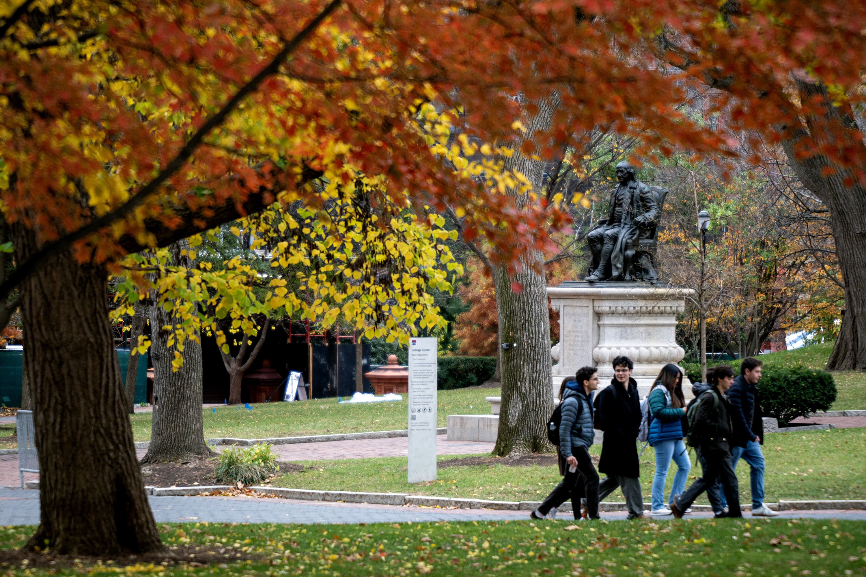
    Nature already is splashing its flecks of yellow on the trees, and soon the Technicolor waves of foliage will ripple toward Philadelphia in what the experts predict will be quite a spectacular season.

    Right on schedule, at 8:04 p.m. Philadelphia time Tuesday, the astronomical fall begins with the instant of the autumnal equinox, when the sun beams its direct light on the equator and nature continues to turn down the dimmer switch in the Northern Hemisphere. It is as though the trees brighten to compensate for our daily loss of 2½ minutes of daylight.

    It’s the season when the night skies are stunningly crowded with winged traffic, when a remarkable 2-inch-long, Halloween-hued creature has its days in the sun.

    And on the nation’s 251st autumnal equinox, we take a look at what nature might offer in the only season with two widely accepted names, “autumn” and “fall.” And we peek at the coming winter — for which a lot of people around here have other names.

    Another Red October?
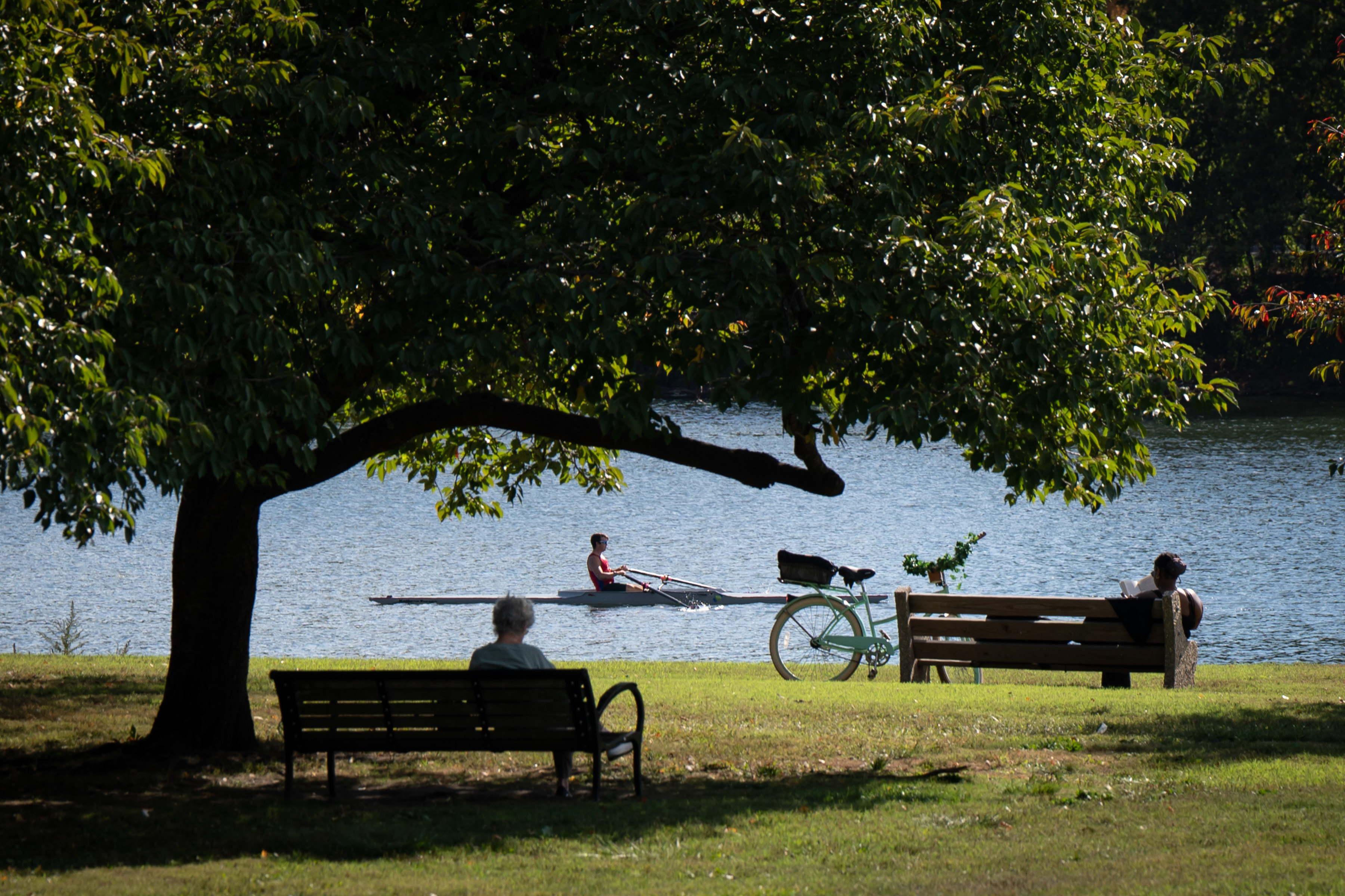
    A beautiful view along Kelly Drive during a sunny day in the quite warm October of 2024.Jessica Griffin / Staff Photographer

    For the third time in the last four years, an equinoctial cooldown is due this week, with daytime highs in the 60s, as much as 10 degrees below normal.

    But the federal Climate Prediction Center on Thursday had the odds tilted toward above-normal temperatures in October in Philly.

    Monthly readings have been above normal in 15 of the last 16 Octobers. In 2024, it hit 84 degrees on Halloween. In that period, annual average temperatures at Philadelphia International Airport have been about 1.3 degrees above normal, but the Octobers have been a full 2 degrees above.

    A very early line on winter

    The intensifying El Niño in the equatorial Pacific is a major player in the center’s winter outlook, posted Thursday. It favors above-normal temperatures here and in most of the nation. The center eschews snow forecasts, but it does foresee a potentially active storm track along the East Coast.

    A cautionary note: This whole seasonal-forecast exercise remains quite the work in progress, and last winter was yet another victory for atmospheric chaos over science. No one foresaw the 30 inches of snow for Philly or a historic snow-and-ice cover.

    The ‘woolly bears’ vs. science?
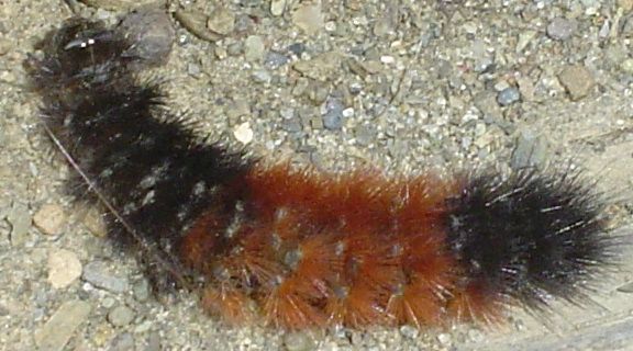
    A “woolly bear” caterpillar. Do those rings say anything about the coming winter?Wiki Commons

    The so-called woolly bear caterpillar had long held a legendary place nationally in weather folklore, but in 1948 the forecasting reputation of the incipient Isabella tiger moths took wings.

    That year a respected entomologist with the Natural History Museum in New York City ventured to a state park and announced that, based on his analysis of the caterpillars’ black-and-orange-ish rings, the subsequent winter would be mild in the New York region. His forecast was dutifully reported in a New York newspaper, and, indeed, the winter was quite mild.

    He continued reporting his annual analyses (however waggishly) that correctly foretold of several mild winters.

    As it happened, some of the winters in that period were so snow-deprived in the Northeast they became the impetus for the snow-making industry that has forever changed skiing.

    Don’t credit or blame the woolly bears, said Douglas S. Richmond, entomology professor at Purdue University. Their ubiquitous presence this time of year all over North America indicates little more than a 100% probability that it is autumn.
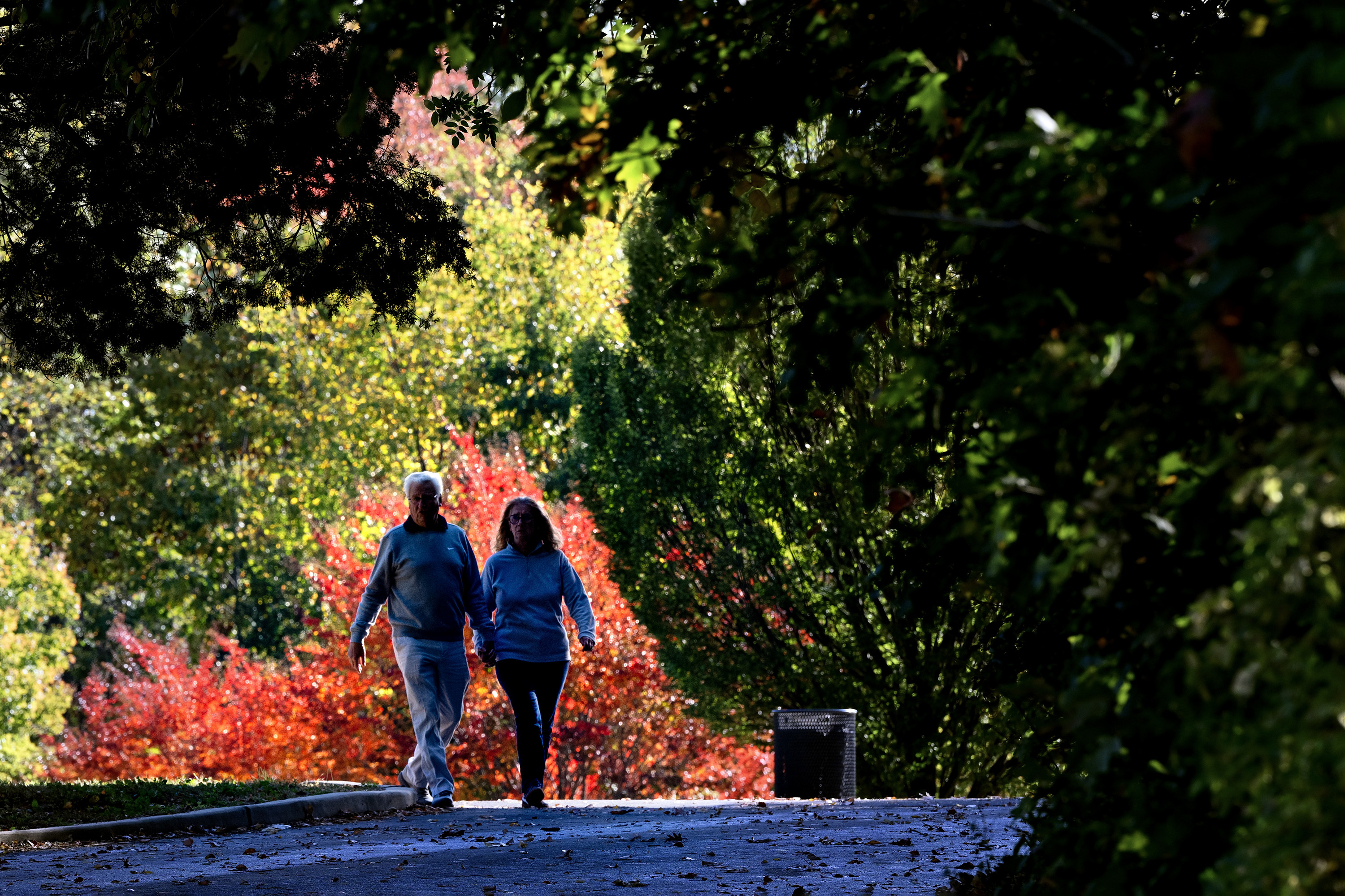
    A single crimson tree in Cherry Hill’s Wallworth Park greets Michel and Brigitte Mistler, from Normandy, France, as they take a morning walk while visiting their daughter in the township Oct. 22, 2025. Tom Gralish / Staff Photographer

    They are quite fascinating creatures, he notes, that survive winters by producing “body fluids that function as cryoprotectants — essentially biological antifreeze.”

    Their bodies actually may contain clues about the behavior of a previous season, according to Richmond.

    “It’s probably better to think about woolly bears as being much better equipped with a rearview mirror than a crystal ball,” he said.

    A natural place to look for clues
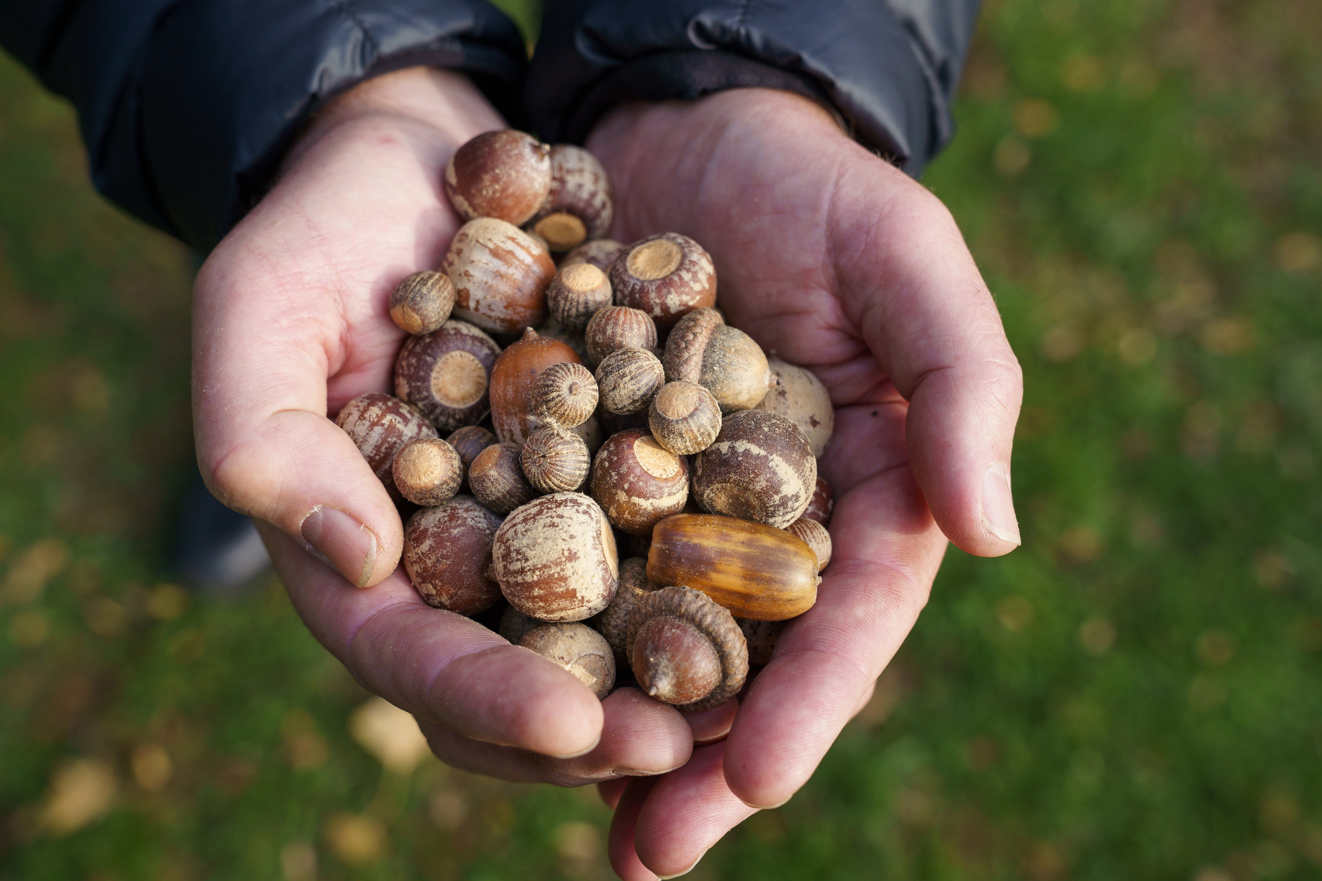
    Bill Cullina, executive director of the Morris Arboretum and Gardens of the University of Pennsylvania, holds a collection of acorns in November 2019. Regardless of what the acorns said, that winter was virtually snowless.Jessica Griffin / Staff Photographer

    Humans have had a long history of forgoing global forecast models and oscillation indexes in favor of consulting nature for winter clues.

    One popular myth cited by The Old Farmer’s Almanac holds that if the acorns keep raining down from the trees like hailstones, get ready for a big chill.

    Leaves would be another indicator: If they drop early, winter will be a breeze. If they linger late, those breezes might be cold.

    Among Native Americans, beavers were bellwethers. The thicker their autumnal coats and stronger their lodges, the harsher the winter.

    The natural world is where to look for clues about the season to come. The waning sun may dim human energy, but it is an ultra-busy time for a lot of other species. It is prime mating season for animals such as birds, bears, deer, moose — and porcupines. We won’t ask how they hug.

    And birds — billions of them — are on the move.

    An avian air force in the night sky
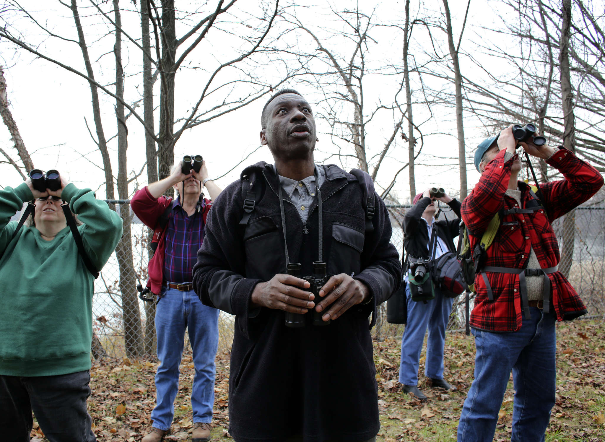
    Audubon’s Keith Russell looking to the skies over Strawberry Mansion while leading a tour.JOSEPH KACZMAREK

    The bird feeders and baths are getting ever emptier these days, but something quite amazing is happening after nightfall about 3,000 feet over our heads.

    An estimated 1.3 million birds flew across Philadelphia on Friday night and early Saturday. And Chester County was the regional hot spot, with 3.8 million heading south-southwest, according to the Cornell University Ornithology Lab’s radar-powered BirdCast dashboard, With a tail wind from the north, they were zipping along at 25 to 30 mph about 1,600 to 1,800 feet above our heads. On the site, you can track bird traffic live, county by county.

    This is the peak migration season, continuing into the first week of October, says Keith Russell, urban-conservation program manager for Audubon Mid-Atlantic, with about 300 species racing through the region, including ruby-crowned kinglets and black-throated green warblers.

    To travel thousands of miles, the birds evidently use a remarkable assortment of clues from the sun, the stars, the Earth’s magnetic field, and even landmarks, according to the Cornell lab.

    If anyone calls you a “bird brain,” be flattered.

    Be grateful for the Earth’s equinoxes
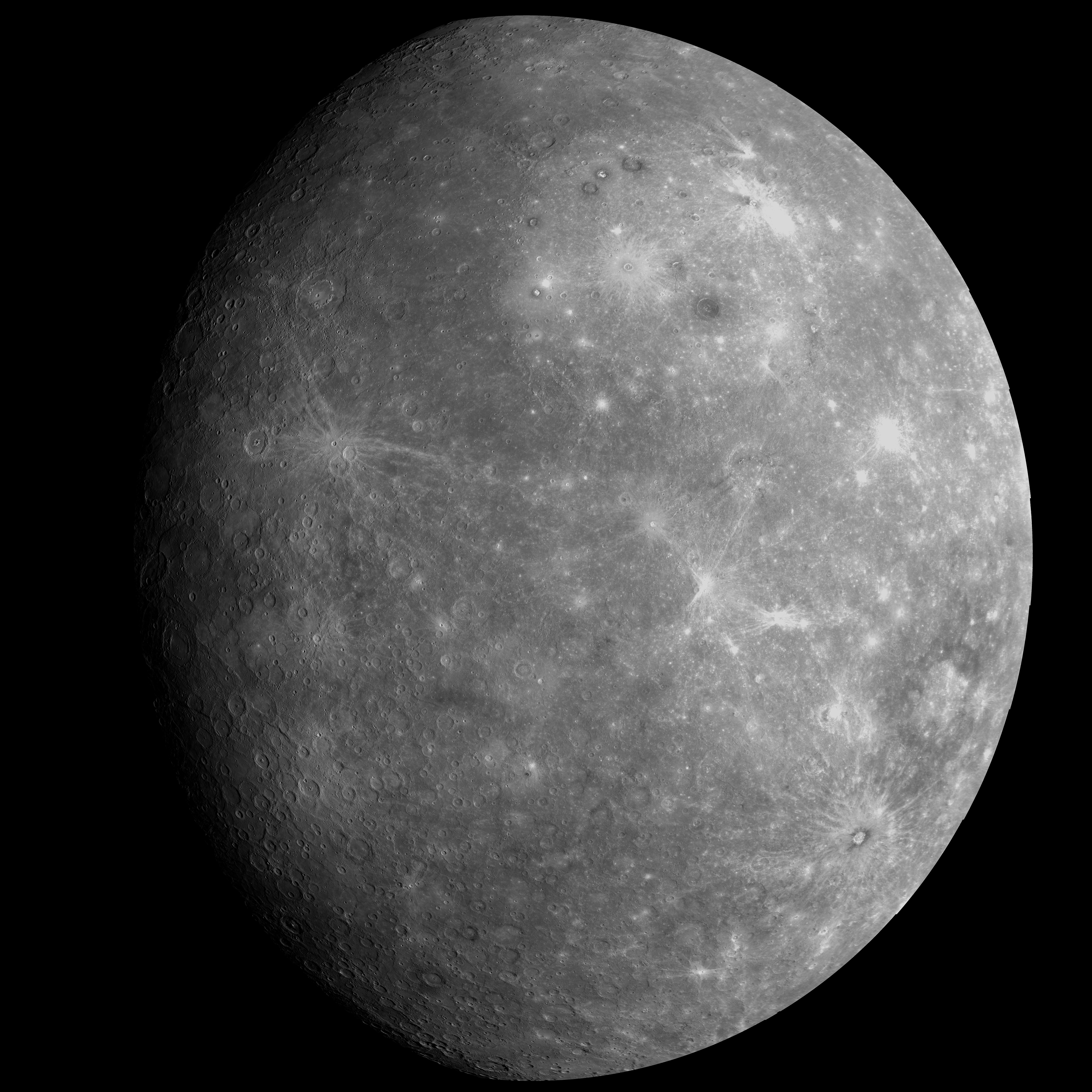
    A NASA/Johns Hopkins University Applied Physics Laboratory/Carnegie Institution of Washington image of Mercury in 2013. You probably don’t want to visit. It has lots of equinoxes but it’s mighty hot, mighty cold, and it has no atmosphere. AP

    Our planet is arguably in the solar system’s sweet spot for equinoxes, which occur twice a year.

    By contrast, Saturn gets one only every 15 Earth years, and Neptune every 82 years, says Harry J. Augensen, director of the Widener University Observatory and a physics and astronomy professor emeritus.

    Mercury has four a year, but temperatures range from 800 degrees Fahrenheit to 290 degrees below zero.

    Earth never looked so good.
  • Downpours expected to return to the Philly region this weekend, with a flood watch in effect

    Downpours expected to return to the Philly region this weekend, with a flood watch in effect

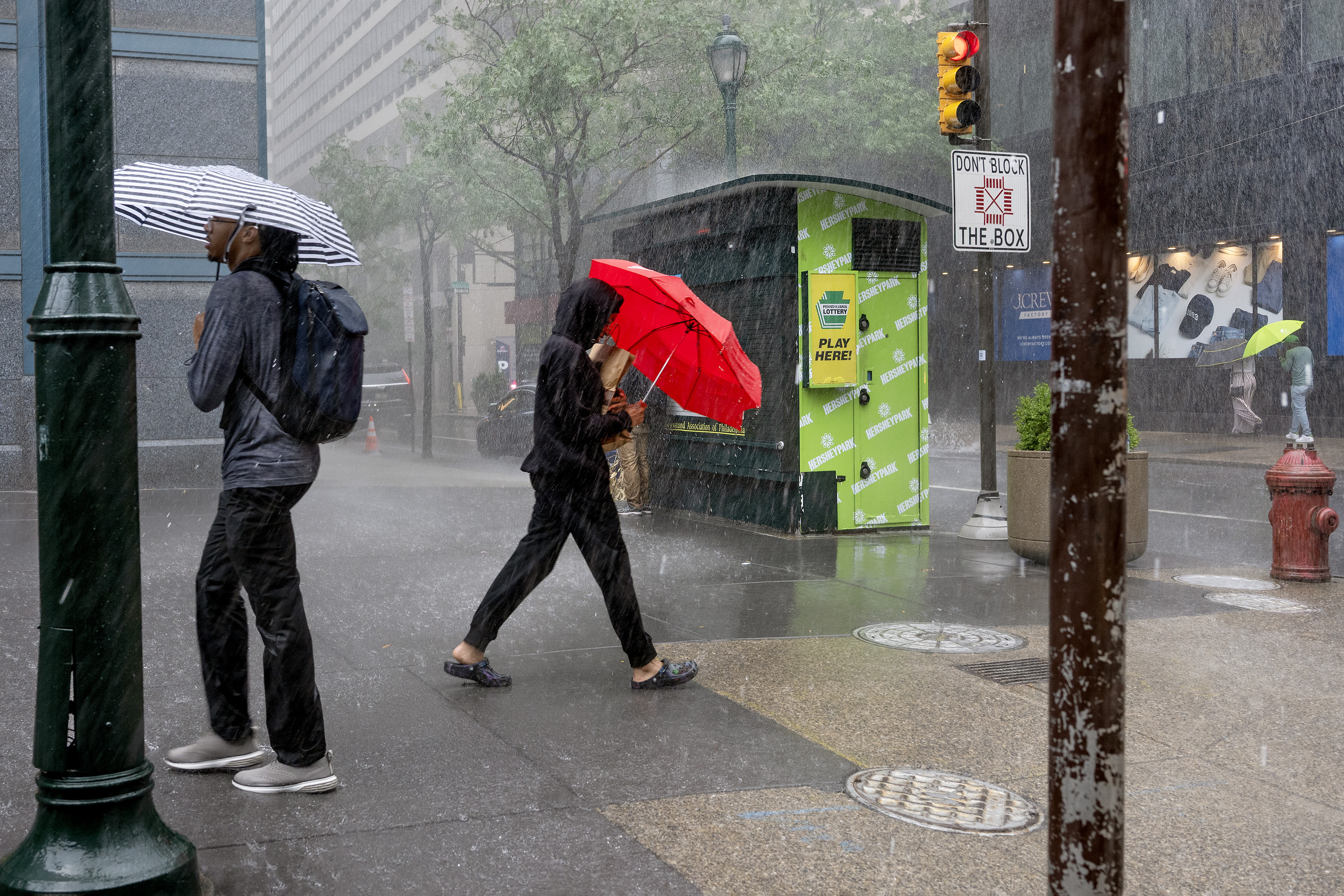
    The atmosphere may be ready to engage in some regressive behavior, with August-like downpours in the weekend outlooks.

    The National Weather Service has posted a flash-flood watch in effect from 11:59 p.m. Saturday through noon Sunday for the entire region, except for Chester County, with heavy showers possible.

    “We have plenty of moisture coming up from the south,” said Frank Pereira, meteorologist with the federal Weather Prediction Center, in College Park, Md.

    The center has the I-95 urban corridor from central Virginia through Philadelphia with an enhanced probability of “excessive rainfall.”

    Widespread heavy rain amounts aren’t likely, said Pereira, but hefty totals could occur in a short period of time.

    The weather service office in Mount Holly said rainfall rates of two inches an hour would be possible.

    Fortunately, after a week’s respite from the episodic rains that so characterized July and August, setting off record numbers of flood warnings, the weather service notes that levels are low in the region’s major waterways.

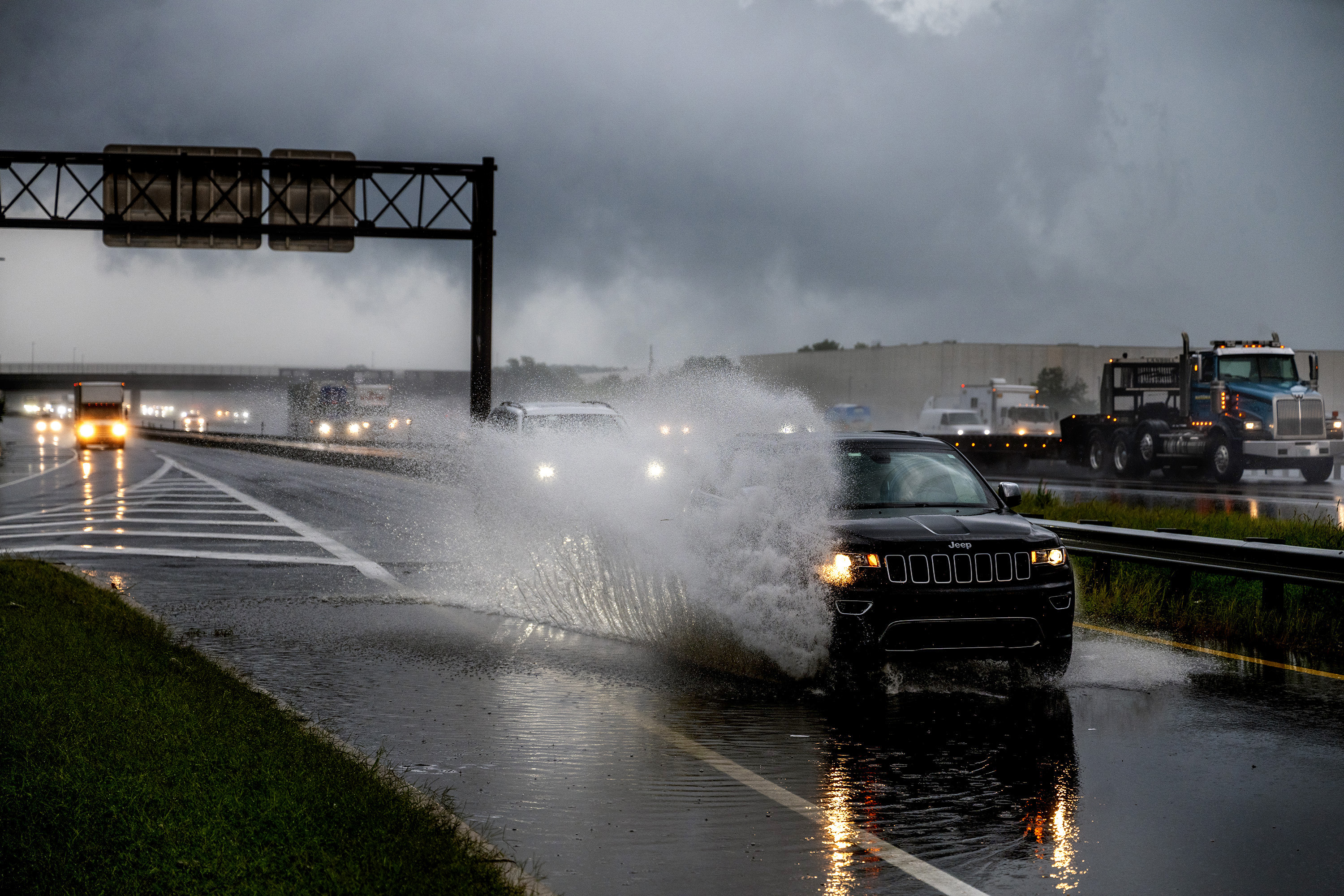
    “The bigger concern with this event will be flash flooding,” the weather service said, the familiar likes of flooding along roads and near the smaller streams.

    While the downpours may evoke August, these would be a shade different in that they wouldn’t be driven by daytime heating, said Paul Fitzsimmons, meteorologist in the Mount Holly office. The sun is getting weaker, the days shorter.

    Setting off the rains would be an approaching cold front from the west and a warm front migrating northward.

    The rains could get an extra kick from very warm decks of clouds about two miles above the surface, said Pereira.

    “You have this very deep saturated warm layer,” he said. “This increases the efficiency of the rainfall,” along with producing larger raindrops.

    In any event, Saturday should be dry during the day, as should most of Sunday afternoon. On the plus side, drought conditions continue to recede.

    Is the drought officially, absolutely over in the Philly region?

    All of New Jersey remains under a state-declared drought warning; however, conditions throughout the Philadelphia region have improved immensely.

    After 16 consecutive months of below-normal precipitation in Philadelphia heading into July, the totals at Philadelphia International Airport are above normal for the year.

    In the latest interagency U.S. Drought Monitor update posted Thursday, most of the region was categorized as absolutely drought-free, a big change from just last week.

    All of Philly was drought-free. Last week, the entire city was designated as “abnormally dry” — the least-serious tier on the monitor’s scale.

    In Chester County, which had been under a state drought “warning” last month, 90% of the county was considered to be in the clear, an increase of 37% from the previous week.

    It might be time for a drought farewell party.

  • Bankrupt Chester City is getting nearly $100 million in state and private funding

    Bankrupt Chester City is getting nearly $100 million in state and private funding

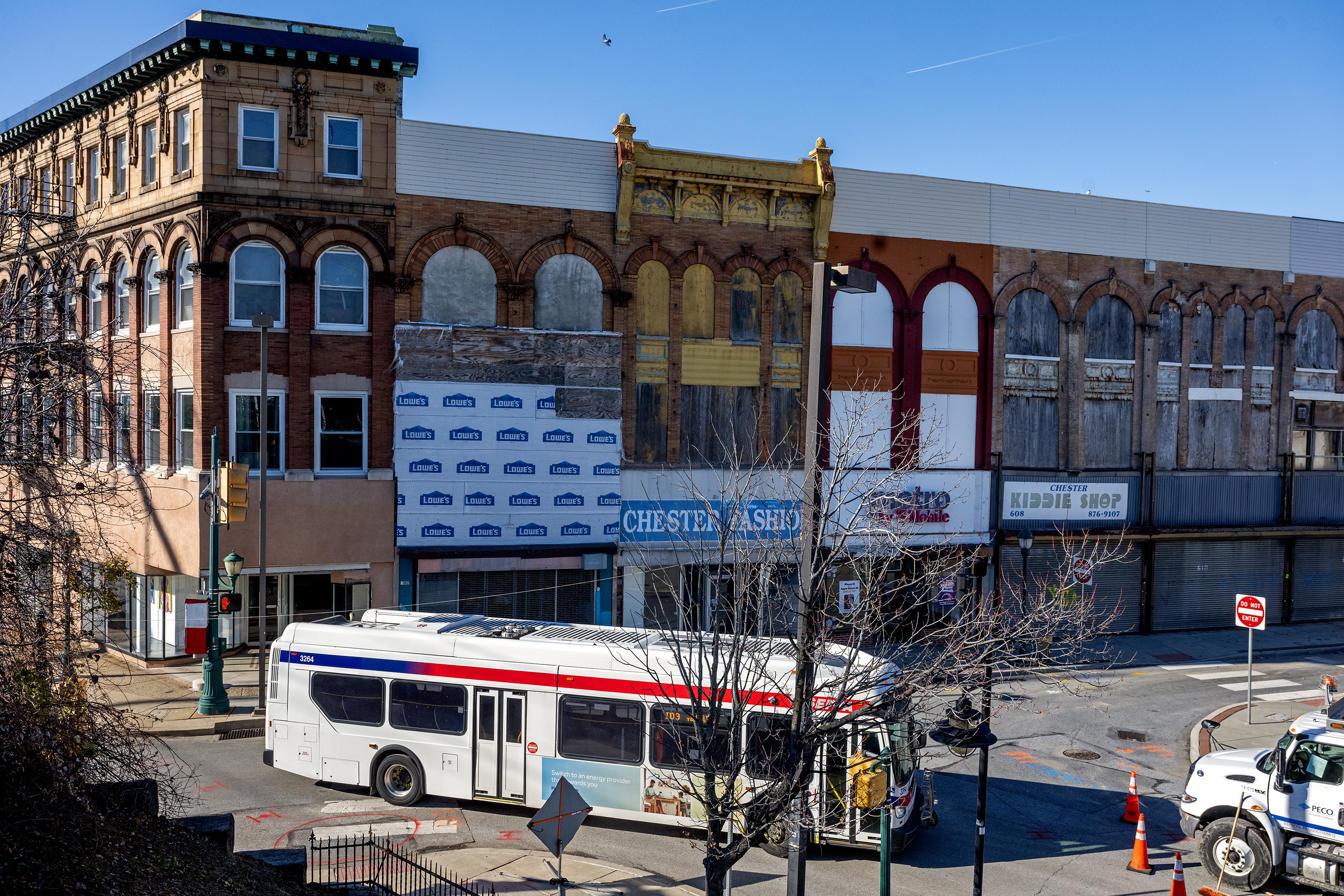
    Approaching the fourth anniversary of its rare and historic bankruptcy, the City of Chester is about to get $97.1 million in public and private investments, Gov. Josh Shapiro announced Thursday.

    “I might just be the happiest mayor in America,” said Chester Mayor Stefan Roots, among those who joined Shapiro for the announcement in Delaware County’s only city.

    Shapiro, noting that the resolution of the protracted and often acrimonious bankruptcy “would take far longer than I’d like,” said “the time to invest in Chester is now.”

    Roots said the money would go toward beautifying neighborhoods and dealing with blighted properties in the city of 33,000. “We’re going to be repairing homes. … We’re going to be improving roads and sidewalks,” he said.

    The majority of the funding, $52.6 million, will go to “revamp and redesign” a section of Route 291/U.S. 13, part of the old “Industrial Highway,” which separates the riverfront from the city neighborhoods. The bulk of that money would come from the Pennsylvania Department of Transportation and the Delaware Valley Regional Planning Council.

    The highway has long been a serious safety hazard for motorists and people who live along it, Roots said in an interview after the event. Speeding has been a major issue, he added.

    PennDot also would be putting up $7.3 million for new sidewalks and walkways to Widener University, at the north end of town, in an effort to integrate the campus with the rest of the city.

    “How do you be a city with a college, and not be a college town?” Roots said.

    He said major efforts would be made to spruce up the Avenue of the States, which is a thoroughfare from City Hall to the campus about 10 blocks away.

    Mayor of Chester Stefan Roots speaks at a Philadelphia City Council meeting in January regarding the incinerator, which has been an important source of Chester’s revenue and a source of protests. Tyger Williams / Staff Photographer

    The state and the Philadelphia Union soccer team are putting up $27.5 million to build “new outdoor fields, a 100,000-square-foot field house, indoor courts, academy space, and a performance center to expand youth programs and support school and community sports” at the riverfront Sportsplex in the city’s West End, according to a state news release.

    Wawa, Essential Utilities Inc., Power Home Remodeling, and Delaware County are contributing $2 million for demolition work and to acquire 10 lots and two buildings, along with fixing up 25 other structures.

    Shapiro said that Chester was now an “enterprise zone,” a Pennsylvania Department of Community and Economic Development program in which tax breaks and grant money would be made available to investors.

    The department is overseeing the city’s bankruptcy process, which began in fall 2022, in part due to several years of missed pension payments.

    But the city’s financial distress has been about 70 years in the making, as it has struggled to pay bills with the loss of businesses and its once-formidable industrial base. Among its prime sources of revenue today are an incinerator and a casino.

    Among the nation’s more than 35,000 municipalities, only about 30 have filed for bankruptcy.

    Neither Shapiro nor Roots made any mention of the bankruptcy beyond the governor’s opening comments.

    State-appointed bankruptcy receiver Vijay Kapoor said in a statement: “We are very grateful for the commonwealth’s and the private sector’s investment in the City of Chester’s future.”

  • The ultra-quiet Atlantic hurricane season is setting records, thanks to El Niño

    The ultra-quiet Atlantic hurricane season is setting records, thanks to El Niño

    Those hurricane outlooks posted by the major forecasting services agreed this was going to be a quieter-than-normal hurricane season.

    But they didn’t call for it to be this quiet.

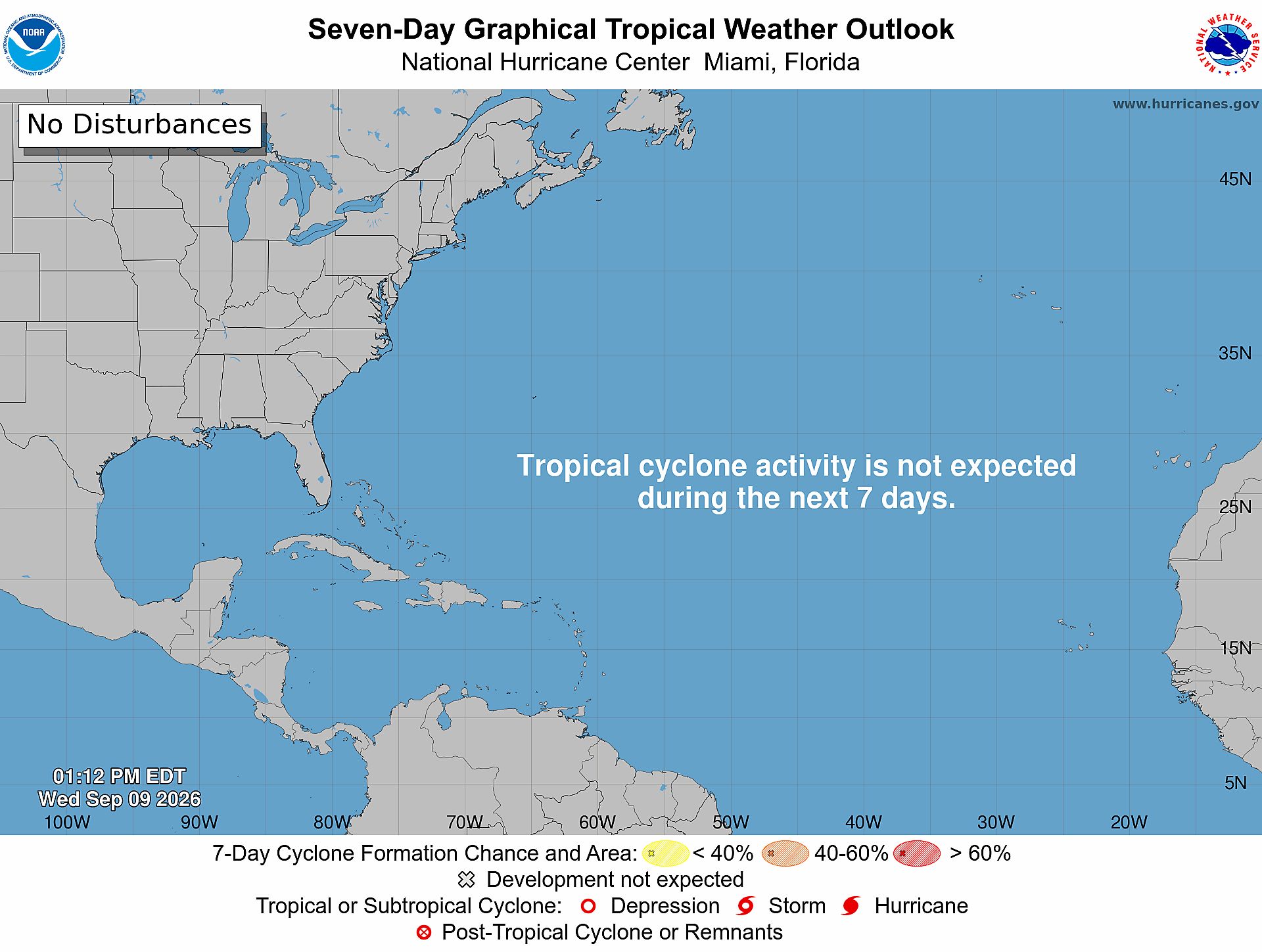
    With the season at its climatological peak, it is about to set a record for the longest wait for the development of a first hurricane in the satellite era, dating to the 1960s, according to the National Oceanic and Atmospheric Administration.

    The standing record, Sept. 11, was set in 2002 and 2013, and this year the National Hurricane Center is seeing zero chances that a hurricane forms in the basin, which includes the Gulf and Caribbean, during the next seven days.

    As the hurricane season approaches a peak, the National Hurricane Center map sums up the quiet of the Altantic Basin. National Hurricane Center

    In 2013, only two hurricanes — storms with winds of at least 74 mph — formed during the season, which spans from June 1 to Nov. 30. That tied 1982 for the fewest number of hurricanes, said Matt Rosencrans, a scientist at NOAA’s Climate Prediction Center.

    The 2026 season might make a run at that record, and the state of the atmosphere and history suggest it has a shot.

    Who hit the mute button?

    The explanation “is almost 100% El Niño,” said Philip Klotzbach, a hurricane specialist at the Colorado State University’s Tropical Meteorology Project, which has been issuing outlooks for over 40 years.

    Would-be hurricanes in the Atlantic haven’t had a snowball’s chance to reach maturity.

    El Niño already is shearing records

    NOAA has said the periodic El Niño warming in the equatorial Pacific has a chance to be the most potent on record.

    Sea-surface temperatures in the vast, key El Niño monitoring zone have been running more than 3 degrees Fahrenheit above normal. That anomalous warmth is affecting the overlying atmosphere in such a way as to generate powerful upper-air winds from the west that are inhibiting the development of tropical storms in the Atlantic Basin.

    For the strength of vertical shear across the western Atlantic, “we continue to crush” records, Klotzbach said, in observations dating to 1979.

    How important is El Niño to the Atlantic hurricane season?

    The El Niño effect on Atlantic hurricanes is evident in the available records. In the six years with El Niños of comparable intensity since 1950, hurricane activity has been well below normal.

    Rosencrans cautions, however, that the data have limits. The era of satellite observation did not begin until 1966, and the credible El Niño records start with 1950.

    Satellites have lifted the qualities of observation to dramatically different heights.

    Klotzbach noted that in 1941 a first hurricane was not observed until Sept. 21, but neither satellite data nor aircraft reconnaissance was available. Plus transatlantic shipping, an important observation source, likely was limited because of the war. Thus, it is entirely possible that a hurricane had occurred earlier.

    One of the strongest El Niño years, 1982, coincided with the record-low number of hurricanes.

    But during the other record holder, 2013, the Pacific waters actually were slightly cooler than normal.

    Even the strongest El Niño would not act in isolation in the chaotic environment of the atmosphere.

    Early in this season, layers of Saharan dust in the atmosphere may have inhibited tropical storm development, said Benjamin Kirtman, dean of the University of Miami Rosenstiel School of Marine, Atmospheric, and Earth Science.

    But the evidence of El Niño’s power over the Atlantic season is “pretty clear-cut.” And this one, he said, was especially precocious.

    “Whereas El Niño episodes typically ramp up toward the peak of hurricane season, this event was already in place and strengthening well before the season’s most active months,” Kirtman said, creating “hostile shear conditions.”

    Take the career of Dolly, which was knighted one of the season’s five tropical storms at 11 a.m. Aug. 27 and demoted to a remnant at 11 a.m. Aug. 28. The hurricane center said it had entered “a hostile environment with significant … shear.”

    What does (or doesn’t) happen next?

    The likelihood of El Niño’s retaining strength into the winter and the limited historical record argue against a late hurricane rally.

    On average, six tropical storms, those with winds of at least 39 mph, have formed after Sept. 11, and four hurricanes. A total of only five hurricanes formed during all six of the comparable El Niño years.

    “I fully expect there to be additional storm threats as the season progresses,” Kirtman said, “but the effects of El Niño remain, so it is unlikely that the season will suddenly become very active.

    “That being said, it only takes one storm to affect where you live.”

  • Philly’s fall foliage season is looking special, September weather permitting

    Philly’s fall foliage season is looking special, September weather permitting

    The sequences of steamy days and downpours in the Philly region and elsewhere won’t rank among the cherished memories of summer, but they may well end up having been a boon to the imminent fall foliage season.

    The consensus among the veteran experts who pay close attention to the behavior of the trees is that this is shaping up to be an excellent season for spectacular waves of fall colors that ripple from northern New England to North Carolina, cresting from early October into early November, with Pennsylvania and New Jersey in the middle of it all.

    As much as some folks may have been fed up with the humidity banquet, the trees — at least those that survived the storms — have been partying. Unlike last year, characterized by an early leaf fall, the players are remaining on the stage.

    “Despite a droughty start to the growing season and some frost damage, our trees are looking green and healthy now, overall,” said Ryan Reed, a forestry specialist with the Pennsylvania Department of Conservation and Natural Resources, who is “looking forward to a beautiful season.”

    What’s more, the snows and Arctic freezes of winter also may have made a significant contribution: The long-lasting snowpack patiently watered the foliage as it melted, neutralizing drought conditions. That was especially true in New England, meteorologist Jim Salge said in his Yankee Magazine foliage forecast.

    But the key to the foliage season would be what happens this month, said Howard Neufeld, a biologist with Appalachian State University, who analyzed weather-foliage patterns for the last several years around the campus area in the heart of the Blue Ridge Mountains and all but interrogated the trees to get at their myriad secrets, most of which they kept to themselves.

    He holds that the main driver in the drama of the season is the production of anthocyanins, the reddish tints that are the show-stealer, and provide the tasteful contrasts to the yellows and russets.

    Sunny days and cool nights are best, say the experts, but like everything else involving the atmosphere, this all gets very complicated.

    As for whether the weather will cooperate, the burgeoning El Niño aside, the scientists who assembled the federal Climate Prediction Center’s fall outlook saw odds slightly tilted toward above-normal temperatures in the fall.

    When to expect the onset and peak foliage

    The day-to-day weather is going to influence when the leaves begin to turn and when they will peak. Just what effect long-term warming is having on the seasons, which are primarily light-driven, is unclear, and “each year brings subtle differences,” says William Keeton, forestry professor at the University of Vermont. Typically, the leaves up his way take on serious color by the end of September and peak the first or second week in October. Where Neufeld, an emeritus professor of ecophysiology, works in the Blue Ridges, whose ultra-popular foliage season was wiped out two years ago by Hurricane Helene, the peak can extend into early November.

    On average, in the immediate Philly region, expect onset in mid-October, with peak around Halloween.

    The higher the September temperature, averaged for the month, the later the onset of color, Neufeld said. A single degree could mean a difference of two days, he added.

    Conversely, he found that higher daily maximum temperatures in September actually sped up the onset. (He didn’t know why, either.)

    The key period for the weather conditions begins right about now, he said. A run of sunny days into October would be ideal for color, but a warm and rainy period would take the blush out of the reds and make for a duller show.

    But that’s very much subject to variability: The trees have complex inner lives.

    What’s behind the fall foliage show

    Without getting too deeply into the weeds (or the leaf piles), here are the basics of the process.

    Along with the shorter days — Philly loses an hour and 15 minutes of sunrise-to-sunset time this month — the sun is losing some mojo. With the dimming of the light, green chlorophyll recedes from leaves, yielding to those carrot-colored carotenoids and flamboyantly reddish anthocyanins. And Neufeld holds the reds are the stars.

    “The oranges and yellows tend to be the same from year to year,” he said, “but the reds vary.” When it’s sunny and cool, sugars accumulate on the leaves and the reds can go to town. But if it’s cloudy and warm, the sugar factories shut down.

    Just why some leaves turn red, such as the maples, “is not completely understood,” Keeton said.

    Neufeld, a biologist, noted that it doesn’t happen in Europe, and holds the redness is related to a form of malnourishment — a function of a lack of nutrients in Eastern North American soils.

    Whatever the cause, the process has contributed to the health and well-being of spectacular falls in one of the world’s prime foliage viewing corridors.

    This year is shaping up to be another one, said Marc Abrams, a Penn State forestry professor emeritus, who has been tracking the woods for over 30 years. “At this point,” he said, “all systems go.”

    Where and when to go leaf-peeping

    For an overview of the likely onset and peak times across the country check out explorefall.com/fall-foliage-map. Its custodians say it’s the product of climatology and computer modeling.

    The show opens in northern New England, and the NewEngland.com site posts graphics that show average conditions for each day.

    Starting Oct. 1, the weekly Pennsylvania Department of Conservation and Natural Resources updates and forecasts, assembled by Reed from on-site reports from forestry officials, will be up and running.

    And check out The Inquirer’s guide on where to peep in the Philly region.

  • The Philly region has been a national hot spot this year — for flood warnings

    The Philly region has been a national hot spot this year — for flood warnings

    If you perceive that the Philadelphia region has had an extraordinary number of flood events this summer, you are not hallucinating.

    The National Weather Service in Mount Holly has set a record for issuing flood warnings this year with 147 in its coverage area from Delaware to northern New Jersey, including 76 in the Philadelphia region, and monthly records in July and August. And an Inquirer analysis documented that among 2,200 U.S. counties, Philly and six of its neighboring counties rank in the top 25 for warnings issued this year, most of which have been followed by actual floods.

    In addition, with four months to go, The Inquirer analysis found, the region already has had nearly triple the annual average for flood warnings, during the 18 years in which it has been using its current methodology.

    (function(){function e(){window.addEventListener(`message`,function(e){if(e.data[`datawrapper-height`]!==void 0){var t=document.querySelectorAll(`iframe`);for(var n in e.data[`datawrapper-height`])for(var r=0,i;i=t[r];r++)if(i.contentWindow===e.source){var a=e.data[`datawrapper-height`][n]+`px`;i.style.height=a}}})}e()})();

    All this without a whiff of a tropical-storm remnant, and the region still emerging from drought conditions.

    The skies keep opening randomly, with no regard to what’s below, whether it be the most affluent communities, the likes of Upper Makefield Township, in Bucks County, to the cities of Camden and Chester, where 30% of the residents live in poverty.

    George Wilson, emergency management chief in Bucks, which ranked in the top 10 for warnings, said “battle fatigue” among rescue workers is only a piece of the flooding ordeals, which empty into days of damage assessments and recovery assistance.

    Just what the generous rains and the repeated “ring of fire” thunderstorms might have to do with the warming planet eludes certainty, said Sarah Johnson, the very busy warning coordination meteorologist in Mount Holly. Other factors, including improved radar and on-the-ground observations, likely have been factors in the increase of flooding reports, she said.

    Johnson noted that given the lack of any tropical involvement — unlike 2020, and 2021, the year of Ida — this year’s numbers would be “pretty unusual.”

    (function(){function e(){window.addEventListener(`message`,function(e){if(e.data[`datawrapper-height`]!==void 0){var t=document.querySelectorAll(`iframe`);for(var n in e.data[`datawrapper-height`])for(var r=0,i;i=t[r];r++)if(i.contentWindow===e.source){var a=e.data[`datawrapper-height`][n]+`px`;i.style.height=a}}})}e()})();

    But if this has been a window into the future, said Dominick Mireles, Philadelphia’s deputy managing director of community safety, “We got a lot of experience this summer.”

    What explains the onslaught

    NASA estimates that rising temperatures across the planet have resulted in more evaporation and added about 7% additional water vapor to the air since the late 19th century.

    Closer to home, it is possible that a pulse of above-normal sea-surface temperatures in June off the Mid-Atlantic coast, a key source of moisture for Philadelphia and the rest of the Northeast, may have added juice to the downpours, said Chad Merrill, senior meteorologist with AccuWeather.

    The Northeast Regional Climate Center, in Ithaca, N.Y., reported that stations from Washington, D.C., to Massachusetts had rainfall far above normal from July 1 to Aug. 15.

    As was the case this week, the I-95 corridor frequently has been on the edge of heat-producing high pressure, a hot spot for “ring of fire” thunderstorms to wring out the moisture.

    The New York City weather service office had its second-busiest July for flood warnings and third-busiest August in data that covers the last 40 years, said Samantha Borisoff, researcher at the climate center.

    Mount Holly’s numbers were triple those of New York’s.

    What might explain why the Philadelphia region would be an atmospheric punching bag?

    (function () {window.addEventListener(‘message’, function (e) { var message = e.data; var els = document.querySelectorAll(‘iframe[src*=”‘ + message.id + ‘”]’); els.forEach(function(el) { el.style.height = message.height + ‘px’; }); }, false); })();

    The best guess would by nature’s caprice, say meteorologists and emergency managers. Nothing personal: Flooding is a reality of life in a heavily urbanized area near so many bodies of water.

    Very simply, “Flooding does happen in Philadelphia and throughout the Delaware Valley,” said Mireles. And much of it is the result of downpours that can target their ferocity to small geographic areas at any time.

    A tragic example of atmospheric randomness was the 2023 deluge in Upper Makefield that killed seven people. Radar images showed most of the county didn’t experience a raindrop. The official total at Philadelphia International Airport that day was 0.00.

    What are some of the region’s prime trouble spots

    The Inquirer data show downpours rarely strike the same precise locations, which isn’t surprising given the small areal scale of most thunderstorms, and the region is short on flood-free zones.

    Parts of all eight counties at some point have been deluge targets, according to weather service storm reports.

    However, several general areas throughout the region have been flooded frequently, Upper Makefield being a prime example.

    “We know River Road at certain points in Upper Makefield, they are going to flood,” said Wilson, as well as Station Avenue, at the lower end of the county in Bensalem Township. “That road has been a problem for all 52 years I have been alive.”

    Germantown is among areas of Philly that historically has been flood prone, said Mireles. On the Camden flood honor roll would be Third Street, Cooper Street, and Admiral Wilson Boulevard

    The Brandywine Creek has been a scenic gem in Chester County, but also a prolific source of flooding in places such as Downingtown and Kennett Square, noted Kelly Tinsman, the county’s deputy director for emergency management.

    However, as would be the case throughout the region, “localized flash flooding … can quickly create response demands even in areas that not considered high-risk flood zones,” Tinsman said.

    Are flood warnings reliable?

    Emergency managers say they have had an excellent relationship with the weather service, which sends out email briefings when severe weather is threatening, sometimes days in advance.

    However, they say they also realize that in the duel between science and atmospheric chaos, the smart money is on chaos.

    “Weather predictions are just predictions,” said Joseph Hales, Camden County chief fire marshal and emergency management coordinator.

    The weather service’s Johnson said that warnings preceded more than 90% of verified floods from 2017 through 2025. However, the false-alarm rate — warnings issued for floods that didn’t occur — was 38%.

    Better to be warned than surprised, Hales said.

    “We experience less issues and less calls for service with the storms that are predicted,” he said. People are less likely to be out and about taunting nature. The pop-up storms that catch people off guard are more problematic.

    “For me, the moral of the story,” said Mireles, is that flooding happens, “warning, not warning; historical flood area or not.”

  • More severe storms are possible this week in the Philly region

    More severe storms are possible this week in the Philly region

    Officially the meteorological fall has begun in Philly, and unofficially it’s beginning to feel a lot like August.

    Along with a heat advisory — the heat index hit 100 Tuesday afternoon — the National Weather Service is warning the region may be in for another one of those random storm outbreaks that so characterized August.

    The weather service issued a tornado warning around 9:05 p.m. for areas in central Burlington County — including for the weather service office in Mount Holly. The warning was based on radar imaging.

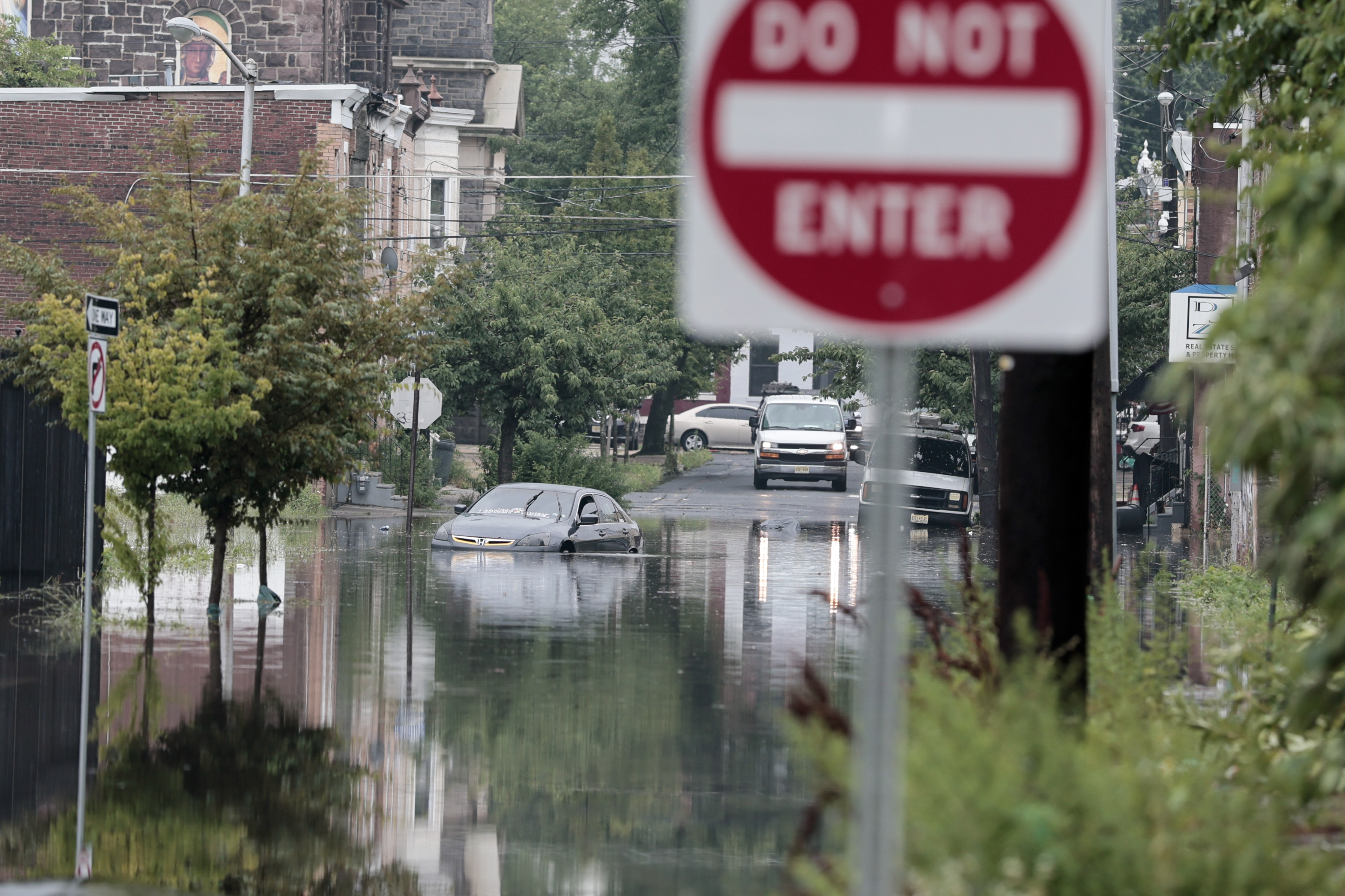
    Flood warnings were up for Chester, Delaware, Camden, and Gloucester Counties. The Collings Lakes Fire Department reported that “multiple roads” in Williamstown, Monroe Township, were “under water.”

    Storm winds reportedly took down trees and wires in several communities in western Chester County, the weather service said, and a tree fell upon Morgantown Road in the West Nantmeal Township area.

    And a severe thunderstorm watch, for storms with gusts approaching 60 mph, was in effect Tuesday until 11:59 p.m.

    “Our biggest concern is damaging winds,” said Sarah Johnson, warning coordination meteorologist at the weather service’s Mount Holly office. “But we can’t rule out the potential for a tornado.”

    Sound familiar?

    What to expect in the Philly region the next few days

    Outside of snow, almost anything.

    In addition to the Tuesday night watch, strong storms are possible Wednesday, and while probabilities are lower during the day Thursday, Johnson said at least one computer model was showing the potential for a “squall line” of storms to approach the region.

    Clouds likely will hold down temperatures Wednesday, but they are expected to reach 90 or better Thursday and the heat index might shoot past 100.

    Is August expected to end soon?

    The atmosphere is due to start cleaning it up on Friday, and the Labor Day weekend is looking spectacular, with the caveat that it’s only Tuesday.

    However, the next three days are looking more like they belong to the August rinse-repeat cycle.

    Once again, the region is likely to experience “ring of fire” thunderstorms from storm-generating impulses along the edges of heat-producing high pressure, said Chad Merrill, senior meteorologist at AccuWeather Inc.

    The sequence has become familiar since mid-June as the edges of the high pressure retreat and allow the storms to develop.

    An overall result has been a remarkable turnabout in the region’s drought fortunes, even though New Jersey remains under a drought “warning.”

    During what the weather community calls the “meteorological summer,” the June 1 to Aug. 31 period, Philadelphia experienced 17 inches of rain, Merrill said, good for 14th place for the three-month period in records dating to the 1870s.

    The meteorological fall really did begin Tuesday. Not that the atmosphere noticed.

    This story will be updated.

  • Strong storms are moving through the Philly region, bringing yet another round of flood warnings

    Strong storms are moving through the Philly region, bringing yet another round of flood warnings

    It’s been a while — about a week, actually — but fresh rounds of strong thunderstorms and flooding bedeviled the Philadelphia region yet again Thursday.

    South Jersey evidently was bearing the brunt of the ferocity during the afternoon, with 5-plus inches of rain reported in Gloucester County, where flooding closed portions of Route 130.

    A tornado warning had been posted in Salem County, but it was not yet known if one was sighted.

    During the late-day commute, a second round of heavy rain moved into northern Chester County and central Montgomery County, prompting flood warnings.

    “Multiple water rescues” were reported in Parkesburg, Chester County, the National Weather Service said, with water up to car windows. Flooding on Route 422 in East Conventry Township resulted in at least one vehicle accident.

    After a couple of uncharacteristically pleasant days, pulses of moisture have returned, and the National Weather Service was warning that as much as three to five inches of rain could fall in “isolated” areas into Thursday night.

    Drivers on the New Jersey Turnpike exit for the Molly Pitcher Service Area during a rain storm Thursday.Tom Gralish / Staff Photographer

    Strong storms rumbled through the area late in the morning and pounded South Jersey in the afternoon.

    Officially, 1.48 inches of rain was measured at Philadelphia International Airport, bringing the 2026 total to 28.84 inches, for 0.03 inches over the year-to-date normal.

    (function(){function e(){window.addEventListener(`message`,function(e){if(e.data[`datawrapper-height`]!==void 0){var t=document.querySelectorAll(`iframe`);for(var n in e.data[`datawrapper-height`])for(var r=0,i;i=t[r];r++)if(i.contentWindow===e.source){var a=e.data[`datawrapper-height`][n]+`px`;i.style.height=a}}})}e()})();

    Heavy rains also set off flash flooding warnings in Delaware County and in portions of Bucks County.

    In addition, a severe thunderstorm watch was in effect for the entire region.

    The flood watch is in effect for the city and the seven neighboring counties from noon Thursday to 4 a.m. Friday, with rain-repelling high pressure moving offshore and a warm front migrating northward.

    Said Cody Snell, meteorologist with the national Weather Prediction Center in College Park, Md., “It’s a pretty typical pattern that we’ve seen before this summer.”

    Indeed.

    Computer model runs were suggesting that the atmosphere would not only be moist, but charged with energy, the weather service in Mount Holly said Wednesday afternoon.

    The federal Storm Prediction Center in Norman, Okla., listed a 15% chance of severe storms, those with wind gusts approaching 60 mph, along the I-95 corridor. At least it made no mention of possible tornadoes — yet.

    When might the storms hit the Philly region?

    The likeliest window for the main events would be between 2 and 8 p.m., said Bill Deger, senior meteorologist with AccuWeather Inc. said

    The sun is likely to appear after the morning rain shuts off, he said, and that would “help destabilize the atmosphere,” adding a kick to potential thunderstorms.

    He expected a midafternoon round, followed by an encore in the evening.

    What areas are likeliest to see flooding or severe storms?

    For severe weather, all of Southeastern Pennsylvania and New Jersey areas along the Delaware River are in the storm center’s highest risk zone, which extends from the Maryland-Virginia border to upstate New York.

    Along the Delaware River, Snell said, “there’s a little bit of signal for training thunderstorms.” Those are the kind to develop and not move, the kind that can wring out three to five inches.

    “The biggest threat is flash flooding,” said AccuWeather’s Deger, with the higher potential in Philly and areas west of the Delaware.

    He said the west-to-east moving storms may run out of steam by the time they get to Jersey.

    However, any rains are likely to cause trouble, he said.

    “Our ground can’t handle much more at this point,” said Deger, who lives in the Quakertown area and has seen the harvests of the downpours in his backyard.

    “I’m mowing every four days,” he said.

    Staff writer John Duchneskie contributed to this article.

  • The forecast for the Philly Cycling Classic’s return has light wind and little chance of rain

    The forecast for the Philly Cycling Classic’s return has light wind and little chance of rain

    What has been the summer of floods, thunder, and smoke is fortuitously poised for a shower of good fortune upon the reconvened Philadelphia Cycling Classic this weekend.

    “I would say it looks good Saturday and Sunday,” said Robert Oravec, a lead forecaster at the national Weather Prediction Center.

    The odds strongly argue in favor of the 212 cyclists completing their miles — 120 for the men, 62 for the women — without encountering a drop of rain, a fitting way to end the classic’s 10-year hiatus.

    What’s more, the winds should be light, forecasters say, on the order of 6 to 12 mph, from the north on Saturday, and southwest on Sunday.

    The forecasts for Saturday and Sunday

    For Saturday’s fan fest, which begins at 10 a.m. and ends at 5 p.m. near the Philadelphia Museum of Art, it should be sunny throughout, with temperatures in the low to mid-80s.

    For race day, it will be a shade steamier than Saturday, but not heat-wave level, said Matt Benz, senior meteorologist with AccuWeather Inc.

    Conditions are likely to be more comfortable in the morning during the women’s 62-mile race, which starts at 8:30. Temperature readings should be in the 70s, with heat indexes well below 90.

    The predicted heat index creeps past 90 during the men’s race, and expect some serious shirt-soaking during the scalings of the iconic Manayunk Wall and by the time the 120-mile course is completed.

    Benz said there is a way-outside chance of a shower near the end of the race, but the National Weather Service is listing the probability at under 10%.

    Given that on average Philly receives measurable rain once every three days, dry weekends are not the norm around here, especially this summer.

    Since June 1, officially Philadelphia has experienced only two weekends without measurable rain.

    The rain cups have been overflowing throughout the region, and Philadelphia’s totals for the last two months have been 133% of normal, according to the Middle Atlantic River Forecast Center.

    While both Chester County and all of New Jersey remained under state drought “warnings,” conditions have improved markedly in Philly and the seven neighboring counties, according to Thursday’s interagency U.S. Drought Monitor update.

    Parts of the region this week were classified as “abnormally dry,” the lowest drought designation on the monitor’s scale.

    But portions of Bucks and Montgomery Counties were labeled as completely drought-free.

    Showers are possible during the workweek as temperatures approach 90 and humidity increases, forecasters say.

    But fortunately for the cyclists, the rain gauges should be empty Saturday and Sunday.

  • Ragweed season is approaching its peak in Philly, and the rains likely gave it a boost

    Ragweed season is approaching its peak in Philly, and the rains likely gave it a boost

    The recent rain rally has been a boon to the Philadelphia region’s plant life, and, unfortunately for the legions of the allergic, the beneficiaries include the homely and ubiquitous tormentor commonly known as ragweed.

    It belongs to the plant family Ambrosia, from the Latin for “food of the gods.” One can only assume the gods did not have allergies.

    Estimates vary, and it’s not as though it is a census category, but in all likelihood several hundred thousand people in the region annually endure the slings and arrows of ragweed pollen, notorious for setting off episodes of sneezing and attendant dopiness.

    It also can induce coughing, wheezing, and chest discomforts, particularly among asthmatics, allergy experts warn.

    The season — the third in the equinox-to-equinox pollen trilogy, successor to the trees and grasses — typically begins modestly in early August, then intensifies late in the month and continues well into September. And this year sufferers may pay a price for the episodic drought-easing rains that have been watering the plants in the Mid-Atlantic region since mid-June.

    “Ragweed thrives on the nitrates in rainwater,” said Payel Gupta, an allergy, asthma, and immunology specialist based in New York City. The rains’ timing has coincided with “ragweed’s late-summer growth window,” she added, and the result likely will be “denser plants and higher pollen output.”

    As for precisely when the pollen will peak: “Every year is different,” said Donald Dvorin, who for more than 30 years was the Philly region’s official National Allergy Bureau pollen counter, “but the first week of September is most common.”

    In addition, with the planet’s temperatures increasing and first frosts taking their good old time, the seasons appear to be lasting a bit longer.

    The prime pollen flight hours are from 5 to 10 a.m.; effects can linger, however, as pollen can stick to clothing and find its way indoors via unwitting humans and pets.

    What is ragweed?

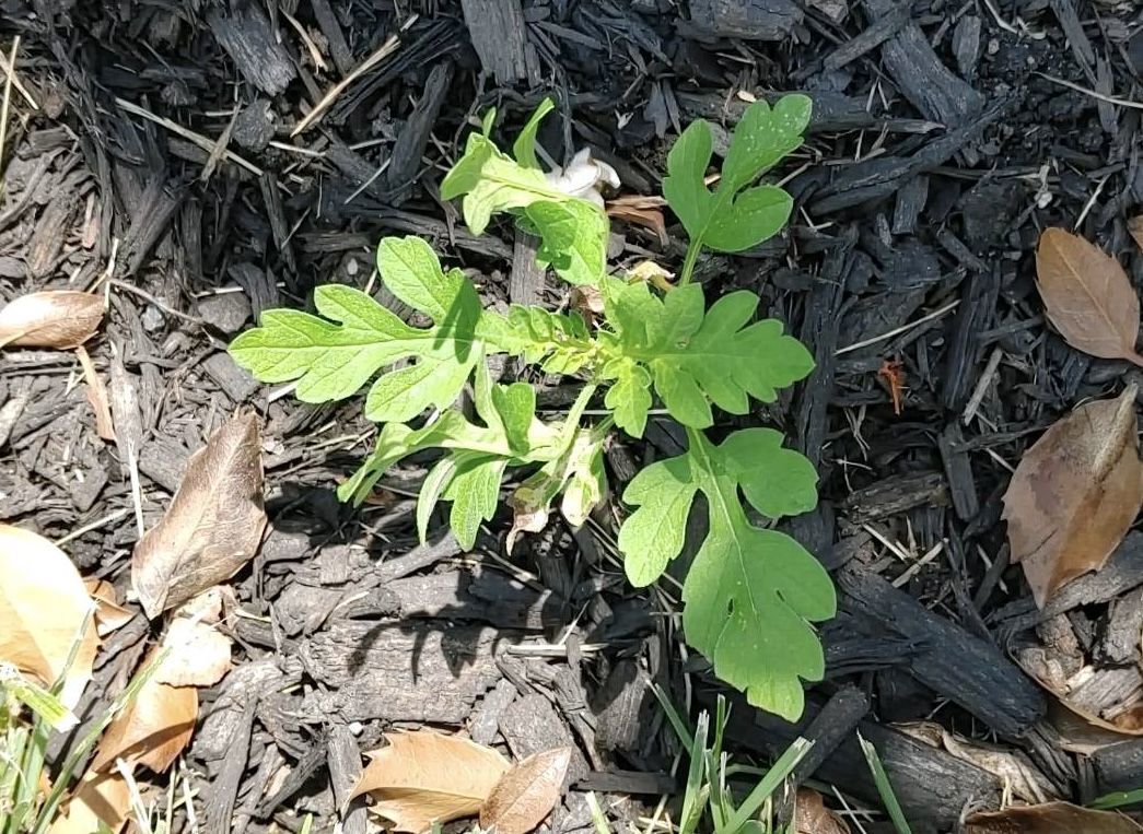
    Ragweed is a tooth-leaved plant that can grow in almost any environment, native to North America but spreading worldwide.

    For the allergenic, Dvorin said, the heavy hitters are the “short” ragweed (Ambrosia artemisiifolia), and the “giant” (Ambrosia trifida).

    A typical pollen grain is a mere 1/25,000th of an inch in diameter, but a single plant can generate a billion of them.

    While the plants live for only about a year, do they ever reproduce! Pollen has been found as far as 400 miles from the source, according to the Allergy and Asthma Network.

    New York City spent millions after World War II to eradicate ragweed in the city, a war it lost resoundingly. For one thing, the warriors discovered that about half the ragweed pollen in the five boroughs was commuting from elsewhere.

    The torments of ragweed

    Most people inhale ragweed pollen without incident, but for the allergic, the body interprets the pollen as an invader, and sneezes and other reactions are part of the immune response.

    For the sufferers, each season can be a little bit different, said Gupta, assistant clinical professor at the State University of New York and Mount Sinai Medical Center in Brooklyn.

    Severity would depend on “how many consecutive high-count days there are,” Gupta said. Exacerbating factors could be “viral infections or air pollution compounding irritation,” she said.

    In addition, some patients may be subject to “priming,” a particularly nasty season that might make some more susceptible to pollen discomforts the following year.

    And ragweed is nothing to just sneeze at, according to the International Ragweed Society, which is based in Switzerland and aims to promote ragweed research.

    In addition to a “socioeconomic burden due to rising healthcare costs” and “productivity losses,” the society states, the weed’s pervasiveness can endanger certain crops and natural habitats.

    How much ragweed is in the air?

    Unfortunately, that has become harder to know. Dvorin, an allergist who had practiced in Center City and Mount Laurel, stopped counting pollen last year, and that was symptomatic of a trend. The network has been shrinking.

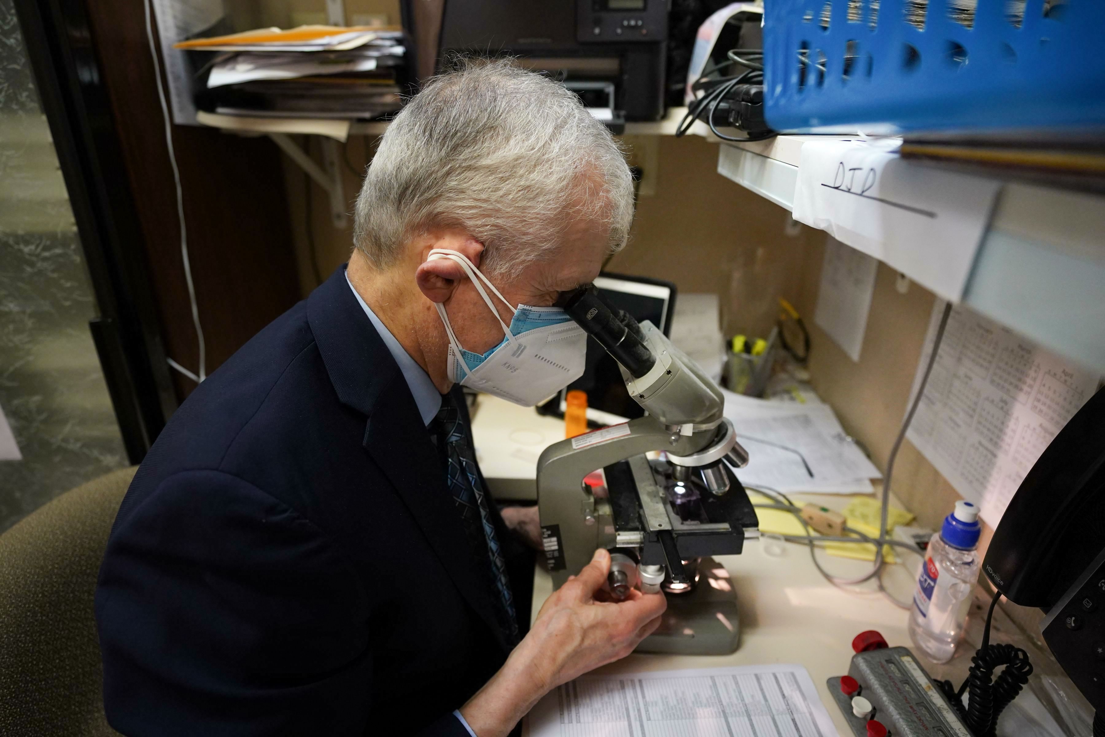
    Gotcha! Donald Dvorin analyzing a pollen specimen. He stopped counting pollen last year, and the network has been shrinking.Jessica Griffin / Staff Photographer

    Traditionally, allergists such as Dvorin supplied daily counts on a voluntary basis as part of the National Allergy Bureau network. However, the analyses require expertise and time that allergists could devote to revenue-paying patients.

    Fewer doctors evidently have been willing to participate.

    The nearest allergy bureau counter who posts frequent counts is in the Washington area.

    The Asthma Center in Center City posts daily counts that are AI-generated, and while that technology shows tremendous potential, the allergy bureau has not yet approved any of the machines for official use, said Pamela E. Gabrish, the bureau’s program director.

    “There has actually been more backlash against using automated devices than ever,” she said.

    Advice for ragweed sufferers

    Day-to-day pollen volumes are difficult to predict, but expect the peak to arrive next week.

    It is a good bet that counts will be high on a warm, dry, and breezy day.

    This will be evident in the online pollen forecasts, but be aware that pollen is commuting on the chaotic whims of the atmosphere.

    In a study of five major cities, published in 2024, allergy experts concluded the accuracy of online pollen forecasts was “low.”

    Along with medications, here are a few suggestions from allergy professionals:

    • Limit time outdoors on dry, windy days.
    • When outside, wear a dust mask.
    • Inside, keep the windows closed.
    • Shower before going to bed.

    And hope for rain, within limits.