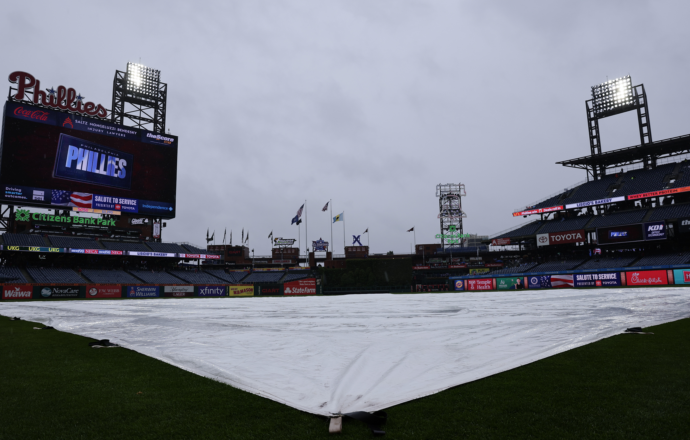
The Phillies might feel right at home Thursday when they are scheduled to play the Minnesota Twins in the “Field of Dreams” game in Dyersville, Iowa.
The weather out there is expected to have more than a dash of Philadelphia-style August flavor, with mugginess and rains during the day that could linger into game time, with the first pitch scheduled for 7:30 p.m. Philly time.
“We’re tracing a potential band of storms that will set up near the ‘Field of Dreams’ Thursday evening,” said Connor DeLaune, meteorologist with the National Weather Service office in Davenport, Iowa.
“There probably will be a few isolated lightning strikes,” he added.
But this caveat might sound familiar: The timing and location of any storms remain uncertain, a forecast problem as challenging in northeastern Iowa as it is in Southeastern Pennsylvania.
John Feerick, senior meteorologist with AccuWeather Inc. and a die-hard Phillies fan, said it is possible the rains will back off during the evening.
“There may be enough of a break where they could get the game in,” he said.
That said, the teams may be better off waiting until Friday, which “looks a lot better.”
While no steady rain is expected Friday, Feerick added that he could not rule out that Philly special — a pop-up thunderstorm.
A certain seasonal disorientation is understandable these days, and we’re not talking about whatever is going on with the planet’s climate.
The Philly-born La Colombe coffee chain began offering its pumpkin spice drinks this week, and while that may seem early for evoking the spirit of Halloween, even among its rivals — Starbucks doesn’t turn to pumpkin until Aug. 25 — La Colombe is miles behind the candy industry, which has been at it for months.
In early May, as part of its “Halfway to Halloween” promotion, Mars Inc. was offering a “Creepy Crunch” variant of Skittles, Twix “skulls,” and pumpkin-shapedSnickers.
Over the weekend, as many as 3,000 people showed up for the seasonal grand opening of the Spirit Halloween store in Egg Harbor Township — 37 days before Labor Day, and in an era when summery weather appears to be lingering longer. (Philly’s average temperatures were above normal the last five Septembers.)
Complaints about the so-called seasonal creep phenomenon are decades old, but what was once a creeping tide has mutated into a tsunami “in the last several years,” in the view of Mark Lang, associate professor of marketing at the University of Tampa and a longtime supermarket executive.
“It snuck up on us,“ said Lang, an alumnus of both Temple and St. Joseph’s Universities.
“The guardrails are gone,” he added, sayingthe creep movement was “racing forward.”
“I see the movement as accelerating,” agreed Richard George, a St. Joe’s food-marketing emeritus professor.
However, it is not as though consumers are resisting, he said. For example, Christmas shopping in October is becoming ever more popular. “Consumers want to capture these deals, take advantage of greater product choices, spread out their spending, and avoid some of the stress related to holiday shopping,“ he said.
But one premature season at a time.
What is driving seasonal creep?
Money, for one, Lang said. And competition.
Sales in the confectionary industry reached a record $55 billion last year, according to Carly Schildhaus, spokesperson for the National Confectioners Association, with Halloween an important bite of that.
Businesses have to mine everything they can from the peak seasons — which very much include the sales of candy and assorted spooky paraphernalia for Halloween and holiday gifts for Christmas — said Lang, who for 11 years was the No. 2 marketing person at the Publix supermarket chain. And it doesn’t hurt to make those seasons longer.
“If they don’t beat last year’s seasonal sales, their whole year is off,” he said
Halloween is becoming the “longest retail season,” according to Mars executive Tim LeBel, who is quoted on the company website as saying, “Culture, not the calendar, is defining the seasons and our strategy.” According to Mars, it would begin in the spring.
By Mars’ count, 30% of all 20-somethings have participated in “Summerween” events, which have been gaining media attention in recent years. As the word suggests, those areHalloween-themed parties during the sweaty season. (The phrase comes from an animated TV series episode that aired over a decade ago.)
“Summerween has gained momentum,” said Schildhaus, who also invoked the cultural factor mentioned by LeBel.
For the retailers, the seasonal creep momentum is more about the economic connection, Lang said.
Stores are not only competing against one another but also battling “category killers,” like those temporary Halloween stores that put pressure on other shops to offer similar merchandise, he said.
“Everybody is grabbing at the bag at the same time,” Lang said. “Retailers have to get their piece or the other guy is going to get it. It’s a lack of imagination. I think retailers and vendors are just out of ideas.”
People gathering for the new Spirit Halloween flagship store in Egg Harbor Township, N.J., on Saturday, Aug. 1, 2026.Tyger Williams / Staff Photographer
Will the seasons continue to creep?
The consumer response argues that it will, and George believes the seasons will continue to stretch, and not just Halloween.
Online shopping has further blurred seasonal lines, George said, since it “combines technology with information and convenience, making shopping occur whenever consumers are in the mood.”
But Lang said he was not so sure the elongations would continue to stretch into perpetuity.
“I hear people saying, ‘Give me a break,’” he said. “When you see Halloween candy in July, it’s like, enough of it.”
Jumping the seasons induces a certain “holiday fatigue,” he added.
He said he fears that what was once an occasion “feels like it’s a selling event.”
For the record, only 139 shopping days until Christmas.
Staff writer Sarah Nicell contributed to this article.
Skin-clinging humidity, random downpours, heat indexes in triple figures, steamy nights. Welcome to Miami North.
The heat advisory for the entire region has been extended to 8 p.m. Saturday, with more random showers likely. As to when something resembling comfort returns to Philly? “That’s the million-dollar question,” said Matt Benz, senior meteorologist with AccuWeather Inc.
Similar conditions could persist into late next week, he added.
Highs might not get much past 90, but with the atmosphere this steamy, the heat index in Philly had reached 102 at 2 p.m. (In Miami, it was down to 82, thanks to a cooling thunderstorm.)
Both Camden and Delaware Counties have posted “code red” heat advisories, even though conditions are not expected to approach the official criteria of two consecutive days of highs of at least 95 degrees.
Waves of air from the Gulf Stream and the gulf itself continue to wash over the Mid-Atlantic region, said Brian Hurley, senior branch forecaster at the federal Weather Prediction Center in College Park, Md., adding that the situation is going to persist.
(function(){function e(){window.addEventListener(`message`,function(e){if(e.data[`datawrapper-height`]!==void 0){var t=document.querySelectorAll(`iframe`);for(var n in e.data[`datawrapper-height`])for(var r=0,i;i=t[r];r++)if(i.contentWindow===e.source){var a=e.data[`datawrapper-height`][n]+`px`;i.style.height=a}}})}e()})();
On the plus side, drought conditions continue to ease, and officially in Philadelphia, rainfall since Jan. 1 is now about normal, recent rains having wiped out a significant deficit.
Officially, both the entire state of New Jersey and Chester County are under state-imposed “drought warnings,” but changes may be in the wind and the clouds.
Three months ago, all of New Jersey was in at least “moderate drought,” according to the interagency U.S. Drought Monitor, but with Thursday’s update, less than half the state was so designated. As for Chester County, the percentage of the county in “severe drought” has dropped from 90% to 37% in the same period.
However, the recent rains have come in fits and starts and have been less generous in some areas and overly generous elsewhere, and have had a knack for outwitting science.
Those random downpours are going to continue
“Multiple rounds of showers and thunderstorms each afternoon and evening may become strong to severe,” the National Weather Service in Mount Holly warned Thursday.
Don’t expect much notice.
Case in point: Around 7:30 p.m. Wednesday, the weather service posted a missive: “The threat for flooding has diminished tonight.”
Shortly thereafter, flood warnings went up for portions of all four of Philly’s neighboring Pennsylvania counties.
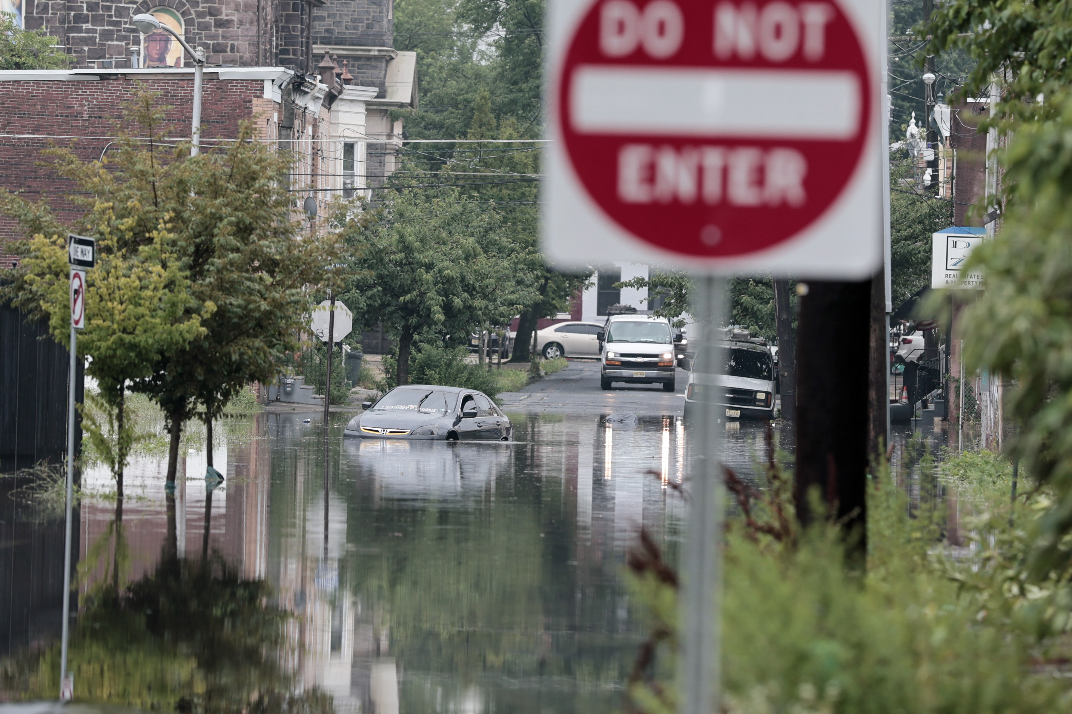
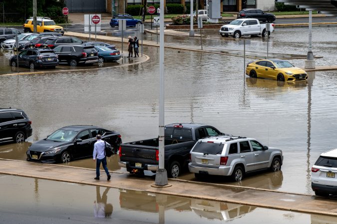
That followed afternoon downpours that caused extensive road flooding in Philly and neighboring areas as a corridor of heavy rain cut through the city.
Michael Silva, a meteorologist in the Mount Holly office, was among those who had not seen it coming.
“Before work, I was about to go out twice for walks,” Silva said. “Then I looked at the radar.”
Despite all the rain, and probably as result of the antecedent dryness — heading into July, Philadelphia had experienced 16 consecutive months of below-normal rainfall — stream and river levels remain well below the danger zones.
And so far, the trees appear to be holding their ground, said Shane Farrell, arborist with the Davey Tree Expert Co., and to date he has not seen the type of “mud slurry” that might coax them out of their roots, barring severe-storm gusts.
Showers are likely to be numerous and widespread on Friday, said AccuWeather’s Benz.
The outlook for the weekend for Philly and the Shore
Saturday is expected to be a clone of Thursday, as a so-called Bermuda high-pressure system over the North Atlantic continues to lure steamy air northward. Winds circulate clockwise around centers of high pressure; thus, areas to the west of the center, where Philly happens to be, experience winds from the south and southwest.
Benz sees an outside chance that an approaching front will provide a very temporary and modest measure of relief on Sunday. Don’t bet on it, however. He said it is going to encounter a whole lot of resistance along the way.
The outlooks are similar for the Jersey Shore, which is likely to be quite a popular destination this weekend.
Yet more rinse-and-repeat flood warnings were posted for Philadelphia and portions of adjacent counties Wednesday as more downpours oozed through the region.
And don’t be surprised if more pop up later in the week, as the atmosphere will remain thickened with so much skin-clinging water vapor that “it’s not going to take much” to turn on the faucets, said Michael Silva, a meteorologist at the National Weather Service in Mount Holly.
One indicator of the atmospheric saturation: The weather service has posted a heat advisory for Thursday as heat indexes could rise to 100 or better — even though temperatures won’t get much past 90. That is all about the humidity in what could be the start of a more muggy wave, as opposed to a traditional heat wave.
The moisture in the air on Wednesday was such that the rain, which began around lunchtime, ended up being more ferocious than expected.
“Before work, I was about to go out twice for walks,” Silva said. “Then I looked at the radar.”
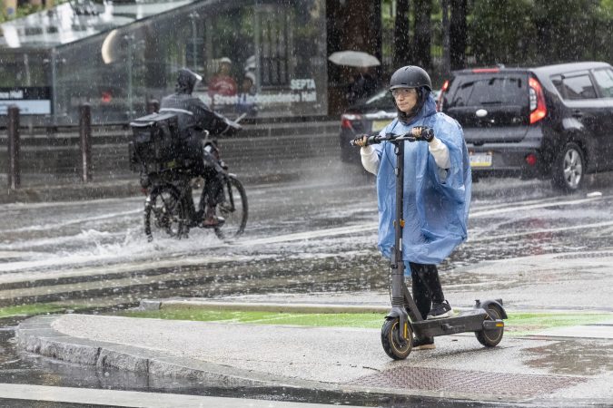
The heavy rains were wrung out along a narrow corridor cutting through the city, and they generated widespread traffic disruptions during the afternoon.
The weather service said that 1.23 inches of rain had been measured at Philadelphia International Airport, just between noon and 1 p.m. More than 2 inches fell upon parts of Bucks County.
Road flooding was widespread in Philly, Bucks County, and South Jersey.
Among the highways affected were the Schuylkill Expressway in the Point Breeze area; I-95 in Eastwick, at the Platt Bridge, and in the Croydon, Bucks County, area, where the warning was extended until 6:15 p.m.; and Route 130 in Burlington County.
(function(){function e(){window.addEventListener(`message`,function(e){if(e.data[`datawrapper-height`]!==void 0){var t=document.querySelectorAll(`iframe`);for(var n in e.data[`datawrapper-height`])for(var r=0,i;i=t[r];r++)if(i.contentWindow===e.source){var a=e.data[`datawrapper-height`][n]+`px`;i.style.height=a}}})}e()})();
The rains were getting juice from a rich pulse of moisture from the South, said Mike Gorse, a meteorologist at the weather service’s Mount Holly office.
What’s more, these types of threats may be a “repeated thing” later in the week, he added, echoing Silva’s comment, with showers in the forecast again for Thursday night and Friday as the region is stuck in another sultry air mass.
The recent rains represent quite a reversal of fortune for the region and the entire state of New Jersey.
After 16 consecutive months of below-normal precipitation in Philly, officially close to 10 inches of rain has been measured since July 1, and recent rains have set off rashes of flood warnings, including on Sunday.
July’s total, 7.03 inches, was 2.65 inches above normal.
Still, water levels along the Schuylkill in Norristown and the Delaware River at Trenton have remained relatively low, the result of all that antecedent dryness.
However, flashier creeks, such as the Neshaminy, in Bucks County, are prone to slosh over in downpours, said Sarah Johnson, the weather service’s warning coordination meteorologist in Mount Holly.
While Chester County and all of New Jersey remain under drought warnings, the recent turn to wetness may have some staying power, she said.
According to the weather service’s Middle Atlantic River Forecast Center, which relies on networks of observations in each county, rainfall in all 21 counties in New Jersey has been well above normal in the 60-day period that ended on Tuesday.
On the Pennsylvania side, rainfall was at or above normal in Philly and its neighboring counties — including Chester County, where the 9.17-inch total was 113% of normal.
The federal Climate Prediction Center’s longer-term outlooks see chances favoring above-normal precipitation from next Tuesday through Aug. 19.
For the first time since, well, Tuesday, flood warnings have been posted in the Philly region and a flash flood watch remains until 11 p.m. Monday, with a potential for up to 5 inches of rain in and around the city.
The National Weather Service flood warnings were in effect until midafternoon for a broad area along the I-95 corridor where “slow-moving thunderstorms” had generated up to 4 inches of rain
The Pennypack Creek in Northeast Philly jumped 1.5 feet in just 15 minutes to go above flood stage, the weather service said. At least one water rescue occurred in Montgomery County, and flooding resulted in lane closures along Route 130 in Gloucester County, the weather service reported.
Strong storms remain possible during the day Monday, but Sarah Johnson, warning coordination meteorologist for the National Weather Service office in Mount Holly, said “the bigger threat we are concerned about is heavy rain and flash flooding.“
While the weather service’s flood watch was in effect from 8 p.m. Sunday until 11 p.m. Monday, she cautioned that with computer models having their differences, the forecast had elements of “uncertainty.” (And when was the last time that happened?)
Once again the atmosphere likely will be playing a version of rain roulette across the region, as it did on Tuesday, said Marc Chenard, senior branch forecaster at the federal Weather Prediction Center, in College Park, Md. Waterfall-like downpours turned the Delaware River into a shade of flowing mocha north of Philadelphia, while less than an inch fell upon the city.
Areas of heavy rain moved through the region Sunday nigh an Monday morning. And regardless of how it all plays out this time around, “it’s definitely going to affect the morning commute” said Bill Deger, senior meteorologist with AccuWeather Inc., with rainfall rates of 1 to 2 inches an hour possible. Even if it’s not raining, he said, significant road flooding is possible.
He said it’s likely that Philly and the surrounding area might be in the 2-to-4-inch bull’s-eye zone.
When is likely timing for rain in the Philly region?
“This is another setup where we have very moist air from the South,” said Deger.
More rains were likely Monday morning, and again later in the afternoon with the approach of a cold front.
That front could fire up strong thunderstorms, said Chenard, and it might take its good old time moving through the area.
He added that as so often happens, the downpours “won’t be all that widespread, but where they do happen you usually get a flash flood.”
The rains likely will shut off Monday night; however, the workweek is looking quite unsettled with shower chances every day.
Will this end the drought in the Philadelphia area?
While the drought warnings continue in New Jersey and Chester County, conditions have improved measurably in areas around the city, which was no longer in “severe” or “moderate” drought, in the latest interagency U.S. Drought Monitor update.
Still, even in Philly conditions were listed as “abnormally dry” in the advisory issued Thursday, despite a July that was officially the wettest month in Philadelphia since March 2024.
Philadelphia’s total, 7.03 inches, was 2.65 inches above normal. Over 8 inches was measured in Wilmington. However, as a testament to the randomness of summer rains, precipitation totals were significantly below normal in Atlantic City and Allentown, the weather service reported.
And while downpours can trigger rapid rises on the local streams such as the Neshaminy Creek, in Bucks County, and the Frankford and Pennypack Creeks in Philly, they are less of a threat to the Delaware and Schuylkill Rivers, where water levels have remained relatively low.
Those levels are the result of the longer-term dryness: July broke a 16-month streak of below-normal rainfall in Philadelphia.
But Johnson said the region’s wetness trend has been showing some signs of staying power.
In July, Republican candidates in Michigan were lining up to excoriate Canada for the wildfire smoke wafting across the international border. “They MUST PAY and PUT OUT the fires!” wrote gubernatorial candidate John James on X, after declaring he would introduce legislation to impose sanctions on the neighbors to the north. Other politicians made similar claims about how they would deal with Canada. Meanwhile, Donald Trump moved to impose new tariffs on Canada in response.
Such political posturing shows little understanding of the actual situation. For example, it overlooks the fact that the scale and magnitude of these fires is surely linked to climate change, which the United States is arguably doing less to combat under the Trump administration than any other industrial nation in the world.
This is not the first time the two countries have dealt with cross-border air pollution. However, in the Great Lakes-St. Lawrence region historically, it was more often American emissions that were afflicting Canada.
By the mid-20th century, air pollution across the Michigan-Ontario border in the St. Clair-Detroit River corridor was raising significant concerns. At the request of both nations, the International Joint Commission (IJC), which had been created by the 1909 Boundary Waters Treaty, formed a joint St. Clair-Detroit Air Pollution Board in the 1960s to investigate the precise sources of air pollution in this region.
In a 1971 report, this board found that sulfur dioxide and particulate matter from Detroit’s auto and steel industries were crossing over to Windsor, Ontario. Along the St. Clair River, the joint board reported that Sarnia’s Chemical Valley south of the city, which had already developed into an enormous petrochemical complex that befouled both air and water, was the main pollution culprit. Certainly some of the poisons drifted into Michigan, though the board determined that the primary victims were in Ontario. The IJC duly recommended that the two federal governments create pollution boards and establish national air quality standards.
A similar dynamic played out in other transboundary air disputes between Ontario and adjoining U.S. states, with both sides (though more often the United States) found to be the culprit. Ontario Hydro built a large coal-fired power station at Atikokan in the northwest part of the province that threatened cherished recreational areas across the border, such as the Boundary Waters Canoe Area Wilderness in Minnesota. In another instance, the Reynolds aluminum smelter in Massena, N.Y., was accused of contaminating the nearby binational Mohawk community, including the parts in Canadian territory.
Over time, the air quality issues stemming from these specific sources mostly either fell off the public’s radar or became subsumed within wider debates about acid rain and national air quality agreements (such as the 1970 Clean Air Act). Indeed, by the 1980s acid rain dominated not only the Canada-U.S. environmental relationship, but general bilateral relations.
Acidified precipitation is created when sulfur and nitrogen oxides (SO2and NOx) emissions, often from coal plants, are transported through the atmosphere and transformed into sulfuric and nitric acids. This acid rain fell onto terrestrial and aquatic environments where it had a range of short- and long-term negative consequences. Melting acidic winter snows produce an “acid shock” in streams during the spring run-off, for example, which is predictably bad for aquatic species.
While both countries generated pollution that fell in the other’s territory, acid rain originating in the United States and descending to earth in Ontario was the biggest problem. Ongoing bilateral studies established that 70%-80% of it came from the United States. That acid rain affected cottage country north of Toronto — where many of the country’s elite have vacation homes — helps explain why this problem gained so much public traction.
But the two countries could not agree on solutions, such as the need for emission limitations and controls. As the primary contributor, the United States would have had to bear the brunt of any necessary changes, and the Reagan administration was ideologically opposed to any environmentally motivated regulations on economic activity. Washington stalled the talks, calling for more research.
The United States proved more amenable to addressing the problem after George H.W. Bush entered the White House in 1989. Negotiations began on what would emerge as the 1991 Canada-United States Air Quality Agreement (AQA), which permanently capped emissions at approximately 13.3 million tons by 2010 in the United States and 3.2 million tons in Canada. While the United States would not make any legal commitments to reduce emissions in Canadian territory, it did pledge to follow the requirements of its recently updated Clean Air Act, which reduced the emissions that created acid rain.
Made By History sponsorsInquirer Staff
Ultimately, the results of the 1991 Air Quality Agreement were mixed. SO2 emissions did go down by almost 70%. Granted, this decrease probably had more to do with domestic regulations and technological changes on both sides of the border. In the long run, neither country has fully followed through on its commitments.
The AQA also created a framework that could incorporate other air pollution issues, such as particulate matter and ozone. In that vein, Canada and the United States signed an “Ozone Annex” to the Air Quality Agreement in 2000. There was also a different type of ozone problem — the hole in the ozone layer — involving Canada and the United States; both were adherents to the 1987 Montreal Protocol on Substances that Deplete the Ozone Layer, considered by many to be the most successful global environmental treaty ever.
To be sure, the United States and Canada have had the world’s most consequential environmental and energy relationship over at least the last century. No two nations have exchanged resources and collectively modified ecosystems on the same scale — which, by extension, has created harmony in wider U.S.-Canada relations and established many important precedents for international environmental law and governance. Yet, both countries are also petro states and climate villains, with their societies and economies organized around deeply unsustainable industrial practices and consumption patterns.
The amity that has long characterized U.S.-Canada relations has been eroding with Trump at the helm. And this recent strife about transborder smoke is representative of the ways that breakdowns in U.S.-Canada environmental and energy relations can undermine the rest of the relationship.
Made By History takes readers beyond the headlines with articles written and edited by professional historians. Opinions expressed do not necessarily reflect the views of The Inquirer.
The smartphone alerts and the battery of weather watches and warnings were chilling. But they failed to capture what actually happened in the immediate Philadelphia area.
As it turned out Tuesday, not all that much happened, beyond a beneficial rainfall, some flashbulb lightning, and wind gusts that officially did not get past 34 mph. Heavy rains hammered Upper Bucks County, but around Philly, creeks behaved and flooding reports were isolated, even as damaging storms struck to the north and south of the region.
As so often occurs with summer thunderstorm outbreaks — not to mention winter storms — we learned science is playing catch-up with the atmosphere. That was evident Tuesday night, and if you feel as though you’ve seen this movie before, the forecasts and the outcomes were similar on July 18 and 21.
And expect recurrences — and surprise storms — even if the climate stops changing.
The atmosphere still is jealously guarding some of its most important secrets, said Bill Bunting, deputy director of the federal Storm Prediction Center, the national house of mayhem in Norman, Okla., that is responsible for all the severe-storm and tornado watches.
In his 40-plus years in the storm-forecasting business, Bunting said,“I have seen remarkable progress, but we’re nowhere near perfection. In the end, the science has its limitations.”
About the Tuesday night storms
Life is unfair, and that works both ways. The Philly region has had its share of storm ambushes historically, and as for what did not happen in and around the city Tuesday, “we’ll consider that a much more fortunate outcome than what could have been,” said Mike Lee, meteorologist at the National Weather Service office in Mount Holly.
The outcome was similar to that of July 18 and July 21, when the menu of threats — wind, possible floods and tornadoes, lightning — was about the same. The gusts on the 18th did not get above 35 mph at Philadelphia International Airport, andthey did not get above 30 mph on the 21st.
Bunting said this week’s storms were particularly problematical meteorologically. “The wind fields were quite strong” in the upper atmosphere, he said. “That environment was not one to mess around with.”
It was as though the system had wandered in from a different season, when cooler temperatures create sharp temperature contrasts that drive storm development,Lee’s colleague Patrick O’Hara said.
At 12:50 p.m., the storm center had seen enough to issue a broad-brush severe-thunderstorm watch that covered a huge swath of the Mid-Atlantic region, including much of Pennsylvania and all of New Jersey and Delaware.
A tornado watch followed a few hours later.
The Mount Holly office issued two tornado warnings for the Philly area — including one covering Wilmington and Chester City.
However, the two twisters verified by the Mount Holly office occurred in Talbot County, Md.
The heaviest rains — in some cases over 4 inches in Quakertown — mostly were confined well to the north of Philly. Officially, 0.72 inches of rain was measured at PHL.
Wind-damage and flooding reports around the Philly area were sparse, although Bunting advised it can take days following a storm to get an accurate assessment of impacts.
The future of thunderstorm forecasting
Bunting suggested that complaints about forecast accuracy could be viewed as forms of flattery, since they well from the public’s expectations that, in turn, well from advances in forecasting.
In 1985, Bunting recalled,he was working with one computer-model output that he received via a fax machine, and observation tools primitive by today’s standards.
But forecasting the development and movement of thunderstorms remains one of the great challenges of meteorology, and it is inevitable that storms are not going to materialize in some areas that are under a storm watch.
“You don’t now exactly where those storms will organize into a cluster, or fast-moving line segment,” he said. “So you have to put larger areas on notice.”
A wild card in any cluster or line of storms would be renegade, isolated storms, the kind that are apt to spin up a tornado, Bunting said.
For any given storm, he said, “until it forms in a larger area with similar conditions, it’s hard to pinpoint the risk.”
What would it take to pinpoint the risks? Improved understanding of storm physics, improved remote-sensing capabilities, and more powerful models, Bunting said.
“It is not a trivial challenge,” he said. “The decisions are not going to be perfect.”
That is not necessarily a bad development, he added.
“Sometimes I wonder what it would be like if we knew what the weather would be in great detail, weeks and months advance,” he said. “It seems to me it would get kind of old.”
With the atmosphere behaving like a shaken bottle of champagne, potent storms crossed the Philly region Tuesday night, prompting tornado and flood warnings.
The National Weather Service issued tornado warnings for parts of Chester and Delaware Counties and northern Delaware. The warning area included Chester city and Wilmington, where a funnel cloud reportedly was sighted, the weather service said.
It was not yet known if any twisters had touched down.
The federal Storm Prediction Center, which issued the general twister advisory, also had the entire region under a severe thunderstorm watch until 10 p.m.
The weather service also had posted numerous flash-flood and severe-storm warnings. The agency posted a report of “multiple” homes flooded in West Brandywine Township, Chester County,
Rainfall this summer has been maddeningly capricious, but this time it appeared that the entire region is going to win some share of the rain lottery proceeds, wanted or not.
“I think this is the type of setup where everyone is going to get rain,” said Marc Chernard, senior branch forecasters with the federal Weather Prediction Center, in College Park, Md. The center had Philadelphia and its neighboring counties targeted for “excessive rainfall” potential.
For flood potential, what would matter would be the rainfall rates, and it’s possible the skies could wring out localized amounts of 3 inches an hour, said Chernard.
Storms could be quite potent, said Patrick O’Hara, meteorologist at the Mount Holly office. The weather service warned that a “few tornadoes” are possible.
“Some of the stuff in Delmarva, South Jersey, maybe even Philadelphia, may be spinning.” said O’Hara. “Welcome to July weather in Philadelphia.”
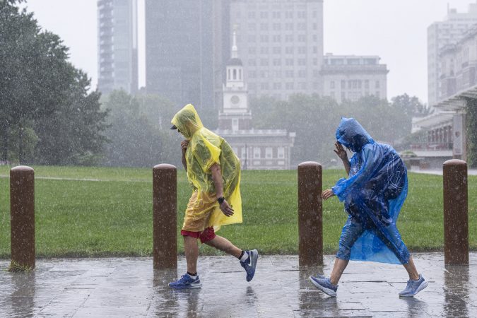
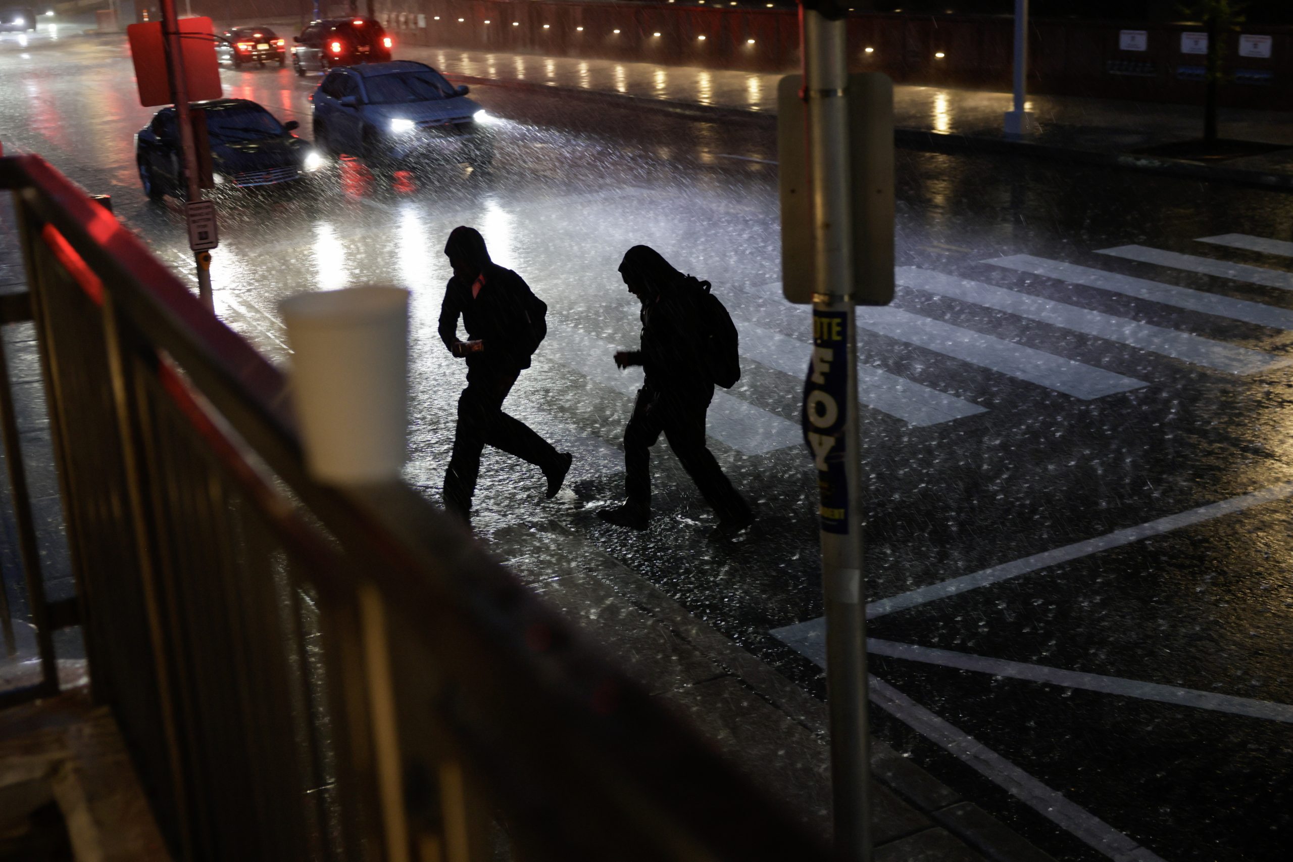
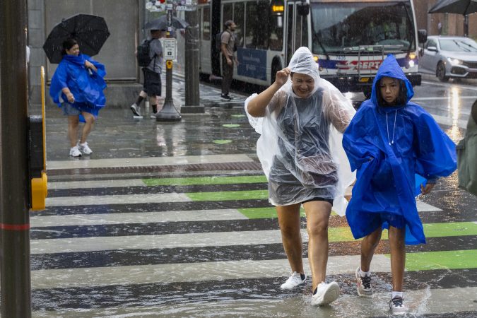
People caught in the heavy rain storm as they cross the street in Philadelphia Tuesday, July 28, 2026, in University City.Elizabeth Robertson / Staff Photographer
The likeliest time for strong storms in the Philly region
An early batch of strong storms is likely to miss Philly and most of the afternoon may be rain-free, but a second round late in the day into the evening won’t, O’Hara said, with a round of soaking downpours likely.
“That will be just torrents,” he said. He expected the heaviest of the rains to appear around 6 or 7 p.m.
Said Chernard, “It could be a lot of rain that comes around quickly.”
The system triggering the rain is something of a hybrid, born of a pattern more common to the cooler weather of fall and spring when temperature contrasts in the atmosphere are sharper, O’Hara said.
“We have a situation where we have summertime heat and humidity, but almost out-of-season dynamics,” he said.
Whatever the cause, the storms could have “significant impacts,” said Chernard.
Chernard said he expected the worst of the rains to move out of the region later Tuesday night; however, the shut-off time remains uncertain.
And neither the Delaware nor Schuylkill Rivers are in imminent danger of sloshing over.
However, rain rates of 2 or 3 inches of hour are enough to generate flash flooding along streams. During a localized downpour on Monday, Pennypack Creeks in the Northeast rose to minor flood stage.
Heavy rains flooded downtown streets and swamped cars in Hammonton, Atlantic County.
How much for Philly?
With July thunderstorms it isn’t simply a question of how much for Philly, but how much for South Philly, Center City, Germantown, or Fox Chase.
Even though everyone might get rain, the heaviest rains will be concentrated, said Chernard.
What is almost certain is that some places are going to get a soaking.
With over a half-foot of rain measured already, what has been Philadelphia’s wettest month since March 2024 is very likely to become significantly wetter.
The National Weather Service has posted a flash flood watch effective from 8 a.m. Tuesday until 2 p.m. Wednesday for rain totals up to 3 inches, with downpours of 1 to 2 inches an hour possible.
The national Storm Prediction Center on Tuesday morning listed a 15% chance of severe storms, those with wind gusts approaching 60 mph, for the entire region, with an outside shot of tornadoes. The Weather Prediction Center has a 40% chance of flooding downpours.
Some appetizers — localized downpours — popped up Monday afternoon, prompting flood warnings for Philly and neighboring sections of Montgomery County, and parts of Gloucester and Atlantic Counties in New Jersey.
Floodwaters swamped downtown Hammonton, Atlantic County, with “numerous” cars stranded on the roads, the weather service reported. The Pennypack Creek in Northeast Philly crested above “minor” flood stage.
Moth-ball-size hail pelted Chestnut Hill, and hail twice that size was sighted in Williamstown, Gloucester County, and in the vicinity of Washington Crossing State Park on the Jersey side of the Delaware River.
Storm coverage on Tuesday is expected to be far more extensive, and potentially more disruptive, with a “few tornadoes” possible, the weather service warned.
Storm activity is likely to linger into Wednesday, said Mike Lee, meteorologist in the weather service’s Mount Holly office, with more showers in the forecasts for Thursday.
What time the storms will arrive in Philly
Late July still is very much the lottery-ball season for damaging downpours, and that again likely will be very much in evidence this week. Rainfall totals in the last 30 days have ranged from 137% of normal in Gloucester County to 79% of normal in Montgomery County, according to the Middle Atlantic River Forecast Center.
Thunderstorms are possible as early as midmorning, but expect “repeated rounds” during the afternoon, said Matt Benz, senior meteorologist with AccuWeather Inc.
The highest probability for severe storms, those with wind gusts near 60 mph, would be in South Jersey and Delaware, although they could nose into Philly, said the weather service’s Lee.
The storms could continue well into the night, and additional rains are expected Wednesday afternoon.
The rain totals again are likely to vary widely; however, a general 1 to 2 inches is expected across the region.
Whatever happened to the drought?
It hasn’t gone anywhere — yet.
All of New Jersey and Chester County remain under state-declared drought warnings. In the latest interagency U.S. Drought Monitor update, conditions in the entire region remain from “abnormally dry” to severe drought.
All that may change by week’s end.
Through Sunday, officially 6.37 inches of rain habr been measured at Philadelphia International Airport this month. That is the highest monthly precipitation total since March 2024.
July’s rains have ended a run of 16 straight months of below-normal precipitation in Philly.
Said Benz: “It’s an old saying that all droughts end on a flood. That’s kind of what we’re seeing right now.”
The National Weather Service in Mount Holly on Wednesday confirmed a tornado briefly touched land in Cape May County during powerful thunderstorms that swept through the region Tuesday evening.
The agency said a waterspout was witnessed going ashore at Cape May Point around 6:15 p.m. Tuesday and causing minor tree damage for about a minute. The tornado was classified as EF-0, with estimated peak winds between 60 and 70 mph, the agency said.
The National Weather Service also confirmed North Jersey tornadoes in the Stanhope and Mount Olive area, and in the Lower Berkshire Valley. An investigation was still ongoing in the Parsippany and Troy Hills area in North Jersey, the agency said.
We have confirmed the path of the tornado in Cape May Point. This tornado started as a waterspout before coming onshore. Here is the link to the storm summary: https://t.co/20miA0SeBspic.twitter.com/LM6ppYAqEN
The waterspout that became the tornado on the southwestern tip of Cape May County could be viewed as far south as Rehoboth Beach, Del.
The high winds tore down some trees and a few power lines in Cape May Point, said Bill Gibson, the borough’s emergency management coordinator.
“We commonly get waterspouts in the bay and harbor, but this was a big one, and when it hit land it was able to continue on for a little bit,” Gibson said Wednesday morning. “But it’s already all cleaned up.”
Here are the preliminary survey locations planned for tomorrow. The full report will be released via Public Information Statement by tomorrow evening. #NJwxpic.twitter.com/7BNmufr2Rj
National Weather Service surveyors were investigating the remaining North Jersey areas with tornadic damage Wednesday. Findings were expected Wednesday evening. The agency conducteda virtual survey for Cape May Point since the damage was minimal.