Category: Weather

  • Ragweed season is approaching its peak in Philly, and the rains likely gave it a boost

    Ragweed season is approaching its peak in Philly, and the rains likely gave it a boost

    The recent rain rally has been a boon to the Philadelphia region’s plant life, and, unfortunately for the legions of the allergic, the beneficiaries include the homely and ubiquitous tormentor commonly known as ragweed.

    It belongs to the plant family Ambrosia, from the Latin for “food of the gods.” One can only assume the gods did not have allergies.

    Estimates vary, and it’s not as though it is a census category, but in all likelihood several hundred thousand people in the region annually endure the slings and arrows of ragweed pollen, notorious for setting off episodes of sneezing and attendant dopiness.

    It also can induce coughing, wheezing, and chest discomforts, particularly among asthmatics, allergy experts warn.

    The season — the third in the equinox-to-equinox pollen trilogy, successor to the trees and grasses — typically begins modestly in early August, then intensifies late in the month and continues well into September. And this year sufferers may pay a price for the episodic drought-easing rains that have been watering the plants in the Mid-Atlantic region since mid-June.

    “Ragweed thrives on the nitrates in rainwater,” said Payel Gupta, an allergy, asthma, and immunology specialist based in New York City. The rains’ timing has coincided with “ragweed’s late-summer growth window,” she added, and the result likely will be “denser plants and higher pollen output.”

    As for precisely when the pollen will peak: “Every year is different,” said Donald Dvorin, who for more than 30 years was the Philly region’s official National Allergy Bureau pollen counter, “but the first week of September is most common.”

    In addition, with the planet’s temperatures increasing and first frosts taking their good old time, the seasons appear to be lasting a bit longer.

    The prime pollen flight hours are from 5 to 10 a.m.; effects can linger, however, as pollen can stick to clothing and find its way indoors via unwitting humans and pets.

    What is ragweed?

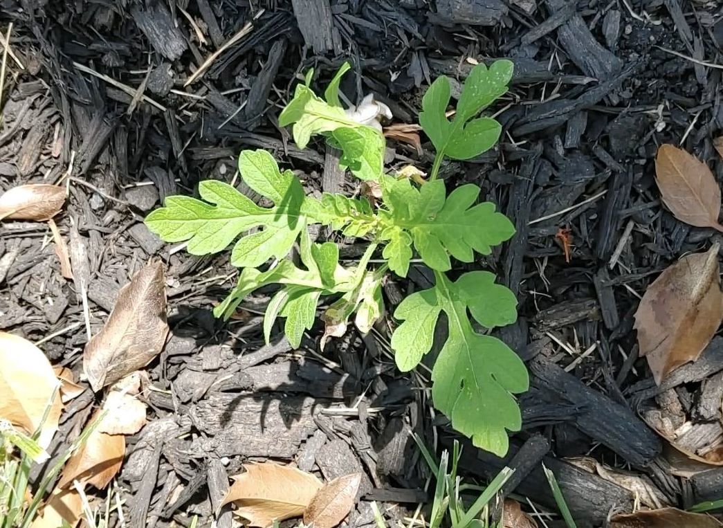
    Ragweed is a tooth-leaved plant that can grow in almost any environment, native to North America but spreading worldwide.

    For the allergenic, Dvorin said, the heavy hitters are the “short” ragweed (Ambrosia artemisiifolia), and the “giant” (Ambrosia trifida).

    A typical pollen grain is a mere 1/25,000th of an inch in diameter, but a single plant can generate a billion of them.

    While the plants live for only about a year, do they ever reproduce! Pollen has been found as far as 400 miles from the source, according to the Allergy and Asthma Network.

    New York City spent millions after World War II to eradicate ragweed in the city, a war it lost resoundingly. For one thing, the warriors discovered that about half the ragweed pollen in the five boroughs was commuting from elsewhere.

    The torments of ragweed

    Most people inhale ragweed pollen without incident, but for the allergic, the body interprets the pollen as an invader, and sneezes and other reactions are part of the immune response.

    For the sufferers, each season can be a little bit different, said Gupta, assistant clinical professor at the State University of New York and Mount Sinai Medical Center in Brooklyn.

    Severity would depend on “how many consecutive high-count days there are,” Gupta said. Exacerbating factors could be “viral infections or air pollution compounding irritation,” she said.

    In addition, some patients may be subject to “priming,” a particularly nasty season that might make some more susceptible to pollen discomforts the following year.

    And ragweed is nothing to just sneeze at, according to the International Ragweed Society, which is based in Switzerland and aims to promote ragweed research.

    In addition to a “socioeconomic burden due to rising healthcare costs” and “productivity losses,” the society states, the weed’s pervasiveness can endanger certain crops and natural habitats.

    How much ragweed is in the air?

    Unfortunately, that has become harder to know. Dvorin, an allergist who had practiced in Center City and Mount Laurel, stopped counting pollen last year, and that was symptomatic of a trend. The network has been shrinking.
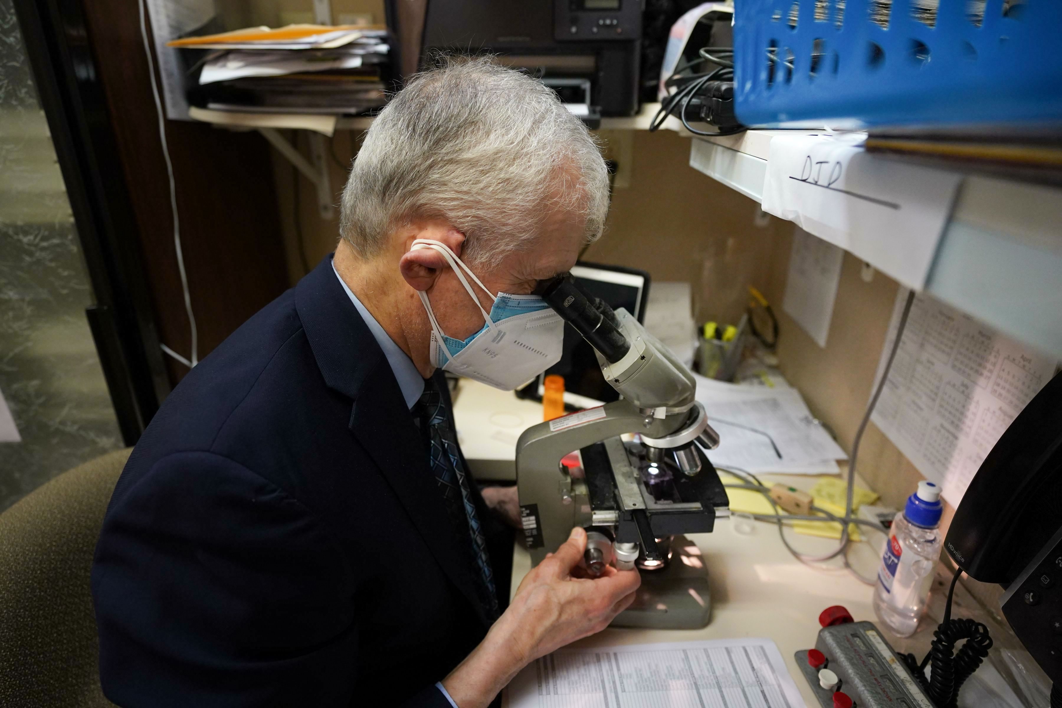
    Gotcha! Donald Dvorin analyzing a pollen specimen. He stopped counting pollen last year, and the network has been shrinking.Jessica Griffin / Staff Photographer

    Traditionally, allergists such as Dvorin supplied daily counts on a voluntary basis as part of the National Allergy Bureau network. However, the analyses require expertise and time that allergists could devote to revenue-paying patients.

    Fewer doctors evidently have been willing to participate.

    The nearest allergy bureau counter who posts frequent counts is in the Washington area.

    The Asthma Center in Center City posts daily counts that are AI-generated, and while that technology shows tremendous potential, the allergy bureau has not yet approved any of the machines for official use, said Pamela E. Gabrish, the bureau’s program director.

    “There has actually been more backlash against using automated devices than ever,” she said.

    Advice for ragweed sufferers

    Day-to-day pollen volumes are difficult to predict, but expect the peak to arrive next week.

    It is a good bet that counts will be high on a warm, dry, and breezy day.

    This will be evident in the online pollen forecasts, but be aware that pollen is commuting on the chaotic whims of the atmosphere.

    In a study of five major cities, published in 2024, allergy experts concluded the accuracy of online pollen forecasts was “low.”

    Along with medications, here are a few suggestions from allergy professionals:

    • Limit time outdoors on dry, windy days.
    • When outside, wear a dust mask.
    • Inside, keep the windows closed.
    • Shower before going to bed.

    And hope for rain, within limits.
  • Philly has 100-year-old stormwater infrastructure and 72,000 easily clogged inlets

    Philly has 100-year-old stormwater infrastructure and 72,000 easily clogged inlets

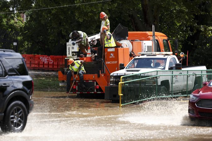
    Helplessly watching stormwater fill the basement is among the most frustrating experiences for Philadelphia homeowners. It is especially bad if you are waiting for the city’s help to do something about it.

    In West Mount Airy, Arielle Wolfson, 37, said roads by her home “become a river” when it storms. She and her wife live at the bottom of a hill near the intersection of Mount Pleasant Avenue and Cresheim Road, where five stormwater inlet drains are responsible for keeping rainfall from growing into rapids as it sloshes downward. But for years, only one of the drains has been fully functioning, Wolfson said. The others have been mostly sealed shut by city repaving projects that raised the level of the street, but not the inlets built into the curb.

    When ankle-deep water slopes down into an alleyway that connects Wolfson’s home and nearly 30 others, it often floods her basement. Every rainstorm is nerve-racking, she said, and her efforts to alert the city, the water department, and City Council members had not resulted in change beyond an occasional inlet cleaning.

    Kelsey Hensley, Wolfson’s wife, said their frequent flood calculus is: “Do we go out with some friends, or do we stay home to monitor the basement?”

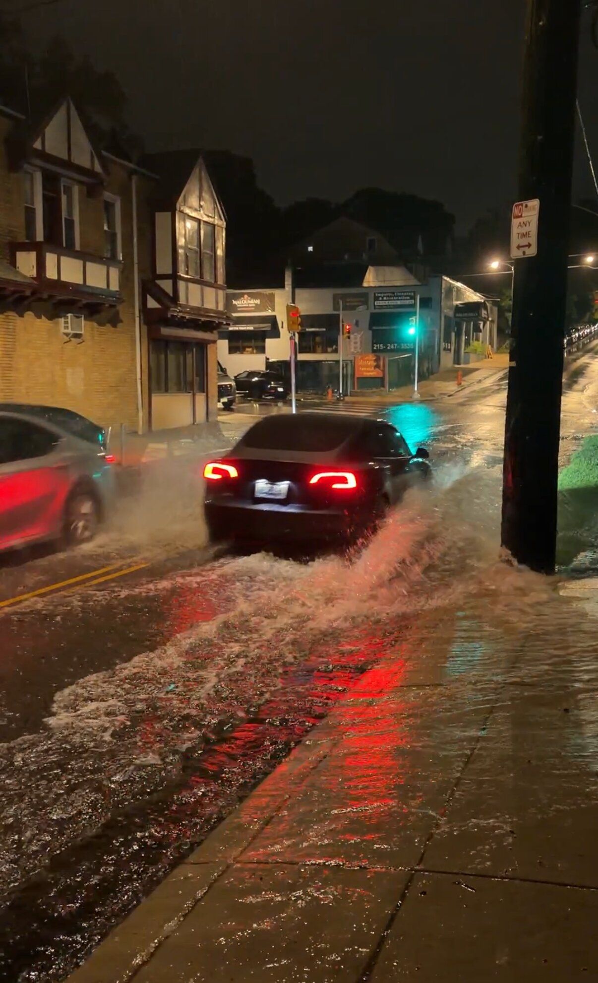
    Flooding near the intersection of Mt. Pleasant Ave and Cresheim Road in Mount Airy after an early August storm. The water often flows down the hill and into the basements of dozens of residents because the street’s stormwater inlets are not functioning properly.Kelsey Hensley

    Their anxiety is common in Philadelphia, where the city’s century-old sewer and stormwater infrastructure struggles to handle modern surfaces and roofs, increased rainfall, and a Delaware River that has risen by roughly a foot since the sewer system was built. And after 16 consecutive months of lower-than-normal precipitation, regular rainfall returned to Philadelphia in July and August, and brought flooding along with it.

    Philly has about 72,000 stormwater inlets, and it does not take much to clog them up — ordinary objects like tree leaves, dirt, trash, and other street debris can all be culprits, according to the Philadelphia Water Department. Last year, residents submitted almost 3,000 requests to the city’s 311 line for inlet cleanings, an Inquirer data review found, and the city is asking for help.

    “Across the city, The Water Department regularly checks all sewer drains and clears those that are clogged. … If they are able, we encourage residents to take part in the cleanup process before a storm comes,” city spokesperson Sharon Gallagher said in an email.

    As the planet continues to warm, the stress on Philadelphia’s flood-prone system only figures to increase, leaving more residents like Wolfson with dread when clouds gather overhead. As she spoke to The Inquirer, an afternoon rainstorm had just passed through.

    “I’m going down to the basement every hour just making sure it’s OK. So just the anxiety that’s pervasive among me, my wife, and other community members, it’s pretty unbearable,” she said.

    A frustrating wait

    Despite having roughly one stormwater inlet for every 20 Philadelphia residents, the city has generally responded to 311 requests for clogged stormwater inlets quickly. Since Mayor Cherelle L. Parker came into office in 2024, the city has closed inlet cleaning requests in under four days on average.

    But 311 data may not capture the complete scope of the issue. Some residents may report their issues directly to the water department.

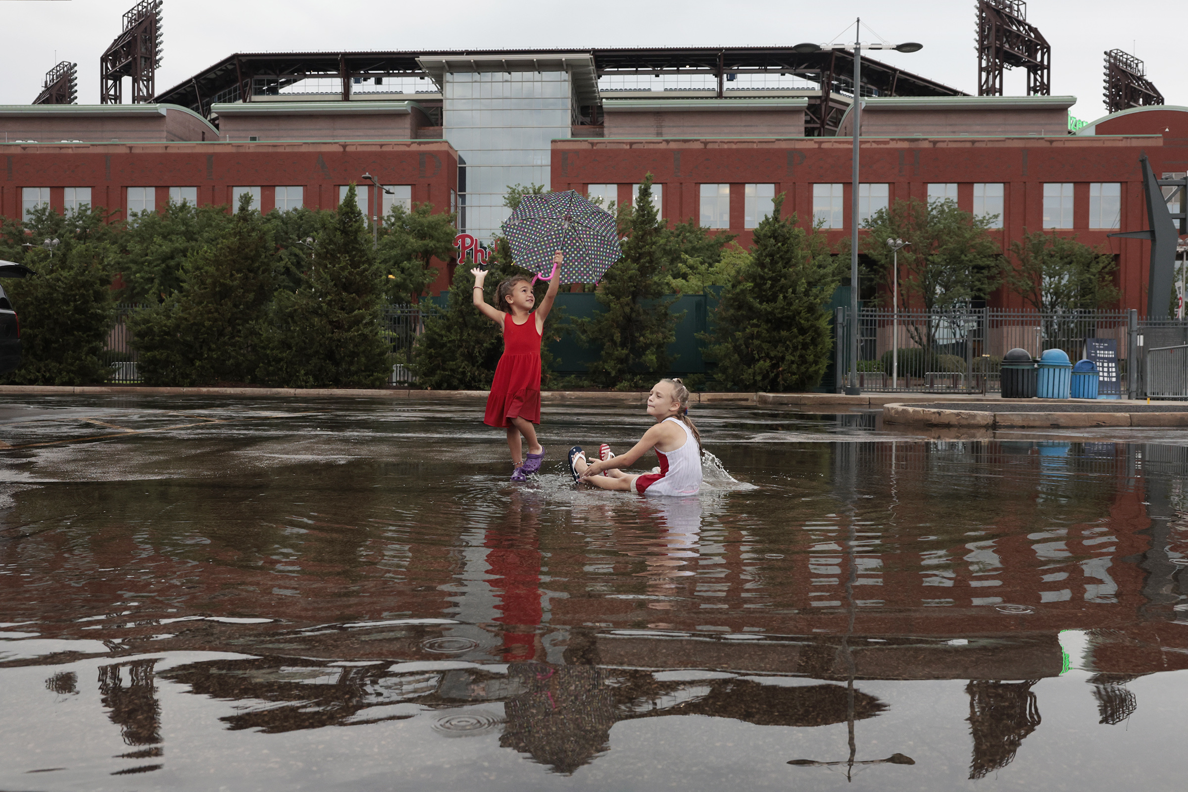
    Alessia Cognata (left, of Downingtown), 5, and Sofia Lubrano, 7, of Thornton play in the rain outside of Citizens Bank Park on Tuesday, July 1, 2025. The cousins were with their families, who decided to continue their tailgate party even after the Phillies game had been postponed because of heavy rain.Elizabeth Robertson / Staff Photographer

    And clogged inlets are just one part of the Philadelphia flooding experience. Mary Catherine Doyle, 56, has been in the middle of a Sisyphean ordeal at the hands of the water department’s slow, antiquated system of hard-copy paperwork.

    She and many of her neighbors along the 2900 block of Pennsylvania Avenue in Fairmount experienced significant basement flooding following storms on July 5. Doyle’s basement was ruined, she said; rainfall, debris, and sewage had destroyed her home office, bathroom, and furniture.

    Her insurance covered the cleanup, but her policy requires she install a backwater valve to prevent future flooding. The valves let wastewater out of homes, but seal to prevent other water from coming back up through pipes.

    The water department has a basement backup protection program where residents can apply for free backwater valve installation. Doyle and over 10 of her neighbors applied after the storm, but a contractor did not show up until Aug. 12.

    Doyle said the water department explained the delays at different points by telling her it lost her physical paperwork, was understaffed, or could not sign off on one approval until a commissioner returned from vacation.

    “I don’t understand where I’m living. I can buy a house in Arizona electronically, but I have to wait … days for someone to come here,” Doyle said.

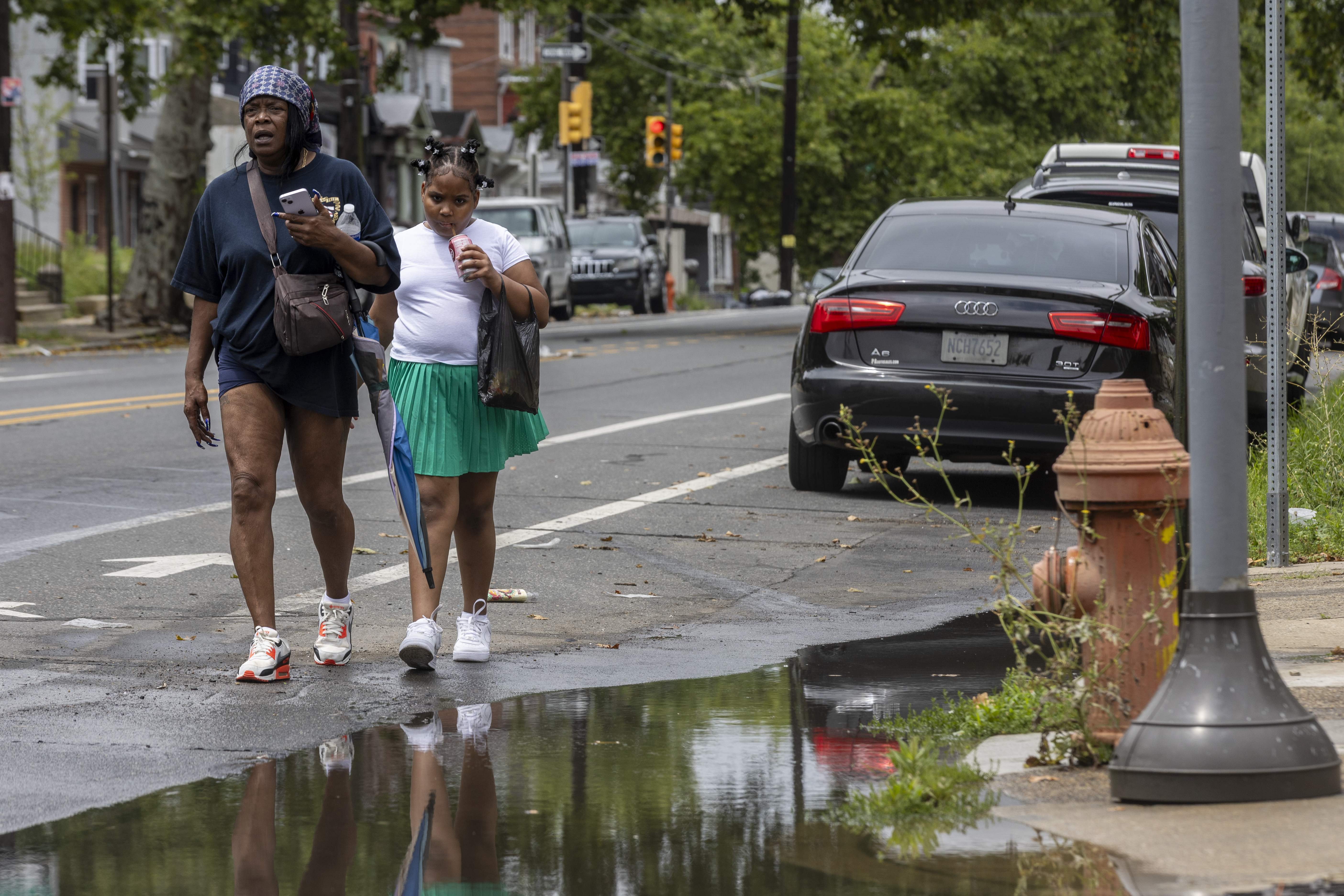
    A mother carries an umbrella while walking around a flooded sidewalk with her daughter by 15th and Erie in North Philadelphia during a flood watch on Monday, July 6, 2026.Aidan T. Gallo / Staff Photographer

    While the city’s water department is ready and willing to perform routine maintenance to prevent flooding, residents with more complex, systemic concerns often end up waiting for fixes while at the mercy of the atmosphere. Gallagher said the city is doing what it can to modernize the city’s flood infrastructure and ready itself for the demands of the future.

    “Teams are constantly working to design and construct additional projects that will increase capacity and help manage water from the increased intensity of seasonal storms,” she said.

    Luckily for Wolfson, she discovered earlier this month that the asphalt had finally been removed from the front of three of the closed inlets, plus some others further up on Cresheim Road.

    Wolfson and Hensley are happy there is finally some progress. But they wish the city would be more communicative and at least give them a timeline for the fix, they said, instead of relative silence or ambiguity.

    “You obviously want a city government to work for its citizens. … It’s extremely, extremely stressful,” Wolfson said. “It’s expensive, and it’s just frustrating because, in my mind, this is a pretty easily solvable issue.”

    Staff writer Joe Yerardi contributed to this article.

  • A tornado touched down in Downingtown during Thursday’s severe storms

    A tornado touched down in Downingtown during Thursday’s severe storms

    A tornado touched down in Downingtown during a barrage of severe storms Thursday evening, the National Weather Service confirmed Saturday.

    The tornado landed in the Chester County borough at 5:40 p.m. Thursday, the weather service said in a statement, as major thunderstorms passed through the area.

    The twister was considered an EF-0, which is considered the least destructive on the Enhanced Fujita rating scale. The tornado touched down for less than a minute, according to the weather service, traveling just over a fifth of a mile along Quarry Road near the Quarry Crossings commercial development. Its winds reached speeds of 60 to 70 mph and brought down several tree branches, the weather service said.

    Downingtown’s tornado was one of three to land in the region on Thursday, according to the National Weather Service. A slightly more intense EF-1 tornado touched down in Dover, Del., at 6:09 p.m., while a tornado with an unknown Enhanced Fujita scale rating occurred at 4:41 p.m. in Estell Manor, in Atlantic County, N.J., about 19 miles inland from Ocean City.

    The tornado in Dover lasted roughly five minutes and traveled just over three miles with winds ranging from 100 to 110 mph, the weather service said. After landing in an open field, the twister caused “extensive damage” to the Dover Little League baseball diamonds at Schutte Park, the weather service said: Two scoreboards were crushed or knocked down, and several lighting fixtures were snapped.

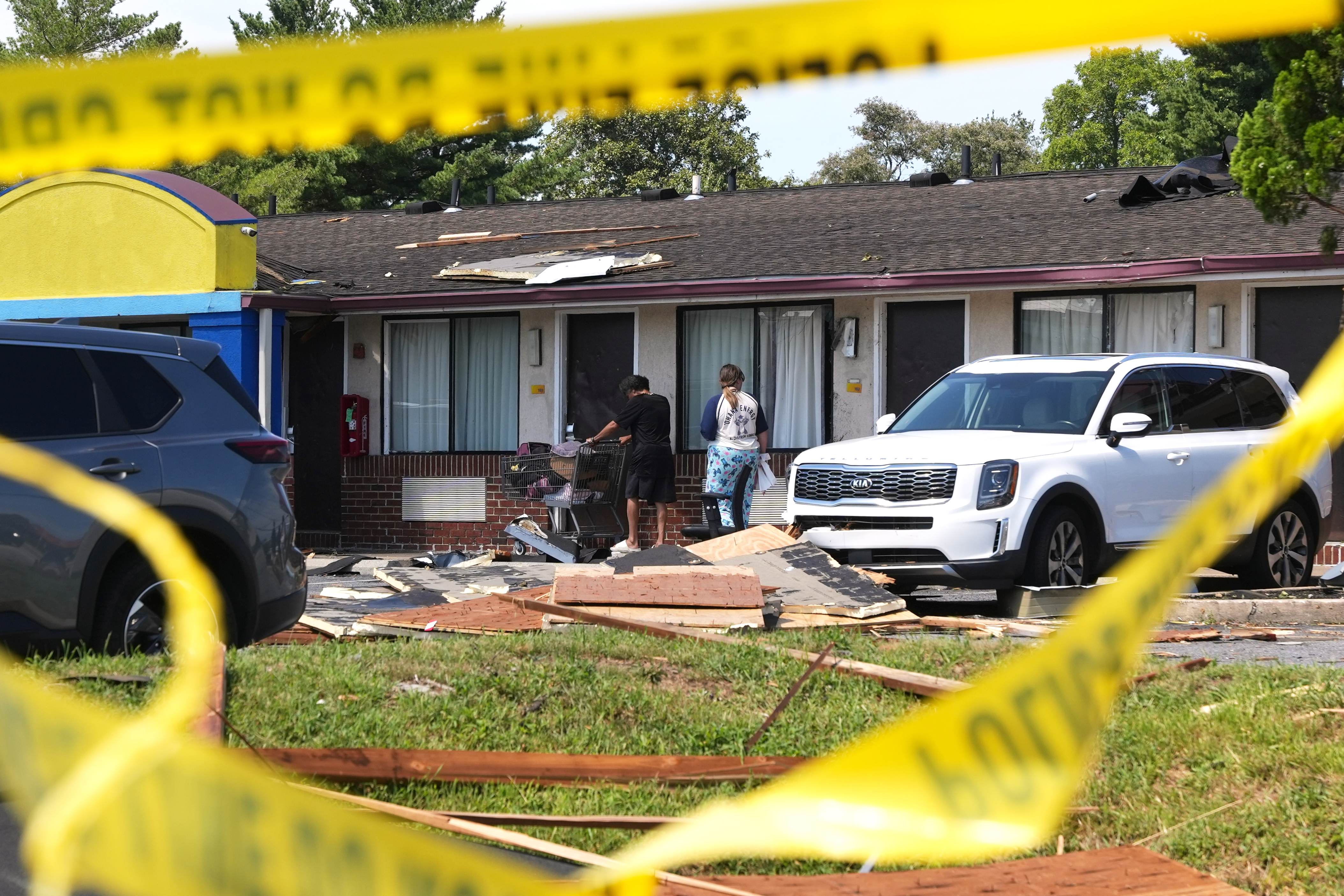
    Then the tornado struck the Van Sant Generating Station — a power plant owned by the City of Dover located across from Schutte Park — before zigzagging through downtown Dover, where it downed trees. The tornado dissipated at the intersection of Kings Highway and North DuPont Highway after peeling the roof off a motel, the weather service said.

    The tornado in Estell Manor lasted approximately 30 seconds or less, according to the weather service, and landed in a wooded area across from the Great Egg Harbor River. There were no reports of associated damage.

    Thursday’s storms were the latest in a summer marked by intense wind and rain. The storms arrived in the Philly region just after 5 p.m. and set off a barrage of flash-flood warnings for Philadelphia, the Main Line, and sections of Delaware and New Jersey. Portions of Delaware and Chester Counties were also under tornado warnings.

    The downpours led to flash floods that made many streets impassable in the Montgomery County townships of West Norriton and Lower Providence, according to the weather service. And in Chester County, fallen trees cut off sections of heavily trafficked Route 322 in Honey Brook.

    The forecast for the rest of the weekend was looking similarly wet.

    “Multiple rounds of scattered showers and thunderstorms expected through tomorrow afternoon,” the National Weather Service at Mount Holly wrote Saturday on X, and forecasters “cannot rule out a few strong to severe thunderstorms” for Sunday.

  • More rain is forecast for Saturday, with potential flooding into the night

    More rain is forecast for Saturday, with potential flooding into the night

    Another round of rain showers is expected Saturday, with potential flooding into Saturday night, but it shouldn’t be as intense as last weekend.

    Multiple rounds of rain are possible Saturday, with most of the region expected to see up to an inch of precipitation, according to AccuWeather. A chance of thunderstorms will creep onto the horizon starting after 4 p.m.

    While the rain is expected to continue into the night with a chance of flooding on streams and ponds, there likely won’t be devastating flash floods, said AccuWeather meteorologist Matt Benz.

    “Certainly, just given the amount of rain that we’ve seen as of late, it doesn’t take a lot of rain to create flooding issues, so there could be some low-end flooding concerns tomorrow,” Benz said.

    Most areas across the region received over an inch of rain on Thursday, with some places getting more than three inches.

    “While a strong to severe thunderstorm can’t be ruled out completely, the threat for damaging winds/tornadoes/hail is much lower compared to what we saw Thursday,” weather service meteorologists said in a forecast discussion.

    Despite the above-normal precipitation over the summer months, the region had experienced 16 consecutive months of below-average precipitation totals leading up to June. Most of the Philadelphia region is classified abnormally dry, with parts of the suburbs in moderate drought, according to the U.S. Drought Monitor. Sunday’s rain ended the first seven-day period without measurable rain in Philly in two months.

    In addition to Thursday’s rain, a tornado touched down in Dover, Del., toppling trees that closed streets and causing widespread power outages. Power has been restored, but crews were still clearing debris from affected areas in Dover.

    Sunday brings another chance of showers on and off throughout the day, especially in the afternoon. Benz advised residents to get their errands done in the morning on Saturday and Sunday to avoid showers.

    The forecast is similar for folks headed down the Shore, as Saturday brings an increased chance of rain showers in the afternoon and evening. Sunday should be drier in the morning, but beachgoers could see a chance for afternoon rain showers or thunderstorms, Benz said.

    Fair weather is expected to return early next week.

  • A tornado touched down in Dover, Del., during Thursday’s storms

    A tornado touched down in Dover, Del., during Thursday’s storms

    A tornado touched down in Dover, Del., on Thursday amid severe weather and flooding, the National Weather Service confirmed.

    Debris from the tornado and widespread power outages closed one mile of Route 13 between Kings Highway and Lepore Drive in Dover for several hours, according to the Dover Police Department.

    Crews and first responders cleared debris, reopened roadways, and restored power to the affected areas.

    There were no reported injuries, “and we are extremely grateful for that,” said a Dover police spokesperson on social media.

    The weather service will conduct surveys to evaluate the damage and gather more information on the tornado.

    Dover Mayor Robin R. Christiansen lifted the city’s state of emergency at 6:10 a.m. Friday, while stressing to residents to avoid areas where debris may still be present and to yield to crews who are still working to clear affected areas.

    “A huge thank you to all of our City staff for the outstanding teamwork and dedication throughout this event. Your hard work and commitment are greatly appreciated,” Christiansen said on social media.

    Thursday’s storm brought fallen trees and downed wires in Chester County, and toppled trees blocked portions of heavily traveled Route 322 in Honey Brook, the weather service reported.

    Some streams overflowed, and flash flooding occurred in West Norriton and Lower Providence Townships in Montgomery County, making many streets impassable.

  • Storms set off tornado and flood watches and warnings in the Philly region. Expect more rain this weekend

    Storms set off tornado and flood watches and warnings in the Philly region. Expect more rain this weekend

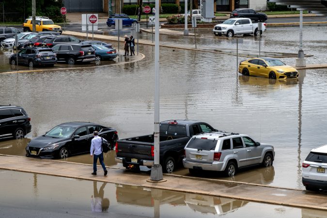
    Severe storms set off tornado and flood warnings on Thursday in the Philly region, and in some places turned the phrase “rush hour” into an oxymoron.

    Intense thunderstorms took down trees and wires in parts of Chester County, and fallen trees blocked portions of heavily traveled Route 322 in Honey Brook, the weather service reported.

    Streams came out of their banks, and flash flooded occurred in West Norriton and Lower Providence Townships, in Montgomery County, making “many streets” impassable.

    A tornado warning had been issued for portions of Chester and Delaware Counties, but it was not known if a twister was sighted.

    About 21,000 Peco customers were without power as of 8 p.m.

    All of Philadelphia; areas to the west of the city, including the Main Line; northern Delaware; and in New Jersey along the Delaware River were under a flash-flood warning until 8:45 p.m.

    Lines of storms gathered to the west and south of the region during the day with the approach of an eastward-moving front interacting with a volatile, energized atmosphere.

    “It’s a pretty juicy air mass,” said Matt Benz, senior meteorologist for AccuWeather Inc. And more juice might be squeezed out of it over the next few days, especially Saturday.

    It turns out that the front that set off the storms may return in a repurposed form during the weekend.

    Disruptive storms came at a bad time

    The storms arrived between 5 and 5:30 p.m. in the immediate Philly area, right when a lot of people likely would have been heading home.

    The storms moved quickly, but the downpours were strong enough to set off flash-flood warnings.

    The fact that the sun interrupted the afternoon gloom on Thursday didn’t help matters, meteorologists said. On a day when the air was so full of moisture and energy, that was about the last thing they wanted to see.

    “It’s ironic, isn’t it,” said Joe Wegman meteorologist with the government’s Weather Prediction Center, in College Park, Md.

    The solar heating likely provided a power jolt to an already charged atmosphere.

    The outlook for the weekend

    If you have outdoor plans Saturday, this is probably something you don’t want to read.

    After the front clears the region, Friday should be a decent day, Wegman said.

    But it’s likely to migrate back, this time as a warm front, said Wegman. Showers are possible Friday night, and might be tapping into a generous moisture supply on Saturday.

    Said Benz, “I wouldn’t throw out the word washout, but it could be pretty wet on Saturday.” Steady rain is possible, as are more downpours Saturday afternoon into the night.

    As for Sunday, you guessed it — another chance of showers.

  • Philly is under flood, storm, and tornado watches Thursday, and more rain is likely this weekend

    Philly is under flood, storm, and tornado watches Thursday, and more rain is likely this weekend

    Both astronomy and meteorology suggest that it won’t be long before these things decline in frequency, but in the meantime another flash-flood watch is in effect for the Philly region.

    A tornado watch also was posted for Philadelphia and the neighboring Pennsylvania counties.

    The National Weather Service watch spans from noon Thursday until 2 a.m. Friday, for the potential for rain rates of 2-to-4 inches an hour in areas along I-95 and South Jersey.

    And the federal Storm Prediction Center has posted a severe-thunderstorm watch, in effect until 10 p.m., for storms that could kick up gusts approaching 60 mph.

    “There could be multiple rounds of heavy rain over urbanized areas,” said Joe Wegman, a meteorologist with the government’s Weather Prediction Center. In advance of the anticipated main events, a blob of light rain moved through the region late Thursday morning.

    Also, the federal Storm Prediction Center sees an outside chance of severe-level storms, those with gusts near 60 mph, and a 5% chance of tornadoes in and around Philly.

    And those who have not had the good fortune of spending the last two months in heat-free and smokeless environments probably can skip the next paragraph.

    The timing, ferocity, rain totals, and targets all remain uncertain.

    What is the best estimate on the storm timing in Philly?

    The higher-resolution models were suggesting that the likeliest time for storms to arrive in the Philly region would be between 2 and 3 p.m. Thursday, Wegman said.

    The worst of it may hold off until 4 or 5 p.m., said Matt Benz, senior meteorologist with AccuWeather Inc.

    The storms likely would back off between 6 and 7 p.m., but that timing could disrupt a peak commuting period.

    “Why would we conveniently time these things?” Wegman quipped.

    “There’s plenty of moisture coming up, and a front approaching from the west,” he said. “If the front stalls, the storms might linger longer than people want them to.”

    Plus, renegade storms could race out ahead of the front, setting off precipitation earlier, he added, and that appeared to be case Thursday.

    The weather service in Mount Holly said the “greatest risk” for severe storms would be between noon and 10 p.m.

    But timing remains one of the most vexing challenges for severe-weather forecasting, says Bill Bunting, deputy director of the storm center, in Norman, Okla.

    “I have seen remarkable progress,” said Bunting, who has been at it for 40 years, “but we’re nowhere near perfection. In the end, the science has its limitations.”

    The forecast for the weekend and the rest of August

    The storm experts have had plenty of practice around here this summer. So far, Philadelphia officially has recorded 21 thunderstorms since June 1, several more than normal.

    It has also been a banner summer for smartphone alerts and assorted scare grams.

    About 11 inches of rain has been measured at Philadelphia International Airport, roughly four inches above normal, since July 1.

    That said, yes, both Chester County and the entire state of New Jersey remain under state-declared drought warnings, with residents asked to conserve water.

    And drier times may be coming, or at least a reduced incidence of those late-day thunderstorms, said Brian Hurley, senior branch forecaster with the Weather Prediction Center.

    The days are getting shorter, and the sun is losing some of the gas it uses to fuel convective storms, he said.

    But all pumpkin spice aside, summer is not quite over, and shower chances are in the forecast into Sunday night.

  • Rains have returned to the Philly region, and they may come in handy later

    Rains have returned to the Philly region, and they may come in handy later

    Just as the soils were beginning to take on that cracked and dried look and the vegetation was working up a thirst, the rains have returned to the Philly region, and showers and possible thunderstorms may bookend the week.

    Rains Sunday ended the first seven-day period without measurable rain in Philly in two months. More showers were possible Monday and later in the week, forecasters said.

    In all likelihood they won’t remotely approach the destructive deluges in the Midwest, said Brian Hurley, senior branch forecaster with the federal Weather Prediction Center, in College Park, Md.

    And around here, despite the generous rains that have fallen upon the region since mid-June, additional rain wouldn’t be altogether unwelcome, said Hurley.

    Precipitation in the last 60 days has been well above normal everywhere in the region save for Montgomery County, where they were just about normal, according to the weather service’s Middle Atlantic River Forecast Center, which uses a network of stations in the counties.

    However, not so long ago, as we headed into June, Philadelphia had experienced 16 consecutive months of below-average precipitation totals.

    And drier times may be coming, Hurley warned.

    Drought conditions have eased, but not disappeared

    New Jersey and Chester County remain under state-imposed drought warnings, with residents asked to go lighter on the water usage.

    “We’ve been putting a dent in that drought,” said Hurley, but in the latest interagency U.S. Drought Monitor update, most of the region remains “abnormally dry,” with parts of Burlington, Bucks, and Montgomery Counties in “moderate drought.”

    Thunderstorm activity has been well above normal this summer, with the weather service reporting 19 days officially with thunder detected at Philadelphia International Airport. The average for the entire June 1 to Aug. 31 period is about 15 days.

    It’s also been quite warm. In 12 of the first 15 days of August, the temperature reached at least 90 at the airport, and this almost certainly is going to end up being one of the warmer summers on record.

    The warmth and the rains are related.

    Philadelphia has spent a whole lot of time on the western edge of the so-called Bermuda high, centered over the North Atlantic. Winds circulate clockwise around the center of high pressure, and areas to the west of the center (where we are) experience winds from the south and southwest.

    Being on the edge also places the region in spraying distance of shower activity as fronts and minor disturbances approach along the western flank of the ridge, with daytime heating adding a kick to the storms.

    Thunderstorms may become scarcer come September

    Those convective thunderstorms, which can wring out rain in waterfall-like downpours, in all likelihood will become less numerous as September approaches and the days shorten, Hurley said.

    “It does get a little harder to pop convection when the sun doesn’t do its thing as much,” said Hurley.

    “In September we tend to dry out until we get tropical connections,” he said.

    This year, however, those tropical connections may be scarce, according to the National Oceanic and Atmospheric Administration and other forecast services.

    What could become the most intense El Niño — the anomalous warming of vast expanses of the tropical Pacific Ocean — in records dating to 1950 is rapidly gaining steam.

    During El Niño, the interaction of the ocean and the overlying air generates powerful upper-level winds from the west that can shear apart tropical storms in the Atlantic Basin before they mature.

    No Atlantic hurricanes have developed yet this season. Meanwhile, Hurricane Lala in the Pacific has caused extensive damage in Hawaii. Typically, when the Pacific is quiet, the Atlantic is active, and vice versa.

    Lala is the 12th named tropical storm — those with winds of at least 39 mph — of the season to form in the Pacific. The average for the date is seven.

    In the Philly region, historically tropical-storm remnants have been generous sources of rainfall.

    Sometimes, however, they have been overly generous. (See Ida, 2021.)

  • A potentially ‘historic’ El Niño may become the biggest on record, NOAA says

    A potentially ‘historic’ El Niño may become the biggest on record, NOAA says

    The rapidly developing El Niño is likely to become a “historic event” that could become the most-intense in the period of record, the government’s Climate Prediction Center said Thursday.

    The El Niño warming in the tropical Pacific, coupled with how it is affecting the atmosphere, is all but certain to have dampening effects on the Atlantic hurricane season, researchers said.

    While it is likely to be disruptive and destructive during the next several months, during the tropical storm season it may mean fewer scares for East and Gulf Coast and Caribbean residents, and perhaps fewer flooding threats in the Philly region.

    El Niño already is making its presence evident thousands of miles away in the Atlantic Basin, said Philip Klotzbach, tropical storm specialist at Colorado State University. Colorado State’s forecast methodology has been the prototype for the outlooks issued by the National Oceanic and Atmospheric Administration and commercial companies.

    In his update last week, Klotzbach predicted the season would produce nine named storms, those with winds of at least 39 mph — down from 13 in the April outlook. NOAA also subtly trimmed its numbers. The long-term average is 14.

    Even with above-normal temperatures that usually would be favorable for storms in the hurricane-development regions of the Atlantic, what’s going on in the Pacific is going to dominate, he said.

    “El Niño is definitely the story of this season,” he said, and NOAA says the Pacific warming is likely to persist through April.

    (Even The Farmers’ Almanac has noticed. The winter outlook it has cooked up appears to be right out of the El Niño recipe book, calling for wetness and storminess in the South, typical of El Nino. Helpfully, it said the forecast up our way is “tricky.”)

    How does warmth in the Pacific affect Atlantic hurricanes?

    El Niños, which occur every two to seven years as part of a natural process, agitate the overlying air and disrupt atmospheric circulation worldwide. It is part of the so-called El Niño Southern Oscillation, or ENSO, and since oscillations do oscillate, El Niño periodically shares the stage with La Niña, during which the waters are cooler than normal.

    The climate center reported Monday that in the key El Niño region of the east-central Pacific, sea-surface temperatures over a 2.4 million-square-mile area were more than 3 degrees Fahrenheit above normal.

    That air-ocean interaction generates strong west-to-east upper-level “shearing” winds that can keep tropical storms from maturing into hurricanes.

    Klotzbach said that last week, the 30-day average of wind shear in the western Atlantic was higher than in any other 30-day period dating to 1979.

    Other players in the atmosphere affect tropical storm activity, but El Niño “usually becomes the dominant factor,” said Matt Rosencrans, the weather service’s lead hurricane forecaster.

    During the top six most-intense El Niños in records dating to 1950, tropical-storm numbers were significantly below normal.

    Is this El Niño yet another symptom of a warming planet?

    “There is still considerable debate in the scientific community on how warming may affect ENSO behavior,” said Michelle L’Heureux, physical scientist with NOAA’s Climate Prediction Center and the head of the ENSO team.

    El Niños likely have been occurring for eons, but the period of record dates only to 1950 because “much fewer observations” are available before then, she said.

    “It would take much more research to compare El Niño events in the older records,” she added.

    El Niños in which the temperatures reached 3.6 degree Fahrenheit — averaged over three-month periods — occurred in 1965-66; 1972-73; 1982-83; 1991-92; 1997-98, and in 2015-16.

    The warmest three-month average, 4.3 degrees Fahrenheit, was recorded in the 1982-83 event, and the climate center sees a 69% likelihood that this will exceed that level.

    But L’Heureux cautioned that “intense El Niño events are not totally unexpected.” The top six list shows that they have reappeared every 10 to 15 years.

    Thus, she said, “There’s a reasonable argument we were due.”

    What might all this mean for the Philly region’s weather?

    Tropical storms or their remnants “are especially notorious for flash-flooding impacts” in the region, said Sarah Johnson, warning coordination meteorologist in the weather service’s Mount Holly office.

    In 2020 and 2021, the region was affected by six such storms or remnants, including the devastating Ida, in September 2021.

    The 2020 season was quite active, and 2021’s hyperactive. Logically, fewer Atlantic storms would reduce the odds of remnants heading this way.

    With the exception of 2012, the year of Sandy, Johnson said that all the years with below-average flash-flood warnings issued by the Mount Holly office coincided with seasons in which no tropical storms or remnants have affected the region.

    We wouldn’t mind an encore.

  • Record El Niño to give Earth a preview of its warmer future

    Record El Niño to give Earth a preview of its warmer future

    This year’s record-smashing El Niño will do more than just shift and enhance patterns of heat, extreme rainfall and drought around the world.

    It will also give the planet a preview of the late 2030s.

    That’s because this El Niño will act like a climate time machine, temporarily pushing global temperatures to levels that might not otherwise be reached for another decade or so.

    According to an analysis by climate scientist Zeke Hausfather that was shared with The Washington Post, there’s around a 95 percent chance that 2027 will become Earth’s hottest year on record — soaring past the last record in 2024 — because the combination of El Niño and climate change could spike global temperatures to around 1.76 degrees Celsius (3.17 degrees Fahrenheit) above preindustrial averages.

    Described as “stunning” by Hausfather, who researches and analyzes the climate for Stripe, Carbon Brief and Berkeley Earth, this value would be so far above the warming trend of the last decade that it could bring global temperatures to levels not otherwise expected under that trend until around 2037.

    “I’m not sure folks have realized just how crazy the second half of 2026 and 2027 will be for global temperatures — on the back of a record-smashing El Niño event,” wrote Hausfather on X.

    It’s currently close to a coin flip whether or not 2026 would become the warmest year on record, according to Hausfather’s analysis, which considers the average of several different temperature datasets. It’s possible that 2026 sets a record in some, but not all, of these datasets.

    Jim Hansen, director of the Program on Climate Science, Awareness and Solutions at Columbia University, said he expects 2026 to become the warmest year, but to only hold that crown until 2027 exceeds it.

    There is a much stronger signal for record warmth in 2027 because increasing air temperatures caused by El Niño lag slightly behind increasing ocean temperatures.

    A global temperature of 1.76 degrees Celsius above preindustrial levels in 2027 would be about 0.29 degrees Celsius higher than what’s expected based on the warming trend of the past decade.

    According to Hausfather’s temperature predictions for next year, the middle 50 percent of forecasts range from 1.67 degrees Celsius to 1.85 degrees Celsius above the preindustrial average.

    At the high end of that range, global temperatures in 2027 would jump roughly 13 years ahead of the recent warming trend, reaching levels that might otherwise become typical around 2040. The low end would represent a 7-year-boost, to around 2034.

    Hausfather said that this El Niño event is happening on top of a “strong acceleration in the rate of warming associated with continued emissions of greenhouse gases.”

    Both Hausfather and Hansen also mentioned that decreasing atmospheric aerosols — which have historically offset some warming — are contributing to the acceleration in warming.

    Although Hausfather expects 2028 to be cooler than 2027, he added that “human emissions are adding a permanent El Niño worth of heat to the climate system each decade.”

    In other words, global temperatures in 2027 will take a big but temporary upward stairstep, and they are unlikely to permanently continue at or above those levels for now.

    These temperature increases will also have consequences for atmospheric water vapor. Because the water vapor-carrying capacity of air increases at a rate of 7 percent per degree Celsius, it’s possible — if not likely — that 2027 also sets a new global moisture record, surpassing 2024. In 2025, The Post mapped the planet’s rising moisture zones and showed how they are closely connected to an increasing risk for rainfall extremes.

    The role of El Niño

    During El Niño, huge stores of ocean heat from the western Pacific spread eastward, eventually reaching the west coast of South America. Thunderstorm activity shifts with that warmth, transferring heat from the ocean and pumping it high into the atmosphere. Winds and atmospheric circulation then redistribute that heat beyond the tropical Pacific and around the globe, raising global temperatures.

    That’s why strong El Niño events often appear as an upward stairstep in long-term plots of global temperatures.

    But this El Niño isn’t just going to be strong. Boosted by the planet’s long-term warming trend, it’s probably going to dwarf the six strongest that came before it in 2015, 1997, 1982, 1972, 1888 and 1877 — the latter contributing to a global famine that caused 3 to 4 percent of the global population to perish.

    Ocean temperatures in the central equatorial Pacific, where El Niño’s strength is measured, have already broken records for 75 days straight.

    That streak isn’t expected to end anytime soon.

    Temperatures in the equatorial Pacific Ocean may surge more than 4.0 degrees Celsius above average (7.2 degrees Fahrenheit) by December, breaking the previous record by more than a degree Celsius.

    The Post is tracking these records on a regular basis — and mapping the potentially significant weather ripple effects — in an El Niño tracker.

    Those weather effects will vary from place to place.

    But the temperature spike will briefly push the entire planet into its warmer future.