Category: Weather

  • ‘Didn’t we try this before?’ And other questions about permanent daylight saving time, answered.

    ‘Didn’t we try this before?’ And other questions about permanent daylight saving time, answered.

    The House passed a bill Tuesday that would make daylight saving time permanent.

    Proponents, including President Donald Trump, say the switch would amount to more daylight during the times when Americans are most active. The act is in turn called the Sunshine Protection Act

    Trump called the House’s vote “great news for America.”

    But critics say it’s not that simple, citing public safety and health issues.

    So, if the change really means more sunlight, what could go wrong? And haven’t we tried this before? Here is everything we know so far about a potential switch to permanent daylight saving time.

    What is daylight saving time?

    Daylight saving time is the period between spring and fall when clocks in most parts of the United States are set one hour ahead of standard time.

    The protocol provides the advantage of pushing back the night, allowing for long summer nights.

    So what is standard time?

    Standard time is the time without daylight saving in effect.

    We are currently observing daylight saving (from March through November). Standard is what most of the country would revert to in November — “falling back” an hour — but not if the Sunshine Protection Act has its way.

    Some lawmakers have also proposed a permanent standard time, which is favored by sleep researchers and medical professionals. But that is not on the table right now.

    The American Academy of Sleep Medicine has advocated for year-round standard time, saying moving the clocks forward presents “significant public health and safety risks” from sleep deprivation.

    What states honor which time?

    Most of the United States alternates between daylight saving and standard time. The exceptions are Hawaii and most of Arizona, which stay on standard time all year long.

    What do supporters say about permanent daylight saving time?

    The argument for daylight saving time hinges on what could be accomplished with an extra hour or so of sunlight. Supporters say the pros include basics like more time for youth recreational sports in daylight and more time for summer grilling.

    Businesses, from outdoor amusement parks and restaurants with patio seating to retail shops, say more sunlight could mean more time for spending money. Experts say a permanent switch could boost retail and tourism spending.

    What do critics say about permanent daylight saving time?

    Detractors say permanent daylight saving time would lead to darker and potentially more hazardous winter mornings when children would be waiting for school buses and adults would be commuting to work in darkness.

    “Millions of Americans will wake up during the winter months in complete darkness, with the sun not rising until long after people get up and travel to school or work or have to go about their days,” said U.S. Rep. Mary Gay Scanlon (D., Pa.), who voted against the bill. Scanlon also advocated for a bill she introduced that would support permanent standard time, which has not gained traction.

    U.S. Rep. Jim McGovern (D., Mass.) voted in favor of the bill, but he questioned whether it was the best way for Congress to be spending its time.

    “For folks getting crushed by rent, groceries, utility bills, and healthcare costs, is this really the best the majority can do?” McGovern asked. “Is this really the most pressing issue before the American people at this moment?”

    Agricultural advocates also say permanent daylight saving time would negatively affect their crops and livestock, resulting in delayed harvesting, behavioral disruptions, and product loss.

    How would permanent daylight saving time look in Philadelphia and across the Northeast?

    Pretty dark in the mornings! Because of Philly’s position on the eastern edge of the Eastern time zone, permanent daylight saving time would mean about an hour more of sun before it sets in the evening.

    But it would also mean winter sunrises rolling in until as late as around 8:30 a.m. This rings true for areas of New York and New Jersey, too.

    Critics caution this would impact morning commutes, circadian rhythms, and general health.

    Was the nation ever on year-round daylight saving time? How did it go?

    During World War II, the nation moved up the clocks year-round from 1942 to 1945, in what officially was designated “War Time.” The hour switch then became a local option again until 1966, when the Uniform Time Act divided the clock year into standard and daylight saving time.

    Later, during the energy crisis of the 1970s, the United States tried year-round daylight saving time, but the experiment was wildly unpopular.

    The National School Boards Association called for the experiment’s immediate end because school buses were picking up students in darkness.

    The experiment was supposed to last two years — it was abandoned after 10 months.

    Where do the House and Senate stand?

    The House vote was 308-117.

    The Senate’s stance is unclear, with senators expressing mixed feelings so far.

    A similar Senate version of the Sunshine Protection Act previously stalled because senators said they needed more time to review the legislation.

    Neither of Pennsylvania’s senators has commented publicly about the current legislation. In 2022, Democratic Sen. John Fetterman, then Pennsylvania’s lieutenant governor, said he supported a similar bipartisan bill pushing for permanent daylight saving time.

    Sen. Dave McCormick, a Republican, has not voted on the issue previously.

    Would permanent daylight saving time happen this year?

    It’s a race against the clock. The House approved its legislation to make daylight saving time permanent, but the Senate would have to do the same before the act could get signed into law. If that does not happen by this fall, Americans will still be expected to turn their clocks back to standard time.

    As it stands, the current Sunshine Protection Act language does not include a start date. According to the Time and Date website, if the act became law before the November switch, the United States would “lock the clock” where it is. But if it were signed into law during standard time, the nation would perform a final “spring forward” in March and then stay in daylight saving time.

    When does daylight saving time end in 2026?

    Daylight saving time is scheduled to end when the clocks “fall back” on Sunday, Nov. 1, at 2 a.m. — returning to standard time. This happens on the first Sunday in November.

    Staff writer Anthony R. Wood contributed to this article, which contains information from the Associated Press.
  • Heat near 100 degrees and Canadian wildfire smoke are on tap as Philly’s hot summer continues

    Heat near 100 degrees and Canadian wildfire smoke are on tap as Philly’s hot summer continues

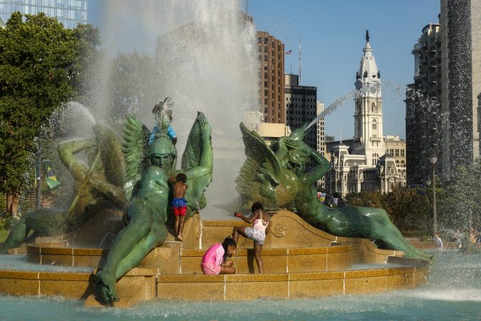
    The Philadelphia region on Wednesday will be under an extreme heat warning, with high temperatures expected to once again hover around the 100-degree mark. But, on the bright side, at least it’s not likely to be record heat for the date.

    That dubious honor for July 15 belongs to 1995, when the mercury hit a scorching 103 degrees. Still, Wednesday will be markedly hotter than normal, with typical highs for the date around 86 degrees, according to the National Weather Service.

    “Any time we put a warning out, it’s telling people this is significant, and you need to take precautions and be aware of this,” said Paul Fitzsimmons, lead meteorologist at the weather service’s Mount Holly office. “Stay in the air-conditioning, do not exert yourself during the hottest parts of the day.”

    It will likely also be noticeably hazy, thanks to smoke from wildfires in Western Ontario, weather service forecasts said.

    Wednesday’s forecast high marks yet another hot day in an already steamy summer, with 2026 posting 21 days at 90 degrees or higher so far — and three 100-degree days, just two shy of the record number of century-mark days set in 1988, weather service data indicate. If Wednesday hits 100 degrees, we would only need one more similarly hot day to tie the record.

    The record number of 90-degree days in a year, meanwhile, stands at 55, set in 2010. But in general, the region typically has only 13 90-degree days by mid-July, and 30 for the entire year, according to weather service data. The area’s temperatures have been about 3.2 degrees above average this month, Fitzsimmons said.

    “That’s certainly noticeable,” Fitzsimmons said. “It’s been quite warm to hot.”

    So, no, you’re not imagining things — it has been plenty hot for us around here lately.

    We’re not in for much relief in the latter half of the week, either. Weather service forecasts indicated a cold front was expected to pass through the area late Wednesday, dropping temperatures slightly, but highs could stretch into the low to mid-90s Thursday and Friday.

    And then, the weekend storms may come. Again.

    Weather service forecasts indicate another cold front is likely to approach the area Friday, bringing with it the chance for weekend storms. It remained too early to tell Tuesday how it would shake out, but early forecasts said that there was potential for severe weather threats Saturday, with a possible risk of heavy rain and flash flooding, similar to what the area has seen the last two weekends.

    Meteorologists have said that it is not uncommon for storms to come in seven-day cycles because of the spacing between atmospheric waves that move weather systems across the country, The Inquirer has reported.

    “The overall setup is not that different — we’re going to have hot conditions and humidity,” Fitzsimmons said. “And we are at a time of year where severe weather is favorable, so it’s possible.”

    Wednesday’s heat serves as yet another day of record-territory temperatures this month. Less than two weeks ago, during the Fourth of July, Philadelphia saw three consecutive days hit 101 degrees or higher, marking the first time that has happened in records dating to 1873, the weather service said.

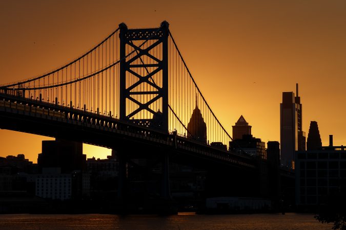
    Severe storms also hit the region late on Independence Day, bringing heavy rain and wind that caused significant delays to the holiday celebrations, which wrapped up around 3 a.m. A week later, severe weather cropped up once again in the form of several microbursts of winds up to 70 mph that toppled trees, damaged buildings, and knocked out power around the area Saturday — and affected the celebration of the Ben Franklin Bridge’s 100th anniversary.

    Even the FIFA World Cup festivities have been affected, with the FIFA Fan Fest closing early on a few occasions because of heat and storms since it launched in June.

    The heat has also had deadly effects in Philadelphia, as city officials earlier this month confirmed eight heat-related deaths for the season.

    Heat deaths in Philadelphia have averaged about five a year for the last decade. That figure is down significantly from the 1990s; in 1993, the city recorded 118 heat-related deaths. But the number of heat deaths this year so far is the most since Philadelphia recorded eight in 2022, health department records indicate.

  • Microburst storms caused unprecedented tree damage in some Philly-area neighborhoods

    Microburst storms caused unprecedented tree damage in some Philly-area neighborhoods

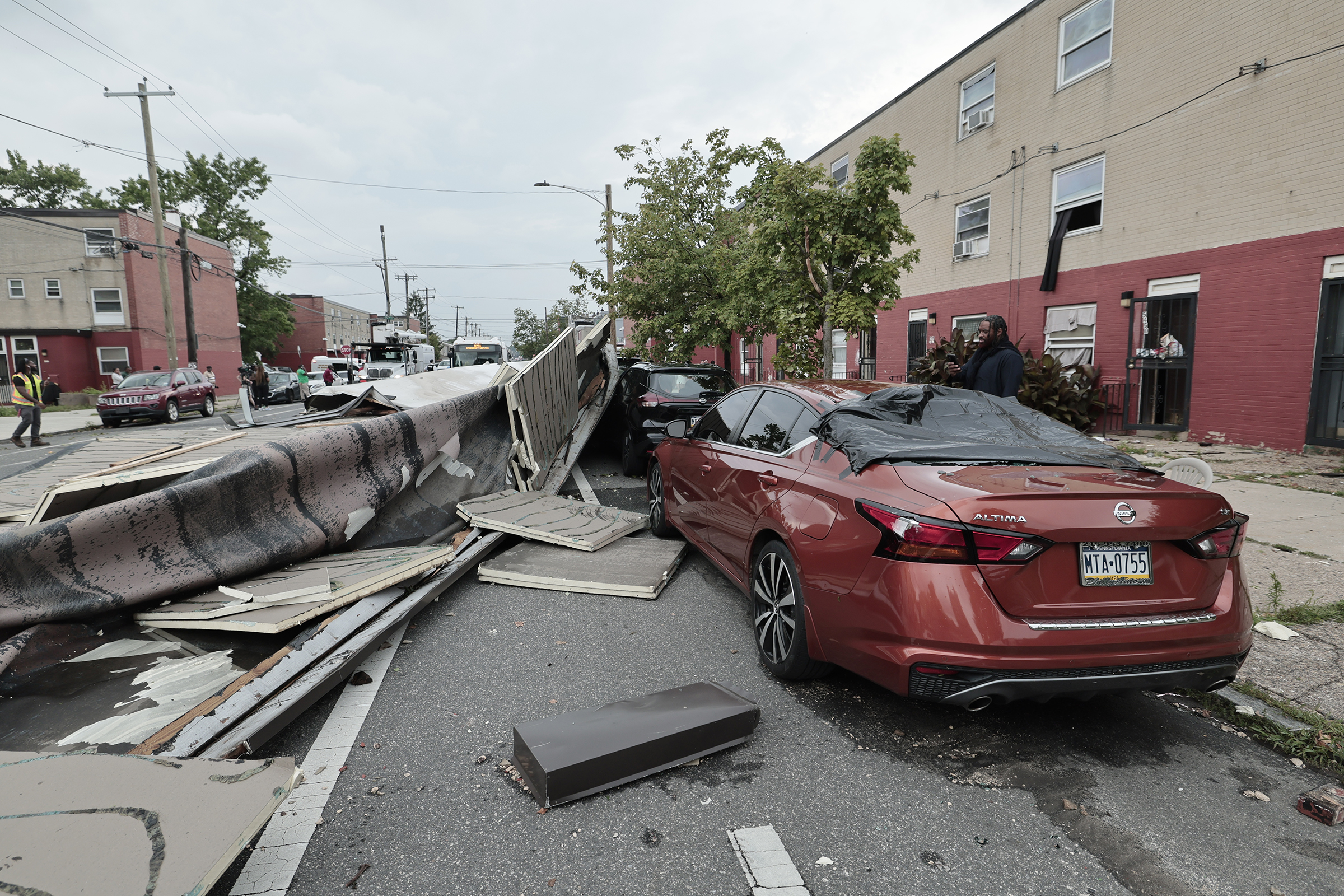
    Hundreds of trees fell in Philadelphia within a matter of minutes during a weekend storm that left a narrow but destructive band of what one official called “unprecedented” damage in its wake in the region.

    “We’ve never seen anything like this,” Parks and Recreation commissioner Susan Slawson said. “We’ve never seen a 15 and 20 minute storm come through an isolated area and take down that many trees.”

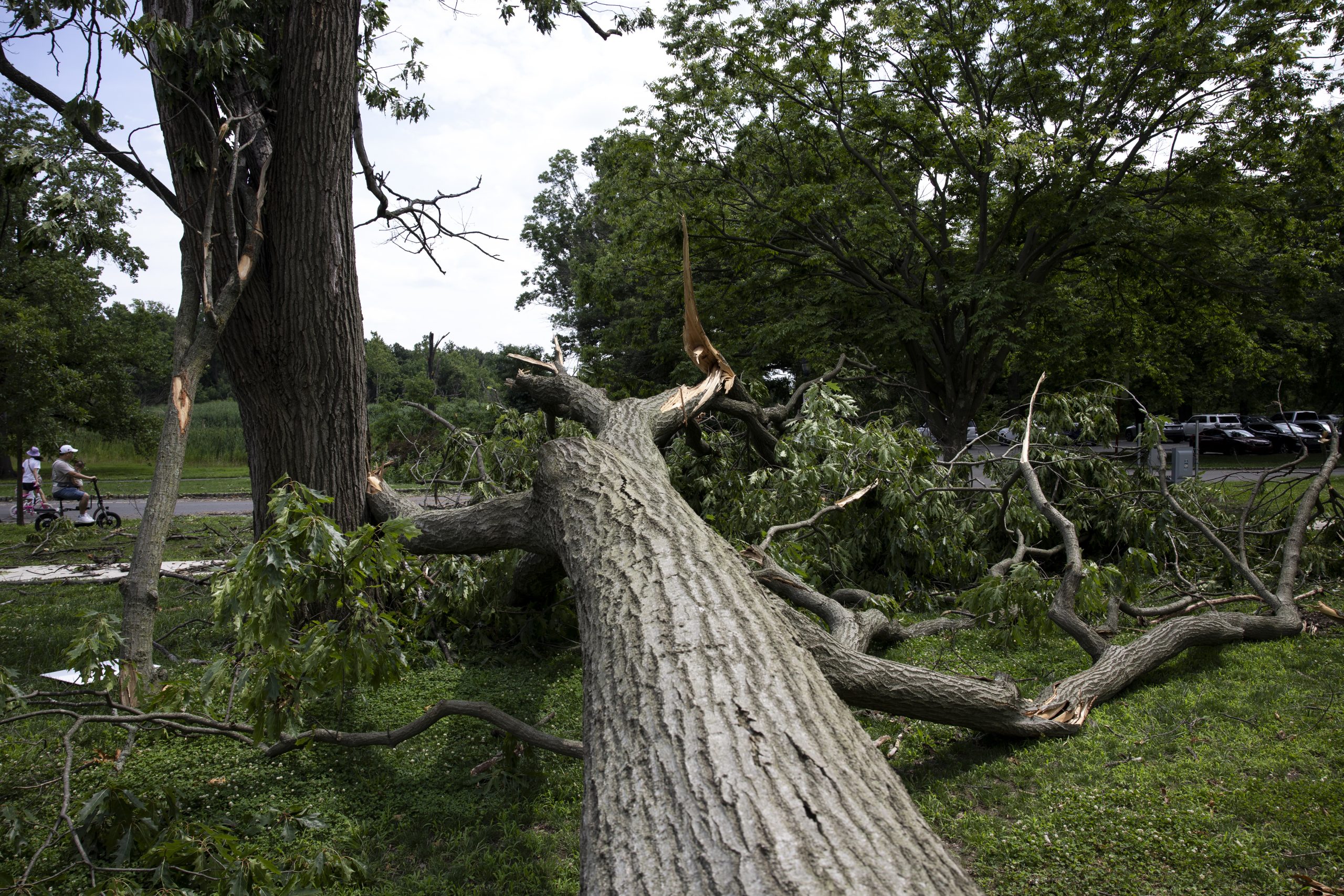
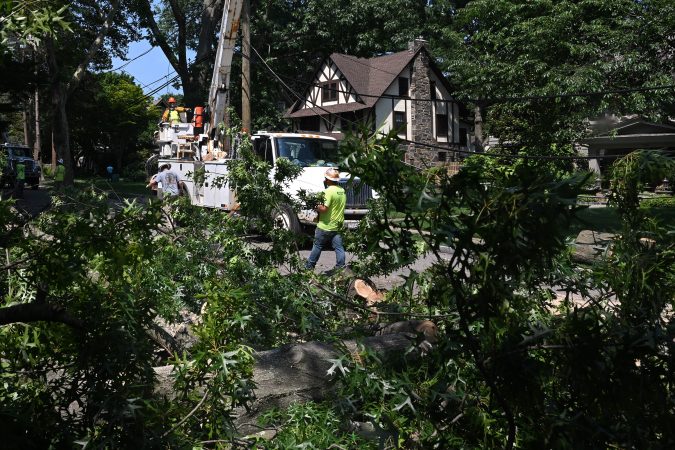
    Those downed trees came following a series of four “microbursts,” which brought wind gusts traveling 60 to 70 mph. Those isolated instances of high winds primarily impacted parts of Philadelphia and Montgomery County.

    Microbursts, the National Weather Service said, happen when a thunderstorm experiences a rapid increase in updraft. When that updraft stops, the mass of the storm system comes crashing back down, resulting in severe winds that sent trees tumbling into homes and vehicles, damaged public parks, and left neighborhoods grappling with cleanup efforts days later.

    Slawson’s department, which handles downed trees in the city, had responded to at least 340 emergency requests as of Monday afternoon, and inspected about 220 trees. The hardest hit areas, she added, were in South Philadelphia, Wynnefield, and Southwest Philadelphia.

    The harsh winter’s heavy caps of ice and snow that lasted for weeks likely left some trees weakened or damaged, Slawson said, making them more vulnerable to being toppled. Those that fell were being taken to the city’s Fairmount Park Organic Recycling Center in West Fairmount Park.

    Evidence of the damage was apparent around the region Monday. In Malcolm X Park in West Philadelphia, piles of giant fallen trees, cut into large chunks, sat waiting for disposal. And nearby on Spruce Street, a downed tree blocked a busy two-way road between 53rd and 54th Streets, its corpse resting atop a crushed red pickup truck.

    “They need to cut these trees down, they’re too tall,” said Schonder Pickney, 61, who lives across the street from the wreckage. She and her neighbors had asked the city to remove some of the old trees that appeared dangerous, but she said nothing came from it.

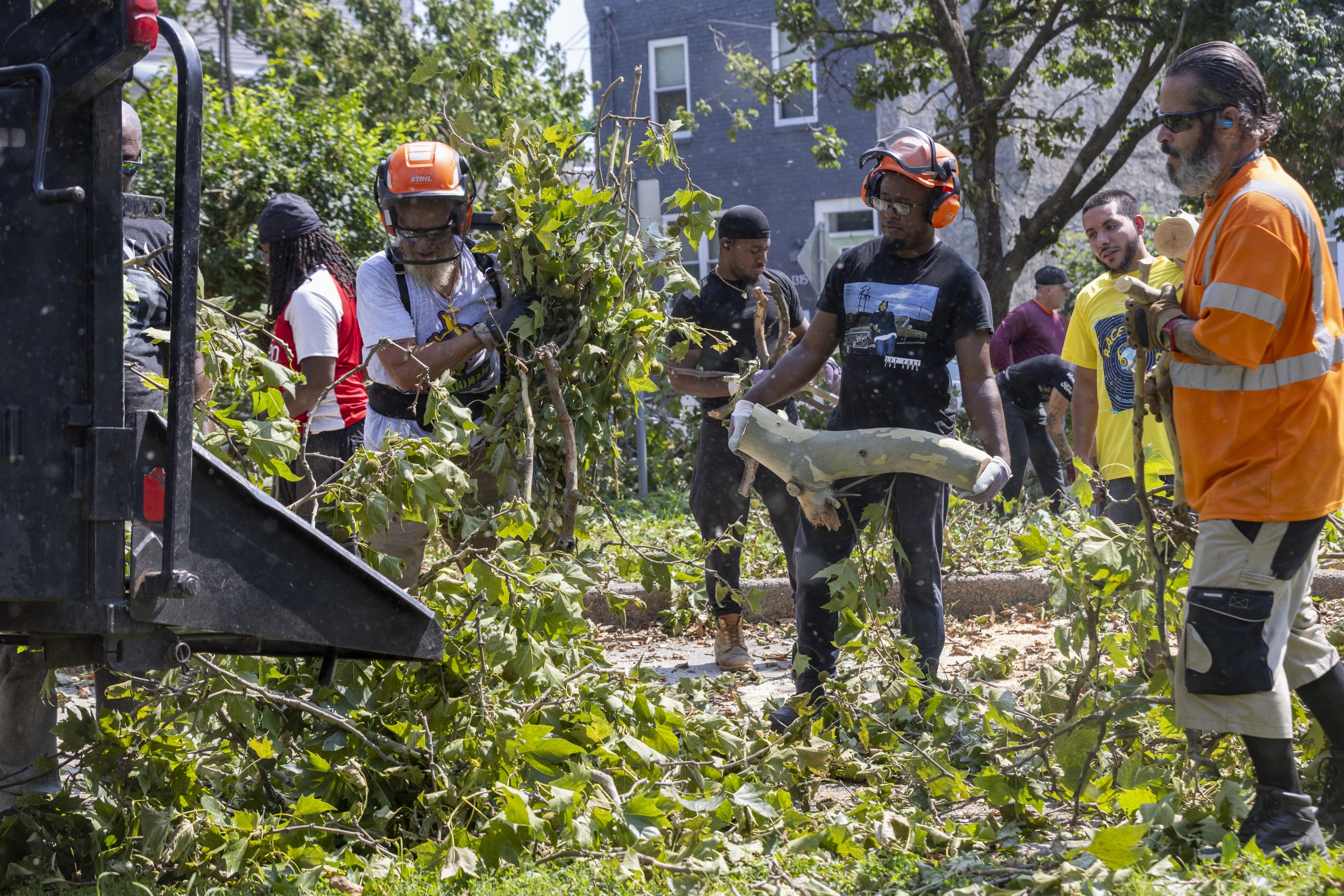
    Philadelphia Parks and Recreation workers throw debris into an auxiliary chipper at Wharton Square Playground in Point Breeze, on
    Monday.Aidan T. Gallo / Staff Photographer

    Private tree management companies, like Rapid Tree Care in Grays Ferry, were inundated with service requests following the storm. Caleb Coome, the company’s founder, said that the storm’s intensity knocked down large trees across densely populated city blocks, and across multiple homes.

    “It’s definitely unprecedented in terms of the amount of volume over a couple-day span,” said Coome, whose company has been in operations for three years.

    Homeowners impacted by fallen trees, he said, were largely concentrated near FDR Park and the stadiums in South Philly, as well as the Cobbs Creek and Cedar Park neighborhoods in West Philly. Homeowners face logistical and financial hurdles for cleanup, as much of the damage occurred in areas with tight rowhouses.

    In those tight quarters, a single fallen tree can span up to six properties, creating liability issues and disputes among neighbors over who is responsible for removal costs. A downed tree spanning multiple properties must be removed all at once, rather than limb-by-limb, for safety reasons, Coome said.

    Some parts of the suburbs also saw shared tree damage. For example, in Narberth, Hugh Parker and his family hurried home from the Shore Saturday after they heard from neighbors that a 40-foot tree had been knocked down in their front yard.

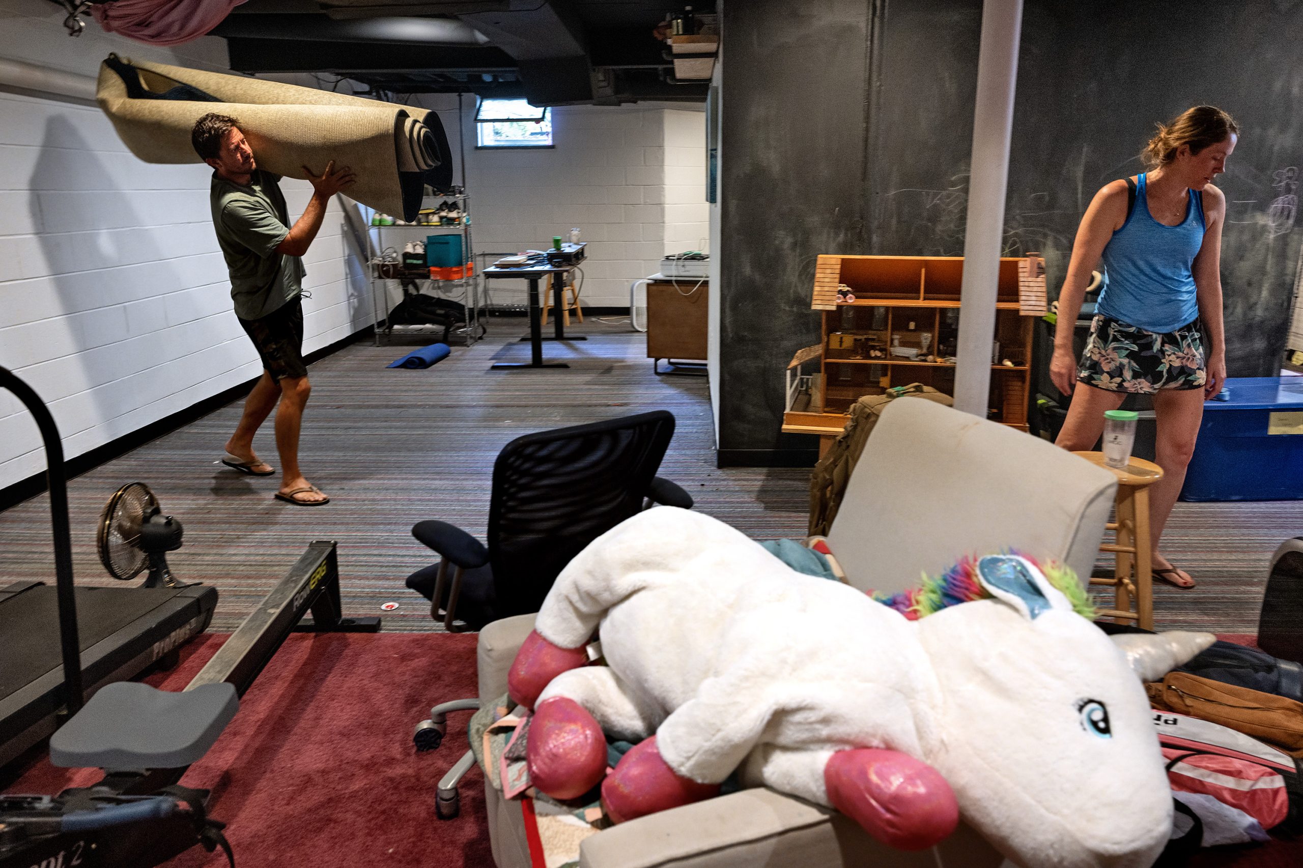
    Hugh and Grace Parker continue the cleanup in the basement of their Narberth home Monday. It flooded during weekend’s storm.Tom Gralish / Staff Photographer

    Located on their neighbor’s property, the tree landed to cover their driveway, as well as a car belonging to Parker’s wife, Grace. As it came down, the tree’s canopy also took down power lines and blocked the street, and the damage it did to the vehicle remained unclear Monday.

    A day later, Peco reconnected their power, which Parker said had been out for a little more than 24 hours. Then, he smelled smoke, thanks to a power line that started a fire after power had been restored. After about 30 minutes, the fire went out, but no one from the utility had come to check the power lines as of Monday morning.

    “It was like something from a movie scene — there were sparks flying 10 to 15 feet in the air,” said Parker.

    In Lower Merion Township, the local fire department responded to 98 incidents over the weekend, including numerous water rescues. Montgomery County communities were some of the hardest hit.

    “It became apparent that nearly every street in Narberth had a tree down, a substantial tree on a car,” said Narberth Council Vice President Cyndi Rickards said.

    The episode also highlights what many local officials have said is a need to further discuss improving local infrastructure and resources for extreme weather events.

    “I think this is the reality of storms now,” said Lower Merion Commissioner Ray Courtney. “They are hard, they are intense, and they dump a lot of precipitation in a short period of time, and all local governments, and our state and federal government, need to be thinking about improvements to our infrastructure, and the resiliency against this kind of weather event.”

    In addition to downed trees in the area, roughly 1,500 Peco customers remained without power across 119 reported outages as of late Monday afternoon. That number is down significantly from the height of the storm, when some 60,000 customers experienced extended outages. Overall, 105,000 Peco customers experienced some loss of power during the course of the storm, the company said.

    Power for all customers in the region, Peco added, was expected to be restored by 11 p.m. Monday.

    Among those impacted were West Philadelphia resident Lisa Phillips, who lives on the 5100 block of Hazel Avenue. A tree on her block went down Saturday, taking power lines with it. Electrical workers arrived Monday to take care of the downed lines, but she was still waiting for the city to clear the tree from her street.

    “Never in my life have I experienced anything like this,” she said.

    Staff writers Isabel Maney, Olivia Prusky, and Fallon Roth contributed to this article.

  • Fans express ‘heartbreak’ after storm causes Louis Tomlinson show to be canceled

    Fans express ‘heartbreak’ after storm causes Louis Tomlinson show to be canceled

    The groans were audible outside Philadelphia’s Highmark Mann Center for the Performing Arts, where pop singer Louis Tomlinson was slated to take the stage.

    Tomlinson had been scheduled to perform at the venue’s Skyline Stage on Saturday. Then the skies opened up.

    “Due to impacts of severe weather on our campus, we are not able to proceed with tonight’s performance,” the venue said in a statement. The show was not rescheduled. Ticketmaster is in the process of issuing refunds.

    For rabid fans of the singer, a former One Direction member with a devoted army of admirers, the last-minute cancellation cut deep.

    “I came all the way from Italy,” a fan who goes by Crystal wrote on X. “I spent so much time and money to be here. I know this isn’t Louis’ fault, but right now I’m angry, exhausted, and my bank account is empty.”

    One Directioners and Tomlinson superfans are pretty common in the area. There’s a One Direction-themed smoothie shop in Scranton that enthusiasts travel hours to visit. And Tomlinson’s former bandmate and collaborator Zayn Malik has expressed his own devotion to the region.

    Tomlinson’s Philadelphia show would have been the 19th on his 27-stop North American tour, part of the “How Did We Get Here?” world arena tour in support of his third studio album of the same name. His show a few days earlier at Madison Square Garden was sold out.

    Tomlinson and officials at the performing arts center said Saturday’s intense storm — which caused significant damage across the city, particularly in parts of West Philadelphia — left the venue grounds and some equipment damaged.

    On Reddit, a purported venue employee said there was flooding, downed trees, and power outages.

    The venue did not respond to a request for comment.

    “[I’m] absolutely gutted that the show can’t happen tonight,” Tomlinson said in an X post. “I understand how frustrating it is and how gutted you all must feel. I wish I had better news for you all.”

    Online, fans swapped stories about how far they had traveled for the show and how many of Tomlinson’s tour stops they had caught so far.

    One fan drove eight hours from North Carolina. Others attempted to snag tickets to shows scheduled for later dates.

    The extent of the Highmark Mann’s damage was unclear. Bob Dylan was scheduled to perform on the main stage — which has covered amphitheater seating, in contrast to the all-outdoor Highmark Skyline Stage — on Tuesday evening.

    Tomlinson’s next show was also set for Tuesday, at the TD Garden in Boston.

  • Philly temperatures are forecast to near 100 degrees, again, this week

    Philly temperatures are forecast to near 100 degrees, again, this week

    No rest is in sight for the weary Philadelphians still recovering from the scalding week that led up to the city’s July Fourth festivities. Temperatures this week are expected to near 100 once again.

    The National Weather Service has issued an extreme heat watch for Wednesday, when temperatures are expected to peak at 99 degrees, accompanied by a heat index of up to 108. Before then, a high of 93 is expected on Tuesday. Temperatures should return back down to 93 on Thursday and settle at 92 on Friday, according to the service’s forecast.

    The forecast doesn’t anticipate anything quite as severe as the series of triple-digit days leading to July Fourth, but it will surely be humid, hot, and uncomfortable, said Zack Cooper, a meteorologist with the National Weather Service’s Mount Holly office.

    Similarly to the early July heat stretch, rain is possible to follow the heat over the weekend, Cooper said.

    The city has tallied eight heat-related deaths this year, according to the city health department.

    This blanket of heat in the atmosphere “probably won’t be centered” over the Philadelphia area, Cooper said. “What really set the last event apart from this one was that high pressure center being right over the area for a period of a few days where, in this case, it’ll mostly be suppressed down to our south.”

    Virginia and West Virginia are anticipated to experience the brunt of this heat spell, he added.

    Temperatures this week are unlikely to break records, Cooper said, as the hottest recorded temperature in the Philly area on a July 15 was 103 degrees, set in 1995.

    Still, Cooper advised Philadelphians to treat this heat similarly to the early July heat wave — limit time outdoors, dress in lightweight clothing, and check up on neighbors.

    “It still will be dangerous heat,” he said.

  • Where microburst storm damage has been reported around Philly, mapped

    Where microburst storm damage has been reported around Philly, mapped

    Cleanup from Saturday’s storm was continuing Monday, as communities around the Philadelphia region deal with aftermath of fallen trees, flooding, and high winds.

    A series of four “microbursts” brought severe damage to a limited area Saturday, with wind gusts traveling up to 60 to 70 miles per hour. Those isolated bouts of high winds, which ripped through parts of Philadelphia and Montgomery County, toppled hundreds of trees and damaged or collapsed several buildings, while sudden and severe rains caused floods around the region.

    Microbursts, the National Weather Office said, occur when there is a rapid increase in the updraft of a thunderstorm. Once that updraft stops, the mass of the storm system crashes back down, resulting in severe winds.

    As of early Monday afternoon, Peco continued to restore power to affected customers, with more than 170 outages impacting nearly 2,400 people. And though a comprehensive account of damages was not immediately available, damage reported to the weather service and select other entities indicated dozens of recorded incidents.

    (function() {
    var l2 = function() {
    new pym.Parent(‘july_11_storms’,
    ‘https://media.inquirer.com/storage/inquirer/projects/innovation/arcgis_iframe/july_11_storms.html’);
    };
    if (typeof(pym) === ‘undefined’) {
    var h = document.getElementsByTagName(‘head’)[0],
    s = document.createElement(‘script’);
    s.type = ‘text/javascript’;
    s.src = ‘https://pym.nprapps.org/pym.v1.min.js’;
    s.onload = l2;
    h.appendChild(s);
    } else {
    l2();
    }
    })();

  • The Southeast Asian Market in FDR Park sustained heavy damage from Saturday’s storm

    The Southeast Asian Market in FDR Park sustained heavy damage from Saturday’s storm

    Sokah McNear had just handed a customer a spiral potato from her stand at the Southeast Asian Market in South Philadelphia on Saturday afternoon when her husband pointed to the dark clouds that had suddenly gathered in the sky.

    “I said, ‘OK, this is your last potato,’” recalled McNear, the vice president of the vendors’ association at the long-running outdoor market in FDR Park. She switched off her stove, and nearly a dozen friends and family members who had been working the stall with her started to pack up.

    Within minutes, they were caught in a torrential downpour. Then came the winds, whipping through dozens of tents across the market.

    McNear and her family were struggling to keep their tent from flying away when another vendor raced by, yelling that it was no longer safe to stay outside. As branches cracked and fell from nearby trees, they abandoned the tent and ran to their car.

    “We sat in there for maybe five minutes. Then we came out and saw the devastation,” McNear recounted on Sunday.

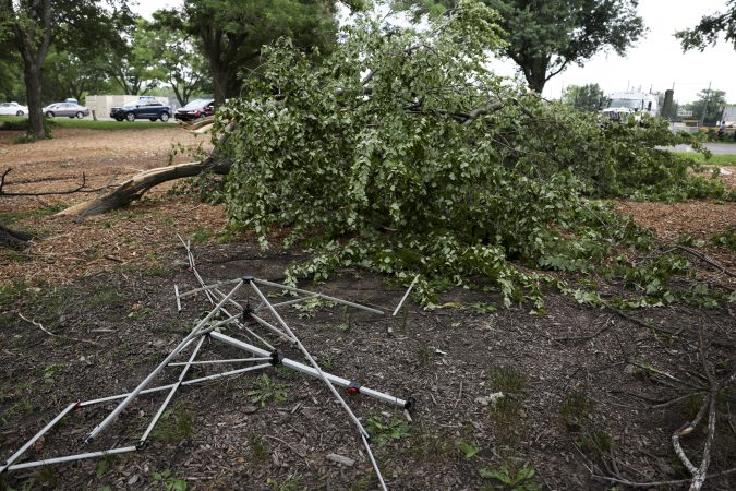
    All of the market’s 53 tents were damaged. Tables were overturned, with ruined food and clothing scattered throughout the market. Two vendors suffered minor injuries when a tree branch fell on their tent.

    Flying debris left a cut on a customer’s nose, said Sonetha Svay, who sells cookies and bagels at the market. “Everything was just flying. We really didn’t know what to do — we just hung on,” she said.

    Eventually, she sheltered in her car with the woman and two other customers. A tree branch also fell on a tent near hers, she said, but the vendors working there had already fled.

    A large downed tree near the Anna C. Verna Playground at FDR Park in South Philly on Sunday, July 12, 2026. The Southeast Asian Market, which was also damaged, is near the playground. On Saturday severe thunderstorms caused damage across the region.Monica Herndon / Staff Photographer

    Afterward, Svay, McNear, and other vendors picked through what was left of the market in shock.

    Melissa Mgar, the vendors’ association secretary, had raced home with her three young children after a falling tree branch narrowly missed their car. She returned to find all three of her family’s tents destroyed. “One was crumpled into a ball,” she said.

    Food inside coolers had survived, but nearly everything else — including supplies for barbecue and papaya salad — was lost.

    Mgar, who has been selling at the market for more than 20 years, estimated her losses at around $1,500. She said she believed inventory at her neighbor’s clothing tent next door was “completely damaged.” Svay also lost her tent and food and estimated damages around $1,000.

    Between ruined food and other merchandise and broken tents and equipment, most stalls likely sustained damage between $500 and $1,000, McNear said.

    Vendors have already been struggling this season with market closures related to high-profile events like the World Cup at the sports stadium complex across the street from FDR Park, McNear said. Food and other supplies are more expensive now, too.

    When she first saw the damage, McNear said, she panicked, worrying that vendors or customers had been injured. Once she made sure no one was seriously hurt, she said, her mind turned to the impact on the market. “These are people’s livelihoods,” she said.

    By Sunday, the market was still closed for safety reasons. “You don’t want any more of these branches to fall,” McNear said.

    Most vendors had managed to clean up what was left of their tents. Market organizers were encouraging donations from the public to help vendors rebuild. A “Dolla Holla” sale set for next weekend was postponed.

    Trees had fallen all over the park, and the Friends of FDR Park marshaled volunteers to help clear debris. Park director John Murawski said he was too busy overseeing cleaning operations to comment. On the park’s Instagram account, staff noted that the storm had also caused flooding throughout the park.

    McNear said that the market’s vendors are resilient and determined to bounce back from an unexpected setback.

    “If you see any of the videos [from the market cleanup], everyone is still smiling. Everyone has such a positive attitude. Even with the devastation, we’re helping each other as a community,” she said.

    Added Mgar: “After the storm, it’s going to be sunshine.”

  • High winds tear off roofs, partially collapse buildings across Philadelphia

    High winds tear off roofs, partially collapse buildings across Philadelphia

    Saturday’s afternoon storm damaged multiple buildings across Philadelphia, uprooted trees, and caused some streets to flood.

    As city officials gathered at news conference Saturday evening, Police Commissioner Kevin Bethel said that the city’s 911 dispatchers fielded 3,000 calls during a one-hour period during the height of the storm.

    Wind gusts, according to Mayor Cherelle L. Parker, topped out at 60 mph.

    Parker pledged that her office, as well as a number of other city agencies, will be working through the weekend to assess the damage and begin repairs.

    “All of our departments are here today to function as one Philadelphia,” she said. “Because in the midst of crisis, that is what we are supposed to do and that is to have full interdepartmental cooperation today, tonight, and until we make it through this crisis.”

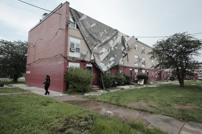
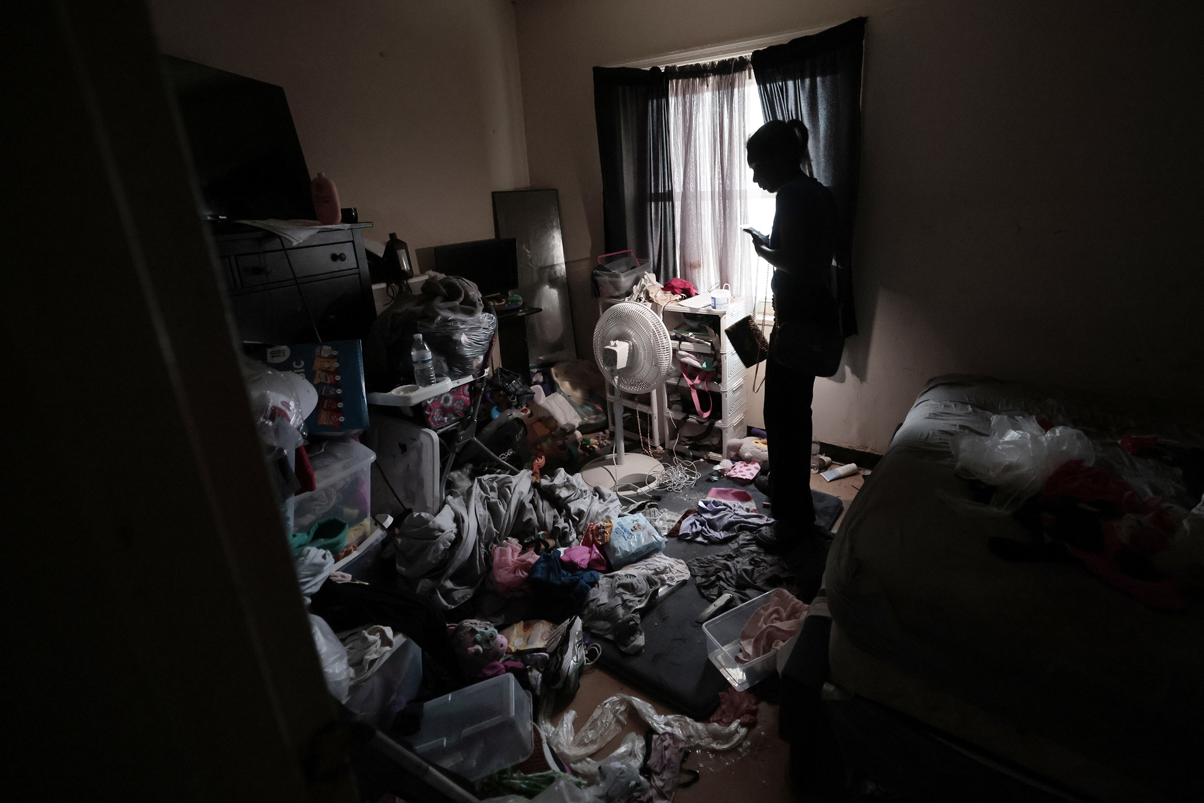
    A woman named Sheila tries to find sneakers for her five children, as everything in her home was soaked. Her PHA building Aspen Way, at 55th and Vine Street, had its roof blown off by strong storms that passed through the area on Saturday afternoon.Elizabeth Robertson / Staff Photographer

    Parker, Bethel, and other city officials spoke near a Philadelphia Housing Authority property on Vine Street near 55th in West Philadelphia that had part of its roof blown off during the storm. Eleven units in the building were affected, officials said, and residents were relocated to nearby hotels.

    Those displaced residents will be moved into new PHA units on Monday, according to PHA president Kelvin A. Jeremiah, while repairs are completed.

    Elsewhere in the city, at least two buildings partially collapsed due to the storm: a vacant property at 24th Street near Washington Avenue, and another building in West Philadelphia on Lansdowne Avenue near 56th Street.

    Carroll Park, in West Philadelphia, had several trees toppled, as did Wharton Square Park in Point Breeze.

    Officials survey the damage to a PHA building, at 55th and Vine Street, that had its roof blown off by strong storms that passed through the area on Saturday afternoon.Elizabeth Robertson / Staff Photographer

    Peco reported that more than 34,000 residents across the region were still without power as of Saturday evening.

    City officials are urging residents to properly document any and all damage their property sustained during the storm — the city is in the process of obtaining state and federal funding to help offset the costs of repairs.

    Officials also warned residents to avoid downed trees and live wires, and could not confirm whether a tornado had caused any of the damage. The officials said they would work with weather experts to determine what sparked the severe storms.

  • El Niño is rapidly intensifying and could become the strongest on record and last through winter

    El Niño is rapidly intensifying and could become the strongest on record and last through winter

    Warming in the tropical Pacific has been intensifying rapidly, and with increasing certainty government meteorologists say this El Niño event could become the strongest in records dating to 1950.

    It is all but certain to have profound effects on the Atlantic hurricane season and the winter of 2026-27 across the United States. It’s also going to stick around.

    In its Thursday update, the National Oceanic and Atmospheric Administration advised that El Niño would “strengthen through the end of the year, with a 97% chance it will last through early spring 2027.”

    Sea-surface temperatures over a critical 2.4 million-square-mile portion of the tropical Pacific are running about 2 degrees Fahrenheit above long-term averages, more than qualifying for El Niño status.

    In records dating to 1950, those temperatures have reached as high as 4.5 degrees above normal. In this El Niño event, the temperatures have a “43% chance” of reaching that level, said Michelle L’Heureux, physical scientist at NOAA’s Climate Prediction Center.

    As for what impacts it will have, NOAA scientists point out that El Niňo will not be acting in isolation and that it would be impossible to know. However, based on past strong El Niños, expect unusual levels of strangeness for the next several months.

    For Philly, it may have significance for the stubborn drought conditions, but that also could come with a positive development.

    And its potentially benign effects on the Atlantic hurricane season may save some lives and yield a robust bonus for the U.S. treasury.

    How does El Niño affect the U.S. weather?

    El Niño events develop as part of a periodic natural process as east-to-west trade winds that push water into the western Pacific slacken, allowing prodigious, massive amounts of warm water to move eastward.

    The warmer water interacts with the overlying air, setting off convective thunderstorms and altering west-to-east upper-air winds that deliver the weather to the United States and other parts of the world.

    Reliable responses to El Niño include storminess in the southern United States and warmth in much of the northern states and Canada. For Philly, about the only constant has been weirdness.

    How is El Niño affected by other phenomena?

    El Niño is a crucial piece of the atmospheric puzzle in long-range forecasting. However, it also interacts with other phenomena, such as the Arctic Oscillation — shifts in atmospheric pressure between the Arctic and the lower latitudes, and an important driver of winter temperatures — and patterns in the North Atlantic, which “may reinforce or counteract each other,” said Johnna Infanti, a climate center meteorologist.

    And when it comes to developing outlooks for the seasons, forecasters have to consider earthly phenomena such as changes in soil moisture and sea ice, she said.

    “It is important to remember that an El Niño can shift the odds toward certain outcomes,” she said, “but the outcome is not guaranteed.”

    That said, “stronger events can tilt the odds more heavily in favor of the expected outcome,” she added.

    Was El Niño behind the July 4th weekend extreme heat?

    The short answer in all probability would be no, Infanti said.

    In summer, she said, “there is no clear link between above-average temperatures over the United States and El Niño.”

    Besides, this El Niño is still a relative toddler. This one is expected to last for about a year, a typical lifespan, L’Heureux said.

    While the sea-surface temperature has surpassed the El Niño threshold, “the atmosphere is still aligning,” said Matthew Rosencrans, NOAA’s lead hurricane seasonal forecaster.

    As it intensifies and the atmospheric response strengthens, the impacts will become more evident, and they are likely to be significant during the peak of the hurricane season, from mid-August into September, he said.

    That may be welcome news for residents and property owners along the Atlantic coast and for U.S. taxpayers.

    How will El Niño likely affect the number of Atlantic hurricanes?

    El Niño can generate powerful upper-air shearing winds that can suppress hurricane development in the Atlantic Basin.

    In the six years in which sea-surface temperatures in the key El Niño zone remained 3.5 degrees or higher above normal for three months or more, the Atlantic tropical-storm season was far less active than normal.

    The numbers for all named storms, those with winds of 39 mph or higher; hurricanes, which have winds of at least 74 mph; and “major” hurricanes, those with winds of 111 or higher, were substantially below long-term averages.

    (function(){function e(){window.addEventListener(`message`,function(e){if(e.data[`datawrapper-height`]!==void 0){var t=document.querySelectorAll(`iframe`);for(var n in e.data[`datawrapper-height`])for(var r=0,i;i=t[r];r++)if(i.contentWindow===e.source){var a=e.data[`datawrapper-height`][n]+`px`;i.style.height=a}}})}e()})();

    Among all federal disaster relief fund disasters, hurricanes are far and away the most expensive. In a congressional study covering the 30-year period through 1992, hurricanes accounted for 44%, or more than $150 billion, of all federal disaster money.

    A potential downside would be that fewer storms would lessen the chances for any drought-relieving tropical-storm remnants. (On the plus side, the region would not have to deal with their attendant flooding: See Ida, 2021.)

    Will El Niño affect the Philadelphia winter?

    Looking way ahead, El Niño is not much help in determining how the winter might play out.

    One characteristic of strong El Niños has been persistence of certain patterns. What happens tends to keep happening, since ocean temperatures change slowly.

    The six strongest El Niños persisted into winter and left quite a disparate legacy in Philly. The winters of 1991-92 and 1997-98 were nearly snowless, and that of 1972-73 was the only truly snowless winter in Philadelphia history.

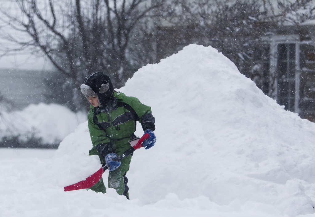
    An industrious young man in Swarthmore adds to a mountain of snow his father crated from the prodigious January 2016 snowfall.

    Conversely, snow was well above normal in the winters of 1965-66, even though no snow had fallen until the end of January; in 1982-83, when an all-out blizzard occurred in February; and in 2015-16, which featured a two-footer in January.

    The upshot: Expect anything.

  • Philly sets a rain record, and more showers are possible Friday and Saturday

    Philly sets a rain record, and more showers are possible Friday and Saturday

    It may be a while before the drought advisories disappear, but since Monday Philadelphia has had more rain than in any entire month since March 2025. And the city of Camden has been clocked well over a half-foot of rain.

    In both instances, if it seemed like most of that came in a hurry, it did.

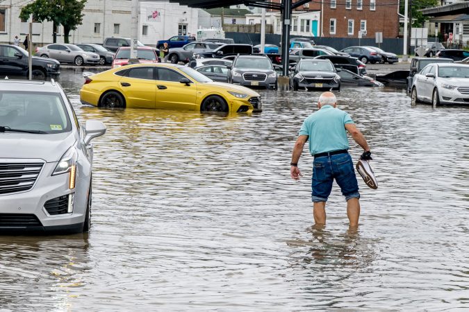
    On Thursday, for the second time in a week, downpours set off a flood of warnings in the city, the neighboring counties and Delaware.

    And more showers are possible Friday and Saturday, but the atmosphere isn’t expected to upstage its performance since it turned off last weekend’s 100-degree heat.

    Thursday’s downpours wrung out 2 and 3 inches of rain in several towns across the region.

    Flooding was reported along numerous roads, with vehicles stranded, including in the vicinity of the Ben Franklin Bridge, the National Weather Service said. The rains could continue until 7 or 8 p.m. Thursday, said Alex Staarmann, meteorologist inthe Mount Holly office.

    Multiple water rescues have been reported in Wilmington.

    Philadelphia broke a 74-year-old record for a July 9 with 2.61 inches of rain measured officially, according to the weather service.

    At one point flood warnings had been posted for the city and in all seven neighboring counties.

    But the rain lately has been random. And in the grand casino of the atmosphere, that was the case Thursday, and not every place got the soakings.

    The drought conditions are likely to persist despite the storms

    In the weekly inter-agency U.S. Drought Monitor update posted Thursday, some degree of drought conditions persisted in all of New Jersey, Philly, and the neighboring Pennsylvania counties.

    The drought monitor has most of the region was in “moderate drought,” with some improvement in Burlington, Camden, and Gloucester Counties.

    But all of Chester County and most Montgomery County were in “severe drought.” Southeastern New Jersey, including the Shore towns, were in “extreme drought.”

    Soil moisture levels will remain significantly below normal during the next week, according to the National Oceanic and Atmospheric Administration’s Climate Prediction Center.

    (function(){function e(){window.addEventListener(`message`,function(e){if(e.data[`datawrapper-height`]!==void 0){var t=document.querySelectorAll(`iframe`);for(var n in e.data[`datawrapper-height`])for(var r=0,i;i=t[r];r++)if(i.contentWindow===e.source){var a=e.data[`datawrapper-height`][n]+`px`;i.style.height=a}}})}e()})();

    And it appears the atmospheric faucets are going to shut after Saturday.

    Said Joseph DeSilva, meteorologist at the weather service’s Mounty Holly office, “Next week looks pretty dry.”