Category: Science

  • The Philly region has been a national hot spot this year — for flood warnings

    The Philly region has been a national hot spot this year — for flood warnings

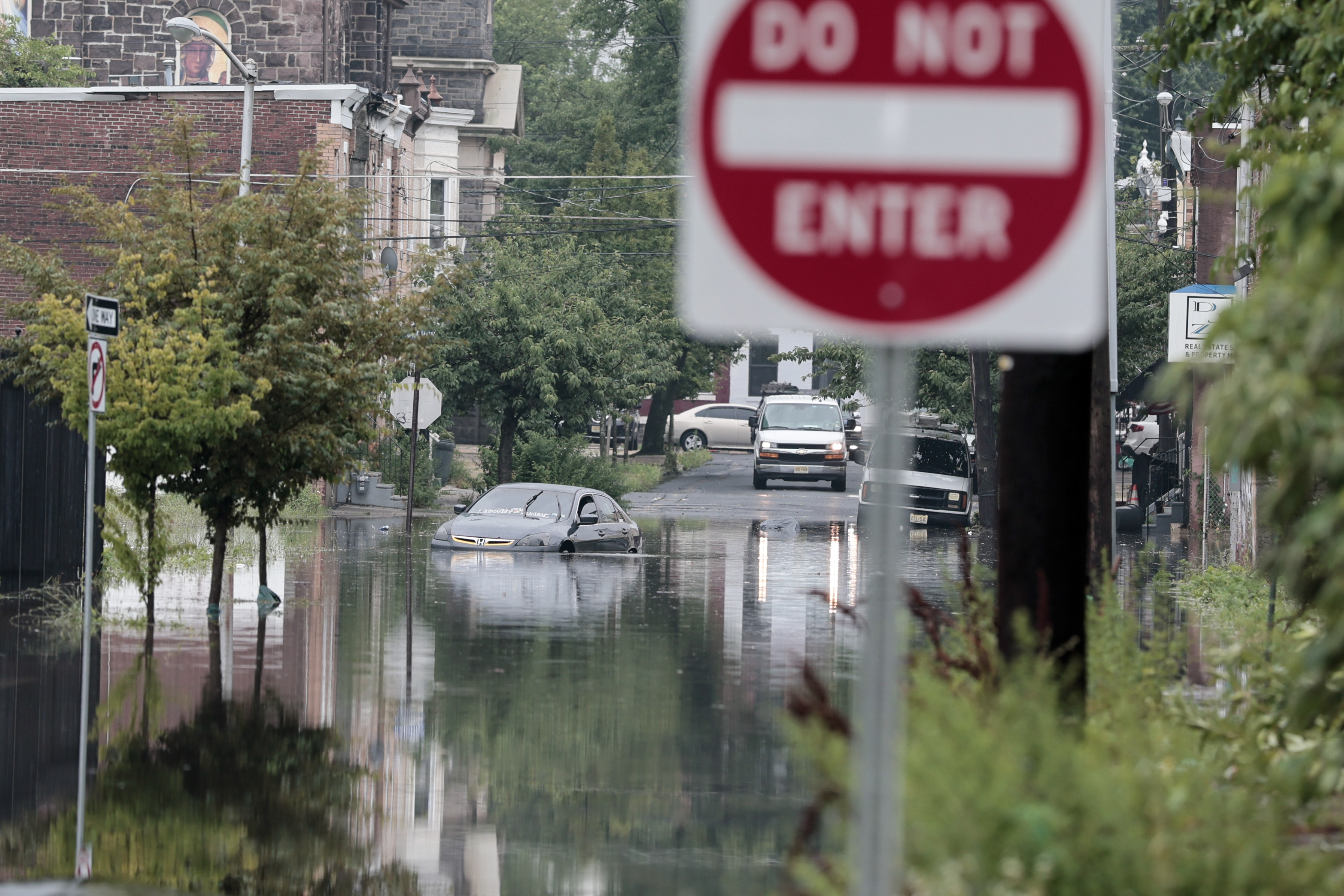
    If you perceive that the Philadelphia region has had an extraordinary number of flood events this summer, you are not hallucinating.

    The National Weather Service in Mount Holly has set a record for issuing flood warnings this year with 147 in its coverage area from Delaware to northern New Jersey, including 76 in the Philadelphia region, and monthly records in July and August. And an Inquirer analysis documented that among 2,200 U.S. counties, Philly and six of its neighboring counties rank in the top 25 for warnings issued this year, most of which have been followed by actual floods.

    In addition, with four months to go, The Inquirer analysis found, the region already has had nearly triple the annual average for flood warnings, during the 18 years in which it has been using its current methodology.

    (function(){function e(){window.addEventListener(`message`,function(e){if(e.data[`datawrapper-height`]!==void 0){var t=document.querySelectorAll(`iframe`);for(var n in e.data[`datawrapper-height`])for(var r=0,i;i=t[r];r++)if(i.contentWindow===e.source){var a=e.data[`datawrapper-height`][n]+`px`;i.style.height=a}}})}e()})();

    All this without a whiff of a tropical-storm remnant, and the region still emerging from drought conditions.

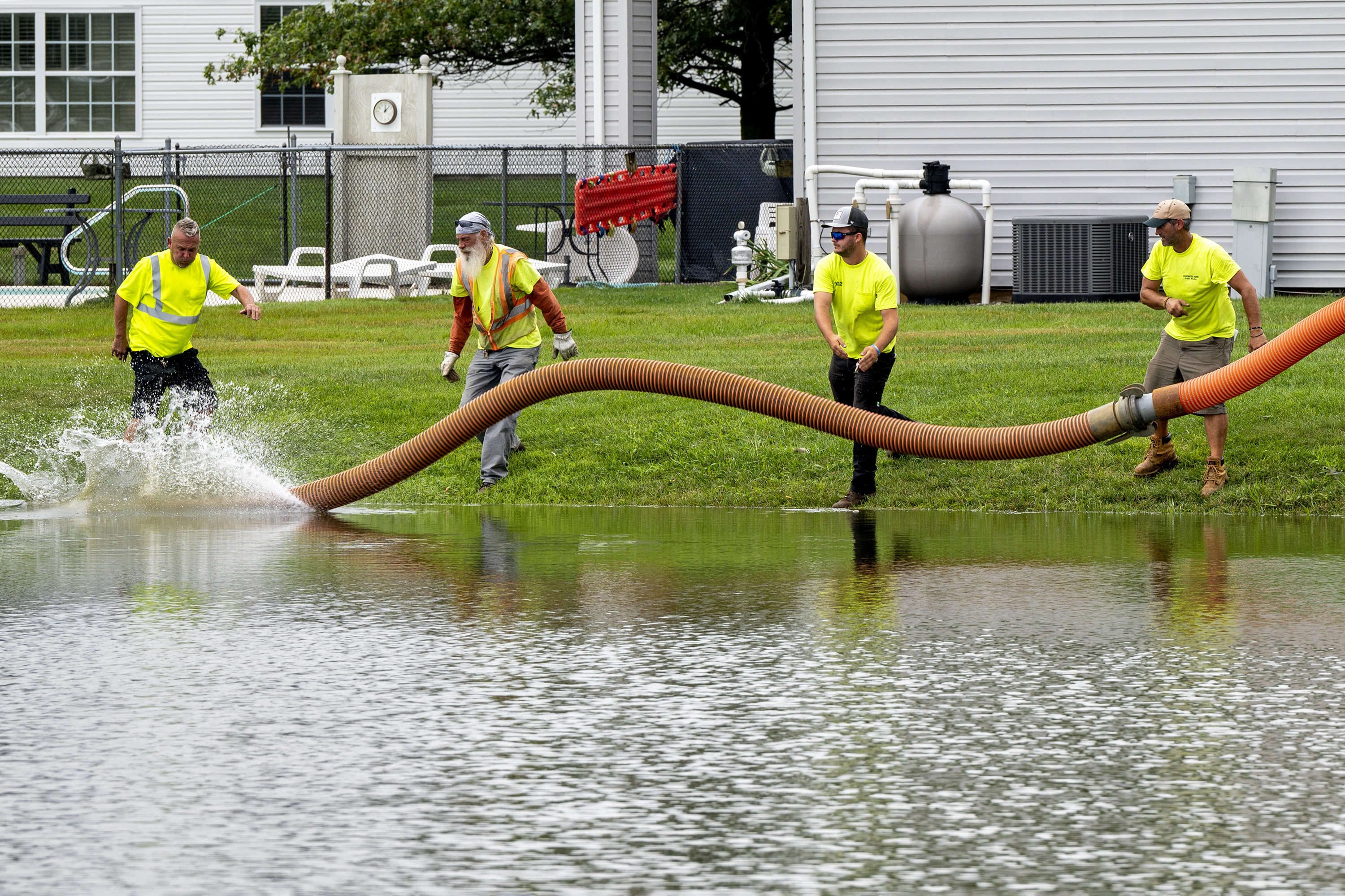
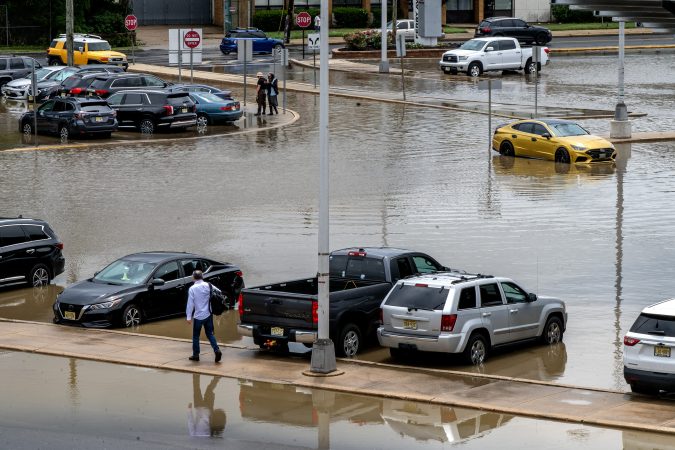
    The skies keep opening randomly, with no regard to what’s below, whether it be the most affluent communities, the likes of Upper Makefield Township, in Bucks County, to the cities of Camden and Chester, where 30% of the residents live in poverty.

    George Wilson, emergency management chief in Bucks, which ranked in the top 10 for warnings, said “battle fatigue” among rescue workers is only a piece of the flooding ordeals, which empty into days of damage assessments and recovery assistance.

    Just what the generous rains and the repeated “ring of fire” thunderstorms might have to do with the warming planet eludes certainty, said Sarah Johnson, the very busy warning coordination meteorologist in Mount Holly. Other factors, including improved radar and on-the-ground observations, likely have been factors in the increase of flooding reports, she said.

    Johnson noted that given the lack of any tropical involvement — unlike 2020, and 2021, the year of Ida — this year’s numbers would be “pretty unusual.”

    (function(){function e(){window.addEventListener(`message`,function(e){if(e.data[`datawrapper-height`]!==void 0){var t=document.querySelectorAll(`iframe`);for(var n in e.data[`datawrapper-height`])for(var r=0,i;i=t[r];r++)if(i.contentWindow===e.source){var a=e.data[`datawrapper-height`][n]+`px`;i.style.height=a}}})}e()})();

    But if this has been a window into the future, said Dominick Mireles, Philadelphia’s deputy managing director of community safety, “We got a lot of experience this summer.”

    What explains the onslaught

    NASA estimates that rising temperatures across the planet have resulted in more evaporation and added about 7% additional water vapor to the air since the late 19th century.

    Closer to home, it is possible that a pulse of above-normal sea-surface temperatures in June off the Mid-Atlantic coast, a key source of moisture for Philadelphia and the rest of the Northeast, may have added juice to the downpours, said Chad Merrill, senior meteorologist with AccuWeather.

    The Northeast Regional Climate Center, in Ithaca, N.Y., reported that stations from Washington, D.C., to Massachusetts had rainfall far above normal from July 1 to Aug. 15.

    As was the case this week, the I-95 corridor frequently has been on the edge of heat-producing high pressure, a hot spot for “ring of fire” thunderstorms to wring out the moisture.

    The New York City weather service office had its second-busiest July for flood warnings and third-busiest August in data that covers the last 40 years, said Samantha Borisoff, researcher at the climate center.

    Mount Holly’s numbers were triple those of New York’s.

    What might explain why the Philadelphia region would be an atmospheric punching bag?

    (function () {window.addEventListener(‘message’, function (e) { var message = e.data; var els = document.querySelectorAll(‘iframe[src*=”‘ + message.id + ‘”]’); els.forEach(function(el) { el.style.height = message.height + ‘px’; }); }, false); })();

    The best guess would by nature’s caprice, say meteorologists and emergency managers. Nothing personal: Flooding is a reality of life in a heavily urbanized area near so many bodies of water.

    Very simply, “Flooding does happen in Philadelphia and throughout the Delaware Valley,” said Mireles. And much of it is the result of downpours that can target their ferocity to small geographic areas at any time.

    A tragic example of atmospheric randomness was the 2023 deluge in Upper Makefield that killed seven people. Radar images showed most of the county didn’t experience a raindrop. The official total at Philadelphia International Airport that day was 0.00.

    What are some of the region’s prime trouble spots

    The Inquirer data show downpours rarely strike the same precise locations, which isn’t surprising given the small areal scale of most thunderstorms, and the region is short on flood-free zones.

    Parts of all eight counties at some point have been deluge targets, according to weather service storm reports.

    However, several general areas throughout the region have been flooded frequently, Upper Makefield being a prime example.

    “We know River Road at certain points in Upper Makefield, they are going to flood,” said Wilson, as well as Station Avenue, at the lower end of the county in Bensalem Township. “That road has been a problem for all 52 years I have been alive.”

    Germantown is among areas of Philly that historically has been flood prone, said Mireles. On the Camden flood honor roll would be Third Street, Cooper Street, and Admiral Wilson Boulevard

    The Brandywine Creek has been a scenic gem in Chester County, but also a prolific source of flooding in places such as Downingtown and Kennett Square, noted Kelly Tinsman, the county’s deputy director for emergency management.

    However, as would be the case throughout the region, “localized flash flooding … can quickly create response demands even in areas that not considered high-risk flood zones,” Tinsman said.

    Are flood warnings reliable?

    Emergency managers say they have had an excellent relationship with the weather service, which sends out email briefings when severe weather is threatening, sometimes days in advance.

    However, they say they also realize that in the duel between science and atmospheric chaos, the smart money is on chaos.

    “Weather predictions are just predictions,” said Joseph Hales, Camden County chief fire marshal and emergency management coordinator.

    The weather service’s Johnson said that warnings preceded more than 90% of verified floods from 2017 through 2025. However, the false-alarm rate — warnings issued for floods that didn’t occur — was 38%.

    Better to be warned than surprised, Hales said.

    “We experience less issues and less calls for service with the storms that are predicted,” he said. People are less likely to be out and about taunting nature. The pop-up storms that catch people off guard are more problematic.

    “For me, the moral of the story,” said Mireles, is that flooding happens, “warning, not warning; historical flood area or not.”
  • More severe storms are possible this week in the Philly region

    More severe storms are possible this week in the Philly region

    Officially the meteorological fall has begun in Philly, and unofficially it’s beginning to feel a lot like August.

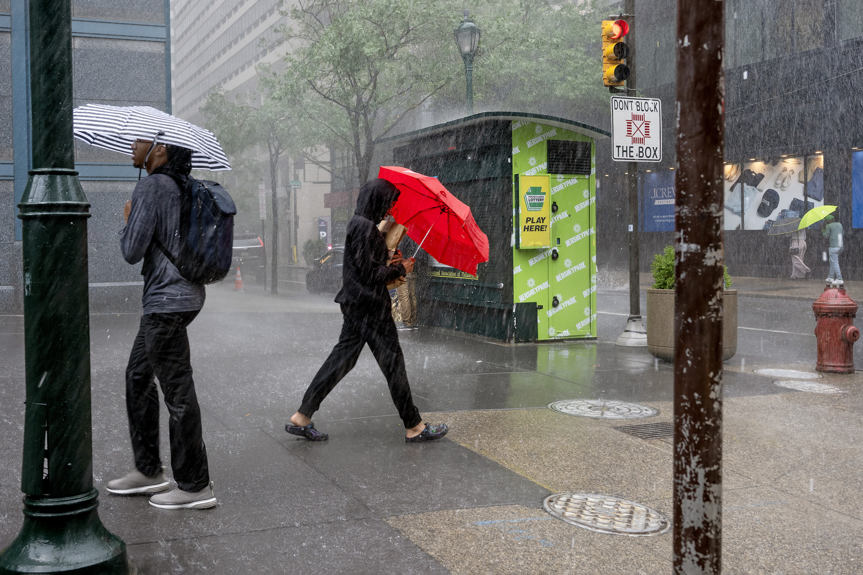
    Along with a heat advisory — the heat index hit 100 Tuesday afternoon — the National Weather Service is warning the region may be in for another one of those random storm outbreaks that so characterized August.

    The weather service issued a tornado warning around 9:05 p.m. for areas in central Burlington County — including for the weather service office in Mount Holly. The warning was based on radar imaging.

    Flood warnings were up for Chester, Delaware, Camden, and Gloucester Counties. The Collings Lakes Fire Department reported that “multiple roads” in Williamstown, Monroe Township, were “under water.”

    Storm winds reportedly took down trees and wires in several communities in western Chester County, the weather service said, and a tree fell upon Morgantown Road in the West Nantmeal Township area.

    And a severe thunderstorm watch, for storms with gusts approaching 60 mph, was in effect Tuesday until 11:59 p.m.

    “Our biggest concern is damaging winds,” said Sarah Johnson, warning coordination meteorologist at the weather service’s Mount Holly office. “But we can’t rule out the potential for a tornado.”

    Sound familiar?

    What to expect in the Philly region the next few days

    Outside of snow, almost anything.

    In addition to the Tuesday night watch, strong storms are possible Wednesday, and while probabilities are lower during the day Thursday, Johnson said at least one computer model was showing the potential for a “squall line” of storms to approach the region.

    Clouds likely will hold down temperatures Wednesday, but they are expected to reach 90 or better Thursday and the heat index might shoot past 100.

    Is August expected to end soon?

    The atmosphere is due to start cleaning it up on Friday, and the Labor Day weekend is looking spectacular, with the caveat that it’s only Tuesday.

    However, the next three days are looking more like they belong to the August rinse-repeat cycle.

    Once again, the region is likely to experience “ring of fire” thunderstorms from storm-generating impulses along the edges of heat-producing high pressure, said Chad Merrill, senior meteorologist at AccuWeather Inc.

    The sequence has become familiar since mid-June as the edges of the high pressure retreat and allow the storms to develop.

    An overall result has been a remarkable turnabout in the region’s drought fortunes, even though New Jersey remains under a drought “warning.”

    During what the weather community calls the “meteorological summer,” the June 1 to Aug. 31 period, Philadelphia experienced 17 inches of rain, Merrill said, good for 14th place for the three-month period in records dating to the 1870s.

    The meteorological fall really did begin Tuesday. Not that the atmosphere noticed.

    This story will be updated.

  • Delaware County is about to get another tool to help manage intense flooding

    Delaware County is about to get another tool to help manage intense flooding

    A new tool may help Delco officials better understand flooding in the county.

    Delaware County recently acquired 70 AWARE flood gauges, which officials say will help track data, improve response to flooding events, and allow the county to better plan for the future as extreme weather events challenge the region’s aging infrastructure.

    Here’s a rundown of what flood gauges do and how they’ll fit into stormwater management in Delco.

    What are flood gauges?

    Flood gauges are tools placed in and around bodies of water that measure water levels — think giant measuring sticks.

    Delaware County’s flood gauges will be placed throughout the county and report data to a public access portal in real time, allowing municipalities and residents to track water levels online.

    Why is the county installing flood gauges?

    Flood risk is growing in Delaware County, Gina Burritt, the county’s planning director, said, as the region’s infrastructure contends with increasingly frequent and intense precipitation events.

    The county is seeing flooding in areas where it used to be rare, Burritt said, and water-proximate areas are becoming more vulnerable to serious storm damage. Flooding is of particular concern in Delco, where much of the land is low-lying and close to the Delaware River and its tributaries.

    “We always kind of say that we’re downstream of everywhere,” Burritt said. “All of the watersheds, they flow to the Delaware River, so we’re at the very bottom of that watershed.”

    Gauges will help the county understand where flood risk is the most acute, said Burritt, informing decision-making for county planners and emergency responders.

    The flood gauges may also eventually provide early warning detection, though Burritt noted that this capability is still being developed.

    Philadelphia installed a similar flood monitoring system earlier this year, with flood sensors and cameras put in nine locations, including Cobbs Creek, Darby Creek, and the Manayunk Canal. Residents can see flood monitoring data on a live portal.

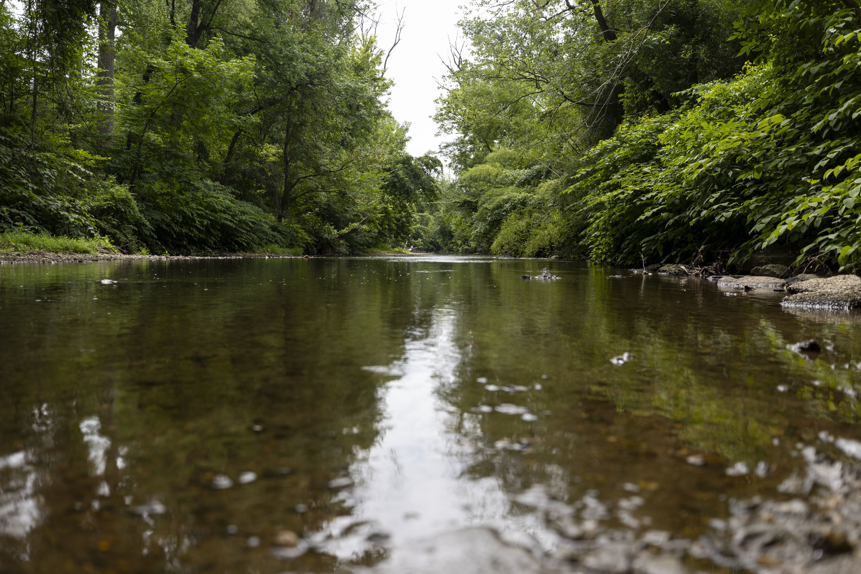
    The creek at Rolling Green Park in Springfield. Delaware County is planning to install 70 flood gauges to measure levels in and around waterways. Tyger Williams / Staff Photographer

    Where will the gauges be installed?

    In drafting its Act 167 plan, a state-mandated stormwater management blueprint, the county and consultant Jacobs Engineering have identified 87 potential flood gauge locations.

    The first batch of flood gauges will be installed on county-owned sites like bridges and parks. Once the initial round of gauges are placed, Burritt said her department hopes to work with other landowners, like the state, PennDot, and local municipalities, to place gauges in other key sites.

    Potential locations outlined in the draft plan include Smedley Park, Catania County Park along Little Crum Creek, Sun Village Park, Clayton County Park, and numerous county-owned bridges, according to the county’s draft Act 167 plan.

    Officials have identified 230 “flood problem areas” across the county, 130 of which fall under the “high priority” category. Some of the highest priority flood risk areas in Delaware County include the intersection of 69th Street and Marshall Road in Upper Darby, Brookhaven Memorial Park, and the section of Baltimore Pike that crosses Brandywine Creek at the border of Chester County. The highest priority areas were identified by the frequency and severity of flooding that occurs there, as well as impacts to emergency services, roads, and structures.

    Delco’s Act 167 plan is in preliminary drafting stages, according to the county, and will be further refined, including with feedback from municipalities and the Commonwealth’s Department of Environmental Protection.

    How much did this cost?

    The 70 flood gauges were acquired with a $107,845 Community Development Block Grant from the U.S. Department of Housing and Urban Development and another $224,274 in Pennsylvania Local Share Account grants.

    Installation of the first batch of gauges will cost $95,000, an expenditure coming out of the county’s capital budget. Burritt said the county is in the request for proposal process and does not yet know exactly how many gauges will be installed in the first round.

    This suburban content is produced with support from the Leslie Miller and Richard Worley Foundation and The Lenfest Institute for Journalism. Editorial content is created independently of the project donors. Gifts to support The Inquirer’s high-impact journalism can be made at inquirer.com/donate. A list of Lenfest Institute donors can be found at lenfestinstitute.org/supporters.

  • Strong storms are moving through the Philly region, bringing yet another round of flood warnings

    Strong storms are moving through the Philly region, bringing yet another round of flood warnings

    It’s been a while — about a week, actually — but fresh rounds of strong thunderstorms and flooding bedeviled the Philadelphia region yet again Thursday.

    South Jersey evidently was bearing the brunt of the ferocity during the afternoon, with 5-plus inches of rain reported in Gloucester County, where flooding closed portions of Route 130.

    A tornado warning had been posted in Salem County, but it was not yet known if one was sighted.

    During the late-day commute, a second round of heavy rain moved into northern Chester County and central Montgomery County, prompting flood warnings.

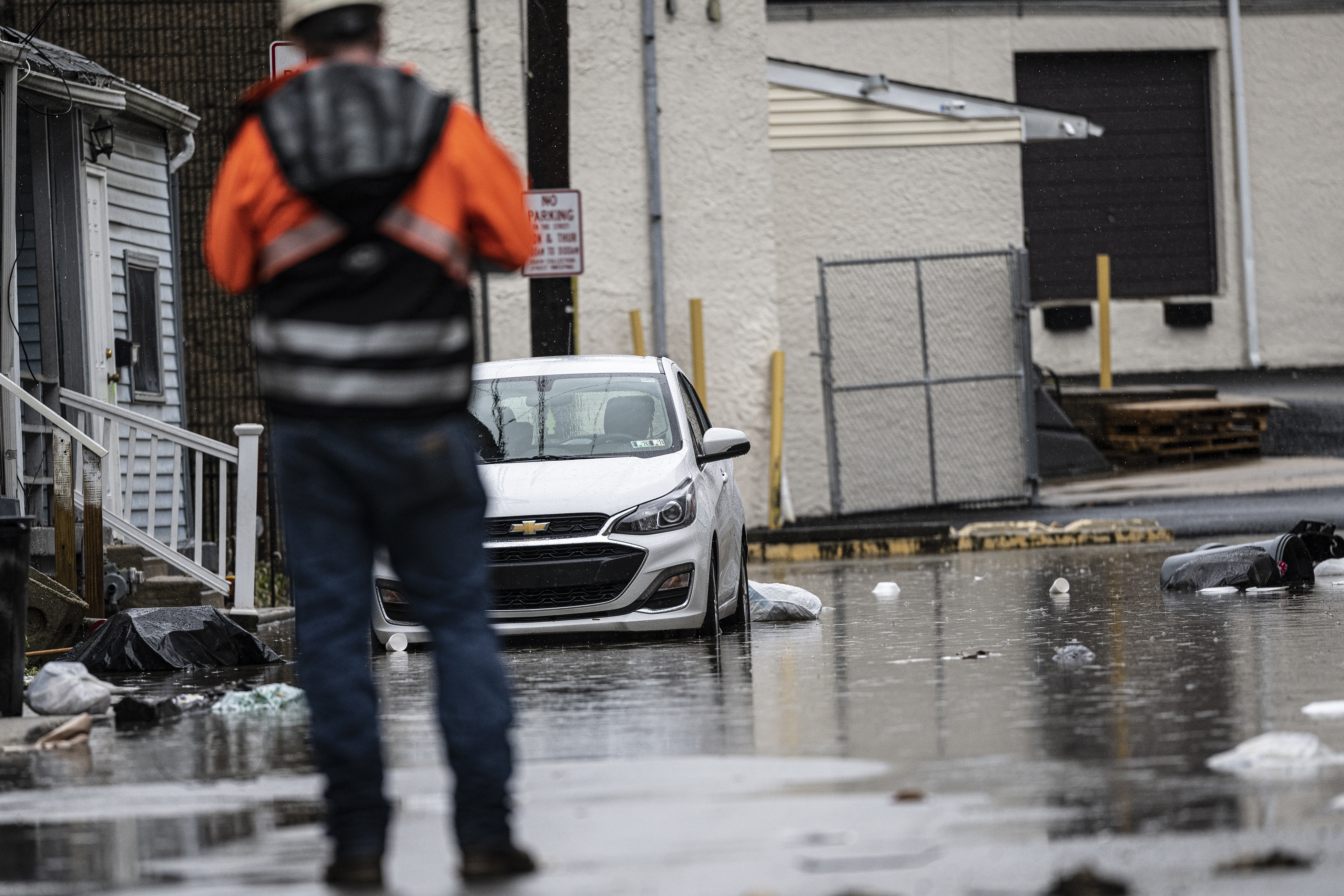
    “Multiple water rescues” were reported in Parkesburg, Chester County, the National Weather Service said, with water up to car windows. Flooding on Route 422 in East Conventry Township resulted in at least one vehicle accident.

    After a couple of uncharacteristically pleasant days, pulses of moisture have returned, and the National Weather Service was warning that as much as three to five inches of rain could fall in “isolated” areas into Thursday night.

    Drivers on the New Jersey Turnpike exit for the Molly Pitcher Service Area during a rain storm Thursday.Tom Gralish / Staff Photographer

    Strong storms rumbled through the area late in the morning and pounded South Jersey in the afternoon.

    Officially, 1.48 inches of rain was measured at Philadelphia International Airport, bringing the 2026 total to 28.84 inches, for 0.03 inches over the year-to-date normal.

    (function(){function e(){window.addEventListener(`message`,function(e){if(e.data[`datawrapper-height`]!==void 0){var t=document.querySelectorAll(`iframe`);for(var n in e.data[`datawrapper-height`])for(var r=0,i;i=t[r];r++)if(i.contentWindow===e.source){var a=e.data[`datawrapper-height`][n]+`px`;i.style.height=a}}})}e()})();

    Heavy rains also set off flash flooding warnings in Delaware County and in portions of Bucks County.

    In addition, a severe thunderstorm watch was in effect for the entire region.

    The flood watch is in effect for the city and the seven neighboring counties from noon Thursday to 4 a.m. Friday, with rain-repelling high pressure moving offshore and a warm front migrating northward.

    Said Cody Snell, meteorologist with the national Weather Prediction Center in College Park, Md., “It’s a pretty typical pattern that we’ve seen before this summer.”

    Indeed.

    Computer model runs were suggesting that the atmosphere would not only be moist, but charged with energy, the weather service in Mount Holly said Wednesday afternoon.

    The federal Storm Prediction Center in Norman, Okla., listed a 15% chance of severe storms, those with wind gusts approaching 60 mph, along the I-95 corridor. At least it made no mention of possible tornadoes — yet.

    When might the storms hit the Philly region?

    The likeliest window for the main events would be between 2 and 8 p.m., said Bill Deger, senior meteorologist with AccuWeather Inc. said

    The sun is likely to appear after the morning rain shuts off, he said, and that would “help destabilize the atmosphere,” adding a kick to potential thunderstorms.

    He expected a midafternoon round, followed by an encore in the evening.

    What areas are likeliest to see flooding or severe storms?

    For severe weather, all of Southeastern Pennsylvania and New Jersey areas along the Delaware River are in the storm center’s highest risk zone, which extends from the Maryland-Virginia border to upstate New York.

    Along the Delaware River, Snell said, “there’s a little bit of signal for training thunderstorms.” Those are the kind to develop and not move, the kind that can wring out three to five inches.

    “The biggest threat is flash flooding,” said AccuWeather’s Deger, with the higher potential in Philly and areas west of the Delaware.

    He said the west-to-east moving storms may run out of steam by the time they get to Jersey.

    However, any rains are likely to cause trouble, he said.

    “Our ground can’t handle much more at this point,” said Deger, who lives in the Quakertown area and has seen the harvests of the downpours in his backyard.

    “I’m mowing every four days,” he said.

    Staff writer John Duchneskie contributed to this article.

  • Ragweed season is approaching its peak in Philly, and the rains likely gave it a boost

    Ragweed season is approaching its peak in Philly, and the rains likely gave it a boost

    The recent rain rally has been a boon to the Philadelphia region’s plant life, and, unfortunately for the legions of the allergic, the beneficiaries include the homely and ubiquitous tormentor commonly known as ragweed.

    It belongs to the plant family Ambrosia, from the Latin for “food of the gods.” One can only assume the gods did not have allergies.

    Estimates vary, and it’s not as though it is a census category, but in all likelihood several hundred thousand people in the region annually endure the slings and arrows of ragweed pollen, notorious for setting off episodes of sneezing and attendant dopiness.

    It also can induce coughing, wheezing, and chest discomforts, particularly among asthmatics, allergy experts warn.

    The season — the third in the equinox-to-equinox pollen trilogy, successor to the trees and grasses — typically begins modestly in early August, then intensifies late in the month and continues well into September. And this year sufferers may pay a price for the episodic drought-easing rains that have been watering the plants in the Mid-Atlantic region since mid-June.

    “Ragweed thrives on the nitrates in rainwater,” said Payel Gupta, an allergy, asthma, and immunology specialist based in New York City. The rains’ timing has coincided with “ragweed’s late-summer growth window,” she added, and the result likely will be “denser plants and higher pollen output.”

    As for precisely when the pollen will peak: “Every year is different,” said Donald Dvorin, who for more than 30 years was the Philly region’s official National Allergy Bureau pollen counter, “but the first week of September is most common.”

    In addition, with the planet’s temperatures increasing and first frosts taking their good old time, the seasons appear to be lasting a bit longer.

    The prime pollen flight hours are from 5 to 10 a.m.; effects can linger, however, as pollen can stick to clothing and find its way indoors via unwitting humans and pets.

    What is ragweed?

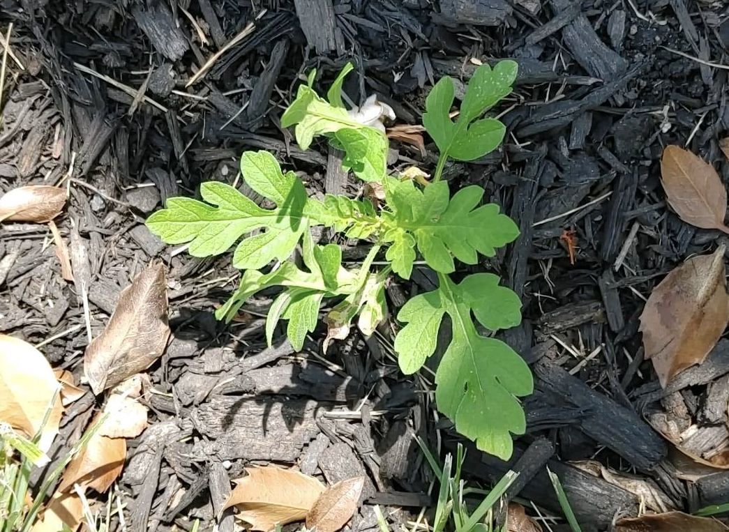
    Ragweed is a tooth-leaved plant that can grow in almost any environment, native to North America but spreading worldwide.

    For the allergenic, Dvorin said, the heavy hitters are the “short” ragweed (Ambrosia artemisiifolia), and the “giant” (Ambrosia trifida).

    A typical pollen grain is a mere 1/25,000th of an inch in diameter, but a single plant can generate a billion of them.

    While the plants live for only about a year, do they ever reproduce! Pollen has been found as far as 400 miles from the source, according to the Allergy and Asthma Network.

    New York City spent millions after World War II to eradicate ragweed in the city, a war it lost resoundingly. For one thing, the warriors discovered that about half the ragweed pollen in the five boroughs was commuting from elsewhere.

    The torments of ragweed

    Most people inhale ragweed pollen without incident, but for the allergic, the body interprets the pollen as an invader, and sneezes and other reactions are part of the immune response.

    For the sufferers, each season can be a little bit different, said Gupta, assistant clinical professor at the State University of New York and Mount Sinai Medical Center in Brooklyn.

    Severity would depend on “how many consecutive high-count days there are,” Gupta said. Exacerbating factors could be “viral infections or air pollution compounding irritation,” she said.

    In addition, some patients may be subject to “priming,” a particularly nasty season that might make some more susceptible to pollen discomforts the following year.

    And ragweed is nothing to just sneeze at, according to the International Ragweed Society, which is based in Switzerland and aims to promote ragweed research.

    In addition to a “socioeconomic burden due to rising healthcare costs” and “productivity losses,” the society states, the weed’s pervasiveness can endanger certain crops and natural habitats.

    How much ragweed is in the air?

    Unfortunately, that has become harder to know. Dvorin, an allergist who had practiced in Center City and Mount Laurel, stopped counting pollen last year, and that was symptomatic of a trend. The network has been shrinking.

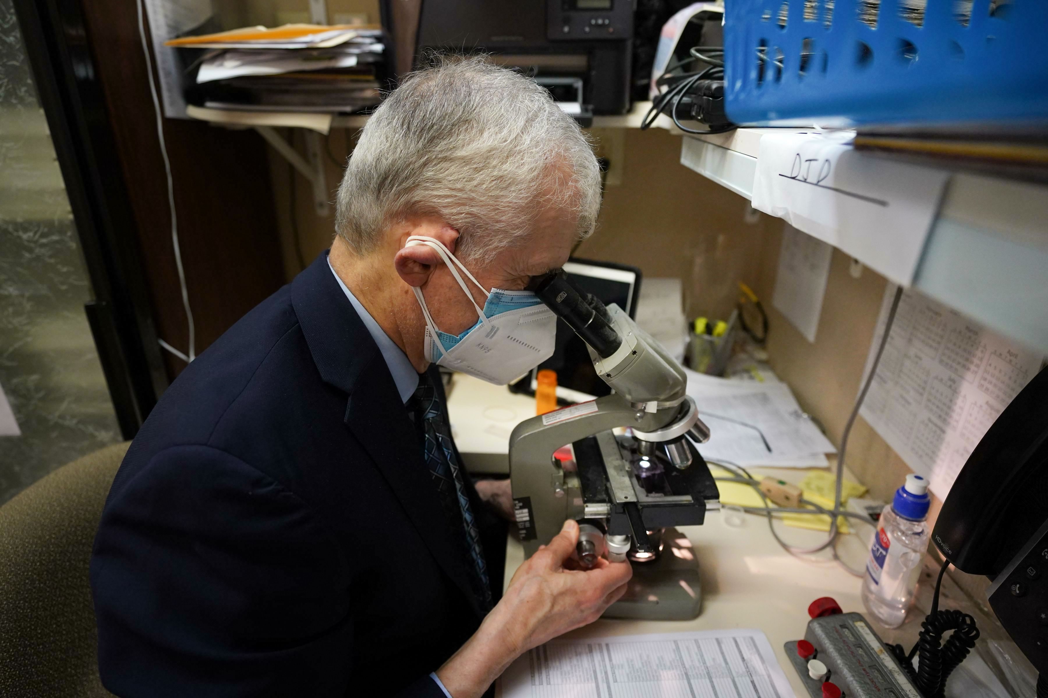
    Gotcha! Donald Dvorin analyzing a pollen specimen. He stopped counting pollen last year, and the network has been shrinking.Jessica Griffin / Staff Photographer

    Traditionally, allergists such as Dvorin supplied daily counts on a voluntary basis as part of the National Allergy Bureau network. However, the analyses require expertise and time that allergists could devote to revenue-paying patients.

    Fewer doctors evidently have been willing to participate.

    The nearest allergy bureau counter who posts frequent counts is in the Washington area.

    The Asthma Center in Center City posts daily counts that are AI-generated, and while that technology shows tremendous potential, the allergy bureau has not yet approved any of the machines for official use, said Pamela E. Gabrish, the bureau’s program director.

    “There has actually been more backlash against using automated devices than ever,” she said.

    Advice for ragweed sufferers

    Day-to-day pollen volumes are difficult to predict, but expect the peak to arrive next week.

    It is a good bet that counts will be high on a warm, dry, and breezy day.

    This will be evident in the online pollen forecasts, but be aware that pollen is commuting on the chaotic whims of the atmosphere.

    In a study of five major cities, published in 2024, allergy experts concluded the accuracy of online pollen forecasts was “low.”

    Along with medications, here are a few suggestions from allergy professionals:

    • Limit time outdoors on dry, windy days.
    • When outside, wear a dust mask.
    • Inside, keep the windows closed.
    • Shower before going to bed.

    And hope for rain, within limits.

  • Weakfish once crowded New Jersey waters. No one can agree on why that stopped.

    Weakfish once crowded New Jersey waters. No one can agree on why that stopped.

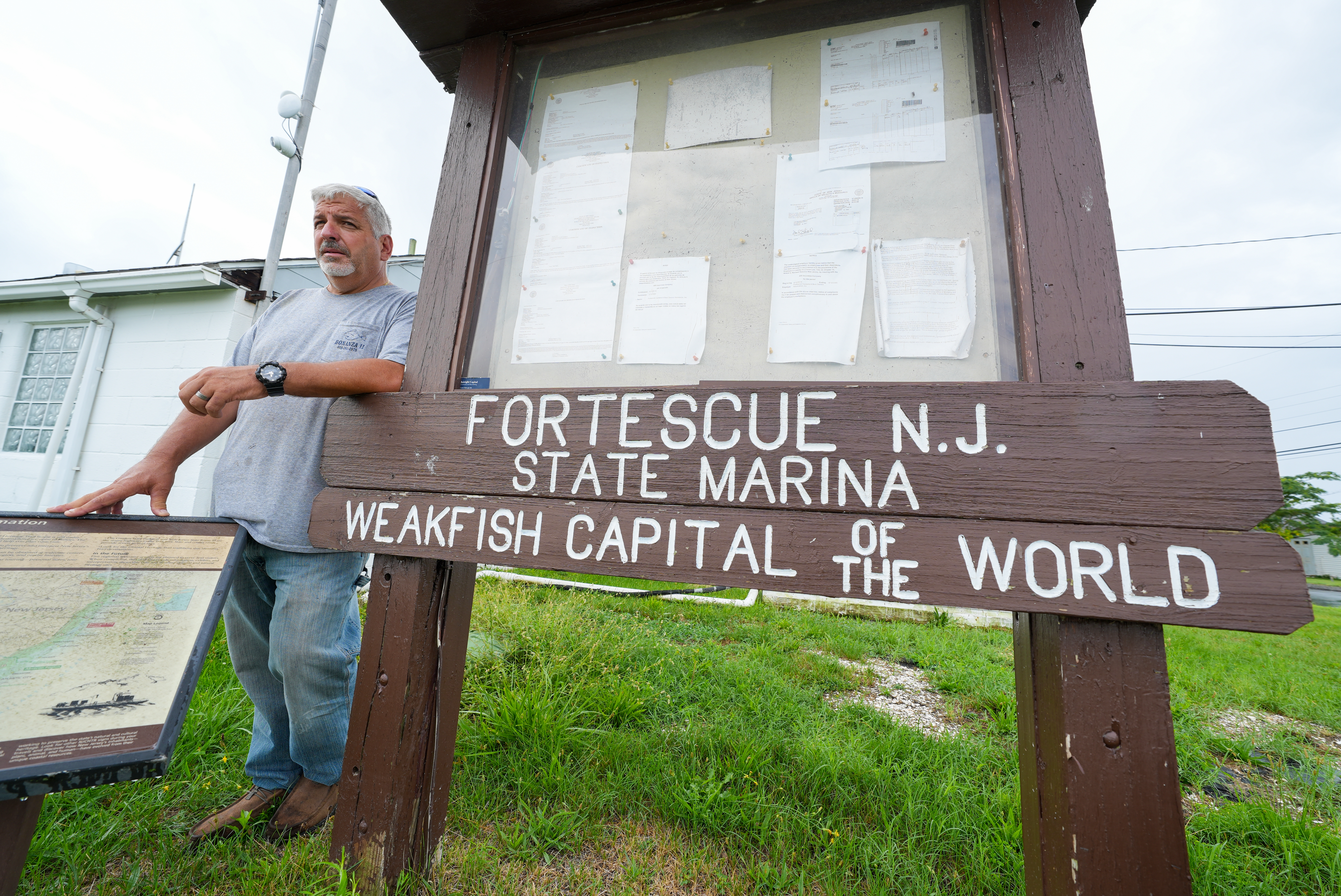
    CUMBERLAND COUNTY, N.J. — Taxidermy and weathered photos line the walls at Higbee’s Bait and Tackle in Fortescue, artifacts from bygone days when the sleepy Delaware Bay town was truly the “weakfish capital of the world.”

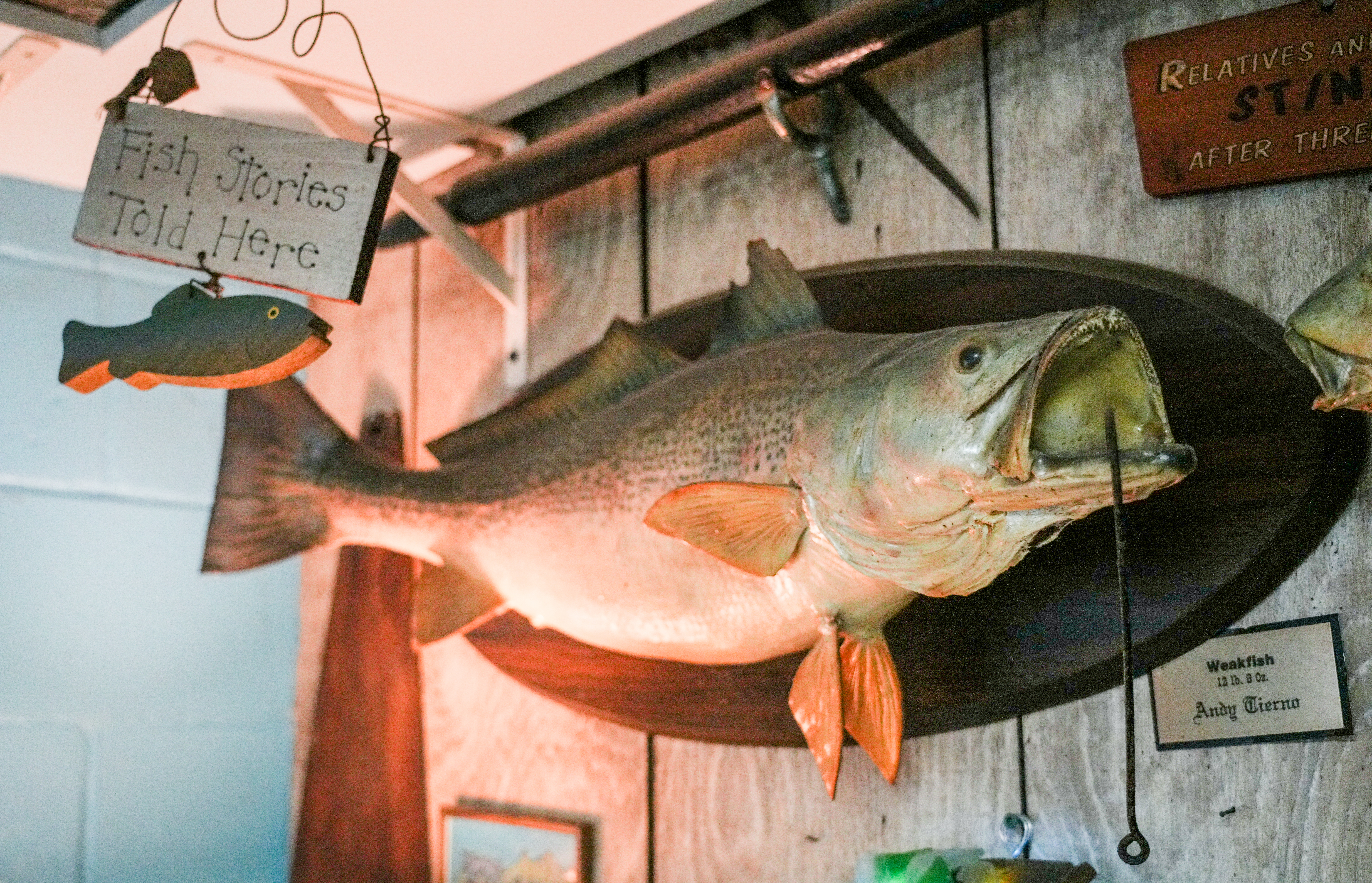
    The taxidermy is a dusty, 12-pound “tide runner,” the nickname fishermen bestow on the biggest, trophy weakfish, a member of the drum family with a tan, often iridescent body and a reputation for fighting hard on a fishing line. The black-and-white photo shows a single fisherman standing beside his catch, about 30 weakfish of various sizes.

    Tide runners are unicorns today, a rarity on New Jersey coasts and across the bay, in Delaware. Catch limits enacted by state fisheries would prevent a single fisherman from catching dozens of fish today, though most would be happy with one legal keeper they could fry up in lemon and butter.

    Fishermen have plenty of theories about where all the weakfish have gone. They blame dolphins and dogfish for gobbling up the young; nuclear power plants; the rise of other popular game fish, like striped bass; and offshore seafood trawlers.

    Some are introspective.

    “I’ll be real honest. It’s us. Back in the day, in the ’80s, we fished these things so hard,” said Mike Rothman, captain of the Bonanza II, a 65-foot charter boat out of Fortescue. “We did it to ourselves, and I’m the first one that — 100% — we did this to ourselves.”

    A weakfish hangs on the wall of Higbee’s Bait and Tackle located at the Higbee Marina on Monday, Aug., 3, 2026. Once known as the “Weakfish capital of the world,” locals are curious where the fish has gone.Tim Hawk / For The Inquirer

    Jessica Gorzo, a scientist with the New Jersey Department of Environmental Protection, who’s studied weakfish, said the population has been on the decline since the mid-2000s. She said the decline over those two decades is the result of natural mortality from predators, not fishing.

    “The prevailing thought is the majority of predation is likely dolphins, offshore, in the winter. It’s estimated that 55% of the mortality can be attributed to dolphins,” Gorzo said. “Coming in second, a far second at 21%, is attributed to striped bass, but the dolphins are taking the lion’s share.”

    Like all things under the sea, however, there’s a degree of mystery involved in spawning stock estimates. Gorzo said weakfish spawning stock estimates, in 2017, were 1,922 metric tons, which was a low number.

    “To have a healthy weakfish population, the spawning stock threshold would be 6,170 metric tons,” she said.

    The Marine Mammal Protection Act protects dolphins, and most fishermen and beachgoers agree their populations have grown along the Jersey coast in the summer for decades.

    “More than ever,” said Joseph LoBianco, owner of Cape May Bait & Tackle. “When I go out on the Delaware Bay, I see them year-round. They are here all the time, and they’re eating a lot of the smaller fish.”

    ‘I would’ve released all those tide runners’

    In 2010, New Jersey tightened weakfish regulations, allowing fishermen to keep just one fish, 13 inches or longer, per day, but many said it was too late to stop the population free fall.

    “Back in the day, you were allowed to keep 15 fish per fisherman,” Rothman said.

    Mike Rothman looks at a picture of weakfish, from 1920, that hangs on the wall of Higbee’s Bait and Tackle located at the Higbee Marina, Monday, Aug., 3, 2026. Once known as the “weakfish capital of the world,” locals are curious where the fish has gone.Tim Hawk / For The Inquirer

    Gorzo said tight regulations on weakfish should result in a comeback. That’s what happened with striped bass, arguably the most popular sport fish along the Jersey Shore, a species that seems more abundant today than it was decades ago.

    “Striped bass do seem to be doing really well,” she said.

    Striped bass are also voracious and grow large enough to swallow bigger weakfish.

    “They are the vacuum cleaners of the ocean,” Rothman said of striped bass.

    In May, Gorzo appeared on the Finnsylvania podcast to discuss the decline of weakfish. The episode was titled “The Ghosts of Cape May,” another longtime weakfish destination for anglers. Host James Suleski reminisced about catching them during childhood summers there.

    “They were just so abundant,” Suleski said.

    Suleski, in his podcast, described the population collapse as one of the biggest mysteries in marine biology.

    Around the same time the episode was released, avid fisherman Frank Ruczynski posted on Facebook, reminiscing about Fortescue’s claim to be the “weakfish capital of the world.” It received close to 700 likes and 200 comments, many of which discussed theories or dismissed the issue.

    “They are probably cyclical like many species,” one man wrote.

    Another said you could almost walk across the backs of weakfish in the bay at one time.

    “If I would’ve known, I would’ve released all those tide runners,” another wrote.

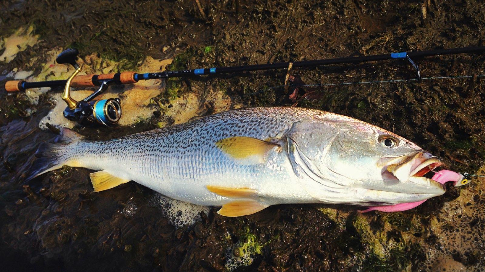
    Weakfish caught by New Jersey angler Frank Ruczynski.Frank Ruczynski

    Ruczynski, who also works for NJDEP, said 2026 was especially bad for him.

    “Overall, I think it’s a mix of 100 different things going on,” he said in May, in Fortescue. “They just disappeared. It’s a shell of what we had here, back in the day.”

    Ruczynski said he’s followed weakfish north, up into Cape May County and even into New York, and he wondered whether water temperatures were prompting the species to move. He said he received a message from a man in Portugal — straight east from New Jersey — who claimed that he caught a weakfish there.

    Weakfish caught by New Jersey angler Frank Ruczynski.Frank Ruczynski

    Rothman, the mayor of Downe Township, which includes Fortescue, said he can take customers out and still catch weakfish, but he relies on other species, or whale and dolphin sightseeing, and even dinner cruises, for the bulk of his business.

    “I’m in the entertainment business these days,” he said.

    Fortescue has never been bustling as far as Shore towns go. There are no traffic lights, few businesses, and plenty of biting greenhead flies. Fishermen will always go there, but the loss of the weakfish gives it a bit of a ghost-town feel at times.

    “We had a world-class fishery here, right in our backyard,” Ruczynski said.

    Across the road from Rothman’s boat, at the tackle shop, owner Cliff Higbee Sr. said there were far larger weakfish in the Delaware Bay than the taxidermy on his wall.

    “We had 16-, 17-pounders in here,” he said. “Used to at least.”

    Higbee isn’t waiting for the tide runners to return, though. The family tackle shop is for sale for just under $400,000.

    Cliff Higbee Sr. owner of Higbee’s Bait and Tackle located at the Higbee Marina, talks about the lack of weakfish, Monday, Aug., 3, 2026. Once known as the “Weakfish capital of the world,” locals are curious where the fish has gone.Tim Hawk / For The Inquirer
  • Storms set off tornado and flood watches and warnings in the Philly region. Expect more rain this weekend

    Storms set off tornado and flood watches and warnings in the Philly region. Expect more rain this weekend

    Severe storms set off tornado and flood warnings on Thursday in the Philly region, and in some places turned the phrase “rush hour” into an oxymoron.

    Intense thunderstorms took down trees and wires in parts of Chester County, and fallen trees blocked portions of heavily traveled Route 322 in Honey Brook, the weather service reported.

    Streams came out of their banks, and flash flooded occurred in West Norriton and Lower Providence Townships, in Montgomery County, making “many streets” impassable.

    A tornado warning had been issued for portions of Chester and Delaware Counties, but it was not known if a twister was sighted.

    About 21,000 Peco customers were without power as of 8 p.m.

    All of Philadelphia; areas to the west of the city, including the Main Line; northern Delaware; and in New Jersey along the Delaware River were under a flash-flood warning until 8:45 p.m.

    Lines of storms gathered to the west and south of the region during the day with the approach of an eastward-moving front interacting with a volatile, energized atmosphere.

    “It’s a pretty juicy air mass,” said Matt Benz, senior meteorologist for AccuWeather Inc. And more juice might be squeezed out of it over the next few days, especially Saturday.

    It turns out that the front that set off the storms may return in a repurposed form during the weekend.

    Disruptive storms came at a bad time

    The storms arrived between 5 and 5:30 p.m. in the immediate Philly area, right when a lot of people likely would have been heading home.

    The storms moved quickly, but the downpours were strong enough to set off flash-flood warnings.

    The fact that the sun interrupted the afternoon gloom on Thursday didn’t help matters, meteorologists said. On a day when the air was so full of moisture and energy, that was about the last thing they wanted to see.

    “It’s ironic, isn’t it,” said Joe Wegman meteorologist with the government’s Weather Prediction Center, in College Park, Md.

    The solar heating likely provided a power jolt to an already charged atmosphere.

    The outlook for the weekend

    If you have outdoor plans Saturday, this is probably something you don’t want to read.

    After the front clears the region, Friday should be a decent day, Wegman said.

    But it’s likely to migrate back, this time as a warm front, said Wegman. Showers are possible Friday night, and might be tapping into a generous moisture supply on Saturday.

    Said Benz, “I wouldn’t throw out the word washout, but it could be pretty wet on Saturday.” Steady rain is possible, as are more downpours Saturday afternoon into the night.

    As for Sunday, you guessed it — another chance of showers.

  • Philly is under flood, storm, and tornado watches Thursday, and more rain is likely this weekend

    Philly is under flood, storm, and tornado watches Thursday, and more rain is likely this weekend

    Both astronomy and meteorology suggest that it won’t be long before these things decline in frequency, but in the meantime another flash-flood watch is in effect for the Philly region.

    A tornado watch also was posted for Philadelphia and the neighboring Pennsylvania counties.

    The National Weather Service watch spans from noon Thursday until 2 a.m. Friday, for the potential for rain rates of 2-to-4 inches an hour in areas along I-95 and South Jersey.

    And the federal Storm Prediction Center has posted a severe-thunderstorm watch, in effect until 10 p.m., for storms that could kick up gusts approaching 60 mph.

    “There could be multiple rounds of heavy rain over urbanized areas,” said Joe Wegman, a meteorologist with the government’s Weather Prediction Center. In advance of the anticipated main events, a blob of light rain moved through the region late Thursday morning.

    Also, the federal Storm Prediction Center sees an outside chance of severe-level storms, those with gusts near 60 mph, and a 5% chance of tornadoes in and around Philly.

    And those who have not had the good fortune of spending the last two months in heat-free and smokeless environments probably can skip the next paragraph.

    The timing, ferocity, rain totals, and targets all remain uncertain.

    What is the best estimate on the storm timing in Philly?

    The higher-resolution models were suggesting that the likeliest time for storms to arrive in the Philly region would be between 2 and 3 p.m. Thursday, Wegman said.

    The worst of it may hold off until 4 or 5 p.m., said Matt Benz, senior meteorologist with AccuWeather Inc.

    The storms likely would back off between 6 and 7 p.m., but that timing could disrupt a peak commuting period.

    “Why would we conveniently time these things?” Wegman quipped.

    “There’s plenty of moisture coming up, and a front approaching from the west,” he said. “If the front stalls, the storms might linger longer than people want them to.”

    Plus, renegade storms could race out ahead of the front, setting off precipitation earlier, he added, and that appeared to be case Thursday.

    The weather service in Mount Holly said the “greatest risk” for severe storms would be between noon and 10 p.m.

    But timing remains one of the most vexing challenges for severe-weather forecasting, says Bill Bunting, deputy director of the storm center, in Norman, Okla.

    “I have seen remarkable progress,” said Bunting, who has been at it for 40 years, “but we’re nowhere near perfection. In the end, the science has its limitations.”

    The forecast for the weekend and the rest of August

    The storm experts have had plenty of practice around here this summer. So far, Philadelphia officially has recorded 21 thunderstorms since June 1, several more than normal.

    It has also been a banner summer for smartphone alerts and assorted scare grams.

    About 11 inches of rain has been measured at Philadelphia International Airport, roughly four inches above normal, since July 1.

    That said, yes, both Chester County and the entire state of New Jersey remain under state-declared drought warnings, with residents asked to conserve water.

    And drier times may be coming, or at least a reduced incidence of those late-day thunderstorms, said Brian Hurley, senior branch forecaster with the Weather Prediction Center.

    The days are getting shorter, and the sun is losing some of the gas it uses to fuel convective storms, he said.

    But all pumpkin spice aside, summer is not quite over, and shower chances are in the forecast into Sunday night.

  • Rains have returned to the Philly region, and they may come in handy later

    Rains have returned to the Philly region, and they may come in handy later

    Just as the soils were beginning to take on that cracked and dried look and the vegetation was working up a thirst, the rains have returned to the Philly region, and showers and possible thunderstorms may bookend the week.

    Rains Sunday ended the first seven-day period without measurable rain in Philly in two months. More showers were possible Monday and later in the week, forecasters said.

    In all likelihood they won’t remotely approach the destructive deluges in the Midwest, said Brian Hurley, senior branch forecaster with the federal Weather Prediction Center, in College Park, Md.

    And around here, despite the generous rains that have fallen upon the region since mid-June, additional rain wouldn’t be altogether unwelcome, said Hurley.

    Precipitation in the last 60 days has been well above normal everywhere in the region save for Montgomery County, where they were just about normal, according to the weather service’s Middle Atlantic River Forecast Center, which uses a network of stations in the counties.

    However, not so long ago, as we headed into June, Philadelphia had experienced 16 consecutive months of below-average precipitation totals.

    And drier times may be coming, Hurley warned.

    Drought conditions have eased, but not disappeared

    New Jersey and Chester County remain under state-imposed drought warnings, with residents asked to go lighter on the water usage.

    “We’ve been putting a dent in that drought,” said Hurley, but in the latest interagency U.S. Drought Monitor update, most of the region remains “abnormally dry,” with parts of Burlington, Bucks, and Montgomery Counties in “moderate drought.”

    Thunderstorm activity has been well above normal this summer, with the weather service reporting 19 days officially with thunder detected at Philadelphia International Airport. The average for the entire June 1 to Aug. 31 period is about 15 days.

    It’s also been quite warm. In 12 of the first 15 days of August, the temperature reached at least 90 at the airport, and this almost certainly is going to end up being one of the warmer summers on record.

    The warmth and the rains are related.

    Philadelphia has spent a whole lot of time on the western edge of the so-called Bermuda high, centered over the North Atlantic. Winds circulate clockwise around the center of high pressure, and areas to the west of the center (where we are) experience winds from the south and southwest.

    Being on the edge also places the region in spraying distance of shower activity as fronts and minor disturbances approach along the western flank of the ridge, with daytime heating adding a kick to the storms.

    Thunderstorms may become scarcer come September

    Those convective thunderstorms, which can wring out rain in waterfall-like downpours, in all likelihood will become less numerous as September approaches and the days shorten, Hurley said.

    “It does get a little harder to pop convection when the sun doesn’t do its thing as much,” said Hurley.

    “In September we tend to dry out until we get tropical connections,” he said.

    This year, however, those tropical connections may be scarce, according to the National Oceanic and Atmospheric Administration and other forecast services.

    What could become the most intense El Niño — the anomalous warming of vast expanses of the tropical Pacific Ocean — in records dating to 1950 is rapidly gaining steam.

    During El Niño, the interaction of the ocean and the overlying air generates powerful upper-level winds from the west that can shear apart tropical storms in the Atlantic Basin before they mature.

    No Atlantic hurricanes have developed yet this season. Meanwhile, Hurricane Lala in the Pacific has caused extensive damage in Hawaii. Typically, when the Pacific is quiet, the Atlantic is active, and vice versa.

    Lala is the 12th named tropical storm — those with winds of at least 39 mph — of the season to form in the Pacific. The average for the date is seven.

    In the Philly region, historically tropical-storm remnants have been generous sources of rainfall.

    Sometimes, however, they have been overly generous. (See Ida, 2021.)

  • A potentially ‘historic’ El Niño may become the biggest on record, NOAA says

    A potentially ‘historic’ El Niño may become the biggest on record, NOAA says

    The rapidly developing El Niño is likely to become a “historic event” that could become the most-intense in the period of record, the government’s Climate Prediction Center said Thursday.

    The El Niño warming in the tropical Pacific, coupled with how it is affecting the atmosphere, is all but certain to have dampening effects on the Atlantic hurricane season, researchers said.

    While it is likely to be disruptive and destructive during the next several months, during the tropical storm season it may mean fewer scares for East and Gulf Coast and Caribbean residents, and perhaps fewer flooding threats in the Philly region.

    El Niño already is making its presence evident thousands of miles away in the Atlantic Basin, said Philip Klotzbach, tropical storm specialist at Colorado State University. Colorado State’s forecast methodology has been the prototype for the outlooks issued by the National Oceanic and Atmospheric Administration and commercial companies.

    In his update last week, Klotzbach predicted the season would produce nine named storms, those with winds of at least 39 mph — down from 13 in the April outlook. NOAA also subtly trimmed its numbers. The long-term average is 14.

    Even with above-normal temperatures that usually would be favorable for storms in the hurricane-development regions of the Atlantic, what’s going on in the Pacific is going to dominate, he said.

    “El Niño is definitely the story of this season,” he said, and NOAA says the Pacific warming is likely to persist through April.

    (Even The Farmers’ Almanac has noticed. The winter outlook it has cooked up appears to be right out of the El Niño recipe book, calling for wetness and storminess in the South, typical of El Nino. Helpfully, it said the forecast up our way is “tricky.”)

    How does warmth in the Pacific affect Atlantic hurricanes?

    El Niños, which occur every two to seven years as part of a natural process, agitate the overlying air and disrupt atmospheric circulation worldwide. It is part of the so-called El Niño Southern Oscillation, or ENSO, and since oscillations do oscillate, El Niño periodically shares the stage with La Niña, during which the waters are cooler than normal.

    The climate center reported Monday that in the key El Niño region of the east-central Pacific, sea-surface temperatures over a 2.4 million-square-mile area were more than 3 degrees Fahrenheit above normal.

    That air-ocean interaction generates strong west-to-east upper-level “shearing” winds that can keep tropical storms from maturing into hurricanes.

    Klotzbach said that last week, the 30-day average of wind shear in the western Atlantic was higher than in any other 30-day period dating to 1979.

    Other players in the atmosphere affect tropical storm activity, but El Niño “usually becomes the dominant factor,” said Matt Rosencrans, the weather service’s lead hurricane forecaster.

    During the top six most-intense El Niños in records dating to 1950, tropical-storm numbers were significantly below normal.

    Is this El Niño yet another symptom of a warming planet?

    “There is still considerable debate in the scientific community on how warming may affect ENSO behavior,” said Michelle L’Heureux, physical scientist with NOAA’s Climate Prediction Center and the head of the ENSO team.

    El Niños likely have been occurring for eons, but the period of record dates only to 1950 because “much fewer observations” are available before then, she said.

    “It would take much more research to compare El Niño events in the older records,” she added.

    El Niños in which the temperatures reached 3.6 degree Fahrenheit — averaged over three-month periods — occurred in 1965-66; 1972-73; 1982-83; 1991-92; 1997-98, and in 2015-16.

    The warmest three-month average, 4.3 degrees Fahrenheit, was recorded in the 1982-83 event, and the climate center sees a 69% likelihood that this will exceed that level.

    But L’Heureux cautioned that “intense El Niño events are not totally unexpected.” The top six list shows that they have reappeared every 10 to 15 years.

    Thus, she said, “There’s a reasonable argument we were due.”

    What might all this mean for the Philly region’s weather?

    Tropical storms or their remnants “are especially notorious for flash-flooding impacts” in the region, said Sarah Johnson, warning coordination meteorologist in the weather service’s Mount Holly office.

    In 2020 and 2021, the region was affected by six such storms or remnants, including the devastating Ida, in September 2021.

    The 2020 season was quite active, and 2021’s hyperactive. Logically, fewer Atlantic storms would reduce the odds of remnants heading this way.

    With the exception of 2012, the year of Sandy, Johnson said that all the years with below-average flash-flood warnings issued by the Mount Holly office coincided with seasons in which no tropical storms or remnants have affected the region.

    We wouldn’t mind an encore.