Category: Climate

  • The hot nights are getting more dangerous as Philly’s rowhouses become ‘brick ovens’

    The hot nights are getting more dangerous as Philly’s rowhouses become ‘brick ovens’

    Philadelphia almost certainly will have set more temperature records over the next two days — but maybe not during the steam-bath afternoons.

    Nature’s natural cooling system, nightfall, is having a hard time getting it done with the atmosphere so swollen with water vapor. It didn’t get lower than 82 Friday morning and an encore is expected the morning of the Fourth.

    Both would be record-high minimum temperatures for the dates in Philadelphia. That record bar is considerably lower than for the high-temperature records — 104 degrees for Friday, and 103 for Saturday — set during the sizzling 1966 Independence week. A late-day thunderstorm could knock back Saturday’s temperatures, and storms Saturday night are “likely.”

    Thursday’s high, 103, tied the record set in 1901, when the nation was a mere 125 years old.

    Those potential century-plus readings are attention-getting, but health officials have long held that for heat-related mortality, consistently warm nights are more dangerous than the days, particularly for older people who live alone in brick rowhouses in the city. As a former Philadelphia health official has observed, without nighttime cooling, they can become “brick ovens.”

    “The intensity and length of the extreme heat will exacerbate impacts to both people and infrastructure,” the weather service warned.

    The sequence of hot nights “are particularly harmful because the body doesn’t have a chance to recover,” said Kraftin Schreyer, associate professor of emergency medicine at Temple University’s Lewis Katz School of Medicine. Extreme heat can exacerbate circulatory and lung conditions, and certain mental disorders, she added.

    But she and other health experts say the detrimental effects may be modified by the heat the region already has experienced this year.

    The Philly forecast for the 250 climax

    Friday’s high is expected to challenge the reigning champ, the 104 set during a blistering heat wave in 1966, when the nation was a mere 190 years old.

    On Saturday, when Philly celebrates the nation’s 250th birthday, the high may fall just short of 100, said Matt Benz, senior meteorologist with AccuWeather, as the high pressure “heat dome” covering much of the nation loses some of its protective power over Philly.

    That also could be a window for “ring of fire” thunderstorms that could be nasty. The federal Storm Prediction Center sees a 15% chance that any storms on Saturday could become “severe,” with wind gusts up to 60 mph. The National Weather sees a 60% chance of storms Saturday night.

    By Sunday, highs will be backing off to the 90s, however the sequence of warm nights probably will persist, at least in areas of Philadelphia most affected by the urban heat island effect.

    The urban heat island and heat-health dangers

    The world has been getting warmer, but cities long ago got the jump on climate change, and their impacts on temperature were observed in the 19th century and documented in a famous experiment in the 1950s by legendary climatologist Helmut Landsberg.

    Landsberg, who observed temperatures had fallen in some European cities after World War II bombings destroyed buildings, set up instrument arrays in an area of Maryland that was undergoing rapid development. As surfaces were paved and structures erected, he recorded significant localized temperature increases.

    In Philly, dense neighborhoods can be several degrees warmer than other areas even within the city. Urban areas reduce cooling at night because they are efficient at storing the sun’s energy and slower to release heat after sunset.

    The heat-death tolls in Paris in 2003, Chicago in 1995, and Philadelphia in 1993 underscored the urban heat hazards.

    It’s warmer, but heat deaths have dropped dramatically in Philly

    The city reported 113 heat-related deaths in the summer 1993, and no other summer has come close. In fact, a total of 42 were recorded in the 10-year period that ended last summer.

    “We’ve been really lucky,” said Samuel Eldrich, medical director of the Temple Health-Chestnut Hill Hospital Emergency Department

    The decline has a lot do with Philadelphia and that summer of 1993, Eldrich added.

    That year, Philadelphia was under fire because it was the only major Eastern city reporting significant numbers of heat deaths. The medical examiner’s office was using forensic evidence, such as closed windows, in determining heat deaths.

    The reasoning: With so many people dying, doctors wouldn’t be able to get to the bodies in time to verify core body temperatures of 105 degrees, the standard for hyperthermia. The Centers for Disease Control later decreed Philadelphia’s method was correct, and it was adopted elsewhere.

    The dramatically high death toll was the impetus for the city’s emergency response plan, lauded by CDC and the National Oceanic and Atmospheric Administration that lauded as a national prototype.

    It includes opening cooling centers and nudging residents to look in on older neighbors, and having the Philadelphia Corporation for the Aging operate a “heat line,” 215-765-9040. It will be operating daily from 8:30 a.m. to 8:30 p.m., and the agency “can also assist callers reporting concerns about vulnerable neighbors, family members, or community members,” said spokesperson Bill Conallen.

    Citing Census figures, the Corporation for Aging says about 95,000 people 65 and older live alone in the city.

    ‘This is temporary’

    Subject to change, the heat wave is due to end Monday, with highs in the lower 80s (remember when that seemed hot?).

    In the meantime the experts are offering coping tips, the three most-important being hydrate, hydrate, hydrate.

    How much water should you drink? More than you think, said Schreyer. Men should drink about a gallon a day, women three quarts, but four to eight cups additional wouldn’t hurt. Sip, don’t guzzle, she said.

    At a time when everyone wants to be outside, it’s critical to take breaks in air-conditioned stores, malls, or wherever, even for a few minutes, Eldrich said. “It gives your body a chance to recover,” he said.

    Sunny G. Hallowell, associate professor of nursing at Villanova University, recommends cool showers and tepid baths. Also, especially with storms threatened, be prepared for power outages. She suggested storing damp towels in the refrigerator or freezer as a quick cool-down resource should the A/C go off.

    She also recommends keeping a cool attitude. “This is temporary,” she said, and if the temperature hits a record, that’s “something to brag about.”

    And if you’ve had it with the heat, think back to your misery during the Arctic freezes, and think that with the heat, “You got your wish.”
  • Lightning injuries are rare, but an expert says the Parkway is an especially risky venue on July 4

    Lightning injuries are rare, but an expert says the Parkway is an especially risky venue on July 4

    In the grand casino of the atmosphere, scheduling outdoor events on July Fourth in the Philly region is almost always going to be a rolling of the bones.

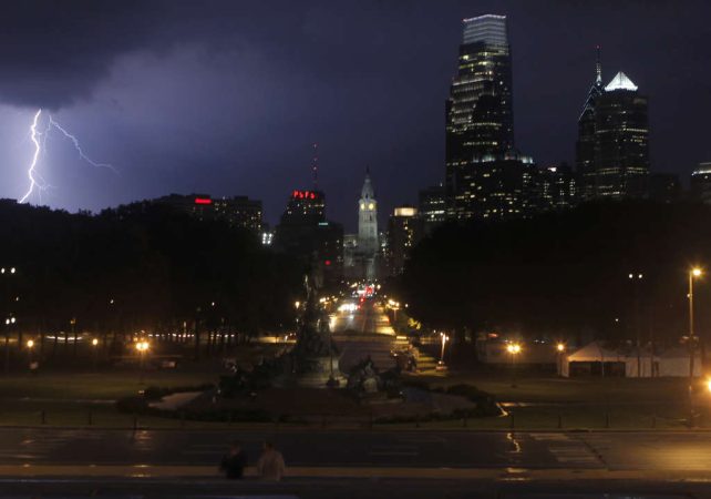
    And on the day Philadelphia and the rest of the nation are holding a mass 250th birthday party, the odds may be dicier than usual, with thunderstorms and accompanying lightning possible Saturday afternoon and night, forecasters say.

    The National Weather Service on Thursday listed a 50-50 chance of storms Saturday night, and the federal Storm Prediction Center, in Norman, Okla., bumped up the probability of severe storms — those with winds up to 60 mph — to 15%.

    July happens to be the peak month for lightning-bearing thunderstorms in Philadelphia, occurring every five days on average, and who doesn’t want to be outside on the Fourth?

    As if record-challenging heat and an atmosphere that feels like syrup weren’t enough.

    Lightning injuries and fatalities are rare — on average in the last decade, 20 people have been killed annually by lightning in the United States, according to the National Weather Service. But among outdoor events with large crowds across the country, Philly’s July Fourth concert would be among the riskiest for lightning, according to Stephen Strader, disaster specialist at Villanova University.

    “It’s way up there, a lot higher than I thought it was,” he said.

    The city is well aware of the atmosphere’s capriciousness, the potential risks in July, and the potential effects on the Parkway celebration and the World Cup match in South Philly and has developed safety protocols, said Jeffery Kolakowski, communications director for the Office of Emergency Management.

    Unfortunately, for attendees and planners, predicting the when and where for thunderstorms remains elusive.

    “There’s uncertainty of the when and where of the storms,” said Rich Thompson, branch chief and lead forecaster at the federal Storm Prediction Center, in Norman, Okla., the source of those severe storm and tornado watches. “It’s still one of the great frontiers of meteorology. It’s incredibly difficult.”

    ‘Ring of Fire’ fireworks and the weekend forecasts

    Readings soared to 97 on Wednesday, and the heat index shot past 105 in Philly as the atmosphere thickened in a hurry.

    And it’s about to get thicker. The heat is forecast to peak Thursday and Friday with highs surpassing 100. It could cool down all the way to 99 on Saturday, said Matt Benz, senior meteorologist with AccuWeather Inc. Unfortunately that would indicate increasing volatility in the atmosphere.

    High pressure though the atmosphere, the so-called heat dome phenomenon, has put a lid on convective storms, “but that starts to come off Friday into Saturday,” he said. That could lead to “ring of fire” thunderstorms, so named because they form on heat-dome edges. They can be especially nasty.

    “We’re worried that something is going to be blowing up,” he said.

    The storms could come in one bunch in the early evening and yield to a peaceful night, but they also could come in waves over a period of hours.

    Even without strong storms — or storms not in the immediate vicinity of the festivities — lightning strikes are possible.

    “Unfortunately that could be the biggest concern that day you’ve got lighting and people outdoors,” said Benz.

    The lightning threat

    The chances of being struck by lightning are remote, about one in a million in a given year, according to the weather service.

    But they do happen: They’re what Strader calls “low probability events” with “high consequences.” In 2019, several people were injured when lightning struck at a PGA tournament in Georgia.

    In 2014, a severe thunderstorm forced thousands of concertgoers at Philadelphia’s Made in America Music Festival to evacuate the Parkway for a short time that Sunday evening.

    But for the most part, Fourth of July fireworks have been confined to the manmade kind.

    In his analysis, Strader looked at thousands of outdoor events attended by 10,000 or more people, what he called “large outdoor public gatherings,” to calculate which ones would expose the most people to cloud-to-ground lightning strikes, taking into account location and time of year.

    He found that both the Parkway and World Cup events in Philly this year would rank among the top 6%, using his criteria. The Parkway would be particularly problematic given the lack of shelter options.

    All during the events the City’s Emergency Operations Center will be operating with a “play by play” from a National Weather Service forecaster, said Kolakowski.

    In the event of lightning he said, “an evacuation of the area could be issued and people would be asked to leave the event ground in a safe manner and seek shelter.”

    He said weather messages would be broadcast on screens, loudspeakers, social media, and text alert.

    He added that people can get free event or safety alerts by texting CUPPHL or AMERICA to 888-777.

    May they be unnecessary.

  • July in Philly has become 4.4 degrees hotter since 1940 on average. Nights are even warmer.

    July in Philly has become 4.4 degrees hotter since 1940 on average. Nights are even warmer.

    Philadelphians sweated through Julys in the 1940s, brooding over World War II as temperatures averaged in the mid-to-upper 70s, including nighttime lows.

    Today, as the city prepares to mark the nation’s 250th anniversary, they swelter under average July temperatures of around 80 degrees — and those nighttimes have gotten warmer.

    Over the past 85 years, Julys in Philadelphia are running on average 4.4 degrees warmer than in 1940, based on an analysis of historical weather data. That translates to an increase of about 0.52 degrees per decade.

    (function(){function e(){window.addEventListener(`message`,function(e){if(e.data[`datawrapper-height`]!==void 0){var t=document.querySelectorAll(`iframe`);for(var n in e.data[`datawrapper-height`])for(var r=0,i;i=t[r];r++)if(i.contentWindow===e.source){var a=e.data[`datawrapper-height`][n]+`px`;i.style.height=a}}})}e()})();

    Nights are even toastier, showing a rise of 4.8 degrees over the same time period.

    (function(){function e(){window.addEventListener(`message`,function(e){if(e.data[`datawrapper-height`]!==void 0){var t=document.querySelectorAll(`iframe`);for(var n in e.data[`datawrapper-height`])for(var r=0,i;i=t[r];r++)if(i.contentWindow===e.source){var a=e.data[`datawrapper-height`][n]+`px`;i.style.height=a}}})}e()})();

    “Science shows that while summer heat is nothing new, climate change is pushing it beyond what we’ve experienced in the past,” Zachary Labe, a climate scientist at the nonprofit Climate Central, said in an email.

    The Inquirer used 1940 as a base year in its analysis because it is the oldest year for consistent records at Philadelphia International Airport. The data from the National Oceanic and Atmospheric Administration’s Regional Climate Centers ends at July 2025.

    The data does not include this July, which could set records.

    105 degrees possible

    The National Weather has issued an extreme heat warning with possible record highs starting Thursday and heading into the July 4 weekend.

    And Philadelphia has declared a heat emergency, activating the city’s pioneering heat-response system.

    High temperatures Thursday, Friday, and Independence Day are all forecast to top 100 degrees and threaten daily records. The current record highs for those dates are 103 degrees for Thursday, 104 for Friday, and 103 for the Fourth.

    The record-warmest lows are 82, 77, and 79 for those days respectively, according to data from the National Weather Service’s Mount Holly office.

    The weather service says dangerously hot conditions with heat index values between 100 and 110 degrees are expected each day. Very warm low temperatures in the mid-70s to the low 80s at night won’t offer much relief, the office noted.

    When combined, multiple days of such high temperatures and humidity will exacerbate impacts, say those meteorologists. The hottest conditions are expected Thursday through Friday.

    Climate change

    Although it’s difficult to pin any single heat wave to climate change, the majority of climate scientists say the burning of fossil fuels has led to ever-increasing amounts of heat-trapping greenhouse gases in the atmosphere and transformed the climate.

    The Princeton-based Climate Center says human activities have warmed the planet by about 1.2°C (2.2°F) above pre-industrial levels. The Princeton-based organization of scientists says that since 1970, July has warmed in 94% of the 243 U.S. cities it studied. Temperatures for the month have risen by 2.6 degrees on average.

    “That includes hotter and more humid nights like those this week, which raise health risks because the body has less time to cool down and recover,” Labe said.

    A big impact on cities

    Excessive heat hits urban areas like Philadelphia hard, said Mathy Stanislaus, of the Philadelphia Climate Justice Collective.

    The collective is a partnership of the Mantua Civic Association, SEAMAAC, Esperanza, Overbrook Environmental Education Center, and the Environmental Collaboratory at Drexel University. Stanislaus is vice provost and executive director of The Environmental Collaboratory.

    In the most densely populated, least tree-lined parts of Philadelphia temperatures can soar 20 degrees higher than in greener, wealthier neighborhoods, he notes.

    That’s because of the heat island effect, which occurs when cities are significantly warmer than surrounding areas because of the lack of tree canopy combined with high concentrations of heat-absorbing pavement, dark roofs, and buildings.

    It’s something many people in the suburbs, or wealthier areas, might not think about, Stanislaus said.

    “I don’t think people realize the gravity of the circumstances for lower income urban communities who have an affordability crisis compounded by the heat crisis,” he said.

    Stanislaus said some households in the city don’t have air-conditioning, and those that do can face a choice as to whether they should use it or not.

    “Even if they have an AC, they may not be able to afford to actually run it,” he said.

    According to a report by the collective, Philadelphia households overall on average spend about 6.7% of their income on energy, but that the burden is much higher for Black and Hispanic households. The poor conditions of many homes because of their age contribute to the strain.

    Stanislaus says temperatures strain critical public and healthcare systems.

    He credits Philadelphia for its array of cooling centers, pools, and spraygrounds. But, he said, many residents are not aware of them or lack transportation. He’d like to see more money devoted to public awareness during heat waves.

    In addition, he said healthcare systems need more staff trained in heat-related care and education, as well as better tracking heat-related illnesses and deaths.

    There has been one death attributed to heat so far this year, according to data from the Philadelphia Department of Public Health. In the past two decades, the biggest number of deaths came in 2011 and 11 with 35. But the city has upped its response measurably since then and the number of deaths has trended down.

    Stanislaus believes heat-related deaths and illnesses are underreported.

    “There’s an urgency to heat,” Stanislaus said. “We need to meet the moment.”

  • Philly declares a heat emergency and Welcome America alters events as 100-degree temperatures loom

    Philly declares a heat emergency and Welcome America alters events as 100-degree temperatures loom

    The National Weather Service on Tuesday issued an “extreme heat” warning for the entire region through July Fourth, with a record-tying three consecutive days of 100-degree temperatures possible in Philadelphia.

    Though heat warnings may lack the sizzle of warnings for blizzards or hurricanes, health officials advise that they can be more dangerous — slow-motion disasters that target the most-vulnerable populations. Plus, the timing of this one couldn’t be much worse.

    Along with the daytime heat indexes approaching 110, the nights aren’t going to be much cooler. Temperatures Friday morning may not get below 80 degrees in the city, said Sarah Johnson, the warning coordination meteorologist with the National Weather Service in Mount Holly, which has been briefing emergency managers since late last week.

    “It’s very concerning,” she said.

    The city on Tuesday declared a “heat health emergency” in effect from 1 p.m. Wednesday through 8 p.m. Saturday, activating its pioneering heat-response system.

    In deference to the heat, Wawa Welcome America announced several schedule changes, including canceling Thursday’s All-American Block Party, and moving back start times for concerts Thursday and Friday.

    It also said the Liberty Medal ceremony on Friday honoring Pope Leo XIV would be moved to inside the Constitution Center and the route of the Semiquincentennial Parade, which begins at Fifth and Chestnut Streets, would end at Broad and Chestnut, rather than proceeding to Logan Circle as originally planned.

    PJM Interconnection, the region’s electric grid operator and one of the nation’s largest, already has sounded alarm bells regarding power demands. Peco advised that it has a contingency plan in case workers go on strike Saturday, as they have threatened.

    SEPTA is making preparations for what would have been a challenging week even if the weather was cool (as it was in 1776, by the way). At Philadelphia International Airport, a bigger concern would be pop-up thunderstorms that could disrupt the weekend celebrations that have been 250 years in the making.

    The heat wave will have staying power in Philly

    Only twice has Philly had three consecutive days of triple-digit temperatures — in 1993, and on July 2, 3, and 4 of 1966. That could happen again on July 2, 3, and 4 of 2026, the weather service says.

    Officially it reached 90 degrees Tuesday at the airport, the 16th time this year that the high reached at least 90 degrees, the second-most number of days before Jul 1 in records dating to 1874. Wednesday’s forecast high, in the mid to upper 90s, would be the prelude to the holiday heat festival.

    Along with the heat, of concern for event planners is the potential for strong thunderstorms on Saturday afternoon and evening during the climax of the Semiquincentennial events.

    Preparing for the heat and storm threats in the region

    At Philadelphia International Airport, it’s not the heat so much as the attendant storm threat that is the major concern, said spokesperson Heather Redfern.

    The national extent of the extreme heat — the result of a so-called heat dome of high pressure — and the pop-up storm threat could “impact flights with delays, diversions to other airports and cancellations,” she said.

    The airport was expecting more than 680,000 departing and arriving passengers from Wednesday through next Tuesday. Redfern advised travelers to sign up for airline flight alerts.

    In its forecast discussion Tuesday, the weather service cautioned “that any holiday weekend festivities could be impacted by thunderstorms,” adding that “the environmental setup would be favorable for strong to severe” storms.

    SEPTA was expecting a crush of passengers, especially Saturday when in addition to the 250th bash, a World Cup soccer match will be played in South Philly. The agency may set up misters outside stations where long lines may develop, spokesperson Andrew Busch said. The agency would try to make some cooling buses available if the city requests, he said.

    A Saturday complication for Peco is a threatened strike by 1,500 union members. The company said it has a “contingency plan” in place to keep customers’ air-conditioning systems operating and would be able to respond to any severe storm issues.

    With or without storms, in deference to the heat SEPTA will be reducing speeds on all rail lines, said Busch, as extreme heat can cause overhead lines to sag and tracks to buckle.

    Heat-wave response is a Philly thing

    It’s not in a league with the Rocky statue or cheesesteaks, but heat response is a very Philly thing that got its start in the 1990s when the city won high praise from the Centers for Disease Control and the National Oceanic and Atmospheric Administration.

    The impetus was the summer of 1993 when Philadelphia recorded 118 heat-related deaths — about triple the combined total of 2015-16. That summer was also the last time the city had three consecutive days of 100-plus degree temperatures.

    The relatively inexpensive program includes setting up more than 50 cooling centers; health officials hold that even a short break from extreme heat can save lives. Residents are encouraged to look in on elderly neighbors, and the Philadelphia Corporation for Aging will be operating a heat hotline, 215-765-9040.

    Variants of Philly’s response system have spread to other cities around the country.

    In Philadelphia, even though summer temperatures have been rising, heat-related deaths have declined dramatically.

    May that trend continue.

    Staff writer Ariana Perez-Castells contributed to this article.

  • Peter Grove, award-winning science educator and lifelong environmentalist, has died at 82

    Peter Grove, award-winning science educator and lifelong environmentalist, has died at 82

    Peter Grove, 82, of Narberth, longtime award-winning science teacher at Friends’ Central Lower School in Wynnewood, former executive director of the Norris Square Neighborhood Project in West Kensington, lifelong environmentalist and conservationist, prolific writer, lecturer, British Special Air Service Reserve veteran, mentor, and world traveler, died Wednesday, May 6, of age-associated decline at his home.

    Reared in rural Surrey, England, Mr. Grove arrived in Philadelphia in 1972 and spent the next 45 years teaching science, horticulture, and civic responsibility to students young and old. He also mentored other teachers and fellow naturalists, and created dozens of notable community gardens and wildlife habitats around the region.

    “Gardening,” he told The Inquirer in 1986, “is a real way to bring about change.”

    He earned bachelor’s and master’s degrees in English and education at the University of Pennsylvania in the 1970s, and joined the Friends’ Central Lower School faculty in 1987. Until his retirement in 2017, Mr. Grove taught thousands of preschool and elementary school-age students at Friends’ Central about gravity, butterflies, bees, birds, mold, trees, and other scientific wonders.

    He was a gifted young student of horticulture back at the old Surrey County Merrist Wood Farm Institute in the 1950s and ‘60s, and he dreamed up dozens of riveting scientific demonstrations for his students. They launched hot air balloons, waded in streams to study fungi, and traversed fields and woods on orienteering treasure hunts.

    They even pulled his car up a hill every year with a scientific pulley system. “He made learning come alive,” a colleague said in a tribute.

    Outside his brick-and-mortar classroom, Mr. Grove and generations of students landscaped much of Friends’ Central’s Lower School campus on Old Gulph Road. They designed fish ponds, a bird blind, a bridge, and flower and vegetable teaching gardens.

    In 1995, they collaborated with students at Overbrook School for the Blind to make a fragrance and texture garden for blind people. “This was great for our kids,” Mr. Grove told The Inquirer. “They’re all digging and working, and making new friends, and learning about a different kind of school.”

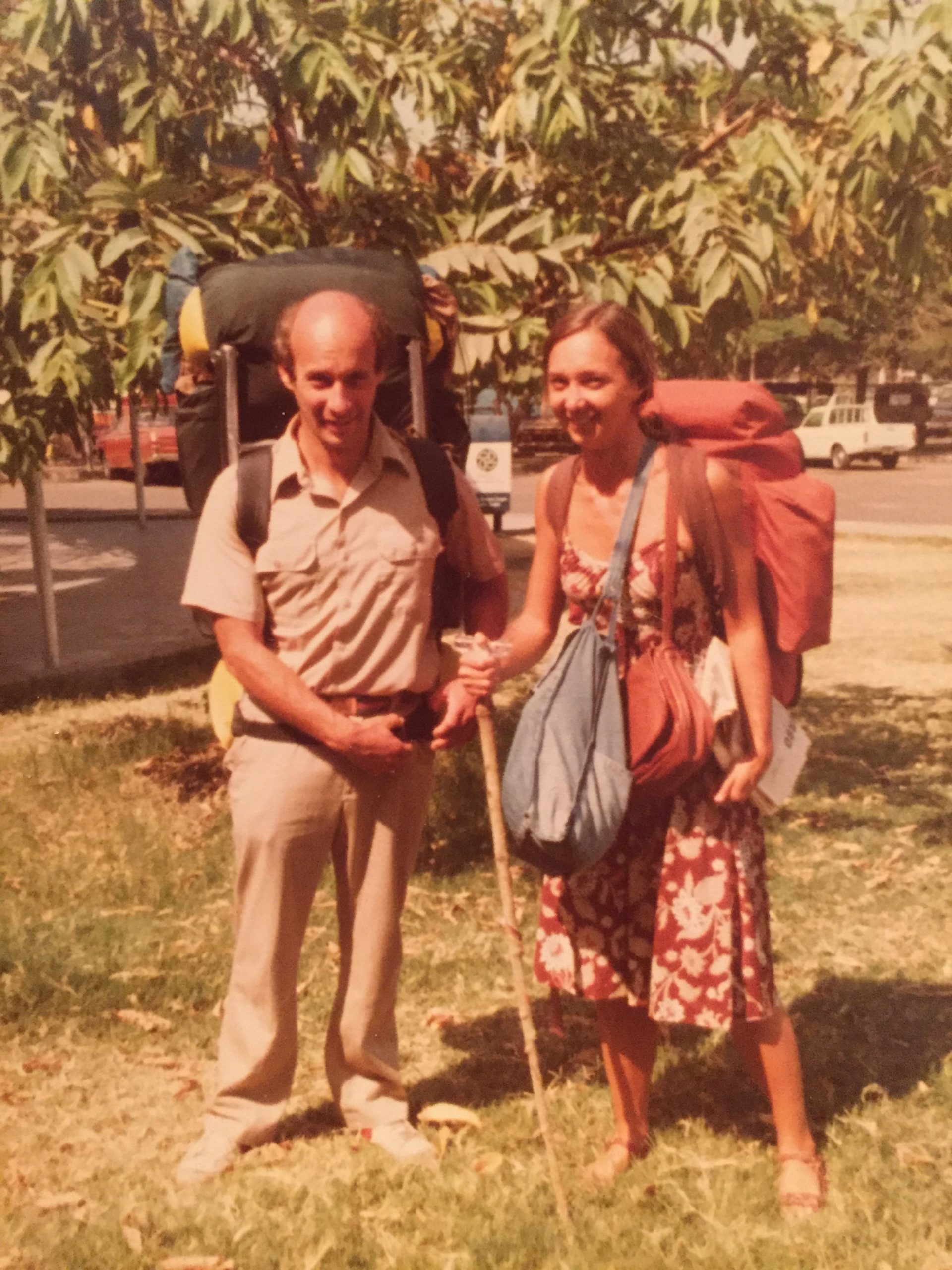
    Mr. Grove and his wife, Nancy Greene, scaled Mount Kenya in Africa.Courtesy of the family

    Before Friends’ Central, Mr. Grove taught second graders at the Miquon School in Montgomery County. He was also an adjunct science professor at Rosemont College in the 1990s, a summer camp science instructor for the Smithsonian Institution in Washington, D.C., in the early 2000s, and a science instructor for Penn’s Teach for America program from 2007 to 2010.

    In 1981, he became executive director of the Norris Square Neighborhood Project and supervised the building of a solar greenhouse in 1983 and the cleanup of Norris Square Park in 1985. “Everything we do here is slanted toward the neighborhood,” he told The Inquirer in 1983. “It’s all aimed at being able to produce something, do something, or find something.”

    He was also an award-winning lifetime honorary board member at the Riverbend Environmental Education Center in Gladwyne and onetime president of the Narbrook Park Improvement Association. During a sabbatical from teaching one year, he volunteered in Costa Rica to protect leatherback turtle eggs from poachers.

    He earned a lifetime achievement award from the Lower Merion Township Environmental Advisory Council, was a semifinalist for the National Science Teachers Association’s Teacher of the Year Award, and received more than a dozen other honors.

    Inspired by the 1956 film Around the World in 80 Days, he signed on with a Norwegian oil tanker in 1966, bicycled across North America, and returned to Europe on a Swedish oil tanker in 1968. He then hitchhiked to India, worked for two years on agricultural improvements for underserved communities, and met his future wife, Nancy Greene, a longtime Philadelphia resident.

    Amazingly, she was also inspired by Around the World in 80 Days and on her own global road trip. After India, Mr. Grove moved on to construction jobs in New Zealand and Australia. He finally settled in Philadelphia and married Greene in 1976.

    For the next 50 years, the two adventurers hiked trails in Borneo and New Zealand, and climbed Mount Kenya and Mount Kinabalu. “I was his biggest supporter,” his wife said.

    Born June 1, 1943, Peter Adrian Grove grew up in Send, a village about 28 miles southwest of London. He connected with nature as a boy, worked as a landscaper and carpenter in the early 1960s, and spent two years in the British Special Air Service Reserve.

    Mr. Grove and his wife, Nancy Greene, traveled the world together for decades. Courtesy of the family

    He earned an associate’s degree in English and biology in 1974 at Montgomery County Community College, and his bachelor’s degree at Penn in 1976 and master’s degree there in 1977. He constantly wrote and recorded audio clips about his life and adventures, and he shared those tales enthusiastically in school and at public events.

    He and his wife had a son, Evan, and a daughter, Marian, and lived in Fitler Square and then Narberth. He doted on his children and grandchildren, and bonded with his dogs.

    Mr. Grove constantly whipped up candlelit gourmet dinners for his family. He was funny, everyone said, and he loved to sing, dance, and fish.

    He called himself a simple man despite his many achievements and lived with cancer for years. “He was,” his wife said, “quite simply one of a kind.”

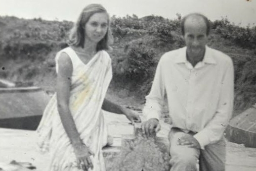
    Mr. Grove met his wife, Nancy Greene, in India in 1968.Courtesy of the family

    In addition to his wife and children, Mr. Grove is survived by five grandchildren and other relatives. Two sisters died earlier.

    A celebration of his life is to be livestreamed on YouTube.com at 1 p.m., Saturday, Aug. 8, at Wayne Presbyterian Church, 125 E. Lancaster Ave., Wayne, Pa..

    Donations in his name may be made to Friends’ Central School, 228 Old Gulph Rd., Wynnewood, Pa. 19096; the Lower Merion Conservancy, 1301 Rose Glen Rd., Gladwyne, Pa. 19035; and Friends of the Earth, Box 7010, Merrifield, Va. 22116.

    Mr. Grove was an avid fisherman.Courtesy of the family
  • Near-record heat around 100 degrees is forecast in Philly this week, with July 4th storms possible

    Near-record heat around 100 degrees is forecast in Philly this week, with July 4th storms possible

    Coinciding with the climax of the nation’s 250th birthday celebration, the atmosphere may make a run at history this week as July gets off to a torrid start in much of the nation, with temperatures in Philly aiming toward 100 degrees both Thursday and Friday.

    And while the record-challenging extreme heat may ease some late in the weekend, atmospheric fireworks may threaten Fourth of July events.

    Conditions also favor tropically steamy nights when it may seem that even the fireflies are adding to the heat.

    The National Weather Service has issued an “excessive heat watch,“ in effect from Wednesday afternoon through the day Saturday, for heat indexes up to 110. The watch covers all of New Jersey, Delaware, and most of Pennsylvania.

    The Delaware Valley Regional Planning Council has posted a “code orange” air-quality alert for Tuesday, advising that pollution could affect people with respiratory and heart condtions.

    If the heat wave persists as forecast, the cumulative warmth could become dangerous for people with background medical conditions and older residents who live alone without air-conditioning in the city’s rowhouses.

    The official high in Philly reached 90 on Monday, and the forecasts are calling for highs in the 90s at least through the weekend.

    Both FIFA Fan Festival organizers and SEPTA are preparing for a pending inferno.

    The World Cup afternoon matches on Wednesday and Thursday won’t be shown at the FIFA Fan Festival, said Melissa Ferdinand, spokesperson for Philadelphia Soccer 2026, but the evening matches will be.

    Among other measures SEPTA will be reducing speeds on regional rails, lest extreme heat cause overhead wires to sag and tracks to buckle, said agency spokesperson Andrew Busch.

    The forecasts for the rest of the week

    Philly’s temperatures are likely to reach the low 90s on Tuesday, said John Feerick senior meteorologist with AccuWeather Inc., but that will be just a warm-up.

    Readings will soar well into the mid- and upper-90s on Wednesday, and likely crest at or above the century mark Thursday and Friday.

    “The humidity gets tropical, too,” he said.

    Some showers are possible Friday afternoon and evening and Saturday, the weather service says

    The so-called high-pressure heat dome is forecast to bake about two-thirds of the nation. Philadelphia will be near the eastern edge of the hot zone, and that can become a precarious place to be when the heat backs off.

    The outlook for the weekend and the ‘ring of fire’ potential

    “Ring of fire” thunderstorms, which can generate prodigious amounts of rain, can form along the edges of heat-generating high-pressure systems, the weather service says. This far in advance — or even a day or even hours ahead of time — it isn’t possible to predict where and when such a storm or storms might develop.

    But in its forecast discussion Monday the weather service office in Mount Holly warned that “the environmental setup would be favorable for strong to severe thunderstorms.”

    “We’re seeing chances of thunderstorms,” said Paul Fitzsimmons, meteorologist with the weather service office in Mount Holly.

    Said Feerick, “I think there’s going to be some pretty intense storms. A lot of times, the heat waves come to an end with a bang. That’s a possibility next weekend for sure. The fireworks might be supplied by mother nature, and humans.”

    On Monday morning the weather service advised, “It is important to point out that any holiday weekend festivities could be impacted by thunderstorms — in addition to the extreme heat.”

    But, Fitzsimmons said, “By Sunday, might be getting a little bit cooler.”

    Warmer world, warmer Philly, although 100s have been less frequent

    Philadelphia’s temperature increases have tracked fairly close to the globe’s, which during the last 12 months were about 2 degrees Fahrenheit above the 20th century average. Local summers have become increasingly warmer.

    Yet 100-degree readings in Philadelphia have been relatively scarce this century. On average, temperatures of 100 or higher have occurred every four years in Philly, but when it reached 100 last summer, that was the first time in 13 years, the longest 100-less stretch on record.

    That could be mere randomness, or it could be related to increased mugginess, which can retard both daytime heating and nighttime cooling. Warmer air can hold more water vapor.

    In records dating to 1874, it has reached 100 a total of 62 times, according to an analysis of temperature data, in 40 different years. For whatever reasons, they have tended to come in clusters, including a five-year run of 100-degree readings that ended in 1955, and three years, ending in 2012.

    Said Busch, “I guess we could look forward to it next year.”

  • Philly’s weather forecast has drought-easing rains this weekend, then a heat wave through July 4

    Philly’s weather forecast has drought-easing rains this weekend, then a heat wave through July 4

    The region may be getting some significant drought relief during the weekend, and then it may be some time before it gets relief from heat that could persist through July Fourth.

    Rounds of showers — possible Friday night into Saturday evening when Croatia and Ghana meet in a World Cup match in South Philly — should be more widespread across the region than Monday’s scattershot downpours, said Brian Hurley, senior branch forecaster with the Weather Prediction Center, in College Park, Md.

    The severe storms likely would stay well to the south of Washington, D.C. However, “you always have potential” for a few thunderstorms, he said.

    Then, after two decent days Sunday and Monday, what is looking like the longest-lasting hot spell of the season to date is due to get underway Tuesday as temperatures head to the mid-90s.

    “That’s going to be main story,” said Hurley.

    The wild card for the duration would be the possibility of “ring of fire” thunderstorms, forecasters said, which might have temporary cooling effects. Those are storms that form along the boundaries of high-pressure heat domes, and Philly may be near the eastern edge.

    How hot might it get next week in Philly?

    Expect some tweaking during the next few days, but with “increasing confidence” the National Weather Service in Mount Holly was seeing heat indexes in the triple figures next week.

    Come Tuesday, daytime temperatures should be “off to the races,” said Bill Deger, senior meteorologist with AccuWeather Inc., which has forecast highs up to 98 degrees late in the workweek.

    It also will be steamy, and that will inhibit nighttime cooling as water vapor slows the escape of daytime warning. Readings are unlikely to get lower than the 70s Wednesday through at least next Saturday.

    The heat could lap into the following week, said Deger. “It shows some staying power,” he said.

    The region already has had 14 days with official temperatures of 90 or higher in 2026, about half the average total for an entire year.

    The potential for those ring-of-fire storms would be a wild card, said Hurley and Deger.

    Cooling thunderstorms can break heat waves, although they may come with a price. Ring-of-fire storms in July 2020 wrung out as much as 6 inches of rain that set off widespread flooding.

    As drought continues, the Philly region could use more rain

    Six inches might be a bit over the top, but the region could use more rain to ease the ongoing drought conditions.

    Some areas received close to 2 inches on Monday and Tuesday; however, the jackpot zones eluded areas where the dry conditions have been most intense — parts of South Jersey and Chester County.

    The entire region remained in some state of drought according to the interagency U.S. Drought Monitor, but Chester County was in “severe drought,” along with small pieces of Bucks and Delaware Counties. In “extreme drought” were all of Cape May County, other Jersey Shore towns, and areas bordering Delaware Bay.

    In an analysis based on a network of measuring stations throughout the counties, the weather service’s Middle Atlantic River Forecast Center calculated that Cape May County received less than a half inch of rain, and Cumberland and Salem Counties about 0.6 inches.

    In contrast, Burlington, Camden, and Gloucester Counties weighed in with well over an inch.

    On the other side of the river, Philly’s total was 1.28 inches, compared with 0.71 for Chesco, which, like New Jersey, is under a state-declared drought emergency.

    All this could change next week.

    .

  • Philly-area rain totals varied dramatically, and drought conditions survived the storms

    Philly-area rain totals varied dramatically, and drought conditions survived the storms

    The storms took down trees and wires, flooded roads, spoiled a World Cup party, and set off a deluge of smartphone panic alerts. But they evidently didn’t come close to erasing the rain deficits throughout the Philly region.

    Even with the additional light rains on Tuesday, bringing the two-day total to about 1.45 inches, officially Philadelphia’s rainfall for June still is slightly below normal, and this is after an extraordinary streak of 10 consecutive months of below-normal precipitation.

    And Monday’s storms exhibited a classic summer caprice. Areas of New Jersey and Chester County, both under state-declared drought emergencies, were all but stiffed, according to an analysis by the National Weather Service’s Middle Atlantic River Forecast Center. Northwestern Philadelphia and southeastern Montgomery County got as much as 2 inches.

    The weather service’s Mount Holly office reported that totals within counties varied radically. In Bucks County, for example, 1.8 inches was measured in Bristol and just over a half inch in Doylestown. Across the river, 2.4 inches fell upon Sewell, and about 0.75 in Monroe Township.

    “Some areas got it, some didn’t,” said Ben Casella, executive director of the New Jersey Farm Bureau. It can “rain here, but it may not rain on the other side of town,” he said.

    Not all of that Monday rain was beneficial, said Andrew Frankenfield, educator with the Penn State Agriculture extension in Montgomery County. Some of the water in those downpours on Monday rushed to the gutters and didn’t stop to soak into the soil.

    And those cloudbursts certainly weren’t beneficial to people routed from the World Cup fan fest in Fairmount Park, or to some motorists. Numerous water rescues were reported in the Wyncote section of Cheltenham Township, Montgomery County, And the weather service noted several reports of flooded streets and rushing water up to a foot deep floating cars in Germantown.

    Tuesday’s gentle rains, Frankenfield said, were more beneficial to the plant life, which is only going to get thirstier as the summer progresses.

    Is more rain coming to the Philly region?

    Showers are possible Thursday, said Alex Staarmann, meteorologist with the National Weather Service in Mount Holly, with a better shot Friday night and Saturday.

    However, these may again be lottery-ball situations, something with which farmers are well acquainted.

    Generally throughout the region through Monday, precipitation was running about 75% of normal, on average about 5 inches below normal, according to the river center, which bases its surveys on several measuring stations in each county.

    The latest interagency U.S. Drought Monitor map had most of the region in “moderate drought,” but Cape May County and areas of New Jersey near Delaware Bay are in “extreme drought.” Those regions were all but shut out from the Monday downpours.

    They evidently fared a bit better on Tuesday, with the Millville airport reporting about a third of an inch, and a half inch measured in Sea Isle City.

    While the rains were welcome, the drought anxieties persist, Casella said.

    “As we turn the calendar into July, the crops are going to need more moisture,” Frankenfield said.

    “We certainly need more” rain, he said. “We can’t make it up in a week, we can’t make it up in a month. We’re concerned, but not alarmed.”

  • Storms move through the Philly area, bringing heavy rains, tornado warnings, and flooding

    Storms move through the Philly area, bringing heavy rains, tornado warnings, and flooding

    After 10 months of precipitation deficits, the Philadelphia region was due for some drought relief — but maybe not this much relief, this fast.

    Powerful thunderstorms that set off tornado and severe-storm warnings and waterfall-like downpours arrived in the region Monday just in time for the peak afternoon commute and the France vs. Iraq World Cup match in South Philly.

    And while the tornado warnings and the worst of the storms had backed off by nightfall, the rains were reluctant to give it up, and the National Weather Service warned that more heavy showers are possible Tuesday.

    “It’s been a while since we had rains like this,” said Patrick O’Hara, a meteorologist at the National Weather Service Office in Mount Holly, which issued multiple flood warnings into the evening. Flooding occurred on the Schuylkill Expressway near Gladwyne, and several water rescues were reported in Cheltenham Township.

    Frankford Creek in Philadelphia rose well into moderate flood stage.

    The agency also had issued two tornado warnings for parts of Chester, Delaware, and Montgomery Counties after Doppler radar had detected radar signatures.

    Multiple uprooted trees were reported in the Valley Forge area, officials said. Several reports of downed wires and trees branches and hailstones came from across the region from Chester County and South Jersey.

    The timing could have been worse, but maybe not much worse for World Cup participants and the nearly 70,000 fans who came to watch the rain-interrupted match.

    A severe-storm warning for Philly popped up just as the World Cup match between France and Iraq in South Philly was underway. That was quickly followed by one for Southwest Philadelphia, parts of Delco, and South Jersey.

    The weather service’s flash flood watch remained in effect until 6 a.m. Tuesday.

    On Monday afternoon an early arriving strong storm passed through parts of Philadelphia and Burlington County, snapping trees and taking down “multiple branches” in the Holmesburg section of the city, the weather service said.

    That was followed by a potent storm that generated strong winds and torrential rains north and west of the city and then even stronger storms and flooding downpours throughout the region.

    Will the rains end the Philly region’s drought conditions?

    Not likely. Life is not fair, and neither is summer rain, which by its nature is capricious.

    About 1.2 inches of rain was measured at Philadelphia International Airport on Monday, with over an inch of that falling between 6 p.m. and 8 p.m.

    The rains weren’t evenly distributed across the region, but the Philly total is of some significance: It brought the city’s total close to the normal for June.

    Based on the forecasts of the potential for more substantial rains Tuesday, Phllly stands to break an impressive streak of 10 consecutive months of below-normal precipitation.

    Most of the region is in “moderate drought” according to the inter-agency U.S. Drought Monitor, and Cape May County, most of Delaware, and New Jersey areas along the Delaware Bay are in “extreme drought.”

    State-declared drought emergencies are in effect for New Jersey and Chester County.

    It is unclear how helpful Monday’s rains were in terms of dousing the drought condtions.

    Downpours aren’t known for their attention spans, and rains can run off rapidly.

    “If the rain doesn’t penetrate the soil, it doesn’t help,” said O’Hara, “Ideally, it would soak into the ground over a couple-day period. That would really help.”

  • Strong storms and downpours Monday could affect Philly’s next World Cup match

    After 10 months of precipitation deficits, the region is expected to experience severe storms and much-needed rain on Monday — unfortunately, the worst might coincide with the timing of the France vs. Iraq World Cup match in South Philly.

    The strongest could arrive around the scheduled start of the match, at 5 p.m., said Brian Hurley, senior branch meteorologist with the federal Weather Prediction Center in College Park, Md.

    Given how daytime heating can add volatility to the atmosphere, with severe-thunderstorm threats in the Mid-Atlantic region, he said, in the late afternoon “we’re always asking for it.”

    The Storm Prediction Center in Norman, Okla., which issues those severe storm watches, listed a 2% chance of tornadoes, and an “isolated” twister can’t be ruled out, said Nick Guzzo, meteorologist with the National Weather Service in Mount Holly.

    The storm center listed a 15% chance of damaging straight-line winds with gusts approaching 60 mph.

    With the anticipated moisture capacity of the atmosphere on Monday, localized downpours that could wring up to 2 inches of rain in a hurry could set off localized flooding.

    “Not everyone will get them,” said Hurley.

    He said a round of heavy showers is likely in the late afternoon or early evening, and then it’s possible that rains will shut off, with even an outside shot at a rainbow.

    But more rain is likely later at night and during the overnight hours.

    Overall, forecasters said, just about every area of the region should get a half-inch of rain.

    Officially, Philadelphia has had 10 consecutive months of below-normal precipitation. All of New Jersey and Chester County are under state-declared “drought emergencies,” although conditions have been improving.

    Most of the rest of the region is in “moderate drought,” according to the interagency U.S. Drought Monitor.

    On the plus side, no more extreme heat is in the forecast, with highs topping out in the 80s through next Sunday.