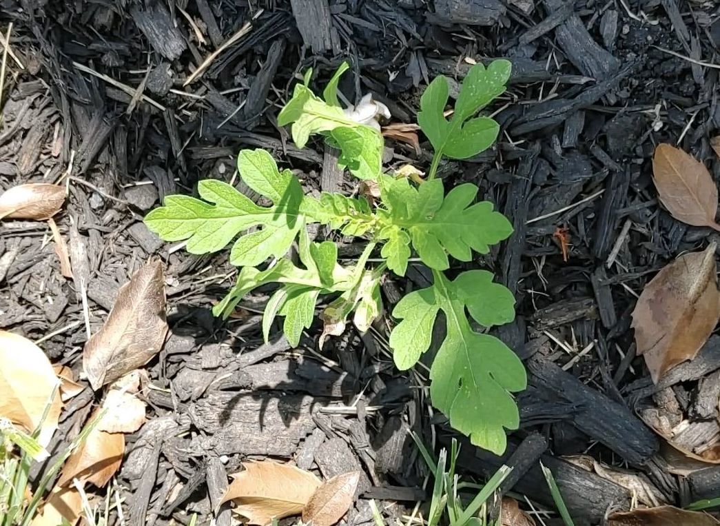
The recent rain rally has been a boon to the Philadelphia region’s plant life, and, unfortunately for the legions of the allergic, the beneficiaries include the homely and ubiquitous tormentor commonly known as ragweed.
It belongs to the plant family Ambrosia, from the Latin for “food of the gods.” One can only assume the gods did not have allergies.
Estimates vary, and it’s not as though it is a census category, but in all likelihood several hundred thousand people in the region annually endure the slings and arrows of ragweed pollen, notorious for setting off episodes of sneezing and attendant dopiness.
It also can induce coughing, wheezing, and chest discomforts, particularly among asthmatics, allergy experts warn.
The season — the third in the equinox-to-equinox pollen trilogy, successor to the trees and grasses — typically begins modestly in early August, then intensifies late in the month and continues well into September. And this year sufferers may pay a price for the episodic drought-easing rains that have been watering the plants in the Mid-Atlantic region since mid-June.
“Ragweed thrives on the nitrates in rainwater,” said Payel Gupta, anallergy, asthma, and immunology specialist based in New York City. The rains’ timing has coincided with “ragweed’s late-summer growth window,” sheadded, and the result likely will be “denser plants and higher pollen output.”
As for precisely when the pollen will peak: “Every year is different,” said Donald Dvorin, who for more than 30 years was the Philly region’s official National Allergy Bureau pollen counter, “but the first week of September is most common.”
In addition, with the planet’s temperatures increasing and first frosts taking their good old time, the seasons appear to be lasting a bit longer.
The prime pollen flight hours are from 5 to 10 a.m.; effects can linger, however, as pollen can stick to clothing and find its way indoors via unwitting humans and pets.
What is ragweed?
Ragweed is a tooth-leaved plant that can grow in almost any environment, native to North America but spreading worldwide.
For the allergenic, Dvorin said, the heavy hitters are the “short” ragweed (Ambrosia artemisiifolia), and the “giant” (Ambrosia trifida).
A typical pollen grain is a mere 1/25,000th of an inch in diameter, but a single plant can generate a billion of them.
While the plants live for only about a year, do they ever reproduce! Pollen has been found as far as 400 miles from the source, according to the Allergy and Asthma Network.
New York City spent millions after World War II to eradicate ragweed in the city, a war it lost resoundingly. For one thing, the warriors discovered that about half the ragweed pollen in the five boroughs was commuting from elsewhere.
The torments of ragweed
Most people inhale ragweed pollen without incident, but for the allergic, the body interprets the pollen as an invader, and sneezes and other reactions are part of the immune response.
For the sufferers, each season can be a little bit different, said Gupta, assistant clinical professor at the State University of New York and Mount Sinai Medical Center in Brooklyn.
Severity would depend on “how many consecutive high-count days there are,” Gupta said. Exacerbating factors could be “viral infections or air pollution compounding irritation,” she said.
In addition, some patients may be subject to “priming,” a particularly nasty season that might make some more susceptible to pollen discomforts the following year.
And ragweed is nothing to just sneeze at, according to the International Ragweed Society, which is based in Switzerland and aims to promote ragweed research.
In addition to a “socioeconomic burden due to rising healthcare costs” and “productivity losses,” the society states, the weed’s pervasiveness can endanger certain crops and natural habitats.
How much ragweed is in the air?
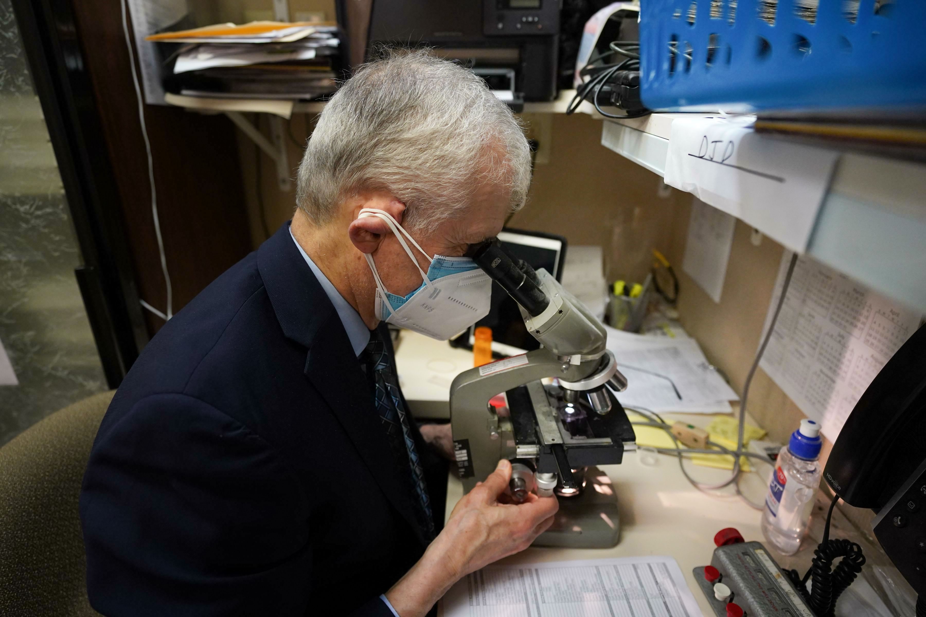
Unfortunately, that has become harder to know. Dvorin, an allergist who had practiced in Center City and Mount Laurel, stopped counting pollen last year, and that was symptomatic of a trend. The network has been shrinking.
Gotcha! Donald Dvorin analyzing a pollen specimen. He stopped counting pollen last year, and the network has been shrinking.Jessica Griffin / Staff Photographer
Traditionally, allergists such as Dvorin supplied daily counts on a voluntary basis as part of the National Allergy Bureau network. However, the analyses require expertise and time that allergists could devote to revenue-paying patients.
Fewer doctors evidently have been willing to participate.
The nearest allergy bureau counter who posts frequent counts is in the Washington area.
The Asthma Center in Center City posts daily counts that are AI-generated, and while that technology shows tremendous potential, the allergy bureau has not yet approved any of the machines for official use, said Pamela E. Gabrish, the bureau’s program director.
“There has actually been more backlash against using automated devices than ever,” she said.
Advice for ragweed sufferers
Day-to-day pollen volumes are difficult to predict, but expect the peak to arrive next week.
It is a good bet that counts will be high on a warm, dry, and breezy day.
This will be evident in the online pollen forecasts, but be aware that pollen is commuting on the chaotic whims of the atmosphere.
In a study of five major cities, published in 2024, allergy experts concluded the accuracy of online pollen forecasts was “low.”
Along with medications, here are a few suggestions from allergy professionals:
Severe storms set off tornado and flood warnings on Thursday in the Philly region, and in some places turned the phrase “rush hour” into an oxymoron.
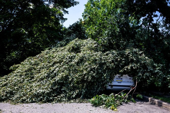
Intense thunderstorms took down trees and wires in parts of Chester County, and fallen trees blocked portions of heavily traveled Route 322 in Honey Brook, the weather service reported.
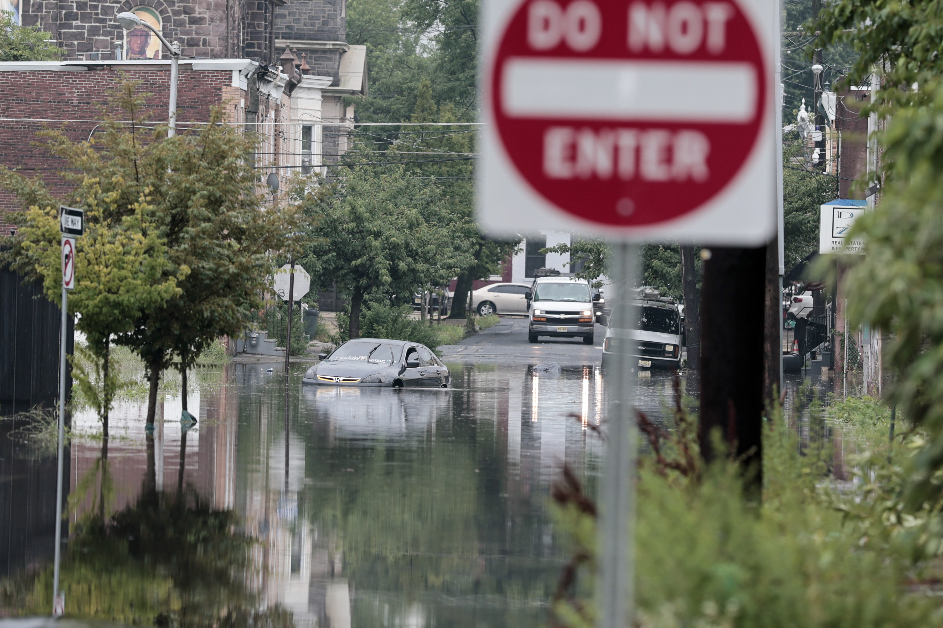
Streams came out of their banks, and flash flooded occurred in West Norriton and Lower Providence Townships, in Montgomery County, making “many streets” impassable.
A tornado warning had been issued for portions of Chester and Delaware Counties, but it was not known if a twister was sighted.
About 21,000 Peco customers were without power as of 8 p.m.
All of Philadelphia; areas to the west of the city, including the Main Line; northern Delaware; and in New Jersey along the Delaware River were under a flash-flood warning until 8:45 p.m.
Lines of storms gathered to the west and south of the region during the day with the approach of an eastward-moving front interacting with a volatile, energized atmosphere.
“It’s a pretty juicy air mass,” said Matt Benz, senior meteorologist for AccuWeather Inc. And more juice might be squeezed out of it over the next few days, especially Saturday.
It turns out that the front that set off the storms may return in a repurposed form during the weekend.
Disruptive storms came at a bad time
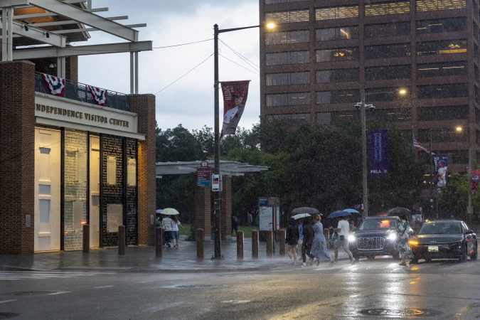
The storms arrived between 5 and 5:30 p.m. in the immediate Philly area, right when a lot of people likely would have been heading home.
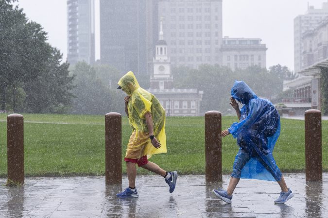
The storms moved quickly, but the downpours were strong enough to set off flash-flood warnings.
The fact that the sun interrupted the afternoon gloom on Thursday didn’t help matters, meteorologists said. On a day when the air was so full of moisture and energy, that was about the last thing they wanted to see.
“It’s ironic, isn’t it,” said Joe Wegman meteorologist with the government’s Weather Prediction Center, in College Park, Md.
The solar heating likely provided a power jolt to an already charged atmosphere.
The outlook for the weekend
If you have outdoor plans Saturday, this is probably something you don’t want to read.
After the front clears the region, Friday should be a decent day, Wegman said.
But it’s likely to migrate back, this time as a warm front, said Wegman. Showers are possible Friday night, and might be tapping into a generous moisture supply on Saturday.
Said Benz, “I wouldn’t throw out the word washout, but it could be pretty wet on Saturday.” Steady rain is possible, as are more downpours Saturday afternoon into the night.
As for Sunday, you guessed it — another chance of showers.
Both astronomy and meteorology suggest that it won’t be long before these things decline in frequency, but in the meantime another flash-flood watch is in effect for the Philly region.
A tornado watch also was posted for Philadelphia and the neighboring Pennsylvania counties.
The National Weather Service watch spans from noon Thursday until 2 a.m. Friday, for the potential for rain rates of 2-to-4 inches an hour in areas along I-95 and South Jersey.
And the federal Storm Prediction Center has posted a severe-thunderstorm watch, in effect until 10 p.m., for storms that could kick up gusts approaching 60 mph.
“There could be multiple rounds of heavy rain over urbanized areas,” said Joe Wegman, a meteorologist with the government’s Weather Prediction Center. In advance of the anticipated main events, a blob of light rain moved through the region late Thursday morning.
Also, the federal Storm Prediction Center sees an outside chance of severe-level storms, those with gusts near 60 mph, and a 5% chance of tornadoes in and around Philly.
And those who have not had the good fortune of spending the last two months in heat-free and smokeless environments probably can skip the next paragraph.
The timing, ferocity, rain totals, and targets all remain uncertain.
What is the best estimate on the storm timing in Philly?
The higher-resolution models were suggesting that the likeliest time for storms to arrive in the Philly region would be between 2 and 3 p.m. Thursday, Wegman said.
The worst of it may hold off until 4 or 5 p.m., said Matt Benz, senior meteorologist with AccuWeather Inc.
The storms likely would back off between 6 and 7 p.m., but that timing could disrupt a peak commuting period.
“Why would we conveniently time these things?” Wegman quipped.
“There’s plenty of moisture coming up, and a front approaching from the west,” he said. “If the front stalls, the storms might linger longer than people want them to.”
Plus, renegade storms could race out ahead of the front, setting off precipitation earlier, he added, and that appeared to be case Thursday.
The weather service in Mount Holly said the “greatest risk” for severe storms would be between noon and 10 p.m.
But timing remains one of the most vexing challenges for severe-weather forecasting, says Bill Bunting, deputy director of the storm center, in Norman, Okla.
“I have seen remarkable progress,” said Bunting, who has been at it for 40 years, “but we’re nowhere near perfection. In the end, the science has its limitations.”
The forecast for the weekend and the rest of August
The storm experts have had plenty of practice around here this summer. So far, Philadelphia officially has recorded 21 thunderstorms since June 1, several more than normal.
It has also been a banner summer for smartphone alerts and assorted scare grams.
About 11 inches of rain has been measured at Philadelphia International Airport, roughly four inches above normal, since July 1.
That said, yes, both Chester County and the entire state of New Jersey remain under state-declared drought warnings, with residents asked to conserve water.
And drier times may be coming, or at least a reduced incidence of those late-day thunderstorms, said Brian Hurley, senior branch forecaster with the Weather Prediction Center.
The days are getting shorter, and the sun is losing some of the gas it uses to fuel convective storms, he said.
But all pumpkin spice aside, summer is not quite over, and shower chances are in the forecast into Sunday night.
Just as the soils were beginning to take on that cracked and dried look and the vegetation was working up a thirst, the rains have returned to the Philly region, and showers and possible thunderstorms may bookend the week.
Rains Sunday ended the first seven-day period without measurable rain in Philly in two months. More showers were possible Monday and later in the week, forecasters said.
In all likelihood they won’t remotely approach the destructive deluges in the Midwest, said Brian Hurley, senior branch forecaster with the federal Weather Prediction Center, in College Park, Md.
And around here, despite the generous rains that have fallen upon the region since mid-June, additional rain wouldn’t be altogether unwelcome, said Hurley.
Precipitation in the last 60 days has been well above normal everywhere in the region save for Montgomery County, where they were just about normal, according to the weather service’s Middle Atlantic River Forecast Center, which uses a network of stations in the counties.
However, not so long ago, as we headed into June, Philadelphia had experienced 16 consecutive months of below-average precipitation totals.
And drier times may be coming, Hurley warned.
Drought conditions have eased, but not disappeared
New Jersey and Chester County remain under state-imposed drought warnings, with residents asked to go lighter on the water usage.
“We’ve been putting a dent in that drought,” said Hurley, but in the latest interagency U.S. Drought Monitor update, most of the region remains “abnormally dry,” with parts of Burlington, Bucks, and Montgomery Counties in “moderate drought.”
Thunderstorm activity has been well above normal this summer, with the weather service reporting 19 days officially with thunder detected at Philadelphia International Airport. The average for the entire June 1 to Aug. 31 period is about 15 days.
It’s also been quite warm. In 12 of the first 15 days of August, the temperature reached at least 90 at the airport, and this almost certainly is going to end up being one of the warmer summers on record.
The warmth and the rains are related.
Philadelphia has spent a whole lot of time on the western edge of the so-called Bermuda high, centered over the North Atlantic. Winds circulate clockwise around thecenter of high pressure, and areas to the west of the center (where we are) experience winds from the south and southwest.
Being on the edge also places the region in spraying distance of shower activity as fronts and minor disturbances approach along the western flank of the ridge, with daytime heating adding a kick to the storms.
Thunderstorms may become scarcer come September
Those convective thunderstorms, which can wring out rain in waterfall-like downpours, in all likelihood will become less numerous as September approaches and the days shorten, Hurley said.
“It does get a little harder to pop convection when the sun doesn’t do its thing as much,” said Hurley.
“In September we tend to dry out until we get tropical connections,” he said.
This year, however, those tropical connections may be scarce, according to the National Oceanic and Atmospheric Administration and other forecast services.
During El Niño, the interaction of the ocean and the overlying air generates powerful upper-level winds from the west that can shear apart tropical storms in the Atlantic Basin before they mature.
No Atlantic hurricanes have developed yet this season. Meanwhile, Hurricane Lala in the Pacific has caused extensive damage in Hawaii. Typically, when the Pacific is quiet, the Atlantic is active, and vice versa.
Lala is the 12th named tropical storm — those with winds of at least 39 mph — of the season to form in the Pacific. The average for the date is seven.
In the Philly region, historically tropical-storm remnants have been generous sources of rainfall.
Sometimes, however, they have been overly generous. (See Ida, 2021.)
The rapidly developing El Niño is likely to become a “historic event” that could become the most-intense in the period of record, the government’s Climate Prediction Center said Thursday.
The El Niño warming in the tropical Pacific, coupled with how it is affecting the atmosphere, is all but certain to have dampening effects on the Atlantic hurricane season, researchers said.
While it is likely to be disruptive and destructive during the next several months, during the tropical storm season it may mean fewer scares for East and Gulf Coast and Caribbean residents, and perhaps fewer flooding threats in the Philly region.
El Niño already is making its presence evident thousands of miles away in the Atlantic Basin, said Philip Klotzbach, tropical storm specialist at Colorado State University. Colorado State’s forecast methodology has been the prototype for the outlooks issued by the National Oceanic and Atmospheric Administration and commercial companies.
In his update last week, Klotzbach predicted the season would produce nine named storms, those with winds of at least 39 mph — down from 13 in the April outlook. NOAA also subtly trimmed its numbers. The long-term average is 14.
Even with above-normal temperatures that usually would be favorable for storms in the hurricane-development regions of the Atlantic, what’s going on in the Pacific is going to dominate, he said.
“El Niño is definitely the story of this season,” he said, and NOAA says the Pacific warming is likely to persist through April.
(Even The Farmers’ Almanac has noticed. The winter outlook it has cooked up appears to be right out of the El Niño recipe book, calling for wetness and storminess in the South, typical of El Nino. Helpfully, it said the forecast up our way is “tricky.”)
How does warmth in the Pacific affect Atlantic hurricanes?
El Niños, which occur every two to seven years as part of a natural process, agitate the overlying air and disrupt atmospheric circulation worldwide. It is part of the so-called El Niño Southern Oscillation, or ENSO, and since oscillations do oscillate, El Niño periodically shares the stage with La Niña, during which the waters are cooler than normal.
The climate center reported Monday that in the key El Niño region of the east-central Pacific, sea-surface temperatures over a 2.4 million-square-mile area were more than 3 degrees Fahrenheit above normal.
That air-ocean interaction generates strong west-to-east upper-level “shearing” winds that can keep tropical storms from maturing into hurricanes.
Klotzbach said that last week, the 30-day average of wind shear in the western Atlantic was higher than in any other 30-day period dating to 1979.
Other players in the atmosphere affect tropical storm activity, but El Niño “usually becomes the dominant factor,” said Matt Rosencrans, the weather service’s lead hurricane forecaster.
During the top six most-intense El Niños in records dating to 1950, tropical-storm numbers were significantly below normal.
Is this El Niño yet another symptom of a warming planet?
“There is still considerable debate in the scientific community on how warming may affect ENSO behavior,” said Michelle L’Heureux, physical scientist with NOAA’s Climate Prediction Center and the head of the ENSO team.
El Niños likely have been occurring for eons, but the period of record dates only to 1950 because “much fewer observations” are available before then, she said.
“It would take much more research to compare El Niño events in the older records,” she added.
El Niños in which the temperatures reached 3.6 degree Fahrenheit — averaged over three-month periods — occurred in 1965-66; 1972-73; 1982-83; 1991-92; 1997-98, and in 2015-16.
The warmest three-month average, 4.3 degrees Fahrenheit, was recorded in the 1982-83 event, and the climate center sees a 69% likelihood that this will exceed that level.
But L’Heureux cautioned that “intense El Niño events are not totally unexpected.” The top six list shows that they have reappeared every 10 to 15 years.
Thus, she said, “There’s a reasonable argument we were due.”
What might all this mean for the Philly region’s weather?
Tropical storms or their remnants “are especially notorious for flash-flooding impacts” in the region, said Sarah Johnson, warning coordination meteorologist in the weather service’s Mount Holly office.
The 2020 season was quite active, and 2021’s hyperactive. Logically, fewer Atlantic storms would reduce the odds of remnants heading this way.
With the exception of 2012, the year of Sandy, Johnson said that all the years with below-average flash-flood warnings issued by the Mount Holly office coincided with seasons in which no tropical storms or remnants have affected the region.
Tori Bauver was sitting at home on July 11 when the sky outside of the Wyndon Apartments in Wynnewood began to darken. Bauver watched the clouds roll in, then the rain come, blowing “literally sideways” outside her window. She remembers leaning in to see the darkening landscape and noticing that rain had begun to penetrate her windows. Then the “outside went stark white” and water started pooling on her windowsills.
“I was like, ‘Oh, my God. This is gonna flood. This apartment’s gonna flood,’” she said.
The light fixture above Bauver’s bed filled with water, then poured over the edges. The ceilings began to leak, then one by one, they collapsed. The building’s roof ripped off, and Bauver had a clear, and unsettling, view of the sky from her living room.
Bauver, now a resident of West Chester, where she and her partner moved after breaking the lease on her Wynnewood apartment, had been living in the Wyndon Apartments for two years when the July microburst storm tore through Lower Merion, destroying her home and more than $5,000 of her and her partner’s belongings. She was one of dozens of suburbanresidents who emerged from the storm with damaged property and a devastated home.
As the Philadelphia region sees hotter and more humid summers, flash flooding, extreme precipitation, and life-threateningstorms have become a more common feature of daily life.Weather eventsmarked by downed trees, dangerous flash floods, waterlogged roadways, and eroded bridges are, more and more,forcing suburban residents and cash-strapped local governments to pour millions into repair and resilience projects, all while large swathsof the region’s infrastructure are built to withstand weather patterns of a bygone era, one in which storms like July’s microbursthappened once in a decade, rather than multiple times a summer.
As the region’s weather patterns intensify, officials and climate experts say the municipal mosaic of Philadelphia’s suburbs faces unique challenges when it comes to planning for a future marked by climate change.
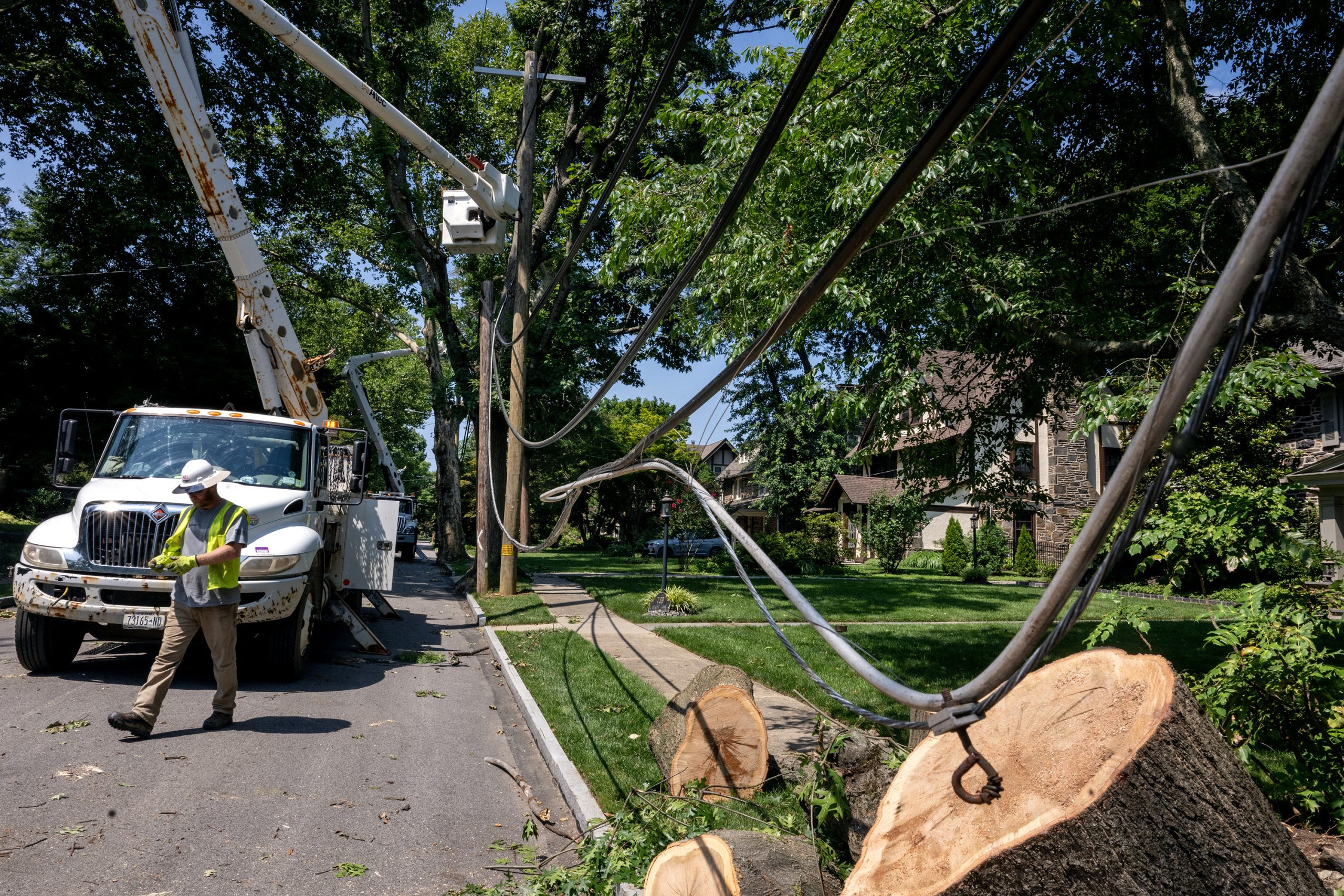
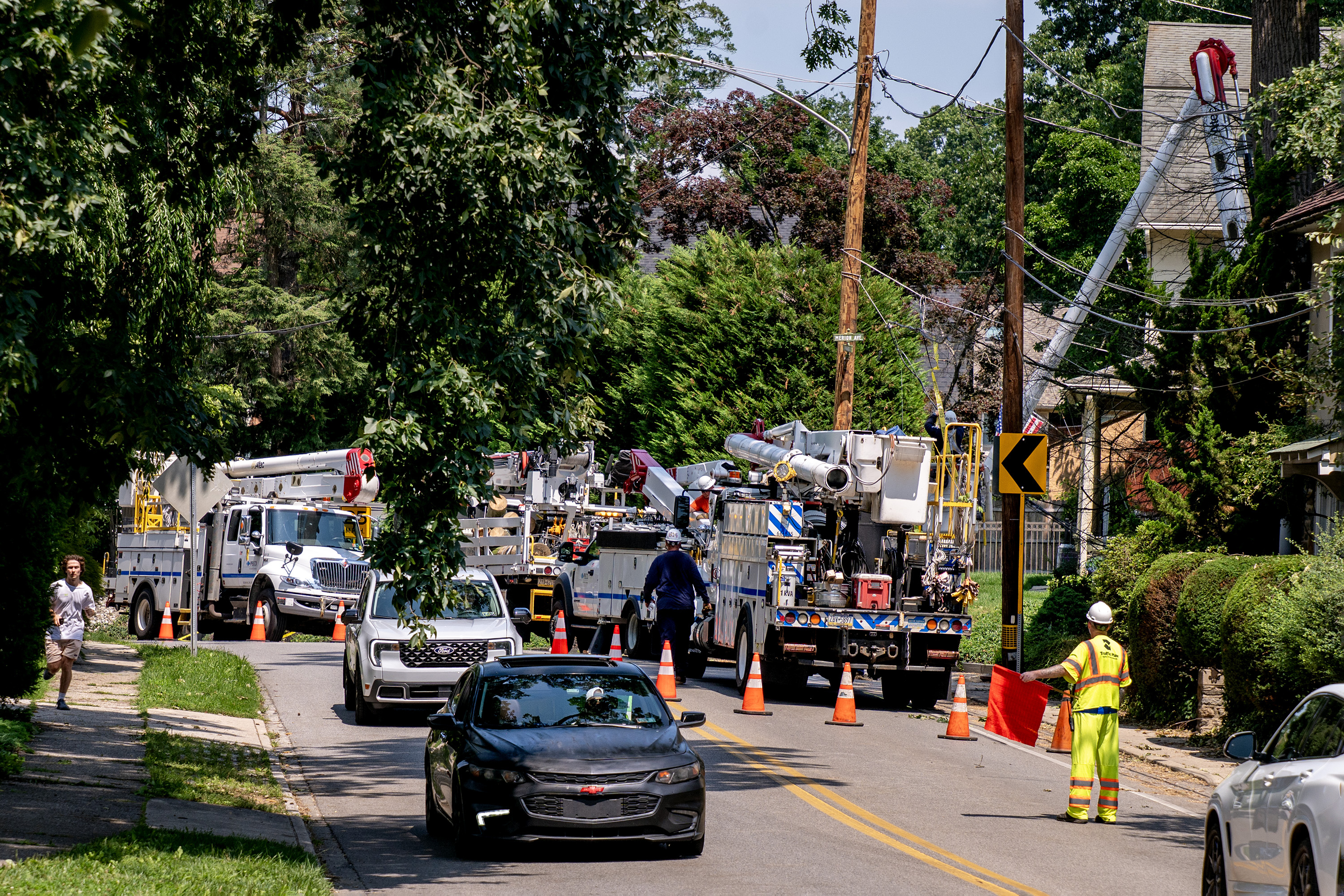
Utility workers restore power in Merion Station on July 13 after a microburst storm ripped through parts of Philadelphia and Montgomery County.Tom Gralish / Staff Photographer
The Philadelphia region’s changing weather
The average July temperature in Philadelphia has risen 4.4 degrees since 1940. In the 1900s, Philadelphia averaged four days per year with temperatures above 95 degrees, according to a 2024 EPA report. This summer, Philly has seen six days with high temperatures above 95 degrees, according to the National Weather Service. By the end of the 21st century, that number could climb to more than 50 days per year.
Hotter weather means more precipitation, and more frequent and intense rain events. For every 1.8 degrees the air temperature increases, the amount of water the atmosphere can hold increases by 7%.
“The infrastructure we have now is not always built to a standard to accommodate the extreme weather we’re seeing now,” said Chris Linn, manager of the Office of Resilience and Environment at the Delaware Valley Regional Planning Commission.
AsRay Courtney, a Lower Merion commissioner and chair of the township’s sustainability committee, said, “We get a 100-year storm every year.”
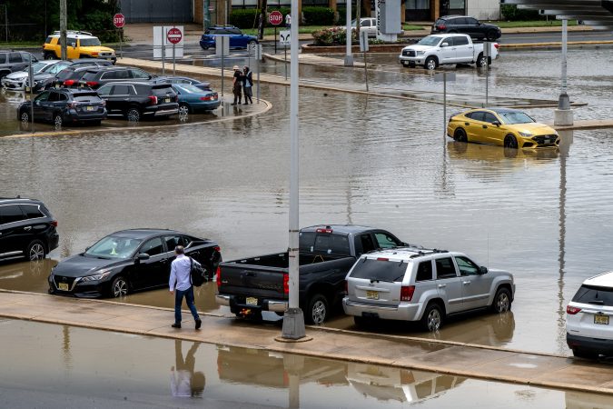
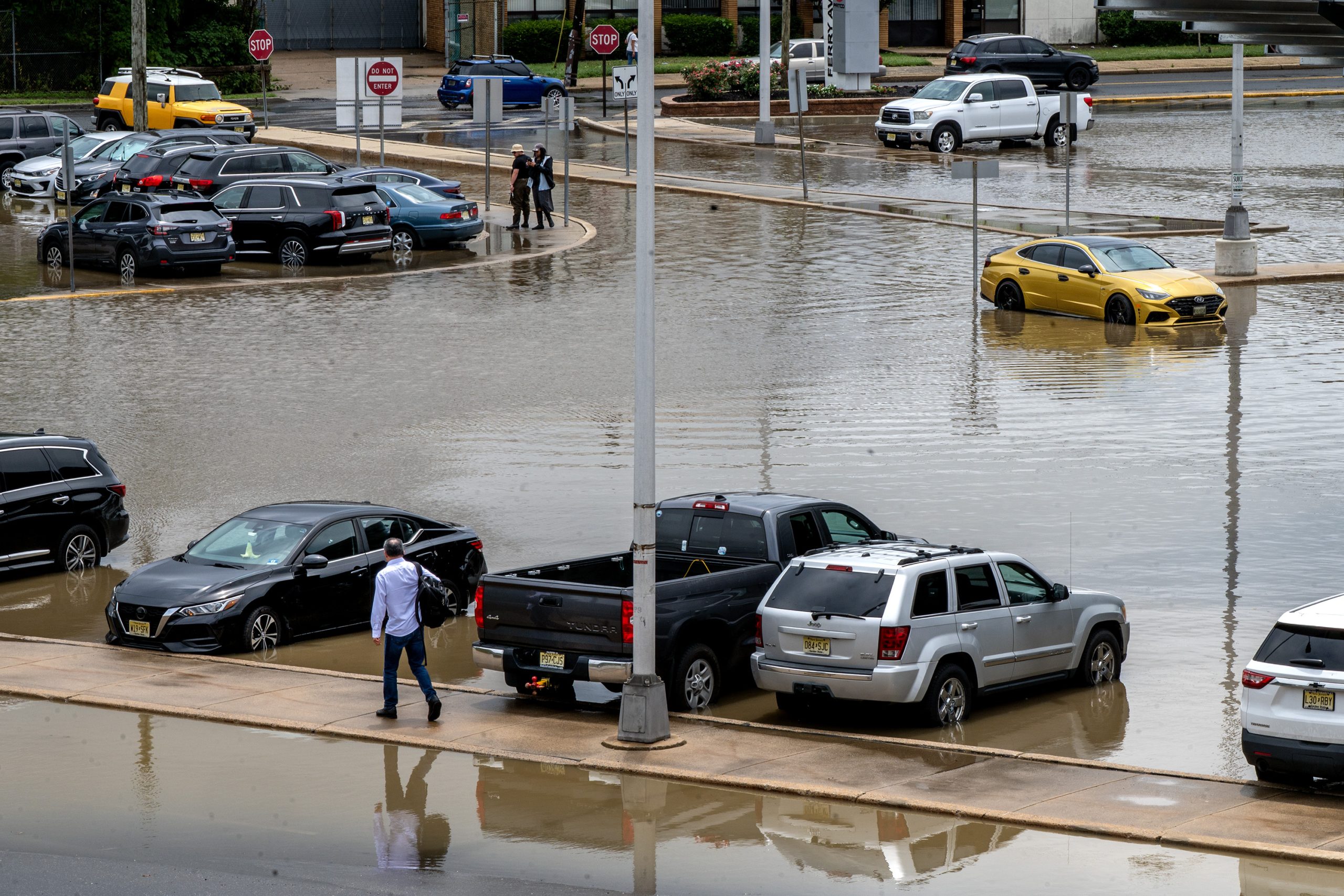
Cars in a flooded parking lot at the Ferry Avenue PATCO station in Camden on July 6. Philadelphia and its suburbs have been hit with numerous flash floods this summer, as an increasingly hot and humid atmosphere gives way to more extreme weather.Tom Gralish / Staff Photographer
Flooding as ‘the biggest and most common hazard’
The impacts of intense storms are multitudinous and cascading, and the topography of Philadelphia’s suburbs can make it particularly difficult to find effectivesolutions.
Linn said flooding is “the biggest and most common hazard that communities face,” and it presents the most “consistent and pervasive” issues for municipal leaders.
Intense precipitation and flash floods, which have been a constant this summer, can disrupt transit, turn roads into rivers, and endanger residents’ lives. High winds and saturated soil frequently bring down trees, damaging homes and cars and knocking out overhead power lines. Disruptions to power can be particularly dangerous when residents are left without fans or air-conditioning during hot summers.
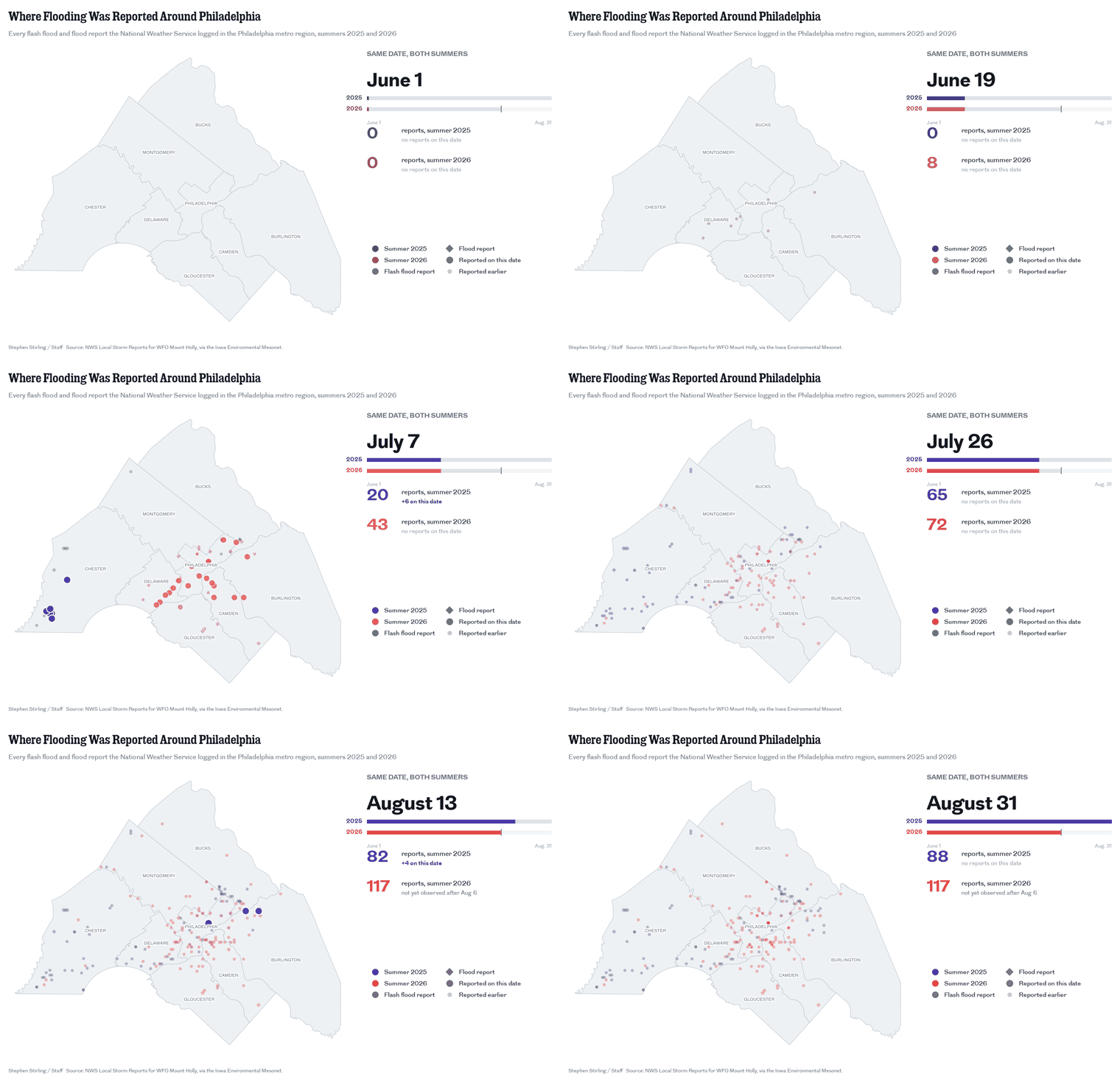
Flooding has been reported more than 200 times in the Philadelphia region over the last two summers.Stephen Stirling
“I see roads flooding consistently, trees coming down, power going out, and then our local government spending resources every time one of these storms happens. It’s overtime costs and tree costs, and then also all the private citizens having to spend costs cleaning up trees and other debris,” Courtney said.
“These unlikely, freak events are really the ones that break us,” said Matthijs Bouw, architect and professor at the University of Pennsylvania’s Stuart Weitzman School of Design.
A key tool for managing extreme weatheris stormwater systems, or the collection of drains, basins, ditches, and pipes that collect rainwater and snowmelt and move it from developed areas into local waterways. Stormwater systems are critical in moving water off impervious, or impenetrable, surfaces, like the parking lots, paved roads, and shopping centers often found in the suburbs.
The more developed a suburb is, the more runoff a storm will produce, increasing flooding risks, said Franco Montalto, professor of civil, architectural, and environmental engineering at Drexel University.
Yet many municipalities are contending with aging stormwater systems that require costly repairs. Lower Merion’s 2018 Comprehensive Stormwater Management Plan listed aging pipes, undersized infrastructure, operational costs, and increasing flooding as challenges for the township. Many of Philadelphia’s suburban communities are composed of buildings that predate a 1978 state law requiring counties and local governments to plan with stormwater management in mind.
Some communities are more vulnerable to climate impacts than others, with density, land cover, wealth, and the state of repair of existing infrastructure as factors. A 2021 climate change vulnerability analysis by Montgomery County found denser, water-proximate communities like Norristown and Pottstown to have some of the highest risk of increased stresses due to climate change. Greener, more rural parts of the county like New Hanover and Marlborough Townships presented lower risks.
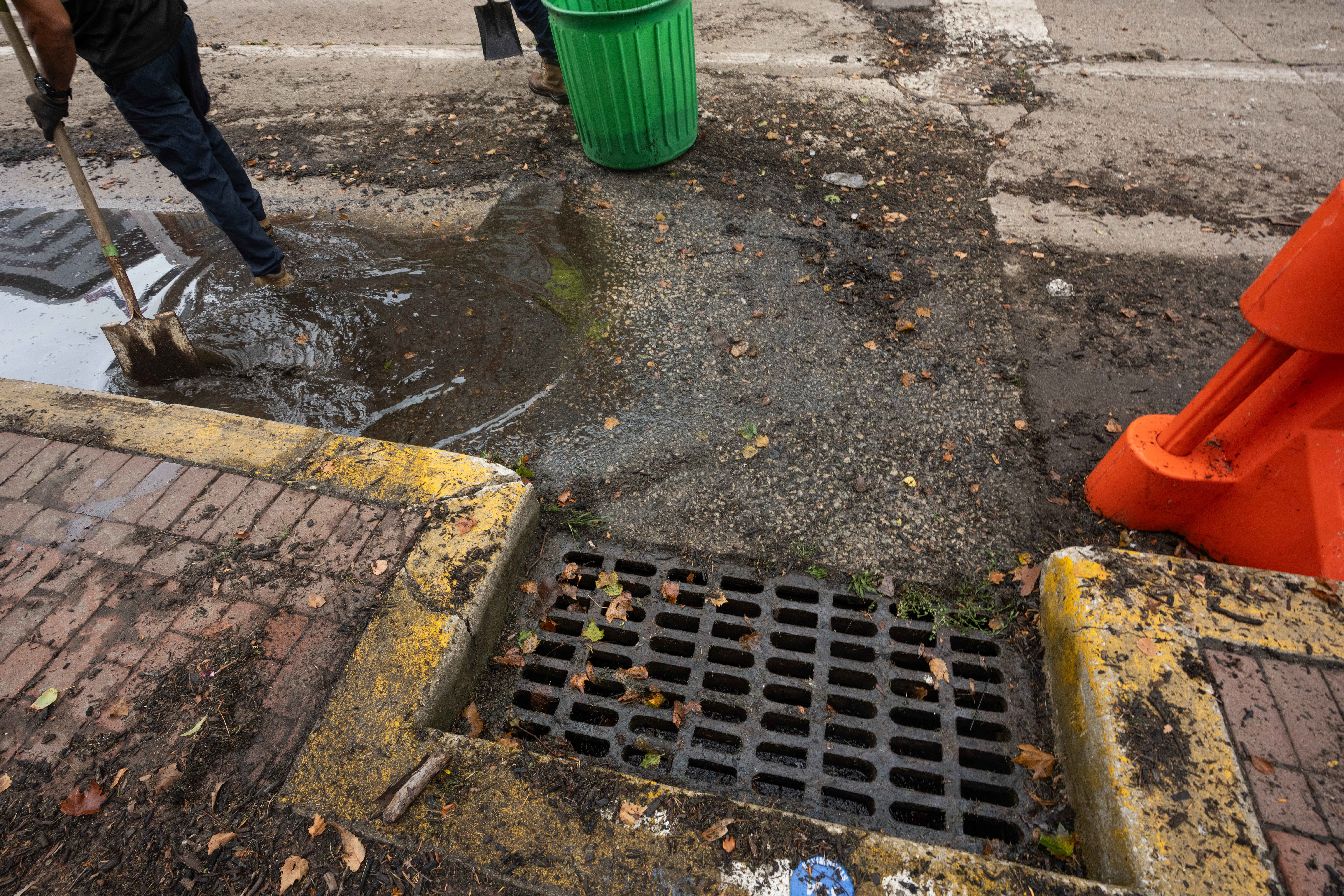
The aftermath and clean up of flooding in Camden on July 6. Stormwater systems are a critical tool for local governments to manage flooding. Jessica Griffin / Staff Photographer
How can communities mitigate impacts?
Experts described a range of interventions for managing climate impacts, from constructing rain gardens to rewriting zoning ordinances.
Maintaining a healthy tree canopy and building rain gardens can help rainwater permeate into the ground. Larger infrastructure efforts like stream restoration projects and floodplain maintenance can help stabilize the built environment.
However, Linn said, these interventions “don’t necessarily address more severe or catastrophic flooding in terms of mitigating those impacts.”
Long-term climate resilience, experts said, relies on making land-use and zoning decisions that preserve floodplains and natural drainage patterns and ensure stormwater systems can manage our new, rainy reality.
Montalto is interested communities that have become “safe to flood,” or that have created parks, parking lots, road medians, and other open spaces that trap water during floods, then properly drain it, keeping it away from buildings and roads. A basketball court built below a park, for example, can fill with water during a storm and slowly drain, mitigating runoff (one was recently installed in New York City). Copenhagen’s Cloudburst Management Plan, adopted in 2012 after a major storm, is a blueprint of sorts in Montalto’s mind.
However, bringing “safe to flood” infrastructure to Philly’s suburbs may be a far-out goal.
In the vast suburbs, the collection of boroughs, townships, and county lines makes unified action difficult, and forces officials to think along municipal, not watershed, lines. On the Main Line alone, rainfall and snowmelt drain into a collection of dozens of creeks and streams that do not start or stop where a municipal boundary is drawn, making it difficult to take coordinated and effective action when it comes to flood mitigation along certain waterways.
Finding the funding to repair and replace stormwater infrastructure, too, can be taxing, as local governments stare down costly projects, even with the availability of state and federal grants.Political will factors in, with municipalities differing in their desire and ability to use taxpayer dollars to tackle climate issues.
Philly’s suburbs, like the city, are also often old, dense, and built out, making it hard to retrofit them to be more climate-sensitive.
“So many of our communities are built out and have been built out for a long time, so the vulnerabilities and the challenges are built in to the community,” Linn said.
Utility workers restore power along Wynnewood Avenue in Merion Station on July 13.Tom Gralish / Staff Photographer
Solving ‘complex issues’ in Montgomery County
Despite the challenges, progress is being made, said Montgomery County Commissioner Jamila Winder.
Montgomery County in 2025 led a flood mitigation planning study for the 362-square-mile Perkiomen Creek Watershed, which stretches across Montgomery, Bucks, Berks, and Lehigh Counties. The study identified flood-prone areas, evaluated mitigation tactics, and worked to build a framework for long-term resilience. The county is currently in the process of carrying out a floodplain restoration project along the Wissahickon Creek in Whitemarsh Township. Both projects came to fruition after Hurricane Ida tore through the region, bringing record floods and killing multiple people.
The county has repaired 30 structurally deficient bridges since 2017 and has repaved dozens of miles of road. County workers also removed 200 dangerous trees earlier this year, resulting in a significant drop in emergency phone calls about tree damage, Winder said.
Lower Merion in 2021 hired its first full-time sustainability manager and in 2023 completed its first sustainability plan. Radnor Township has adopted a comprehensive climate plan, and Haverford Township has set out to achieve 100% zero-carbon renewable power by 2035.
The Pennsylvania Department of Environmental Protection in January announced more than $17 million in funding for environmental projects across the state, including stream restoration and stormwater management.
Winder said, “We’re seeing that when we work across federal, state, county, and local leadership, that we can come together to solve some of these complex issues.”
This suburban content is produced with support from the Leslie Miller and Richard Worley Foundation and The Lenfest Institute for Journalism. Editorial content is created independently of the project donors. Gifts to support The Inquirer’s high-impact journalism can be made at inquirer.com/donate. A list of Lenfest Institute donors can be found at lenfestinstitute.org/supporters.
Skin-clinging humidity, random downpours, heat indexes in triple figures, steamy nights. Welcome to Miami North.
The heat advisory for the entire region has been extended to 8 p.m. Saturday, with more random showers likely. As to when something resembling comfort returns to Philly? “That’s the million-dollar question,” said Matt Benz, senior meteorologist with AccuWeather Inc.
Similar conditions could persist into late next week, he added.
Highs might not get much past 90, but with the atmosphere this steamy, the heat index in Philly had reached 102 at 2 p.m. (In Miami, it was down to 82, thanks to a cooling thunderstorm.)
Both Camden and Delaware Counties have posted “code red” heat advisories, even though conditions are not expected to approach the official criteria of two consecutive days of highs of at least 95 degrees.
Waves of air from the Gulf Stream and the gulf itself continue to wash over the Mid-Atlantic region, said Brian Hurley, senior branch forecaster at the federal Weather Prediction Center in College Park, Md., adding that the situation is going to persist.
(function(){function e(){window.addEventListener(`message`,function(e){if(e.data[`datawrapper-height`]!==void 0){var t=document.querySelectorAll(`iframe`);for(var n in e.data[`datawrapper-height`])for(var r=0,i;i=t[r];r++)if(i.contentWindow===e.source){var a=e.data[`datawrapper-height`][n]+`px`;i.style.height=a}}})}e()})();
On the plus side, drought conditions continue to ease, and officially in Philadelphia, rainfall since Jan. 1 is now about normal, recent rains having wiped out a significant deficit.
Officially, both the entire state of New Jersey and Chester County are under state-imposed “drought warnings,” but changes may be in the wind and the clouds.
Three months ago, all of New Jersey was in at least “moderate drought,” according to the interagency U.S. Drought Monitor, but with Thursday’s update, less than half the state was so designated. As for Chester County, the percentage of the county in “severe drought” has dropped from 90% to 37% in the same period.
However, the recent rains have come in fits and starts and have been less generous in some areas and overly generous elsewhere, and have had a knack for outwitting science.
Those random downpours are going to continue
“Multiple rounds of showers and thunderstorms each afternoon and evening may become strong to severe,” the National Weather Service in Mount Holly warned Thursday.
Don’t expect much notice.
Case in point: Around 7:30 p.m. Wednesday, the weather service posted a missive: “The threat for flooding has diminished tonight.”
Shortly thereafter, flood warnings went up for portions of all four of Philly’s neighboring Pennsylvania counties.
That followed afternoon downpours that caused extensive road flooding in Philly and neighboring areas as a corridor of heavy rain cut through the city.
Michael Silva, a meteorologist in the Mount Holly office, was among those who had not seen it coming.
“Before work, I was about to go out twice for walks,” Silva said. “Then I looked at the radar.”
Despite all the rain, and probably as result of the antecedent dryness — heading into July, Philadelphia had experienced 16 consecutive months of below-normal rainfall — stream and river levels remain well below the danger zones.
And so far, the trees appear to be holding their ground, said Shane Farrell, arborist with the Davey Tree Expert Co., and to date he has not seen the type of “mud slurry” that might coax them out of their roots, barring severe-storm gusts.
Showers are likely to be numerous and widespread on Friday, said AccuWeather’s Benz.
The outlook for the weekend for Philly and the Shore
Saturday is expected to be a clone of Thursday, as a so-called Bermuda high-pressure system over the North Atlantic continues to lure steamy air northward. Winds circulate clockwise around centers of high pressure; thus, areas to the west of the center, where Philly happens to be, experience winds from the south and southwest.
Benz sees an outside chance that an approaching front will provide a very temporary and modest measure of relief on Sunday. Don’t bet on it, however. He said it is going to encounter a whole lot of resistance along the way.
The outlooks are similar for the Jersey Shore, which is likely to be quite a popular destination this weekend.
Yet more rinse-and-repeat flood warnings were posted for Philadelphia and portions of adjacent counties Wednesday as more downpours oozed through the region.
And don’t be surprised if more pop up later in the week, as the atmosphere will remain thickened with so much skin-clinging water vapor that “it’s not going to take much” to turn on the faucets, said Michael Silva, a meteorologist at the National Weather Service in Mount Holly.
One indicator of the atmospheric saturation: The weather service has posted a heat advisory for Thursday as heat indexes could rise to 100 or better — even though temperatures won’t get much past 90. That is all about the humidity in what could be the start of a more muggy wave, as opposed to a traditional heat wave.
The moisture in the air on Wednesday was such that the rain, which began around lunchtime, ended up being more ferocious than expected.
“Before work, I was about to go out twice for walks,” Silva said. “Then I looked at the radar.”
The heavy rains were wrung out along a narrow corridor cutting through the city, and they generated widespread traffic disruptions during the afternoon.
The weather service said that 1.23 inches of rain had been measured at Philadelphia International Airport, just between noon and 1 p.m. More than 2 inches fell upon parts of Bucks County.
Road flooding was widespread in Philly, Bucks County, and South Jersey.
Among the highways affected were the Schuylkill Expressway in the Point Breeze area; I-95 in Eastwick, at the Platt Bridge, and in the Croydon, Bucks County, area, where the warning was extended until 6:15 p.m.; and Route 130 in Burlington County.
(function(){function e(){window.addEventListener(`message`,function(e){if(e.data[`datawrapper-height`]!==void 0){var t=document.querySelectorAll(`iframe`);for(var n in e.data[`datawrapper-height`])for(var r=0,i;i=t[r];r++)if(i.contentWindow===e.source){var a=e.data[`datawrapper-height`][n]+`px`;i.style.height=a}}})}e()})();
The rains were getting juice from a rich pulse of moisture from the South, said Mike Gorse, a meteorologist at the weather service’s Mount Holly office.
What’s more, these types of threats may be a “repeated thing” later in the week, he added, echoing Silva’s comment, with showers in the forecast again for Thursday night and Friday as the region is stuck in another sultry air mass.
The recent rains represent quite a reversal of fortune for the region and the entire state of New Jersey.
After 16 consecutive months of below-normal precipitation in Philly, officially close to 10 inches of rain has been measured since July 1, and recent rains have set off rashes of flood warnings, including on Sunday.
July’s total, 7.03 inches, was 2.65 inches above normal.
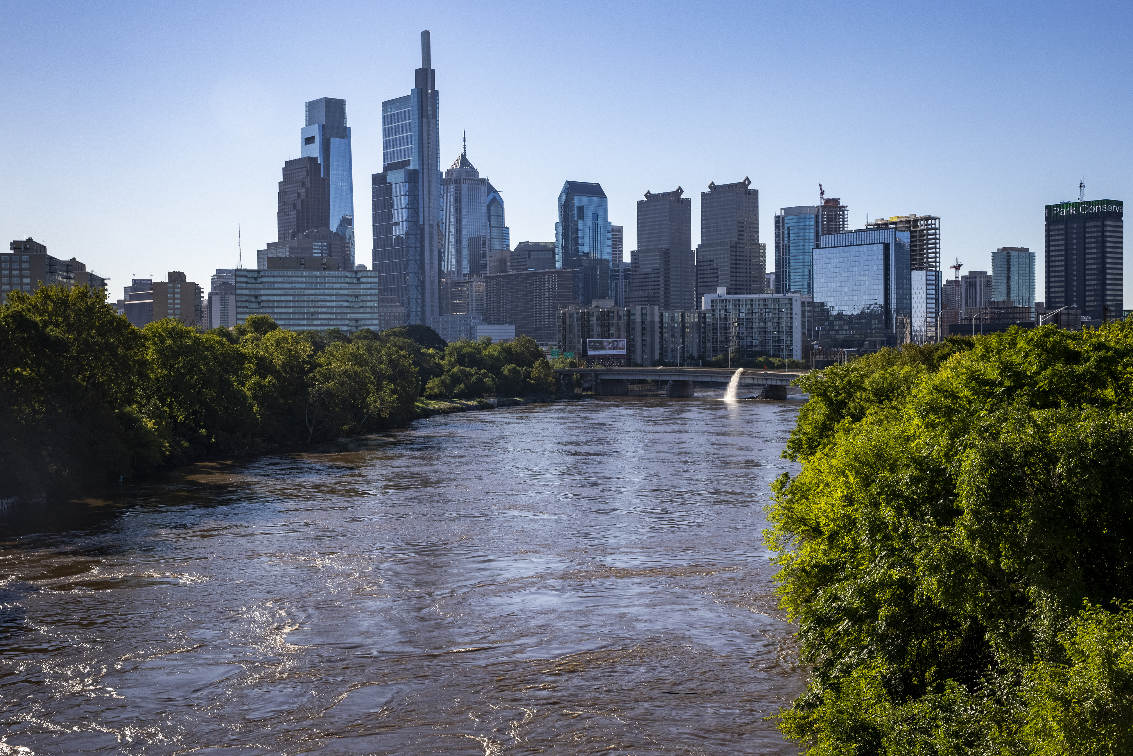
Still, water levels along the Schuylkill in Norristown and the Delaware River at Trenton have remained relatively low, the result of all that antecedent dryness.
However, flashier creeks, such as the Neshaminy, in Bucks County, are prone to slosh over in downpours, said Sarah Johnson, the weather service’s warning coordination meteorologist in Mount Holly.
While Chester County and all of New Jersey remain under drought warnings, the recent turn to wetness may have some staying power, she said.
According to the weather service’s Middle Atlantic River Forecast Center, which relies on networks of observations in each county, rainfall in all 21 counties in New Jersey has been well above normal in the 60-day period that ended on Tuesday.
On the Pennsylvania side, rainfall was at or above normal in Philly and its neighboring counties — including Chester County, where the 9.17-inch total was 113% of normal.
The federal Climate Prediction Center’s longer-term outlooks see chances favoring above-normal precipitation from next Tuesday through Aug. 19.
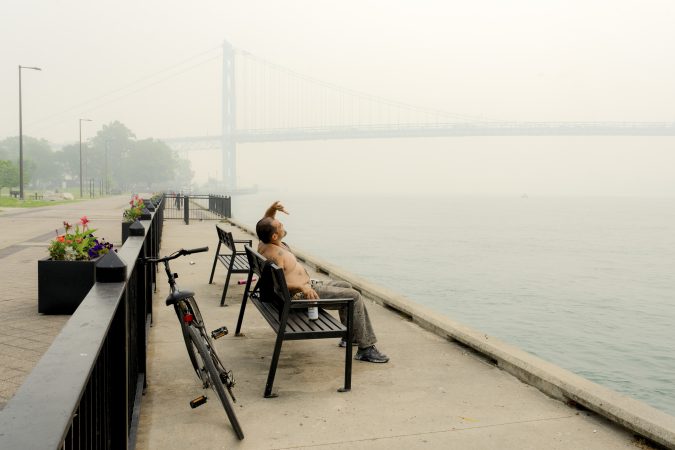
In July, Republican candidates in Michigan were lining up to excoriate Canada for the wildfire smoke wafting across the international border. “They MUST PAY and PUT OUT the fires!” wrote gubernatorial candidate John James on X, after declaring he would introduce legislation to impose sanctions on the neighbors to the north. Other politicians made similar claims about how they would deal with Canada. Meanwhile, Donald Trump moved to impose new tariffs on Canada in response.
Such political posturing shows little understanding of the actual situation. For example, it overlooks the fact that the scale and magnitude of these fires is surely linked to climate change, which the United States is arguably doing less to combat under the Trump administration than any other industrial nation in the world.
This is not the first time the two countries have dealt with cross-border air pollution. However, in the Great Lakes-St. Lawrence region historically, it was more often American emissions that were afflicting Canada.
By the mid-20th century, air pollution across the Michigan-Ontario border in the St. Clair-Detroit River corridor was raising significant concerns. At the request of both nations, the International Joint Commission (IJC), which had been created by the 1909 Boundary Waters Treaty, formed a joint St. Clair-Detroit Air Pollution Board in the 1960s to investigate the precise sources of air pollution in this region.
In a 1971 report, this board found that sulfur dioxide and particulate matter from Detroit’s auto and steel industries were crossing over to Windsor, Ontario. Along the St. Clair River, the joint board reported that Sarnia’s Chemical Valley south of the city, which had already developed into an enormous petrochemical complex that befouled both air and water, was the main pollution culprit. Certainly some of the poisons drifted into Michigan, though the board determined that the primary victims were in Ontario. The IJC duly recommended that the two federal governments create pollution boards and establish national air quality standards.
A similar dynamic played out in other transboundary air disputes between Ontario and adjoining U.S. states, with both sides (though more often the United States) found to be the culprit. Ontario Hydro built a large coal-fired power station at Atikokan in the northwest part of the province that threatened cherished recreational areas across the border, such as the Boundary Waters Canoe Area Wilderness in Minnesota. In another instance, the Reynolds aluminum smelter in Massena, N.Y., was accused of contaminating the nearby binational Mohawk community, including the parts in Canadian territory.
Over time, the air quality issues stemming from these specific sources mostly either fell off the public’s radar or became subsumed within wider debates about acid rain and national air quality agreements (such as the 1970 Clean Air Act). Indeed, by the 1980s acid rain dominated not only the Canada-U.S. environmental relationship, but general bilateral relations.
Acidified precipitation is created when sulfur and nitrogen oxides (SO2and NOx) emissions, often from coal plants, are transported through the atmosphere and transformed into sulfuric and nitric acids. This acid rain fell onto terrestrial and aquatic environments where it had a range of short- and long-term negative consequences. Melting acidic winter snows produce an “acid shock” in streams during the spring run-off, for example, which is predictably bad for aquatic species.
While both countries generated pollution that fell in the other’s territory, acid rain originating in the United States and descending to earth in Ontario was the biggest problem. Ongoing bilateral studies established that 70%-80% of it came from the United States. That acid rain affected cottage country north of Toronto — where many of the country’s elite have vacation homes — helps explain why this problem gained so much public traction.
But the two countries could not agree on solutions, such as the need for emission limitations and controls. As the primary contributor, the United States would have had to bear the brunt of any necessary changes, and the Reagan administration was ideologically opposed to any environmentally motivated regulations on economic activity. Washington stalled the talks, calling for more research.
The United States proved more amenable to addressing the problem after George H.W. Bush entered the White House in 1989. Negotiations began on what would emerge as the 1991 Canada-United States Air Quality Agreement (AQA), which permanently capped emissions at approximately 13.3 million tons by 2010 in the United States and 3.2 million tons in Canada. While the United States would not make any legal commitments to reduce emissions in Canadian territory, it did pledge to follow the requirements of its recently updated Clean Air Act, which reduced the emissions that created acid rain.
Made By History sponsorsInquirer Staff
Ultimately, the results of the 1991 Air Quality Agreement were mixed. SO2 emissions did go down by almost 70%. Granted, this decrease probably had more to do with domestic regulations and technological changes on both sides of the border. In the long run, neither country has fully followed through on its commitments.
The AQA also created a framework that could incorporate other air pollution issues, such as particulate matter and ozone. In that vein, Canada and the United States signed an “Ozone Annex” to the Air Quality Agreement in 2000. There was also a different type of ozone problem — the hole in the ozone layer — involving Canada and the United States; both were adherents to the 1987 Montreal Protocol on Substances that Deplete the Ozone Layer, considered by many to be the most successful global environmental treaty ever.
To be sure, the United States and Canada have had the world’s most consequential environmental and energy relationship over at least the last century. No two nations have exchanged resources and collectively modified ecosystems on the same scale — which, by extension, has created harmony in wider U.S.-Canada relations and established many important precedents for international environmental law and governance. Yet, both countries are also petro states and climate villains, with their societies and economies organized around deeply unsustainable industrial practices and consumption patterns.
The amity that has long characterized U.S.-Canada relations has been eroding with Trump at the helm. And this recent strife about transborder smoke is representative of the ways that breakdowns in U.S.-Canada environmental and energy relations can undermine the rest of the relationship.
Made By History takes readers beyond the headlines with articles written and edited by professional historians. Opinions expressed do not necessarily reflect the views of The Inquirer.
The smartphone alerts and the battery of weather watches and warnings were chilling. But they failed to capture what actually happened in the immediate Philadelphia area.
As it turned out Tuesday, not all that much happened, beyond a beneficial rainfall, some flashbulb lightning, and wind gusts that officially did not get past 34 mph. Heavy rains hammered Upper Bucks County, but around Philly, creeks behaved and flooding reports were isolated, even as damaging storms struck to the north and south of the region.
As so often occurs with summer thunderstorm outbreaks — not to mention winter storms — we learned science is playing catch-up with the atmosphere. That was evident Tuesday night, and if you feel as though you’ve seen this movie before, the forecasts and the outcomes were similar on July 18 and 21.
And expect recurrences — and surprise storms — even if the climate stops changing.
The atmosphere still is jealously guarding some of its most important secrets, said Bill Bunting, deputy director of the federal Storm Prediction Center, the national house of mayhem in Norman, Okla., that is responsible for all the severe-storm and tornado watches.
In his 40-plus years in the storm-forecasting business, Bunting said,“I have seen remarkable progress, but we’re nowhere near perfection. In the end, the science has its limitations.”
About the Tuesday night storms
Life is unfair, and that works both ways. The Philly region has had its share of storm ambushes historically, and as for what did not happen in and around the city Tuesday, “we’ll consider that a much more fortunate outcome than what could have been,” said Mike Lee, meteorologist at the National Weather Service office in Mount Holly.
The outcome was similar to that of July 18 and July 21, when the menu of threats — wind, possible floods and tornadoes, lightning — was about the same. The gusts on the 18th did not get above 35 mph at Philadelphia International Airport, andthey did not get above 30 mph on the 21st.
Bunting said this week’s storms were particularly problematical meteorologically. “The wind fields were quite strong” in the upper atmosphere, he said. “That environment was not one to mess around with.”
It was as though the system had wandered in from a different season, when cooler temperatures create sharp temperature contrasts that drive storm development,Lee’s colleague Patrick O’Hara said.
At 12:50 p.m., the storm center had seen enough to issue a broad-brush severe-thunderstorm watch that covered a huge swath of the Mid-Atlantic region, including much of Pennsylvania and all of New Jersey and Delaware.
A tornado watch followed a few hours later.
The Mount Holly office issued two tornado warnings for the Philly area — including one covering Wilmington and Chester City.
However, the two twisters verified by the Mount Holly office occurred in Talbot County, Md.
The heaviest rains — in some cases over 4 inches in Quakertown — mostly were confined well to the north of Philly. Officially, 0.72 inches of rain was measured at PHL.
Wind-damage and flooding reports around the Philly area were sparse, although Bunting advised it can take days following a storm to get an accurate assessment of impacts.
The future of thunderstorm forecasting
Bunting suggested that complaints about forecast accuracy could be viewed as forms of flattery, since they well from the public’s expectations that, in turn, well from advances in forecasting.
In 1985, Bunting recalled,he was working with one computer-model output that he received via a fax machine, and observation tools primitive by today’s standards.
But forecasting the development and movement of thunderstorms remains one of the great challenges of meteorology, and it is inevitable that storms are not going to materialize in some areas that are under a storm watch.
“You don’t now exactly where those storms will organize into a cluster, or fast-moving line segment,” he said. “So you have to put larger areas on notice.”
A wild card in any cluster or line of storms would be renegade, isolated storms, the kind that are apt to spin up a tornado, Bunting said.
For any given storm, he said, “until it forms in a larger area with similar conditions, it’s hard to pinpoint the risk.”
What would it take to pinpoint the risks? Improved understanding of storm physics, improved remote-sensing capabilities, and more powerful models, Bunting said.
“It is not a trivial challenge,” he said. “The decisions are not going to be perfect.”
That is not necessarily a bad development, he added.
“Sometimes I wonder what it would be like if we knew what the weather would be in great detail, weeks and months advance,” he said. “It seems to me it would get kind of old.”