Category: Climate

  • New Jersey’s drought officially is history, and the Atlantic hurricane season is making history

    New Jersey’s drought officially is history, and the Atlantic hurricane season is making history

    Go ahead New Jersey, drink up and wash the cars: After 300 days, the governor’s office has officially lifted the statewide drought warning.

    The decree came Thursday after three months that have featured an assortment of downpours and general rainfalls, with a bonus early-season nor’easter, throughout the Garden State and the Philadelphia region that may have had a lot of folks wondering when too much would be enough.

    The region has another shot at rain Sunday, but the atmosphere may be poised to flip into a radically different, season-changing, rain-repelling pattern.

    In fact, said Richard Bann, a meteorologist with the federal Weather Prediction Center, “If this were January, people would worry about how cold it would be.”

    Any rain Sunday would be the result of a stalled front and “a surge of tropical moisture from the Gulf,” distantly related to the remnants of Hurricane Polo, said Matt Benz, senior meteorologist with AccuWeather Inc.

    Polo, of course, originated in the Pacific, which has been on fire with tropical activity — the mirror opposite of the Atlantic.

    The Atlantic Basin, which includes the Gulf and the Caribbean, hasn’t spawned a single hurricane this season, and this has a shot at becoming the first season without a verified hurricane in 132 years.

    One extraordinary feature of the Philly region’s remarkable turn in rain fortunes has been the absolute absence of tropical-storm related rainfall, which often has been an important source of late summer and early fall rainfall around here.

    The weekend outlook for the Philadelphia region

    On the subject of turnabouts, that was the sun that reappeared in the skies over Philly Thursday and Friday after a September in which it seemed as if the region was living under a dropped ceiling. For the month, Philly officially had three clear days.

    The average is about eight during one of the sunnier and drier months of the year.

    As though the sun was making up for lost time, on Friday temperatures in Philly shot into the mid-80s. While that’s not a record for the date — that would be 95 degrees, set in 2019 — the normal high for the date is 73.

    And that’s about what is forecast for Saturday, which should be a fabulous day for hay-riders and corn-maze enthusiasts.

    A storm was expected to form along as stalled front and move near the region and was likely generate showers on a Sunday afternoon that would be several degrees cooler than Saturday.

    And October weather really arrives with the workweek, said Benz.

    Next week is looking sunny and dry with daytime highs that might not get much past 60 degrees Tuesday and Wednesday, and fall into the 40s both mornings. If the foliage experts are right, those sunny days and cool nights should be ideal for the leaf-color.

    A fond farewell to the drought

    At least the trees won’t be moisture-starved.

    It may be hard to remember that on July 1, Philadelphia officially had experienced 16 consecutive months of below-normal precipitation.

    Antecedent dryness was one thing that moved New Jersey to declare a drought “warning,” asking residents to conserve water voluntarily, on Dec. 5.

    On June 1, Philadelphia, its seven neighboring counties, and all of New Jersey were in states of at least “moderate drought,” according to the interagency U.S. Drought Monitor.

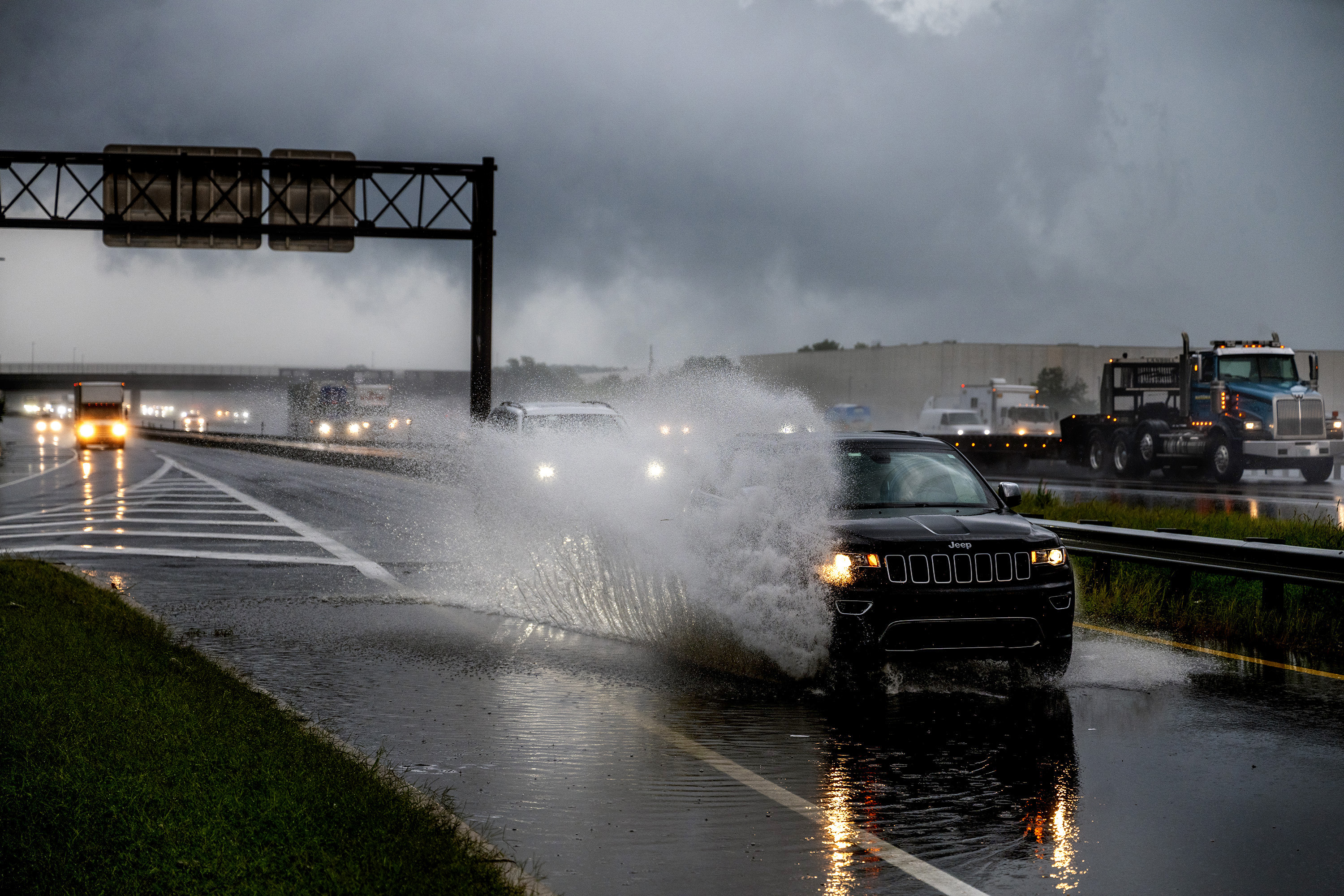
    However, in June, the celestial faucets turned on again, and the National Weather Service Office in Mount Holly issued a record number of flood warnings.

    Through Wednesday, rain totals in all the counties of New Jersey and Eastern Pennsylvania were well above normal during the previous 90 days, according to the Middle Atlantic River Forecast Center.


  • New Jersey’s drought officially is history, and so is the Atlantic hurricane season

    New Jersey’s drought officially is history, and so is the Atlantic hurricane season

    Go ahead New Jersey, drink up and wash the cars: After 300 days, the governor’s office on Thursday officially lifted the statewide drought warning.

    The decree comes after three months that have featured an assortment of downpours and general rainfalls, with a bonus early-season nor’easter, throughout the Garden State and the Philadelphia region that may have had a lot of folks wondering when too much would be enough.

    The region has another shot at rain during the weekend, but the atmosphere may be poised to flip into a radically different, season-changing, rain-repelling pattern.

    In fact, said Richard Bann, a meteorologist with the federal Weather Prediction Center, “If this were January, people would worry about how cold it would be.”

    Any rain this weekend would be the result of a stalled front and “a surge of tropical moisture from the Gulf,” distantly related to the remnants of Hurricane Polo, said Matt Benz, senior meteorologist with AccuWeather Inc.

    Polo, of course, originated in the Pacific, which has been on fire with tropical activity — the mirror opposite of the Atlantic.

    The Atlantic Basin, which includes the Gulf and the Caribbean, hasn’t spawned a single hurricane this season, and this has a shot at becoming the first season without a verified hurricane in 132 years.

    One extraordinary feature of the Philly region’s remarkable turn in rain fortunes has been the absolute absence of tropical-storm related rainfall, which often has been an important source of late summer and early fall rainfall around here.

    The weekend outlook for the Philadelphia region

    On the subject of turnabouts, that was the sun that reappeared in the skies over Philly after a September in which it seemed as if the region was living under a dropped ceiling. For the month, Philly officially had three clear days.

    The average is about eight during one of the sunnier and drier months of the year.

    The sun is due for an encore during a summery Friday, with highs expected in the mid-80s, but as an autumnal front approaches, showers are possible at night.

    Saturday should be a fabulous day for hay-riders and corn-maze enthusiasts, with sun and highs expected to be more October-like, perhaps 15 degrees cooler than Friday’s.

    A storm is expected to form along the front as it stalls and moves toward the region, perhaps transporting some of Polo’s leftovers, and showers again are possible Sunday and Sunday night.

    But October weather really arrives with the workweek, said Benz.

    Next week is looking sunny and dry with daytime highs that might not get much past 60 degrees Tuesday and Wednesday, and fall into the 40s both mornings. If the foliage experts are right, those sunny days and cool nights should be ideal for the leaf-color.

    A fond farewell to the drought

    At least the trees won’t be moisture-starved.

    It may be hard to remember that on July 1, Philadelphia officially had experienced 16 consecutive months of below-normal precipitation.

    Antecedent dryness was one thing that moved New Jersey to declare a drought “warning,” asking residents to conserve water voluntarily, on Dec. 5.

    On June 1, Philadelphia, its seven neighboring counties, and all of New Jersey were in states of at least “moderate drought,” according to the interagency U.S. Drought Monitor.

    However, in June, the celestial faucets turned on again, and the National Weather Service Office in Mount Holly issued a record number of flood warnings.

    Through Wednesday, rain totals in all the counties of New Jersey and Eastern Pennsylvania were well above normal during the previous 90 days, according to the Middle Atlantic River Forecast Center.
  • One of the gloomier Septembers on record in Philly has come to a merciful end

    One of the gloomier Septembers on record in Philly has come to a merciful end

    Given the remarkable gloominess of the last 30 days, it would be reasonable to believe that the sun had lost its will to shine.

    It is due to make a comeback by Thursday afternoon on the first day of a fresh month, but last month has entered the books as one of the wetter and cloudier Septembers in the period of available records.

    Ordinarily, the September sun is some consolation for what is a month of rapidly shrinking daylight hours and lengthening nights. Not this time.

    Officially, Philly had more than a half-foot of rain during a month when the daytime skies were more than 70% cloud-covered.

    “Not your typical September,” said Ray Martin, lead meteorologist at the National Weather Service office in Mount Holly, who has his own hypothesis that includes an indirect connection with the burgeoning El Niño event in the equatorial Pacific.

    For some folks, the gloominess is more than an aesthetic issue: It can have deleterious effects on mood and overall well-being, mental health experts advise.

    “We’re losing daylight quite rapidly, and a stretch of cloudy weather like we’ve certainly had lately can make that change feel even more pronounced,” said Alan Jacobson, a psychologist practicing in Massachusetts and a specialist in seasonal affective disorder, known as SAD.

    What’s going on up there in the skies over Philly?

    Perhaps both the sun and moon, whose fullness last weekend also was obscured by the clouds, had spent so much time out of the public eye they developed a certain shyness.

    For the month, 18 days came close to or exceeded the criteria for “cloudy,” according to the weather service.

    Unfortunately, sky-cover records are wanting since the agency radically changed the observation protocols — replacing humans with a sky-scanning machine — in the mid-1990s.

    However, this September by far was the gloomiest since September of 2018, when close to 10 inches of rain was measured at Philadelphia International Airport. The 6.61 inches of September 2026 was the highest total since then.

    As to why it has been so cloudy: “We’ve definitely had a lot of systems move through, a lot of moisture,” Martin said.

    And why might that be?

    This has become the longest wait on record for the first hurricane of the season in the Atlantic basin, as the warming of waters in the equatorial Pacific has interacted with the atmosphere to generate powerful storm-shearing winds from the West. It is at least possible that what’s not happening in the Atlantic has been a factor in the clouds over Philly.

    “You could almost argue that the energy that normally would be expended in the tropics by hurricanes … maybe kind of worked its way north,” Martin said, but added: “That’s pure speculation.”

    Whatever the cause, the lack of sun has not been exactly an energizer.

    The effects of the lack of sunlight

    To feel enervated and melancholy at times as the days shorten is a sure sign of normality, Phyllis Zee, a circadian and sleep-medicine specialist with the Northwestern University Medical Center, has observed.

    The sunrise-to-sunset periods are shrinking by more than 2½ minutes daily in the Philadelphia region.

    Plus, the sun is losing radiative power daily, and clouds dilute whatever reaches the surface.

    Less light affects people in a variety of ways.

    “For some people, reduced light can affect sleep, energy, concentration, and mood,” Jacobson said.

    An estimated 5% of people experience serious symptoms of seasonal affective disorder, which is a form of depression, and 10% to 20% are affected by mild versions.

    For those who do not require clinical intervention, Jacobson and other specialists advise that an excellent remedy would be to spend time in the sun (assuming it returns), especially in the morning

    “Get outside and move your body daily,” said Tonya Ladipo, a Philadelphia therapist and founder of the Ladipo Group counseling service. “Even if it’s dark and cloudy, you’ll get some natural vitamin D in addition to the mood and energy boost that comes with being outside in fresh air.”

    The sun is due for a comeback

    And the sun is due to rule the day Friday, and it is at least possible it will show up Saturday and every day of the next workweek.

    But showers are possible Friday night and rain is looking likely Sunday, although conditions certainly should not approach anything like last weekend’s.

    At least that’s the forecast.

  • For the Phillies, suddenly it’s summer as they play the Braves in Atlanta

    For the Phillies, suddenly it’s summer as they play the Braves in Atlanta

    Whether the Phillies experience a Red October remains to be seen, but they are in for a Red September in Atlanta with summerlike temperatures and what looks to be a hitter-friendly atmosphere.

    On a Tuesday in which the sun was fighting mightily to prove its existence over Philadelphia — in what has been an unusually gloomy September — the skies over Atlanta were perfectly clear and forecast to stay that way through the next three afternoons.

    Highs there Tuesday afternoon should crest in the mid-80s, said Todd Vaughan, meteorologist with the regional National Weather Service in Peachtree, Ga.

    That would be about 20 degrees warmer than it was Sunday, when the Phillies beat the Tampa Bay Rays in South Philly to make the postseason.

    Temperatures may make a run at 90 degrees Wednesday and Thursday afternoons, when the humidity would also be increasing, said Vaughan. As for winds, “They’ll be less than 10 mph,” he said.

    On Sunday, in dismal, rainy Citizens Bank Park, winds were gusting to 29 mph.

    As for what could go wrong with the Atlanta forecast, Vaughan said, “The forecast confidence is pretty high.”

    An aside: If the best-of-three series goes to a third game, the Phillies’ Aaron Nola is on record as saying he loves to pitch in the heat. However, he also has given up a lot of long balls this season, and meteorologist Paul Dorian, who maintains a “Home Run Index” based on weather variables, said conditions would be favorable for homers this week.

    No rain would be expected in Atlanta until Friday night, at which time the Phillies would be on the West Coast for their next series or heading back home for the winter.

    If they return to Philly by Friday, they may rediscover that Ernest Hemingway was on to something with The Sun Also Rises, with clear skies and highs in the Atlanta-like 80s.

    In fact after Tuesday, the sun should reign over Philly through the week, said Alex Staarmann, meteorologist at the weather service in Mount Holly. Highs are expected to be in the 70s Tuesday and Wednesday, and low 80s on Thursday.

    You may have noticed a Vitamin D shortage this month. Overall, skies have been more than 70% cloud-covered since Sept. 1, according to weather service sky data, in what normally is one of the sunnier months.

    “It’s been an unusually cloudy month for September, Staarmann said.

    The clouds are due back this weekend. Rain is possible Friday night into Saturday, he said, and maybe more on Sunday.

    If the Phillies have their way, they’ll be in Los Angeles playing in the Division Series.

  • The nor’easter may foreshadow a busy and challenging season for forecasters and computers

    The nor’easter may foreshadow a busy and challenging season for forecasters and computers

    That erratically behaving nor’easter that really, finally, is done with the Philly region, not only was a spoiler for the last weekend of September, it may well have foreshadowed what’s to come — perhaps even in the very short term.

    Along with being a possible prelude to the future of storm traffic, it also underscored the limitations of computer models that were late to latch on to the concept that the storm center improbably would make a left turn and wander onto the shores of New Jersey.

    “There was a lot of evolution with this nor’easter,” said Allison Santorelli, meteorologist with the federal Weather Prediction Center, in College Park, Md., which, like Philadelphia, became a late addition to the roster of areas that would be affected by the storm.

    And on the subject of improbability, in a season where not single a hurricane has formed in the Atlantic, the region may be affected by the remnants of a tropical storm this weekend — from the Pacific.

    Santorelli said that some moisture from Hurricane Polo, due to make landfall in Baja California, could get picked up by a front and make it to the Mid-Atlantic during the weekend.

    While October typically is one of the driest month of the year — and no rain fell in Philly during the month two years ago — another dousing would have to be considered “ill-timed,” said Ray Martin, a lead meteorologist in the National Weather Service office in Mount Holly.

    In the last two months, 14 inches of rain officially have fallen on Philly, about double normal.

    Forecast for the week

    No rain is expected during what is forecast to be a splendid workweek with the sun (yes, coming soon to a horizon near you) due to return. Temperatures are expected to rise into the 70s and perhaps to 80 by Thursday and the low 80s Friday, without so much as a coastal flood advisory.

    Incidentally, conditions will be similar in Atlanta — only with highs well into the 80s — where the Phillies play the Braves in the wild-card round.

    At least in the early going, Saturday also was looking decent, but rains might return Saturday night and continue Sunday as the aforementioned front stalls near the region and a storm develops.

    Given the possible entrainment of Polo’s leftovers, “It could bring another slug of rain and gusty winds to areas impacted by this nor’easter,” said Carl Erickson, meteorologist with AccuWeather Inc.

    For now, it doesn’t look “overly impactful,” said Santorelli. But she cautioned the threat was still several days away, and last weekend’s nor’easter looked very different in the middle of last week.

    The nor’easter bedeviled computer models

    The nor’easter was deteriorating Monday afternoon near Long Island and was poised to call it a career. And what a strange one it was.

    Computer models had foreseen that a coastal storm would develop and its low pressure, or lighter air, would interact with the heavier air of potent high pressure to the north to generate beach-eroding winds and flooding tides.

    In its Wednesday night discussion, the weather service said the storm “now overall looks to remain far enough offshore to keep heavy rains away from the region.”

    Said Santorelli, “A lot of models had it as a classic nor’easter off the coast, with a lot of the Mid-Atlantic, including Philly … spared. Then all of sudden the models were like, ‘We’ll just stall off the East Coast for a day or two.’”

    It wasn’t until Friday morning that the model consensus shifted to a track that would have the storm make a left turn and cross the Jersey Shore, inciting coastal flooding; gusty, erosional winds; and heavy rains throughout the Philadelphia region.

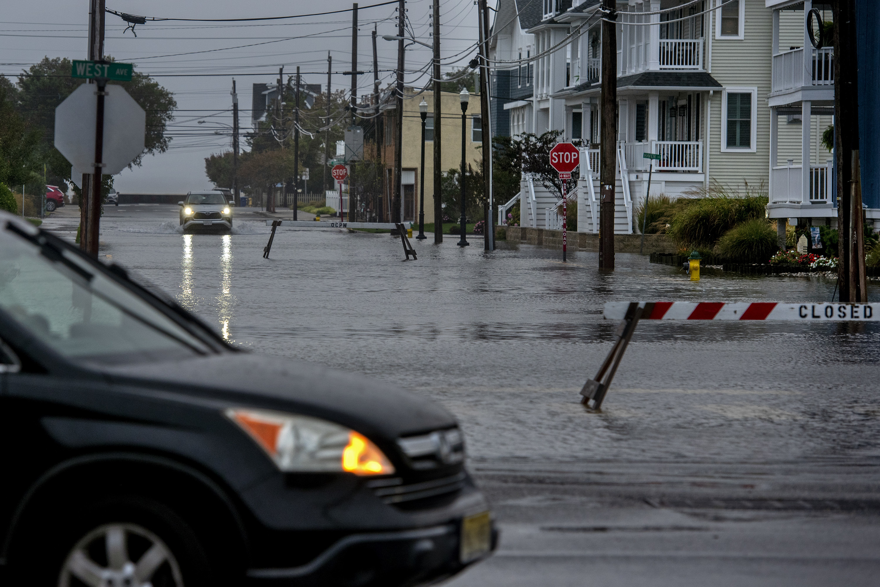
    Totals of 3 to 5 inches were common, with more than 7 inches in Ocean County. Streets and bridges were closed in the beach towns.

    Winds gusted past 60 mph at the Shore, and 50 mph across the region.

    The computer modeling had caught on to storm potential early last week, and the weather service began sending out briefings to emergency managers Monday.

    But, as usual, the details were elusive. The computers, said Erickson, constitute a “tool. Even if they get better and better with time there’s still a tool,”

    That may be worth keeping in mind in the weeks ahead, particularly during the winter, said Santorelli.

    Was the nor’easter a practice run?

    The El Niño warming in the equatorial Pacific, which may reach record levels, almost certainly will have major impacts on the Philadelphia winter as the west-to-east upper level winds it generates persists for months.

    That could lead to more nor’easters than typical, said Santorelli.

    The quiet Atlantic tropical-storm season also may come into play, as it has resulted in quieter waters that have allowed sea-surface temperatures to warm, said AccuWeather’s Erickson. Warm waters would help provide sharp contrasts to cold air migrating off the coast, aiding winter-storm development.

    Said Santorelli, “It’s still early to tell when they’re going to happen, where they’re going to happen, and who they’re going to impact, but certainly the potential is out there.”

    And so is the potential for uncertainty, as the region just learned.

  • The Jersey Shore is bracing for a big September storm — but it’s a nor’easter, not a hurricane

    The Jersey Shore is bracing for a big September storm — but it’s a nor’easter, not a hurricane

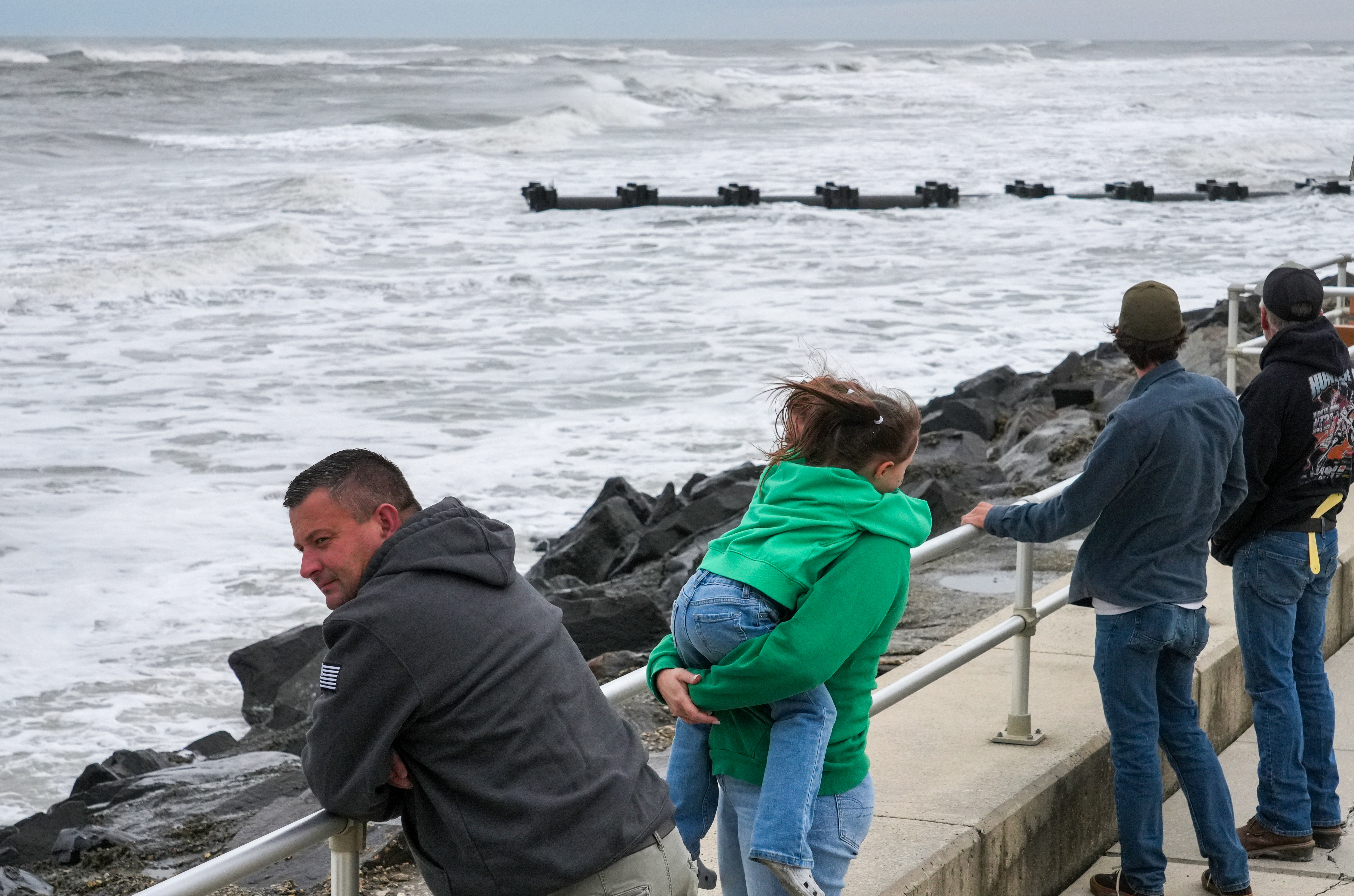
    It isn’t a hurricane, or a storm with a name (at least not yet), but the early-season nor’easter that was brewing off the Mid-Atlantic coast Friday may end up focusing its ferocity on the Jersey Shore and pester the Philly area with one memorably miserable weekend.

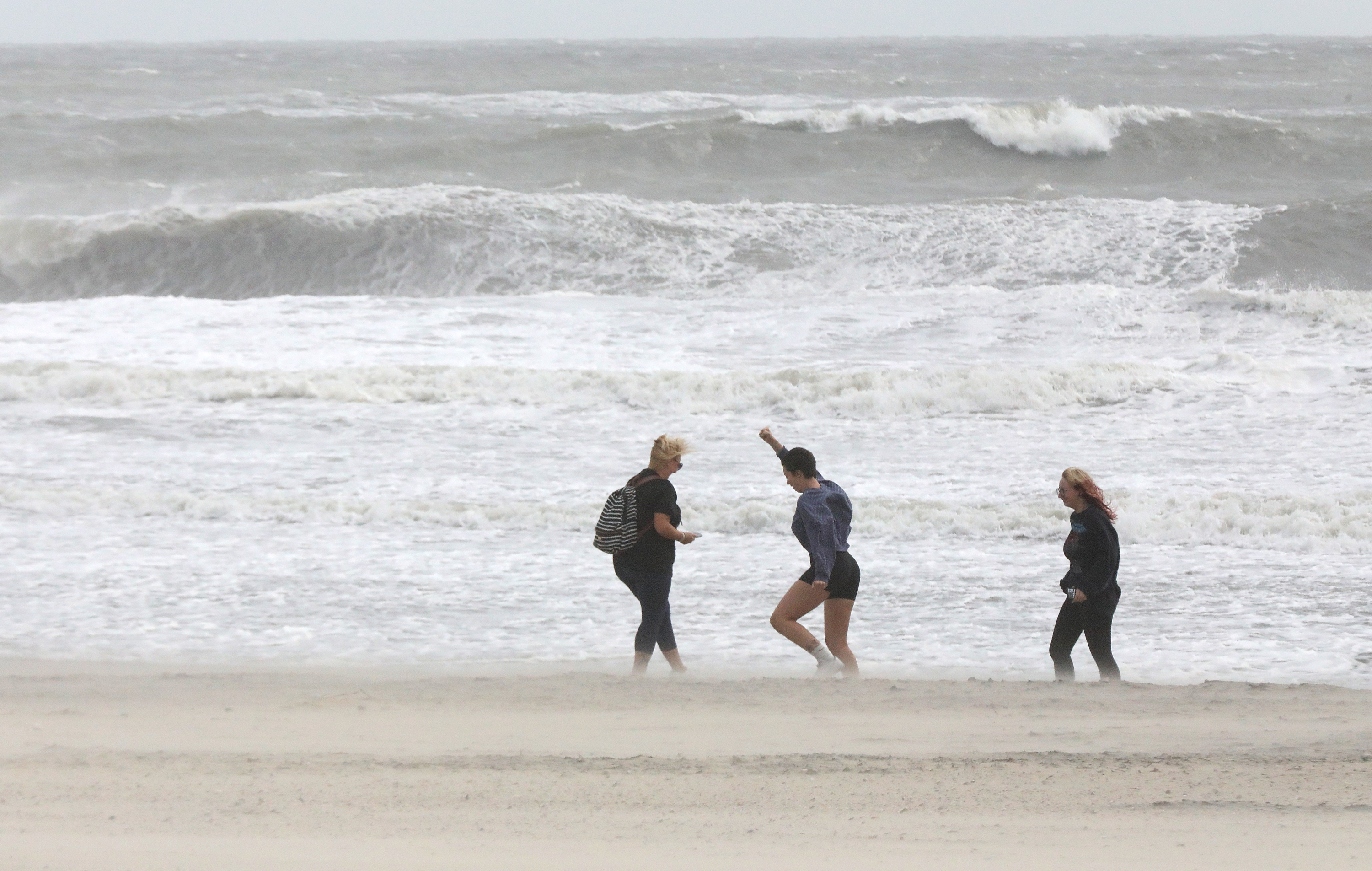
    With the storm’s projected path changing dramatically, forecasters warned Friday that heavy rains were possible throughout the weekend along with tropical-storm-force gusts that could go as high as 70 mph at the Shore. Flood warnings and advisories have been extended well into the weekend.

    “Major” flooding was expected Saturday morning and possibly Saturday evening on the beachfronts and bay areas, with the National Weather Service warning “some locations may become isolated by the floodwaters.”

    Up to 5 inches of rain are possible at the Shore, and as much as 4 inches in Philly.

    Gov. Mikie Sherrill declared a state of emergency for the eight Shore counties, effective 5 p.m. Friday.

    It is possible that the storm, which was centered about 200 miles east of Norfolk, Va., on Friday, may make a sharp left sometime during the weekend and cross the New Jersey coast a la Superstorm Sandy in 2012, said Bob Oravec, senior branch forecaster with the federal Weather Prediction Center. (No, this won’t be in a league with Sandy, he assured.)

    With storm waves pounding the oceanfront, and the back bays congested with water, multiple rounds of at least moderate flooding were expected at the Shore, and at least minor flooding along the Delaware River in Philadelphia, where winds could gust to 45 mph.

    “And the full moon doesn’t help,” said Jason Franklin, the meteorologist in charge of the National Weather Service’s Mount Holly office. The monthly astronomical tug is going to exacerbate any flooding.

    The timing of the storm’s impacts

    A flood warning for the Shore is in effect until 2 a.m. Sunday, and minor flooding occurred with high tides Friday morning.

    Significant flooding was expected for at least three consecutive high tides, which occur at roughly 12-hour intervals, on the oceanfront and the back bay abutting Ocean City starting at 7 p.m. Friday, with the major flooding Saturday morning.

    On Friday, Franklin noted that the onshore winds from the Northeast — why they call them nor’easters — had taken on a more northerly direction. That would be problematic for north-facing beaches, such as the ones in North Wildwood and the north end of Avalon.

    And given that the wind and gust festival was in its third day, drainage was becoming a challenge, said Franklin, particularly for the bays.

    “They’re swollen,” said Franklin.

    A flood advisory was up for Philly and areas along the Delaware River for minor flooding during four straight high tides beginning 1 a.m. Saturday.

    The Shore was under a wind advisory until 6 a.m. Sunday, and it was possible that gusts to 70 mph could be measured along the Jersey Coast to Long Island, said Peyton Simmers, meteorologist at AccuWeather Inc.

    The advisory for Philly, also in effect to 6 a.m. Sunday, called for gusts to 45 mph.

    The nor’easter was have impacts all the way to Cape Cod, but in the end the highly unusual — and very early — coastal storm could save its worst for the Jersey coast, said Oravec.

    The nor’easter is early, and extraordinary

    Coastal storms form along the boundaries of chilly and warm air and usually hold off until later in the fall or winter when the temperature contrasts between the cold air from the north and remnants of summer to the south ripen.

    In this instance the cold air was being supplied by a powerful area of high pressure, or heavier air, over eastern Canada, whose clockwise winds from the northeast made Philly feel October-like this week.

    The high’s cold winds have been interacting with the very warm waters of the Gulf Stream to generate the nor’easter and add a kick to the onshore winds, part of a cyclone’s counterclockwise circulation.

    Pressure differences incite winds: A common image is that of air from a punctured tire rushing into air that is half as light.

    One subplot to watch is that the nor’easter may take on tropical characteristics, drawing moisture and warmth from spending so much time over the Gulf Stream, said Simmers. That could bump up the rain amounts.

    It could even become a “subtropical storm,” he said, although he wouldn’t expect the National Hurricane Center to name it. Not that the distinction would make much difference.

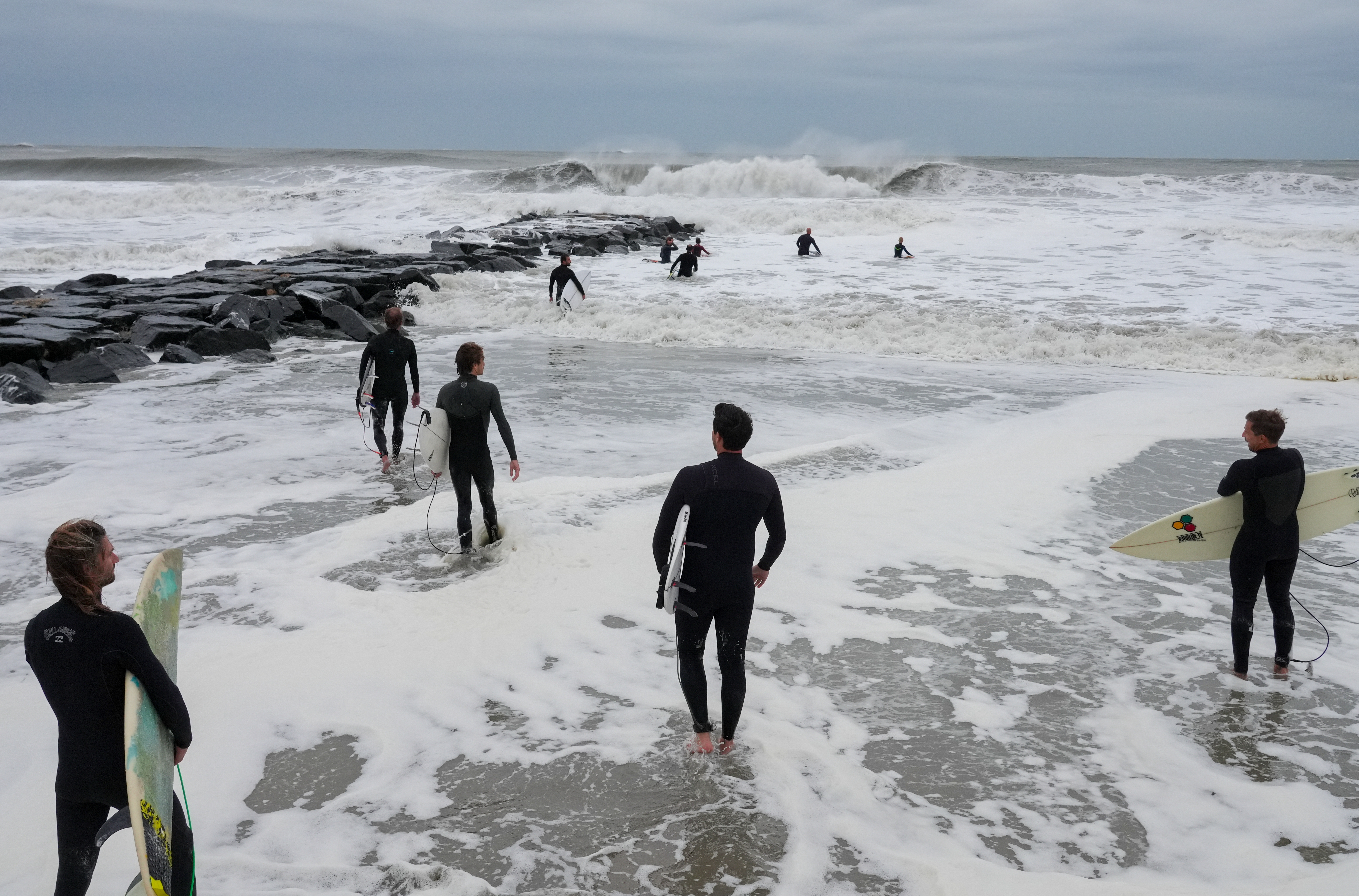
    Surfers check out the nor’easter incited waves in Ocean City, where back-bay flooding could be significant. Tim Hawk / For The Inquirer

    Nor’easters vs. Hurricanes

    The U.S. East Coast happens to be one of the world’s favored spawning grounds for cyclones, notes John Gyakum, an atmospheric scientist at McGill University in Montreal who is an expert in coastal storms.

    Unlike hurricanes, which form in the tropics, nor’easters develop in the cooler midlatitudes.

    Hurricanes tend to be more destructive and have more celebrity power, but their influence is relatively small compared with nor’easters, whose circulation can cover thousands of miles. Also, nor’easter winds can persist for days, eroding beaches and causing significant property damage. Hurricanes tend to be quick hitters.

    A coastal storm that coincided with a full moon and five consecutive high tides in March 1962 caused mass devastation and forever changed the New Jersey Shore. One of the most destructive nor’easters in the period of record was the Blizzard of March 1993, which affected areas from Florida to Maine and as far west as Illinois.

    Sandy technically was a hybrid storm, losing its tropical characteristics after it made landfall in October 2012 near Atlantic City and buzz-sawed west, knocking out power to more than a million electric customers.

    This nor’easter will be no Sandy, but for celebrity power, it won’t be competing with any hurricanes. Not a single one has formed this season, an unprecedented wait for a first hurricane.

    No complaints have been registered among residents or property owners along the Gulf or Atlantic coasts.

  • Nor’easter is likely to cause significant flooding at the Shore, and winds may gust to 60 mph

    Nor’easter is likely to cause significant flooding at the Shore, and winds may gust to 60 mph

    With moderate flooding already has been reported at the Jersey Shore, along with wind gusts to 50 mph, the beach towns were left to wonder Friday what may happen when the extraordinary early-season nor’easter gets closer.

    And forecasters were warning that the storm almost certainly would overstay its welcome.

    “It could be slow to pull out,” said Lee Robertson, a lead meteorologist at the National Weather Service in Mount Holly. “We really may not be out of the woods until Monday.”

    In a major shift, strong winds and signifcant rains were expected during the weekend all the way to Philadelphia, where winds could gust to 45 mph.

    Updated computer-model runs were favoring a storm track closer to the coast than previously anticipated, said Bill Deger, senior meteorologist at AccuWeather Inc., which would increase both the flooding and the wind potential. Beaches already have endured a long-duration assault of onshore winds, he added.

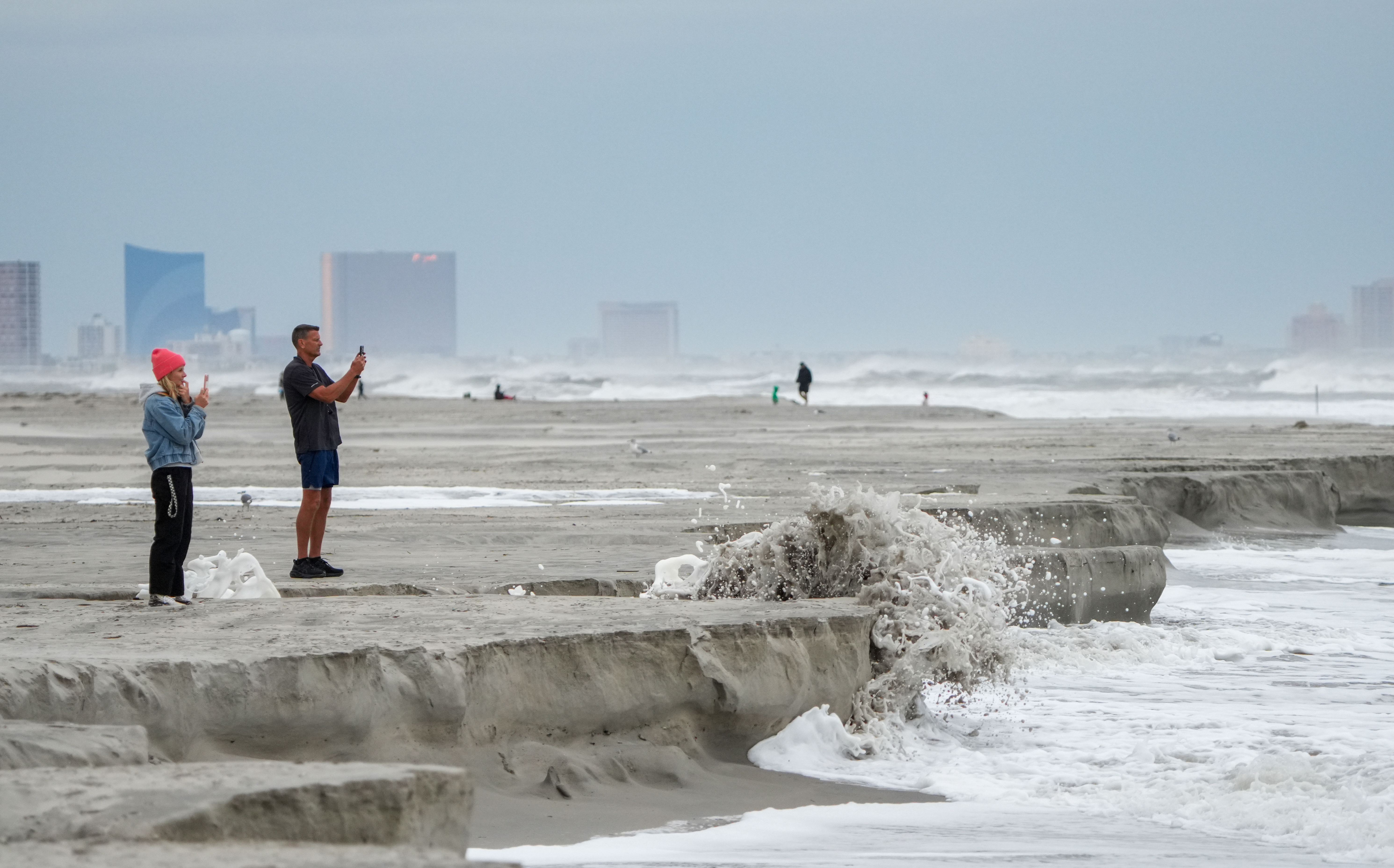
    “Our beach is going to suffer,” Atlantic City Mayor Marty Small Sr. said at a Thursday afternoon briefing. “We’re going to see a lot of beach erosion.”

    The more westward track also would increase the potential for weekend rainfall throughout the region during a time typically busy with hayrides, corn mazes, and other autumn activities, Deger said. “Mother Nature looks like it isn’t going to cooperate very much,” he said.

    He said the nor’easter could even become a “bomb cyclone,” a term for an especially intense storm.

    Potentially road-closing moderate flooding was forecast Friday into Saturday for the Jersey Shore. If the storm tracks further west, some places could see “major flooding,” said the weather service’s Robertson.

    A flood warning was in effect for the Jersey Shore towns until 2 a.m. Saturday, and flood advisories along the Delaware River until 4 a.m. Friday.

    Chances were excellent both would be extended. The storm, which was gaining strength off the Southeast coast Thursday afternoon, could take its good old time as it travels northward, which would increase the duration of flooding and the strongest winds.

    In addition, a high-wind watch was in effect at the Shore from 6 p.m. Friday into Saturday afternoon, with gusts that could reach 60 mph.

    Expected timing of the storm impacts

    Very much subject to change, the government’s National Ocean Service predicted oceanfront high tides at Atlantic City at or near moderate flood levels at 7 p.m. Friday and at 8 a.m. and 8 p.m. Saturday.

    Warning that what was anticipated was more than “nuisance flooding,” Small said the critical periods in Atlantic City would be a few hours before and after the high tides.

    In the back bay areas that are a chronic source of flooding in Ocean City, tides are forecast to hit moderate levels at 8 p.m. Friday and 8 a.m. Monday.

    At moderate levels, some roads become impassable, and building damage is possible, the weather service said.

    In Philly, minor flooding was forecast along the Delaware River for at least five consecutive high-tide cycles, which occur roughly every 12 hours, starting at 1 a.m. Friday.

    In Atlantic City, Small said he expected the streets to fill with up to a foot of water.

    Scott Adams, the city’s emergency chief, said the duration of the winds and waves were prime concerns. “It’s not a one-two punch,” he said.

    Just how much rain the storm would generate in the region was uncertain. The rains likely would reach the Shore late Friday and the immediate Philly area sometime Saturday afternoon, Deger said.

    The winds were likely to peak Friday afternoon into the evening; however, that would depend on the career of the storm.

    The beaches should get a break Saturday as the winds become more northerly than onshore, Deger said, which would at least slow the erosion, but the strong winds likely would continue.

    Isn’t this early for a nor’easter?

    Coastal storms of this magnitude typically occur later in the fall and winter, as colder air from the north country interacts with the warm waters of the Gulf Stream. Storms form on frontal boundaries of warm and cold air.

    In this case, a major player is an area of higher pressure, or heavier air, centered over eastern Canada that has been exporting cold air southward. That has kept temperatures several degrees below normal in Philly this week.

    It is working in tandem with the storm, providing the necessary cold air to contrast with the warm waters. In addition, winds circulate clockwise around centers of low pressure, so it also was generating winds from the northeast, which is why they are called nor’easters.

    Meanwhile, the intensifying storm also was generating winds from the northeast; winds circulate counterclockwise around centers of cyclones.

    The high may be as impressive as the storm, said Steve Decker, atmospheric science professor at Rutgers University. In data dating to 1979, it might be the strongest high over Quebec on record.

    He noted that while a nor’easter did develop in mid-September last year, “it was quite weak.” All indications are that this one won’t be.

    Incidentally, this was to be the last weekend of open swimming in Atlantic City, but if you were hoping to take a dip, better wait until Memorial Day.

    Small announced the beach would be closed, and all the equipment has been moved out of harm’s way.

    Besides, the water might be a little rough.

  • Early-season nor’easter prompts flood warnings for the Shore, and advisories for Philly into the weekend

    Early-season nor’easter prompts flood warnings for the Shore, and advisories for Philly into the weekend

    Flood warnings are up for the Jersey Shore, where winds could gust to 50 mph, and high-tide flooding is expected along the Delaware River into Saturday as that very early-season nor’easter matures off the Southeast coast.

    On Thursday morning, the storm was gathering strength off the Southeast coast, as predicted, and the projected track was closer to the coast than earlier predicted.

    But what’s been happening thus far at the Shore and Philly area likely has had more to do with an extraordinary system to the north that normally is associated with dry and tranquil weather, said John Gyakum, an atmospheric scientist and coastal-storm expert at McGill University in Montreal.

    It is working in tandem with a burgeoning cyclone that he characterized as “unusual” for occurring so soon in autumn — actually, make that Day One.

    Overall, he said, this has been a start to fall “that we haven’t experienced in quite a while.”

    And while the El Niño intensifying in the equatorial Pacific likely has nothing to do with what will happen around here in the next few days, this nor’easter may foreshadow what is to come during the winter.

    The National Weather Service on Wednesday was warning of potentially damaging “moderate flooding” with the “potential for widespread roadway flooding … as well as damage to vulnerable structures. Some roadways will become impassable.” In addition, winds could gust up to 45 mph at the beaches and 35 mph inland.

    What’s more, the growing influence of the moon, which reaches fullness Saturday, is going to provide an astronomical tug to the tides.

    The weather service also has issued an advisory for flooding along the Delaware River expected to reach moderate levels Friday and Saturday.

    Officials in the beach towns were making preparations.

    Ocean City was advising residents to “move vehicles to safe places,” spokesperson Doug Bergen said. And the Army Corps of Engineers moved its beach-fill equipment in Avalon and Ocean City to safe harbors.

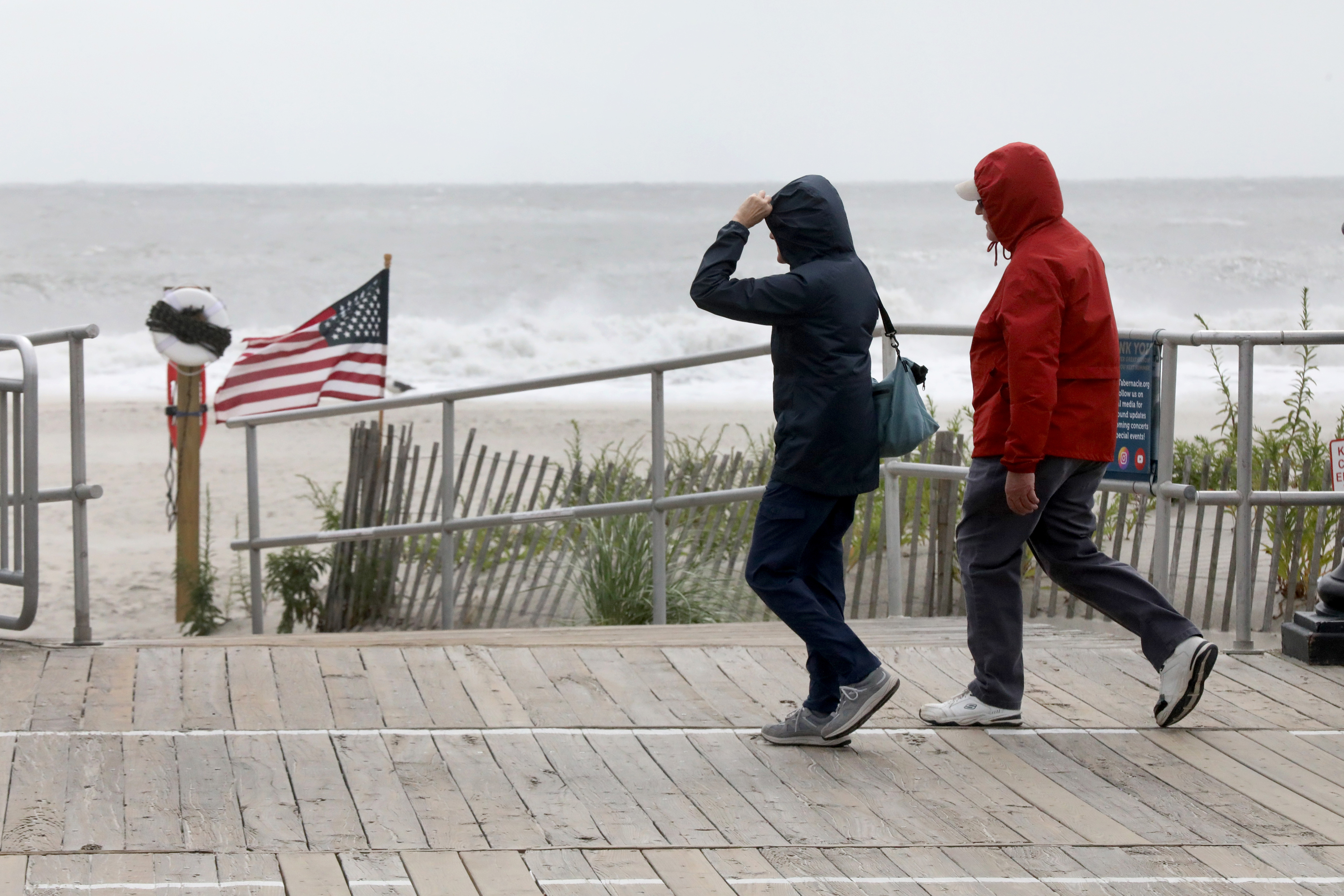
    It was a breezy day for strollers on the Ocean City Boardwalk, here near 9th Street.Vernon Ogrodnek / For The Inquirer

    The expected timing of the flooding

    The weather service said moderate flooding could be expected on the oceanfront with four consecutive high-tide cycles at7 p.m. Friday and 8 a.m. Saturday, with minor flooding during the other hide tides.

    Moderate flooding was forecast in the back bay areas Thursday evening and again on Friday evening and Saturday morning.

    At the moderate level, some roads can become “impassable,” and some houses could incur damage, the weather service said.

    Along the Delaware River, minor flooding was predicted for six consecutive high tides starting at 1 p.m. Thursday.

    No rain is expected until the weekend, with the amounts very much dependent on whether the storm makes a westward jog toward the coast or stays farther out to sea. As of late Wednesday, the computer models still were disputing the issue.

    For now, the weather service has a chance of rain both in the immediate Philly region and at the Shore.

    It is likely to stay breezy through the weekend, but the winds are forecast to take a more northerly turn, rather than howling onshore. The switch would be gentler on the beaches, which will have lost considerable sand.

    The nor’easter is getting a kick from the north

    Temperatures in the region Wednesday were in the mid-60s, about 10 degrees below normal and close to what they would normally be in late October.

    The chilly conditions were the result of a massive area of high pressure, or heavier air, over southeastern Canada.

    Winds circulate clockwise around centers of high pressure, and thus the Shore and the Philly region have been getting brisk winds from the northeast.

    The high is also supplying the cool air that is contrasting with the warm air off the Southeast coast, thus igniting the nor’easter, said Gyakum, who is credited with minting the term bomb cyclone.

    Winds circulate counterclockwise around storm centers, so areas to the northwest of the center (see: Jersey Shore, Philadelphia) experience onshore winds from the northeast (thus the term nor’easter).

    The two systems working in tandem are conspiring to generate gusts and potential rains likely to peak along the New England coast, said Bob Oravec, senior branch meteorologist at the federal Weather Prediction Center.

    Still, the Jersey Shore impacts are likely to be significant.

    What might the storm mean for the future?

    Typically, El Niño does not start to affect weather in the Northeast until later in the fall and into the winter.

    However, this storm could be a harbinger.

    “There tends to be an increased number of nor’easters during El Niño events, particularly strong El Niños,” said Samantha Borisoff, climatologist with the Northeast Regional Climate Center at Cornell University.

    Although this nor’easter is a precocious one, on the first full day of the astronomical fall, it is a clear indication the seasons have changed.

    Said Oravec: “You can’t fool the sun. Eventually the atmosphere responds.”

  • A nor’easter is poised to rip sand from Shore beaches and flood roads

    A nor’easter is poised to rip sand from Shore beaches and flood roads

    While computer models still remain at sea on the fate of a nor’easter taking shape off the Southeast coast, it is all but certain that floodwaters will be covering some roads at the Jersey Shore the next few days while the beaches lose some sand.

    Already, the Army Corps of Engineers beach-fill contractor working in Avalon has decided to halt operations and move the equipment out of harm’s way, said Army Corps spokesperson Stephen Rochette.

    The National Weather Service has issued flood warnings for the oceanfronts and back-bay areas in effect from late Wednesday afternoon until early Saturday, with moderate flooding expected in four of the next five high-tide cycles, warning that “many roads” may become impassable. The agency said it’s possible that some of the flooding could reach the “major” category.

    Inland impacts remained a source of considerable less certainty, but the National Weather Service posted a flood advisory for the tidal Delaware River from northern Delaware to central Bucks County from 10 p.m. Wednesday until 4 a.m. Friday.

    And after that?

    “Once you get to Friday and beyond, the forecasts becomes uncertain,” said Zachary Cooper, a meteorologist at the weather service’s Mount Holly office.

    As expected, a coastal storm was taking shape off the Carolina coasts and was forecast to mature through the workweek, generating winds from the northeast — that’s why they are called nor’easters — adding to an already brisk onshore flow.

    In addition, with a full moon due Saturday, the tides are going to get an additional astronomical tug.

    “There could be some shenanigans with that,” said Matt Benz, senior meteorologist with AccuWeather Inc.

    The timing of the storm’s impacts at the Shore and in the Philly area

    The winds were forecast to increase Wednesday, with gusts to 45 mph at the coast and 35 mph in the Philly area.

    Moderate flooding was expected with the early-evening high tides on the oceanfront and back Wednesday, Thursday, and Friday evenings, and on Friday morning.

    Minor flooding was expected Tuesday evening on the oceanfront and back bays at the Shore, with more-significant moderate flooding at high tides Wednesday and Thursday evenings.

    Along the Delaware River in Philadelphia, high-tide flooding was likely to be minor but could approach moderate levels late Wednesday and Thursday nights.

    No significant rains were in the forecast at least through Thursday, but the outcome for the weekend would depend on the intensity and path of the coastal storm, with rain more likely at the Shore than inland.

    What’s with all the forecast uncertainty?

    The food fight among computer models has persisted, with the European favoring a more westward track, and the U.S. model more out to sea.

    A more westward track, which would make substantial rains, and more wind, more likely, Cooper said. For now, the weather service was going with a 20% to 50% chance of rain across the region Friday into Sunday.

    The forecasts are far more certain on the winds.

    The onshore winds Tuesday were the result of high pressure, or heavier air, over southeastern Canada. Winds circulate clockwise around centers of highs, and thus the winds from the northeast, which also explain the October-like chill, with temperatures getting no higher than the 60s this week.

    An intense coastal storm would add mojo to those winds and could make for quite a raw weekend.

    One thing that is a near certainty is that the forecasts will undergo significant changes in the next day or two.

    Yes, this is early for a nor’easter

    This is unusually early to be concerned about a nor’easter. They usually wait until later in the fall, when the temperature contrasts that ignite storms become sharper as warm air lingers and interacts with the ambitious colder air from the north.

    However, a precocious nor’easter would not be as unusual as what is happening with the hurricane season in the Atlantic Basin.

    That would be: nothing.

    The season already has set a record for the longest wait for a first hurricane, and nothing is cooking. It is also setting records for the least amount of tropical-cyclone energy, said Philip Klotzbach, hurricane expert with the Colorado State University Tropical Meteorology project.

    But while it will not become a hurricane, Benz said the coastal storm bears watching because it could draw up moisture from the waters around the Bahamas and take on some tropical characteristics.

    That would increase the rainmaking and wind potential, he said.

    Stay tuned.

  • An early nor’easter threatens the Philly area, with Shore flooding and strong winds possible

    An early nor’easter threatens the Philly area, with Shore flooding and strong winds possible

    With the astronomical summer about to call it a season, the atmosphere is executing an equinoctial flip to mark the arrival of fall with impacts that could last several days.

    With an unusually early nor’easter due to form off the Atlantic coast this week, strong onshore winds in combination with the approaching full moon could result in coastal flooding and significant beach erosion at the Shore in what is likely to be the coolest week since early May.

    The National Weather Service office in Mount Holly has issued a flood advisory for the Shore areas for minor flooding late Tuesday afternoon, and a watch for the potential of moderate flooding late Wednesday afternoon into the evening.

    In addition, it said, “Moderate tidal flooding could continue through at least Friday evening’s high tide or perhaps longer.”

    An advisory for minor flooding along the Delaware River in Philly likely will be added Wednesday into Thursday, said weather service meteorologist Eric Hoeflich.

    Potent winds from the northeast could persist through the weekend from the Outer Banks of North Carolina to the Jersey Shore, said Brian Hurley, senior branch forecaster with the federal Weather Prediction Center, in College Park, Md.

    When winds and rains may arrive in the Philly region

    The nor’easter likely won’t develop until Wednesday, said Hurley, but rain and strong onshore winds aren’t going to wait for the party to start.

    Showers are likely Tuesday throughout the region, with winds from the northeast gusting to 45 mph at the Shore, starting Tuesday and continuing into late Sunday night. They are likely to generate beach-eating storm waves. Inland, gusts in the range of 35 mph are forecast for the immediate Philly region, lasting about as long.

    It should be dry in South Philly Tuesday night when the Phillies host the Milwaukee Brewers, but it literally will feel like October, with temperatures around 60 degrees at game time. Readings the rest of the week aren’t expected to get out of the 60s, several degrees below normal.

    Rain is possible Friday, but how much falls later in the week and during the weekend will depend on how intense the coastal storm becomes and precisely how it tracks.

    If you’ve lived around here for a while, that may sound familiar.

    “It’s not different from what we talk about in the winter when we try to determine where the snow” is going to fall, said Dan Pydynowski, forecasting supervisor at AccuWeather Inc.

    What is all but certain is that those beach-eroding and flood-inciting onshore winds are going to have staying power.

    What’s going on up there?

    An area of strong fair-weather high pressure, over heavier air, over southeastern Canada is forecast to hold its ground for the next several days. Said Pydynowski, this is “a very strong high for this time of year.”

    As the storm intensifies to the south, it also will be stirring up onshore gusts across the region. Winds blow counterclockwise around storm centers, and areas to the northwest of the center experience northeast winds. That’s why they are called “nor’easters.”

    Between the two systems, the region is in for a major wind-fest.

    Regardless of whether the system becomes a significant rainmaker, said Hurley, “I think we’re going to have coastal flooding erosion issues from the Outer Banks all the way up through the Delmarva and the Jersey Shore for several days in a row.”

    In addition to the winds, the areas along I-95 will experience so-called cold-air damming, the result of chilly northeast winds being dammed in by the Appalachian Mountains to the west.

    “It’s a very weird time of year to get it,” Pydynowski said.